Well it has been a mild to warm last week across most of the eastern half of the USA. In fact, a lot of that activity still has another few days to go on it. But starting this weekend, and especially going into Thanksgiving Week next week and into the last week of November for the following week (10-14+ days), we have some significant changes you’ll want to be aware of. Because. It will get you if you don’t have the heads up on this NOW! It’s going to get colder. And it is potentially, especially from around Thanksgiving to the end of the month (November 21-30), will actually turn snowy across Upstate NY. And we are talking accumulating snowfalls. To the point to where shovels are needed. And potentially snowblowers. Oh my!
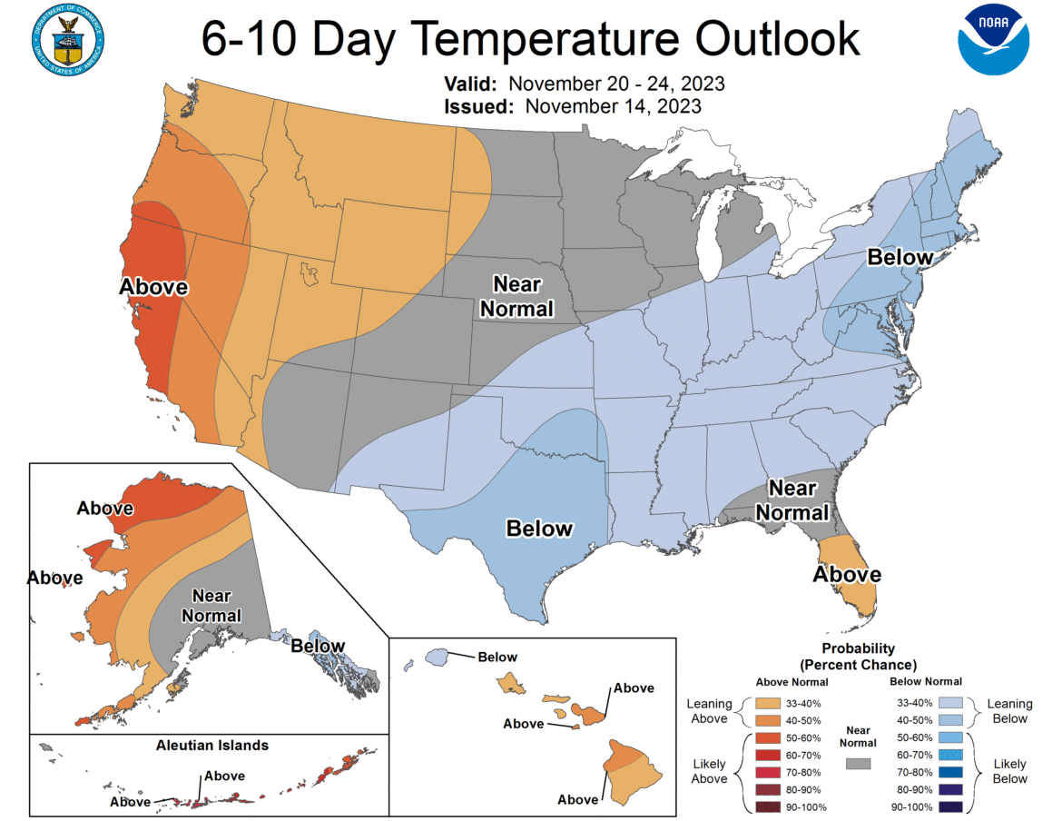
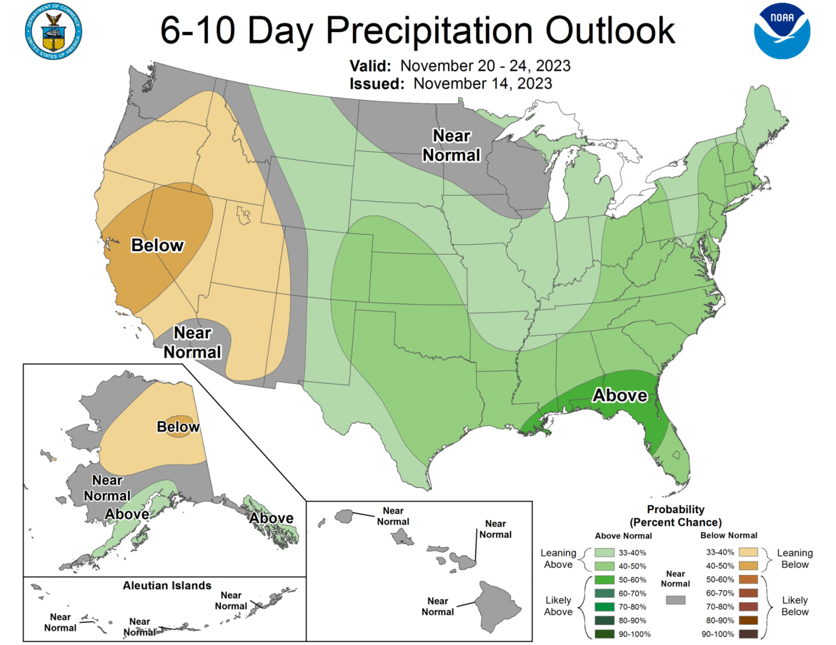
Oh boy! Here is the 6-10 day Temp and Precip outlook through Thanksgiving Weekend 2023. And let me tell you it does not look good! We have a lot of precipitation across the eastern 2/3 of of the country along with below average temps. Getting into this time of year with normal temps falling quickly through the 40s, it means 30s are more likely with almost certain below freezing temps at night. Given some of the 20s and even teens already seen across Upstate NY even with the above average scenario now, this means below freezing almost 24/7, especially for areas north of the Thruway is becoming a lot more imminent. So lets take a look at a few of the weather maps come around Thanksgiving:
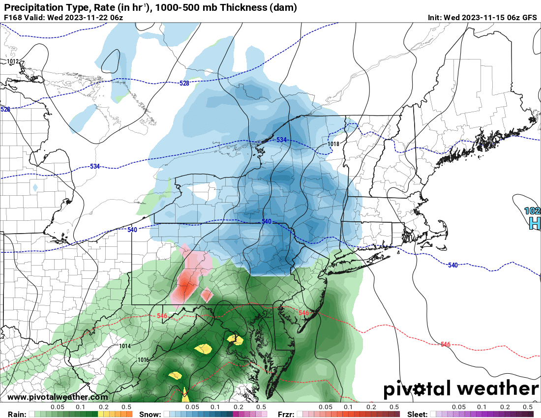
This map shows a storm developing at the beginning of the week well to the south and west of Upstate NY but then comes crashing on through Tuesday Night going into Wednesday Morning, one of the busiest travel times of the year, with not just snow: But accumulating snow. At this long range it looks likely to be a few inches and nothing more than that. It does not look like a 6-12+ or anything of that sort. Yet. Oh but just wait! As the colder air comes racing in Wednesday during the day and into Thanksgiving Morning, we have the development of a Lake Effect Band of Snow behind this storm. And for it to show up on the Models at Day 8 is significant!
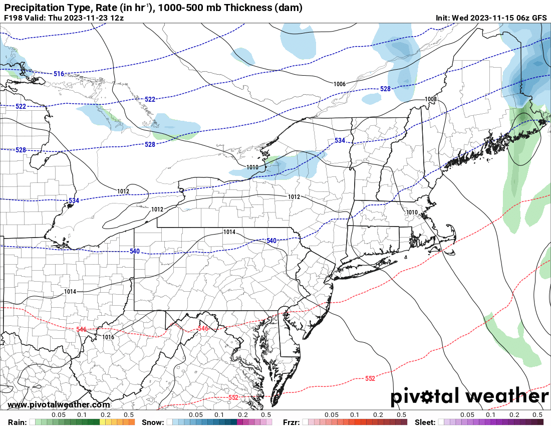
OK… so at this point while we are eating turkey and watching football, we should have all eyes north of the Mohawk Valley, particularly on the Tug Hill and western Adirondacks. It is here where several inches of snow may become a lot more likely if these model scenarios hold on as they are right now. Why such a high forecast of snow for the first big snow of the year and always at Thanksgiving? That’s how Mother Nature wants to play it. We continue with Lake Effect Snow from Thanksgiving through Friday and into Saturday. It looks even better then!
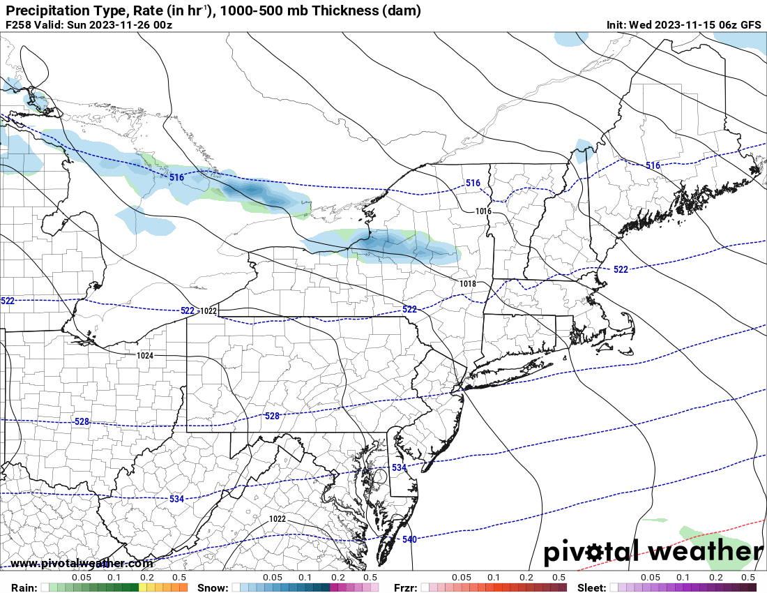
As the cold air deepens over Thanksgiving Weekend, expect heavier lake effect snows to go on particularly off of Lake Ontario. If the scenario that the maps puts out comes anywhere close to reality, some locations in the Tug Hill and in the Adirondacks will be looking at potentially a few FEET of snow! Again this is highly localized. This is HIGHLY UNLIKELY to hit Watertown, Syracuse or Utica/Rome proper. Also Rochester and Buffalo… and especially SOUTH of Buffalo… where the lake effect bands roam… there has not been a scenario with the lake effect snow hitting anywhere near as hard. In fact nearly none. I think that’s too little, considering the cold, but given we are 8-10 days out on this scenario, give it time to develop. Overall the 8-14 day scenario for temps and precip looks a lot like the 6-10 day. Just jingle a little:
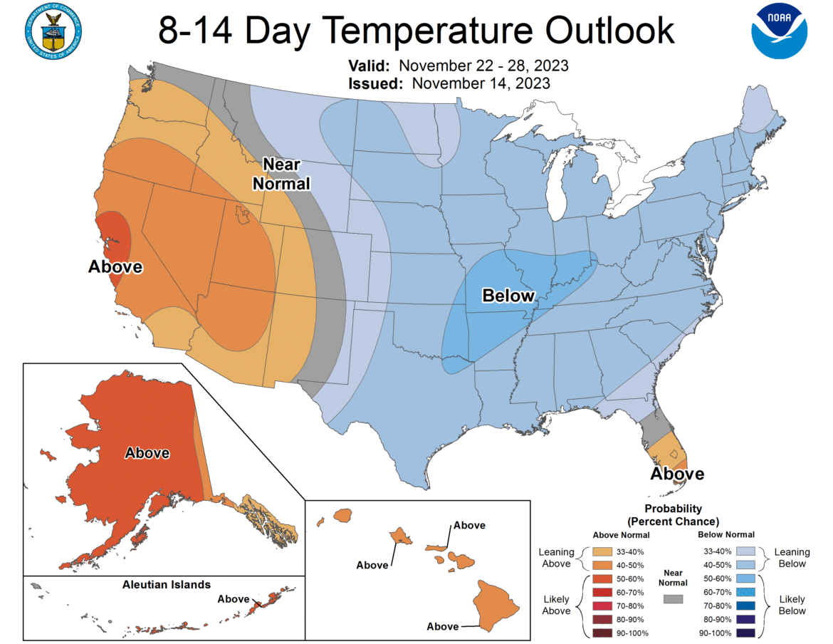
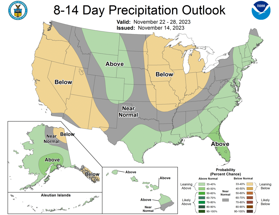
So basically what’s my bottom line here? HANG ON A MINUTE! It’s November 15th and we need to see EXACTLY how things go through November 30th. This way when I issue the FINAL FORECAST on December 1, I have the clearest and most accurate look into the winter. The forecast for now remains the same, which is as follows:
TEMPERATURE:
20% Above Normal
60% Near Normal
20% Below Normal
PRECIPITATION:
30% Above Normal
60% Near Normal
10% Below Normal
Temperatures are to be within 2 degrees F of normal to be considered “Near Normal”. Precipitation shall be within 20% of normal for rain and for snow to be considered normal. So once again, no change from the November 1 outlook. Yet. Depending on how the next two weeks go, there will be changes for my final outlook on December 1st. Since some outlooks are scheduled to come out that day, and because December 1 falls on a Friday this year, expect a Friday evening edition of the Winter Weather Outlook.
Rich Lupia
November 15, 2023


