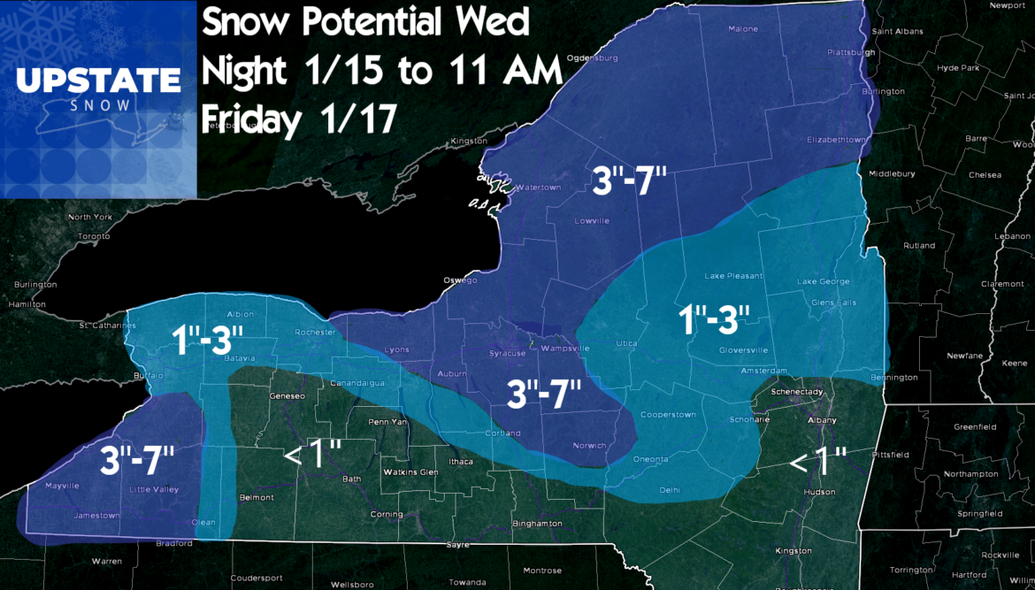
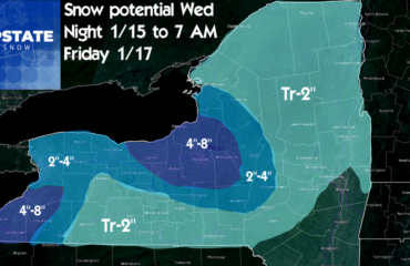
Our clipper and lake effect will be rolling on through and we will be rolling back into winter! Watch out for gusty winds today along with any snow. By Friday morning, temperatures will nosedive. Single digits and teens in most places. Our forecast from yesterday still stands…
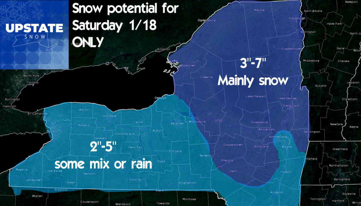
A quiet day Friday before the well advertised Saturday storm. It starts out Saturday morning in WNY and Southern Tier, late morning to midday CNY/Tug Hill and Catskills, midday to early afternoon Capital Region and Adirondacks. The heaviest precipitation will be late morning through afternoon. We expect rain and/or mixed precip to get into areas west of I-81 and south of the Thruway in the afternoon and early evening. Here is our snowfall forecast for the main storm on Saturday into Saturday evening. Less to the west where the warmer air gets in. This is JUST for the Saturday portion of the storm. What follows, for some areas, could be much bigger than this…
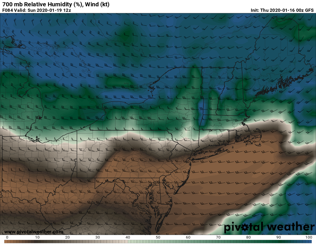
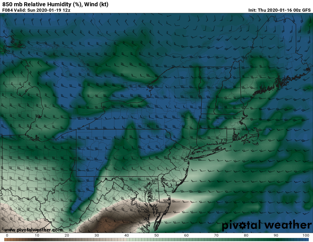
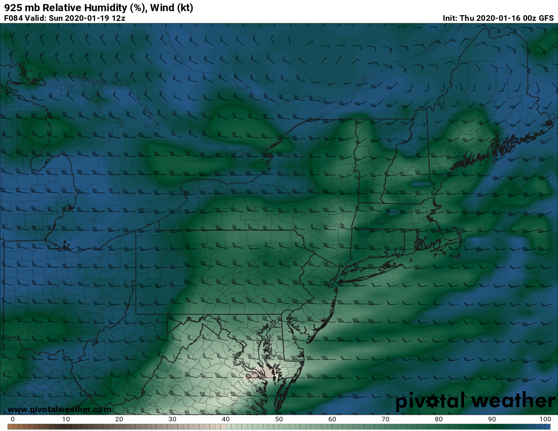
The low pressure passes to the N of Upstate going into Sunday morning and the lake effect kicks up! IF the models are correct… AGAIN… IF… Sunday could be our first truly hearty lake effect event of the winter with strong squalls and potentially heavy accumulations. I won’t put a snowfall map on the lake effect until Friday’s morning blog… BUT… If the models and trends are correct, over a foot of snow, possibly up to 2 feet of localized lake effect could happen over the course of 24 hours from early Sunday to early Monday. I can’t say where for sure yet, but on the southern half of Tug Hill would be my best first guess. The low level moisture is in place, the flow is well aligned and we could have solid lake effect across the southern half of Lewis County, northern half of Oneida County, northern Herkimer and Hamilton Counties… possibly even to Warren County! LOOK AT ALL THE DEEP MOISTURE FROM 925 to 850 to 700 MB (just above the ground to about 2 miles high) with a strong (but not too strong) and well aligned flow.
At this time, I believe the lake effect potential on Sunday into Monday could be the bigger story than the snowfall Saturday.
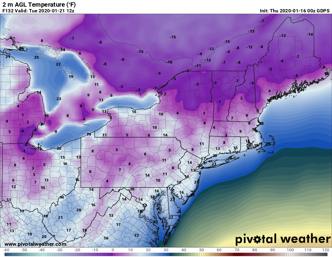
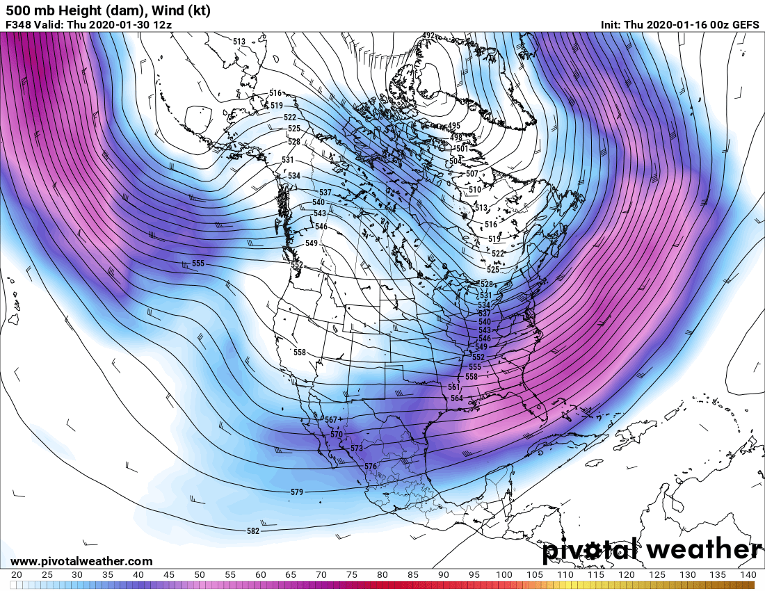
Cold air looks to be well entrenched all next week. Lows Tuesday morning could be near or below zero across a lot of Upstate. It looks to stay cold all next week, below normal temperatures. Clippers and lake effect unknown at this point.
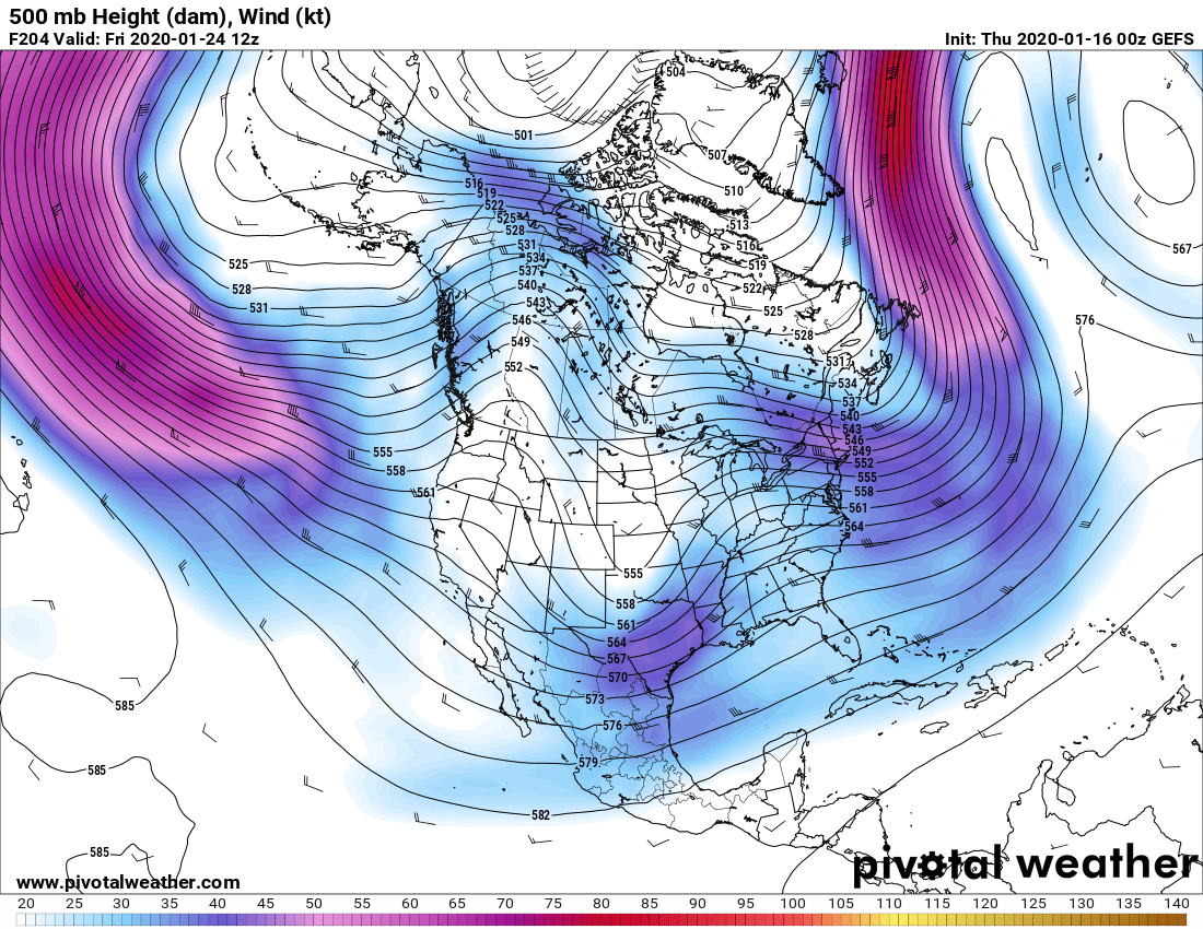
It won’t be a big pattern for a Nor’easter, but keep your eyes on the following weekend off the Atlantic coast. And yes all indications are this will stick around for the forseeable future until the end of January
Bottom line – Riding will return this MLK weekend for a few areas. Hopefully for more next week. Always check with local clubs before going, and remember, though it’s usually prime riding season, conditions will be early season with little to no base. Be patient and go slow if you go this weekend.

