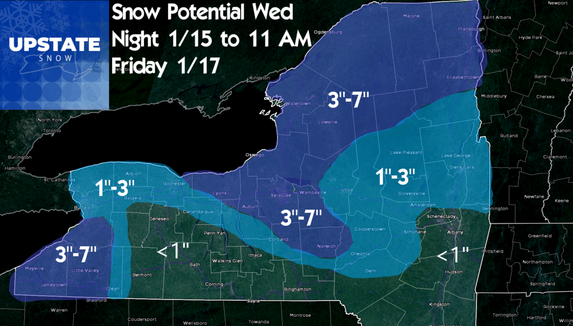
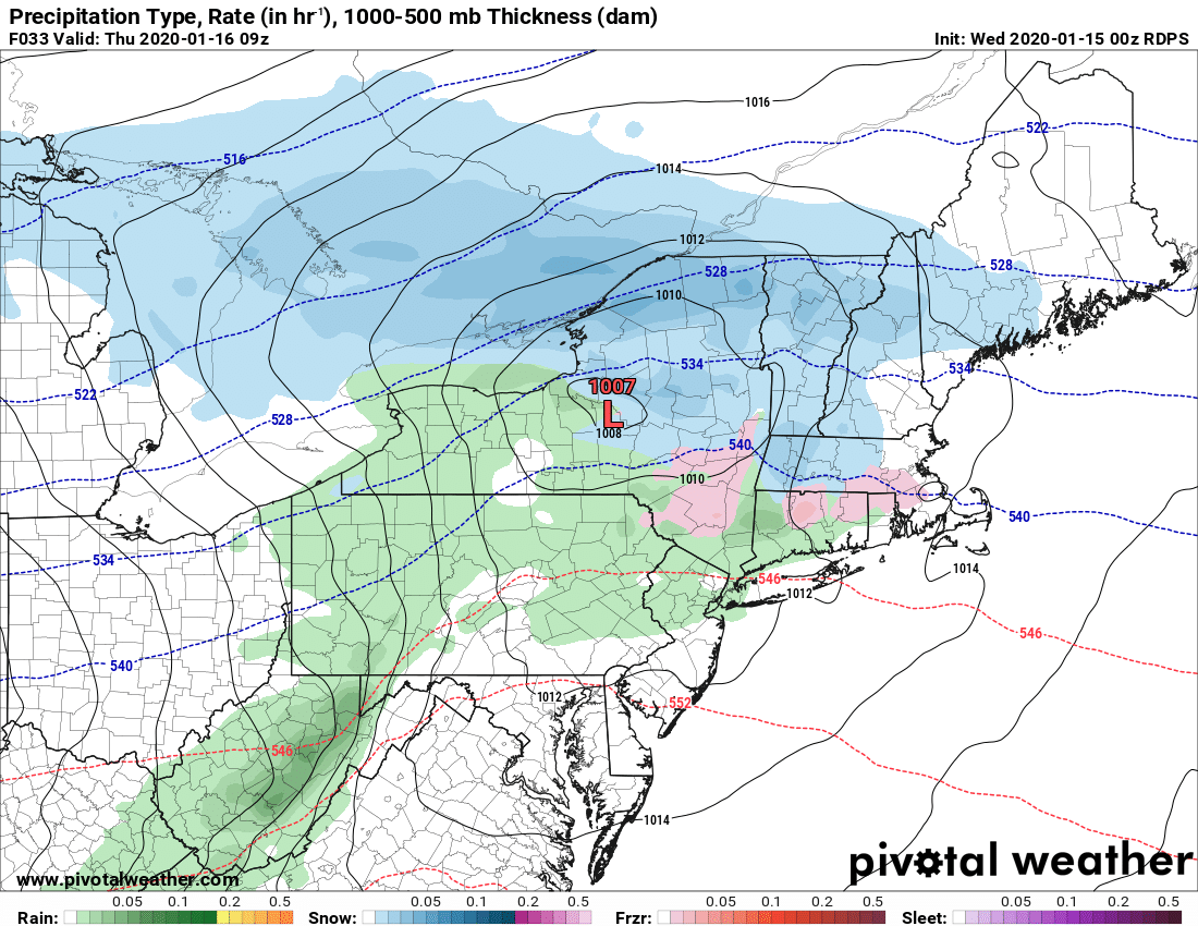
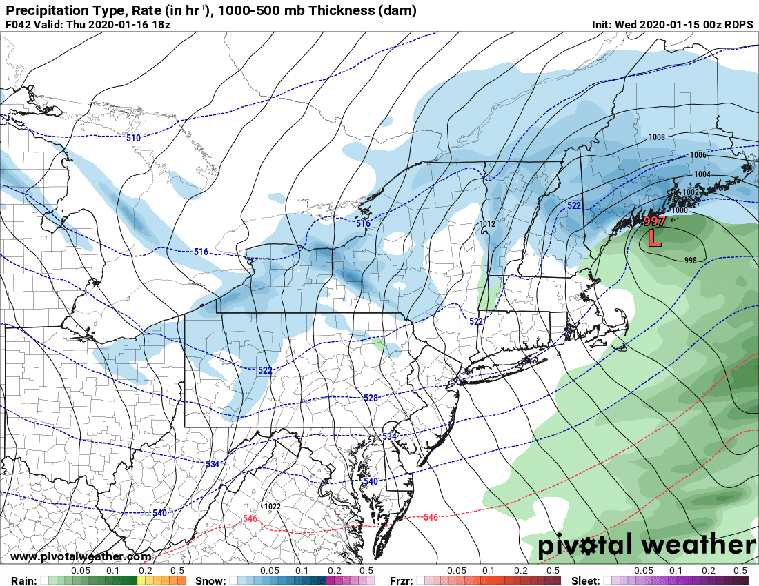
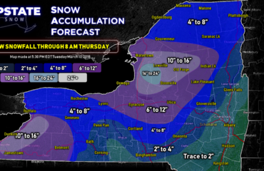
Latest runs of the models showing our clipper system a little farther south. Despite this I think the models may be picking up on our lack of snow cover. With this being a borderline temp situation overnight Wednesday, the slightly farther south track and with good low level moisture and upslope flow over Tug Hill and the central/northern Adirondacks, I made adjustments to the accumulation forecast.
This is in favor of a little more snow over the Adirondacks and Tug Hill than before. Not enough to get riding, but we have to start somewhere. Remember, NO BASE out there. I do think lake effect will still hit W of Utica towards the Syracuse area and hills surrounding later Thursday into Thursday night and some snow may linger into Friday morning.
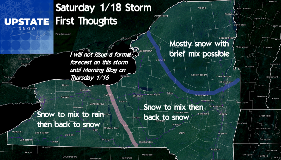
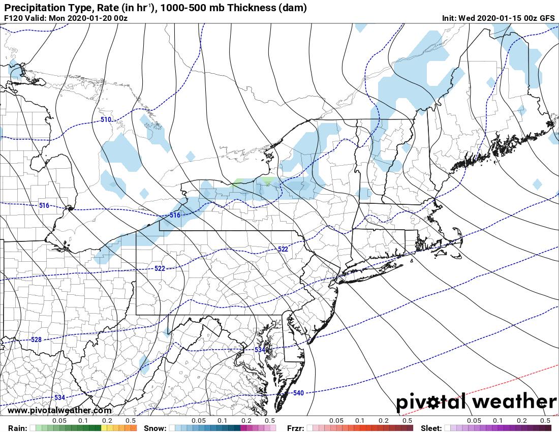
The trend continues to be for the storm this weekend to slow down and stay west. Looking less likely for a secondary low to develop which means my graphic I made in the previous morning blog is holding a lot more credence. It also means without secondary development as big of factor, this won’t be as big of a storm as it could be. It makes us more reliant on the lake effect behind it Sunday into Monday. Don’t worry… we’ll get that.
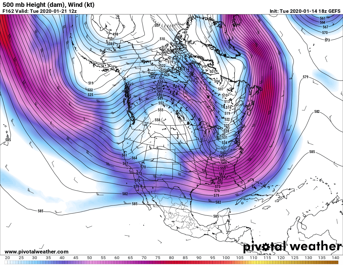
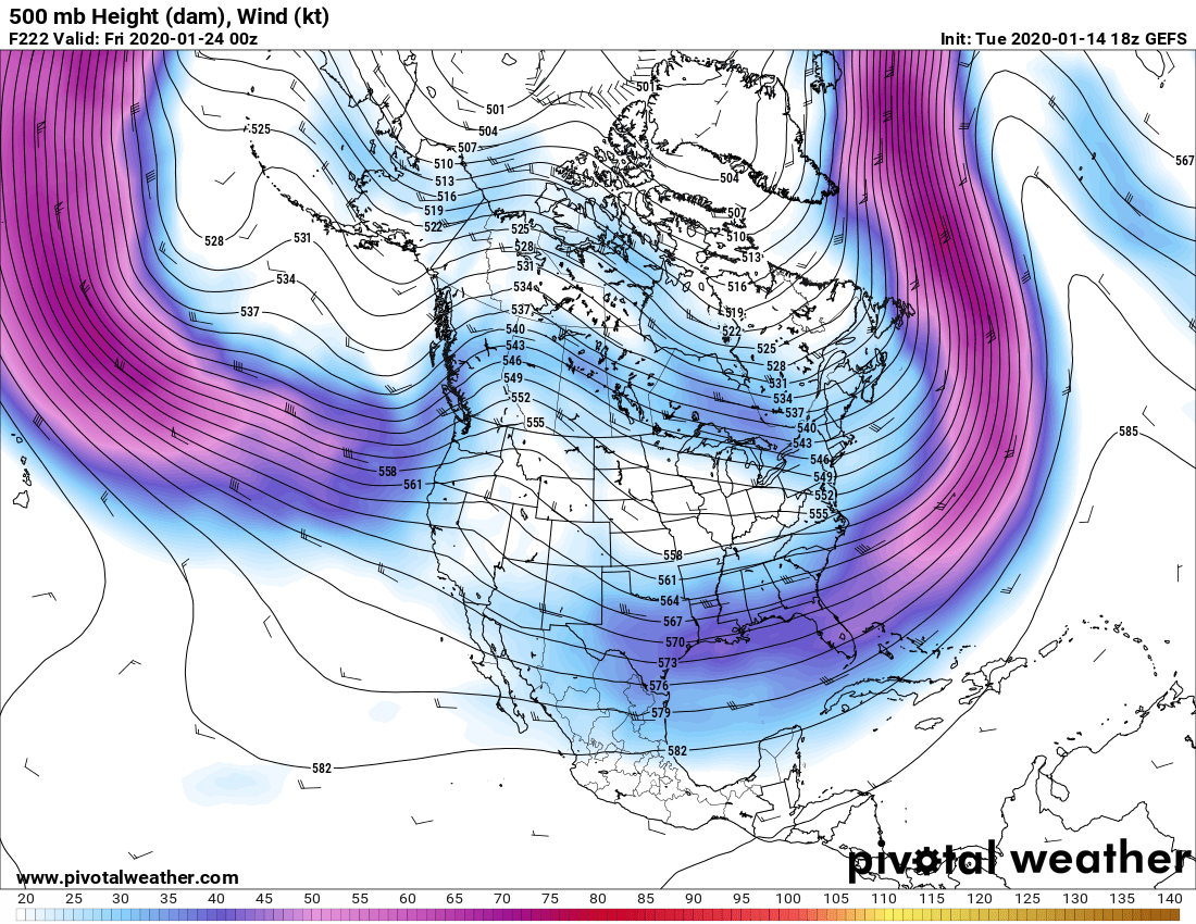
Looking deeper into next week it does look like the pattern shift will hold. The ensembles continue to run with a ridge out west and a trough east with our height lines coming from Canada (Meaning colder with clippers and lake effect) rather than this past weekend when it was from the Gulf of Mexico (why it was 60F + at night and everything snow disappeared like MAGIC)… So the cold will help freeze things down, keep our snow and greatly improve chances for trails to open back up next week and hopefully beyond.
In tomorrow’s morning blog I’ll give you my first snow map for Saturday’s storm… not the lake effect afterwards…
Things continue to look up…
Rich

