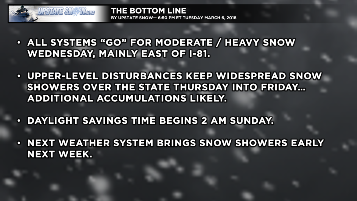
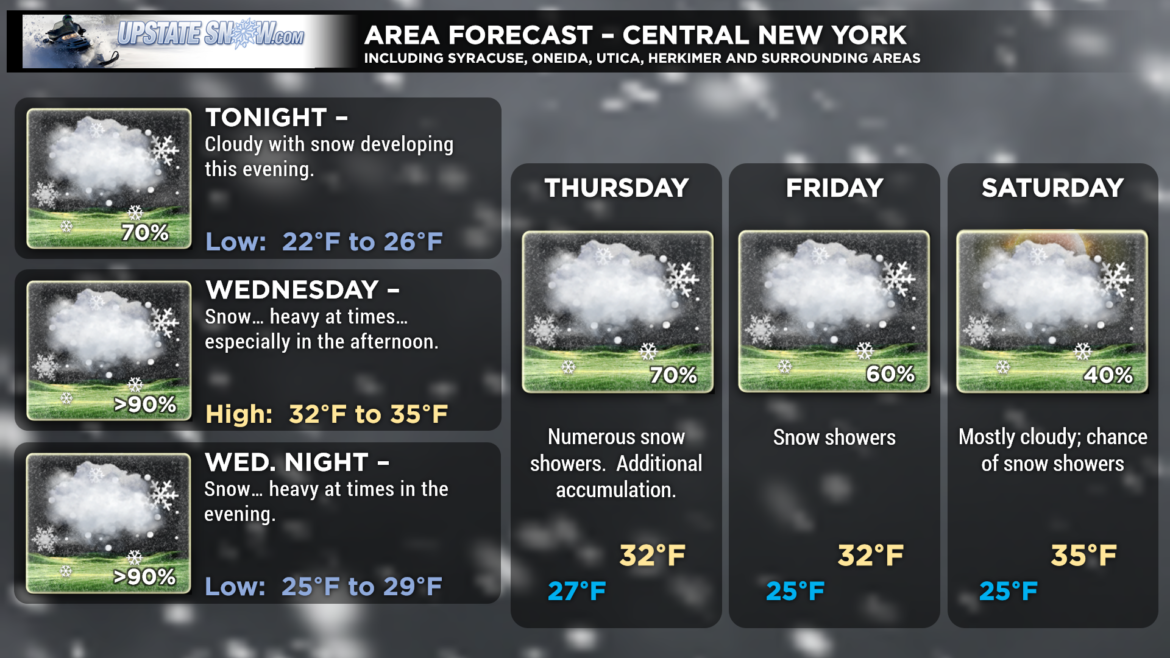
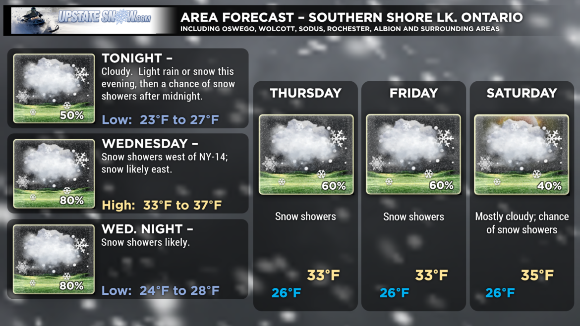
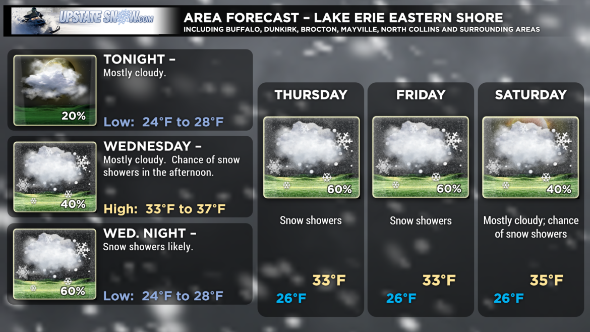
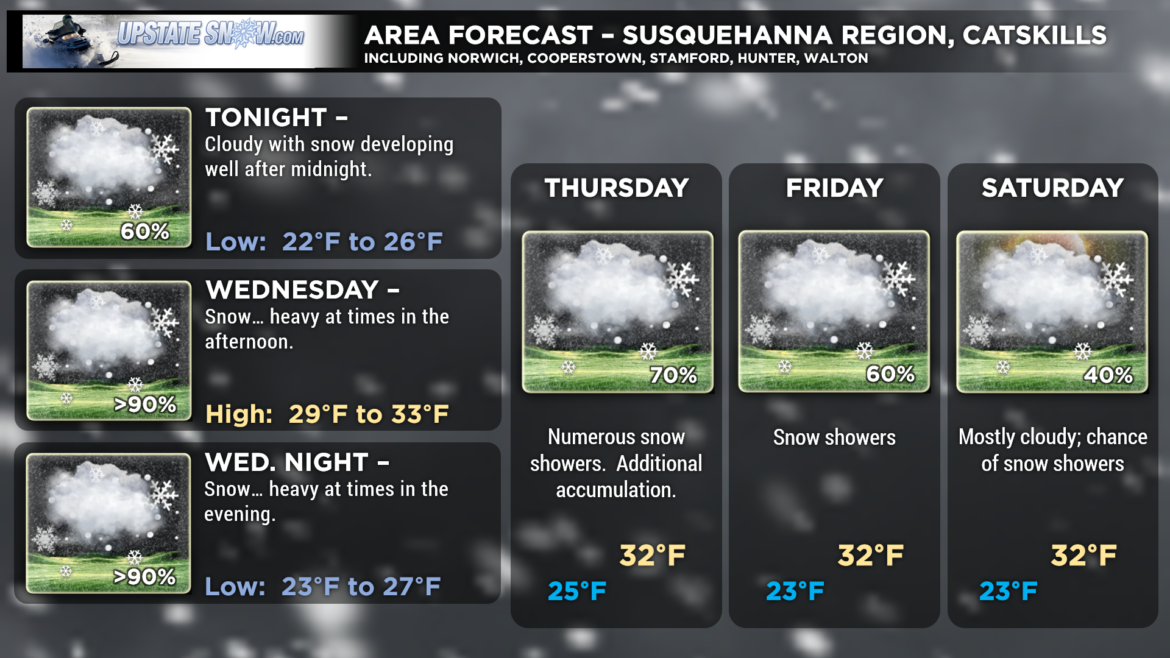
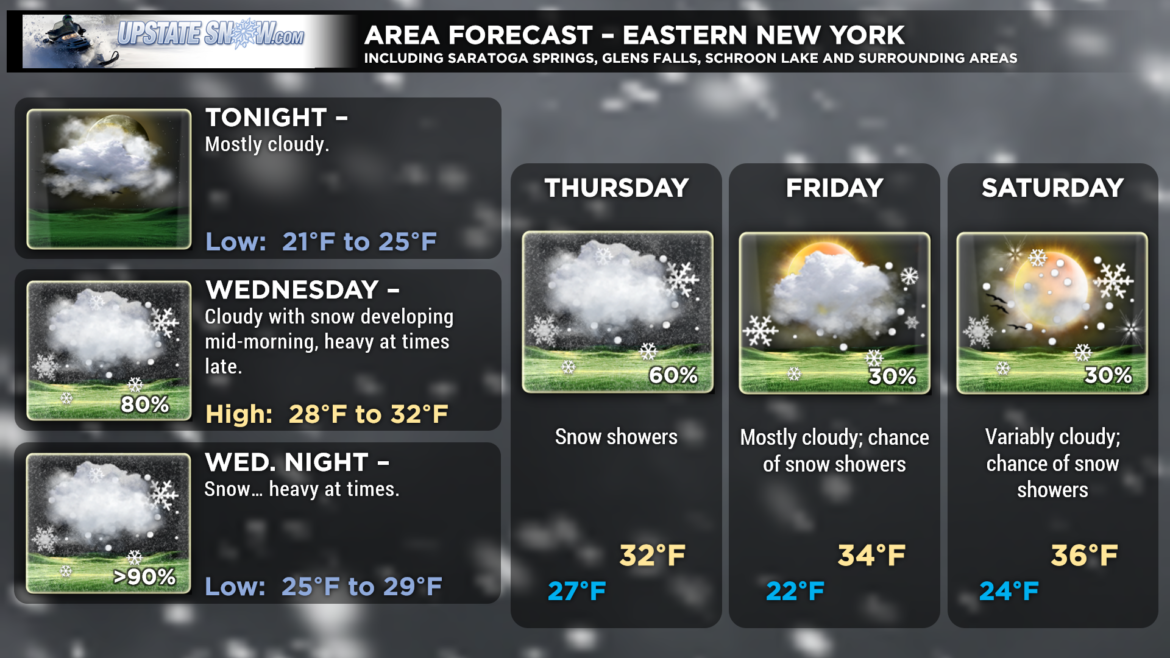
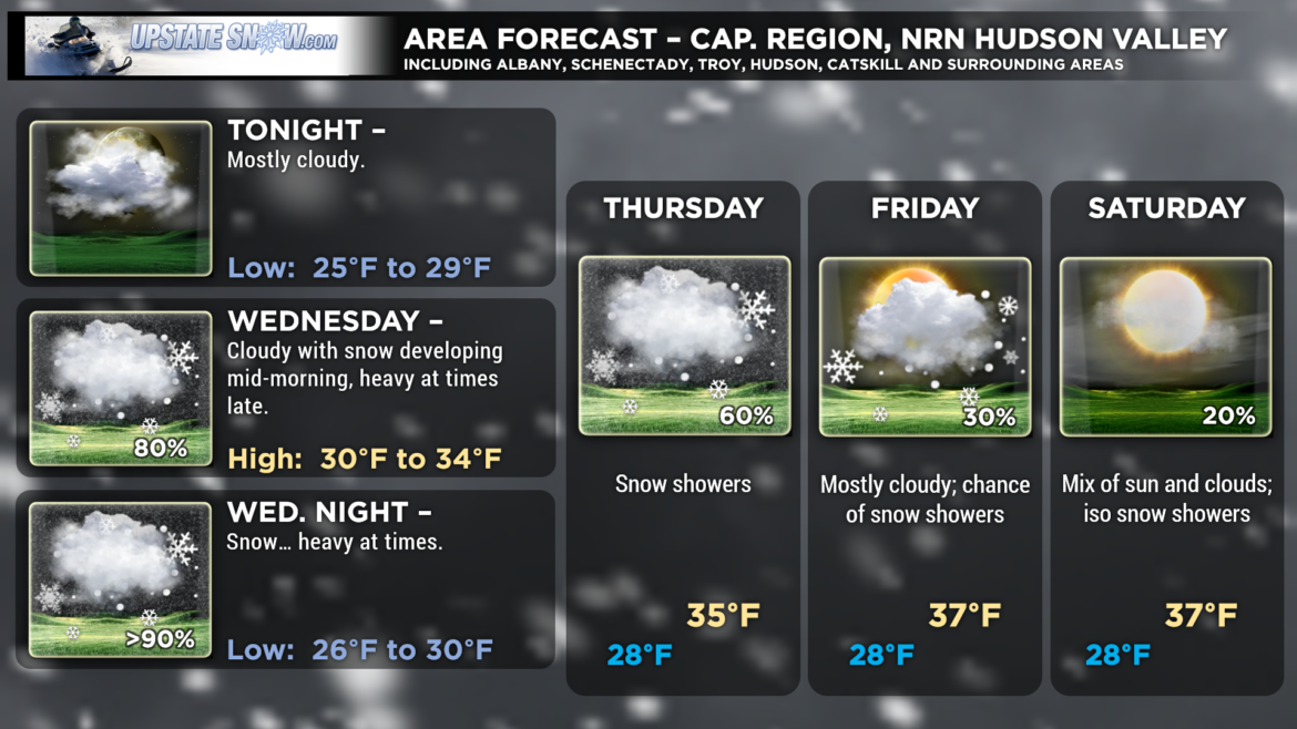
Our “second winter” continues… as Nor’Easter 2.0 will impact central and eastern New York with periods of heavy snow Wednesday into early Thursday.
Low pressure will move up the east coast to a position southeast of Long Island by Wednesday evening, and into the Gulf of Maine by Thursday evening. At the same time an area of low pressure will drift to a position over Lake Erie by Wednesday afternoon. These two systems will bring snow to the state. Negatively tilted upper-level trough will linger over the northeast as a large ridge of high pressure is established well to the east. This will force our surface low into northern Maine, and then eventually westward over Quebec.
This system will differ from the first one in a couple of ways. First, it will be a relatively quick hit, with the window for heavy snow lasting about 8-12 hours. Second, and good for riding, the snow/water ratio will be closer to the normal value of 10 to 1. Finally, the surface cyclone won’t be quite as strong, therefore we won’t experience the high winds, trees down, power lines down, etc. This will be a fairly “typical” (is there such a thing?) snowstorm for eastern New York.
When compared to yesterday, the models are pretty consistent in their solutions. There was some wobbling over a few runs but when it comes right down to it, there’s not an awful lot of change. The NAM continues to show heavy snowfall for eastern New York, and as it has been the World Champion performer this season, there’s not much reason to hate on the numbers (although we’re not going to jump on the 24+ totals being shown for some of the peaks of the Catskills).
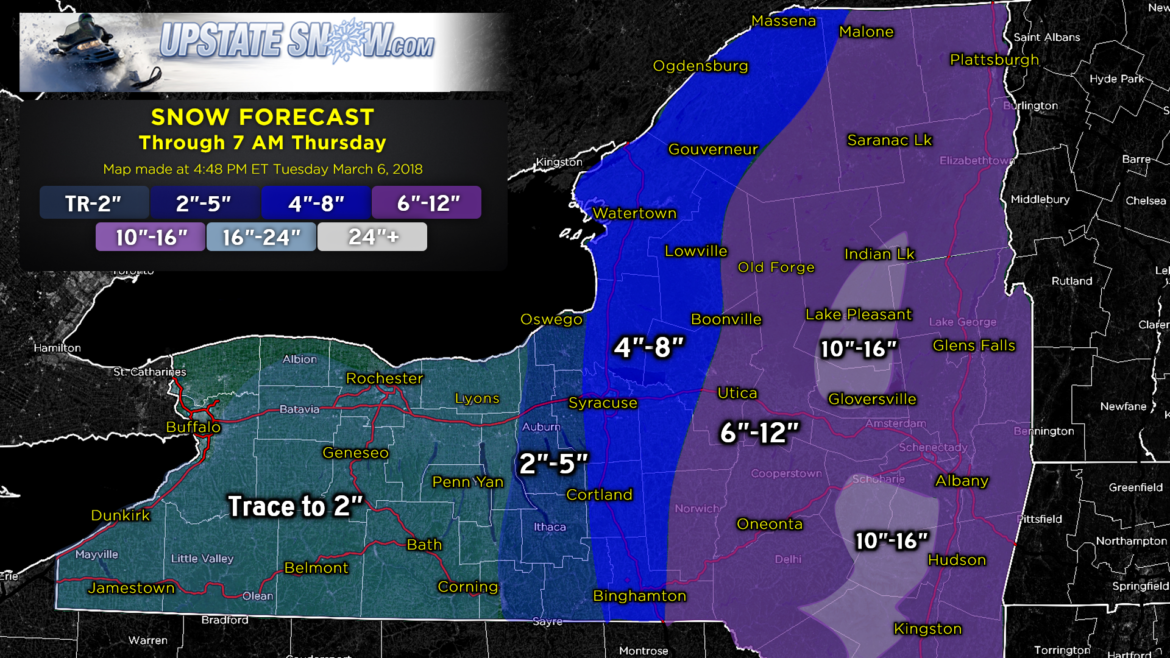
Here’s our offical snow forecast for this event… ending at 7 AM Thursday (and we’ll get to that in a second).
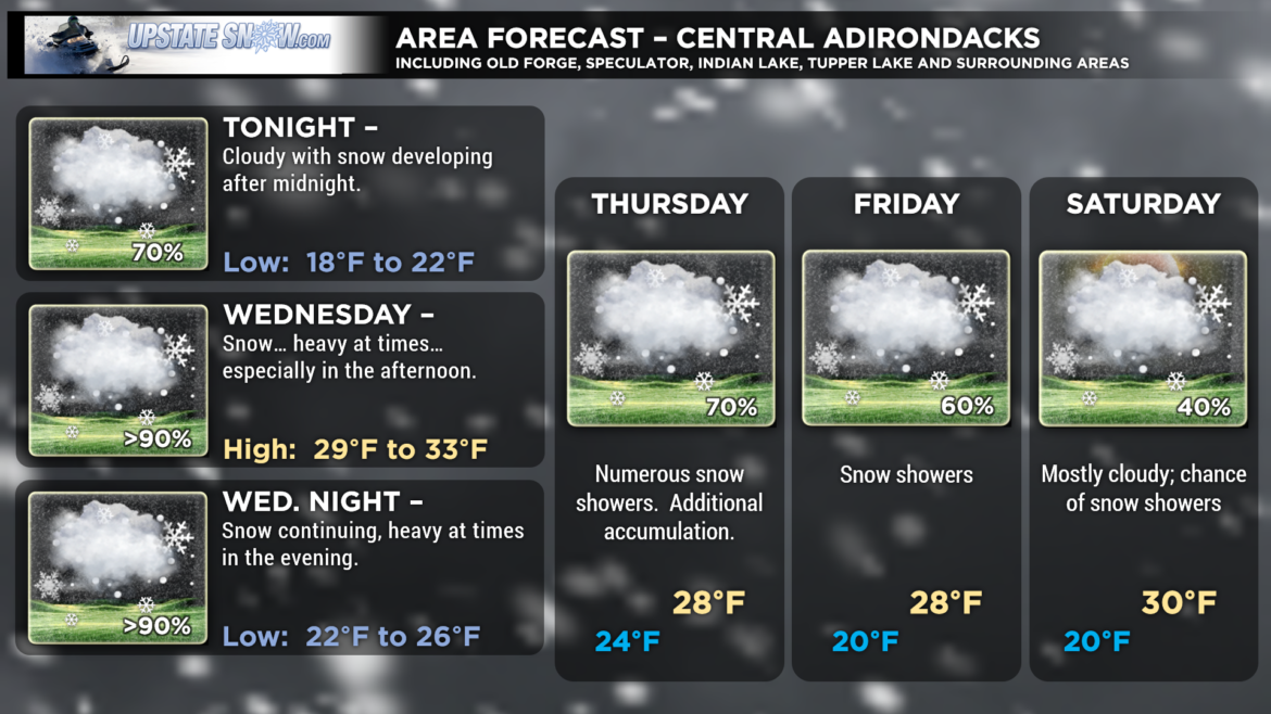
Our highest snow totals are in the higher elevations of the Catskills and the south/central Adirondacks, where we are going 10″-16″. There may be some isolated spots even higher than that, but again, isolated is the key word. As well, not everyone will see these numbers; we believe the 6″-12″ will be prevalent through all areas generally east of NY-26 into the Mohawk Valley, and generally east of NY-12 southward to Binghamton.
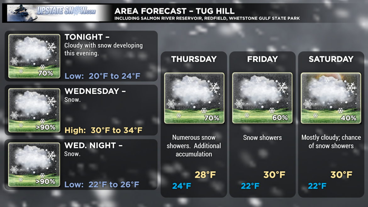
Snow amounts drop off fairly quickly as you head west. We’re going 4″-8″ along the I-81 corridor including Cortland, Syracuse, Watertown. This also includes the Tug Hill, Lowville, Gouverneur, to the Canadian border. The Fingerlakes will be looking at generally 2″ to 5″, with the highest amounts east. Get west of route 14, while there will be some snow showers around, not much in the way of accumulations through 7 AM Thursday.
AFTER 7 AM THURSDAY—
A unique presentation of a few upper-level lows (“disturbances”) doing a bit of a dance will keep widespread wraparound snow showers across the state Thursday through Thursday night and into Friday as well. These will be widespread and prevalent enough… models are showing several inches’ additional accumulation keeping things fresh. High pressure finally slides southeast over the Great Lakes from Canada by the weekend bringing an eventual end to the snow showers.
NEXT WEEK—
We’re still going to be watching a storm system that forms on the northern stream, but as of right now (Tuesday evening) the long-term models show this shoving eastward off the coast, as high pressure builds southward out of Canada. Temperatures should remain just a bit below seasonal norms.

