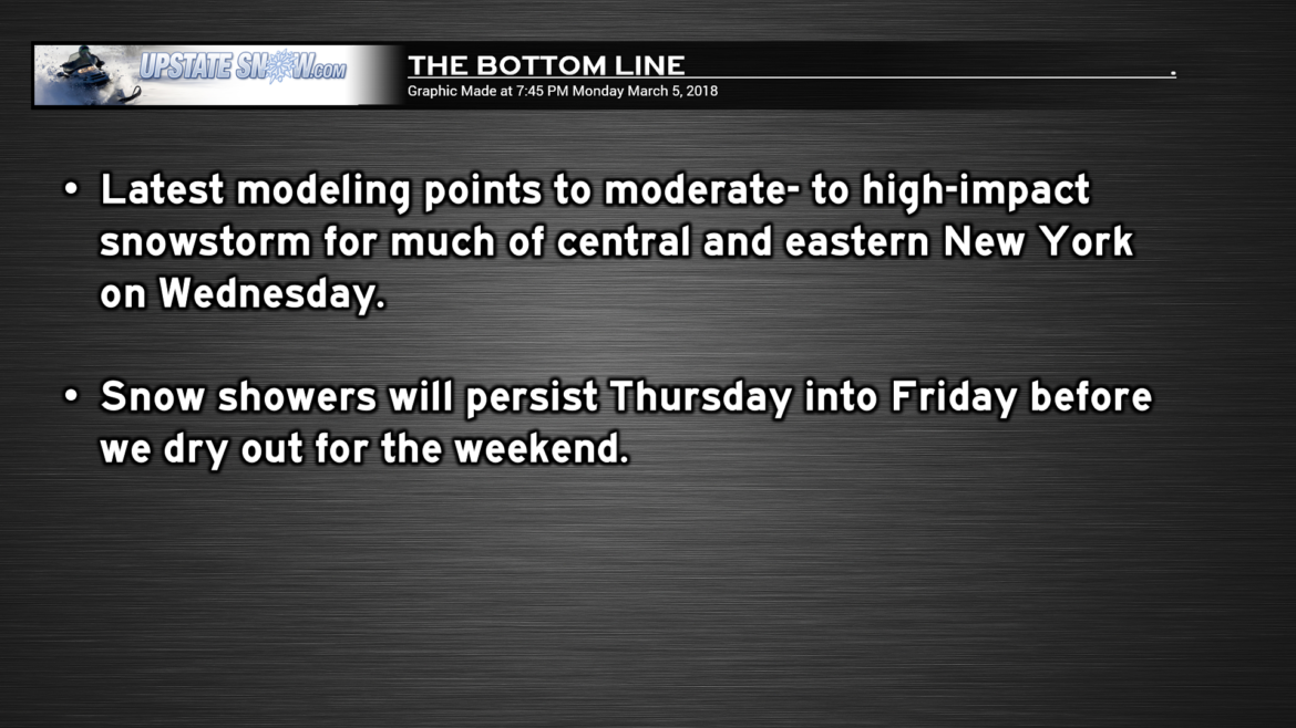
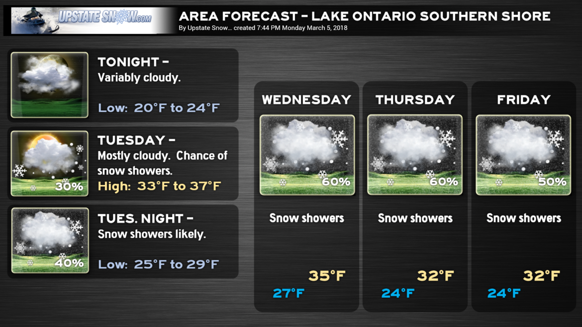
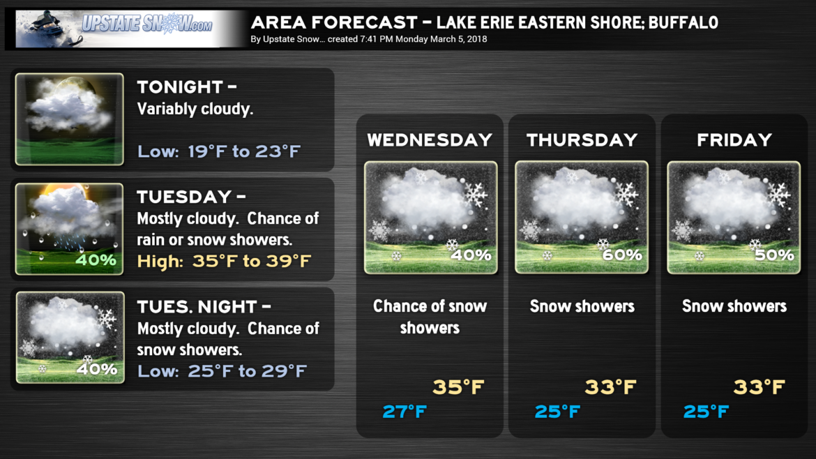
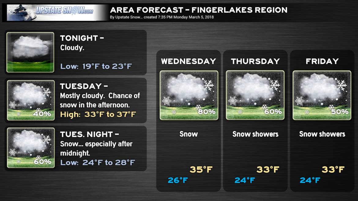
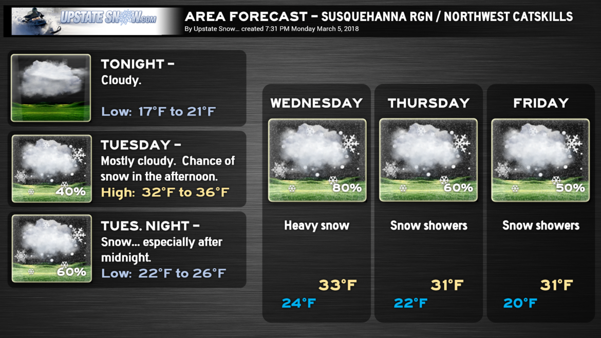
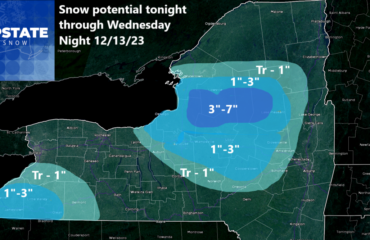
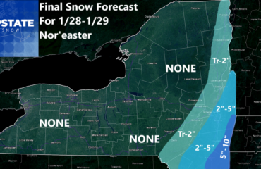
Good evening. The focus of tonight’s report will be the storm system that will bring significant snowfall to much of central and eastern New York late Tuesday night through Wednesday evening.
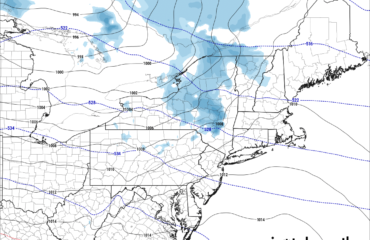
What a change 24 hours makes! Where modeling had been waffling and inconsistent earlier, they have come together nicely at this point. The GFS and NAM (in particular) point to a moderate- to high-impact snowstorm. Our “first call” map leans heavily on the NAM as it has been the #1 performer this entire season… there’s really no reason to doubt it anymore. The GFS forecast is similar in scope. We have a textbook 500-mb pattern that would spank the area with snow…. Vegas ridge, Ohio trough, 50/50 low, Greenland block, negative tilt to the trough ALL point to…….
We’re going more aggressive with snow totals after the last storm and the phenomenal performance of the NAM model.
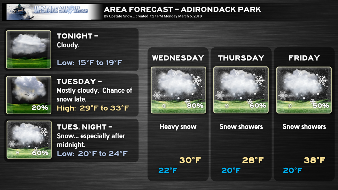
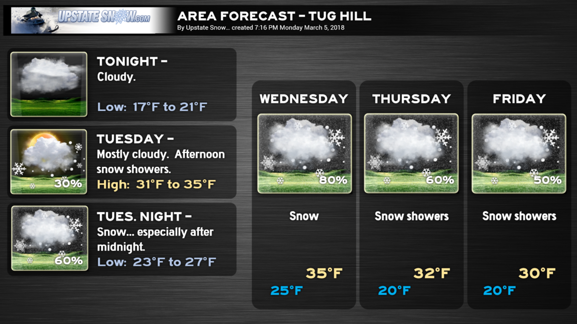
During the day Tuesday an area of moisture will lift northeast across the state, bringing some light snows. This won’t amount to much, and is really just the precursor. A surface low will move eastward into northern Ohio by Tuesday evening. Another low will develop off the southeast NC coast Tuesday afternoon and strengthen as it moves up the coast. This becomes our primary storm center by early Wednesday morning. By Wednesday afternoon, a 990-mb low will be just east off the Jersey coast and just south of Long Island. Expect light snows Tuesday night to increase in coverage and intensity, with the peak coming from late Wednesday morning through about suppertime. This should be an all-snow event, even though temperatures at the surface will be in the lower to middle 30s. This will be another wet snow. Fortunately the storm system won’t be nearly as intense at the surface, and therefore the winds won’t be too much of an issue, mitigating the threat for downed trees and power lines.
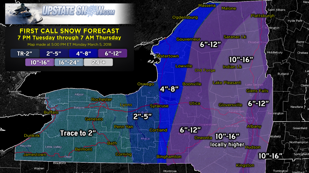
So… through 7 AM Thursday we’re going with a solid stripe of 10″-16″ from the Catskills to the eastern Adirondacks. This will be bracketed by a swath of 6″-12″ for the Hudson Valley up to Glens Falls, as well as for CNY including Binghamton, Norwich, Utica, Boonville, Old Forge, Big Moose, Cranberry Lake, Tupper Lake. Heading westward, along and just east of I-81 we have an area of 4″-8″ snow totals including Cortland, Syracuse, Lowville, Watertown, Gouverneur…. using route 11 as an approximate dividing line between the 4″-8″ and 6″-12″. Totals drop off pretty rapidly as you head westward; the eastern Fingerlakes looking at 2″-5″ with areas west of Lyons, Penn Yan, and Corning, 2 inches or less.
All this being said, here’s the big caveat: There is a bust potential here. These totals are very dependent on the eventual storm track. If the storm jogs a little farther east (away from CNY), that would pull the heavier totals farther east as well. If the storm track pushes closer to the coast, or ON the coast, heavy snows would shift west of I-81 with the potential for rain farther east. We’re banking right now on the storm moving right along the Goldilocks Zone just offshore, giving us these snow totals.
AFTER THE STORM — A rather unique situation develops as a couple of upper-level low centers (at about 18K feet) do a bit of a dance over the area. This keeps troughiness and unsettled conditions over the state through Friday. The surface low that, by early Thursday SHOULD be near Cape Cod, will get pulled into this little dance and move a bit north and … eventually WEST … by Friday. All of this combined together means plenty of moisture lingers about the state and several more inches of snow can be expected Thursday and Thursday night… and probably into Friday… before high pressure finally builds in from southeastern Canada.
It is at THAT point we turn our attention to the NEXT storm that MIGHT impact the region early next week…..
Have fun!

