Hello! You know I don’t like to put this kind of stuff out in advance, especially when it is over one week in advance. But. When all kinds of Meteorologists start screaming “pattern shift”… and when one of your closest friends in the business screamed it last night on his blog, I figured it was time to give my .02 cents on this.
NOTHING WILL HAPPEN IN THE NEXT WEEK
If you are looking for accumulating snows in the next 1-3 days, or even in the next 3-7 days, you are out of luck. Like totally out of luck. Temperatures in the afternoon will be in the 40s and 50s for several days. Way above what we would need to hold any snow. Even in the higher elevations of the Adirondacks and Tug Hill and the North Country. However, changes are coming after Day 7. Normally I don’t subscribe to this but with friends now buying in, I feel the need to at least explain what is going on:
END OF NEXT WEEK BEGINS THE PATTERN SHIFT
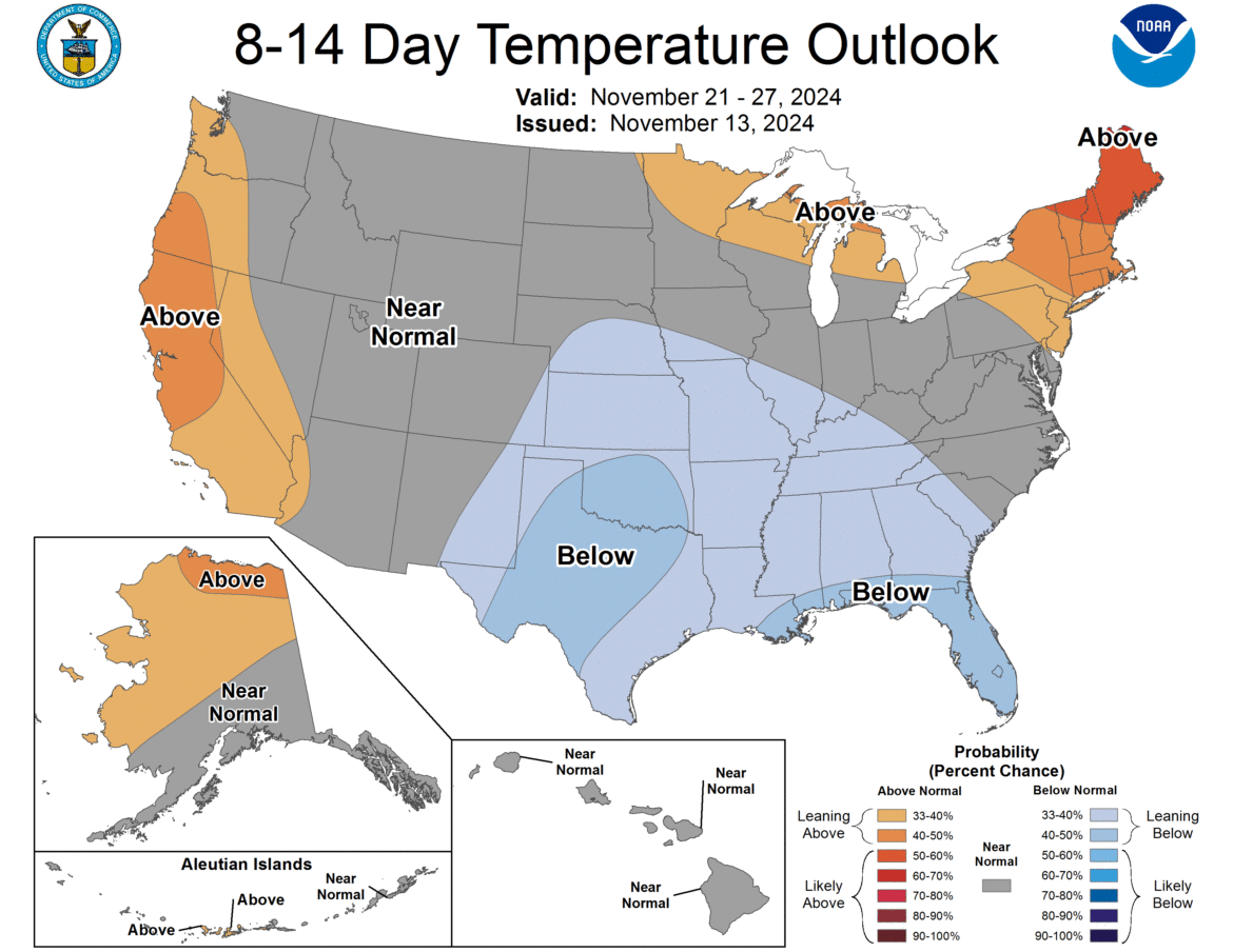
This is when, starting on Day 8, the cooler weather moves on in. It is still showing an 8-14 day average of ABOVE NORMAL but the percentages are way lower than they were days ago. And in addition, there will be some days in which we will get below normal. That will be a big thing to draw in the biggest factor in our snowfall: LAKE EFFECT SNOW!
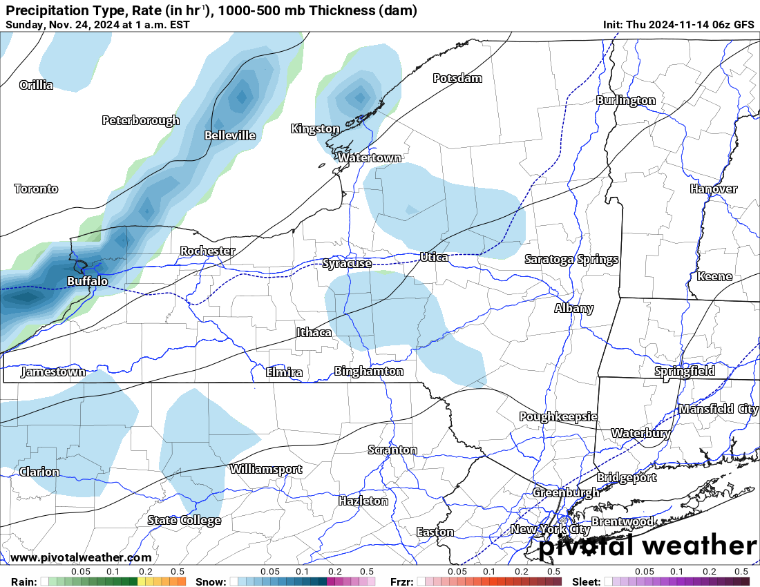
NOVEMBER 23-30 COULD BE HUGE FOR LAKE EFFECT… MAYBE
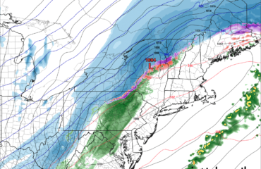
If this map is right… and again its at 240 hours so PLEASE take this with more than a GRAIN OF SALT… BUFFALO WOULD BE CRUSHED WITH FEET OF LAKE EFFECT SNOW! This is just one of several events. There’s a lighter one a few days before it, then there is another one during Thanksgiving week, including Thanksgiving Day and Black Friday. Yikes! Seeing as how all of this is 8-16 days out on the GFS, the craziest model for snow here in the Northeast, pray that as the other models start to get into this that it SHUTS DOWN! Or we may be in for a crazy second half of November!
Being as how it has been so warm in the second half of September, nearly all of October and the first half of November, lake temperatures are near records for this time of year. The lakes are in the mid 50s! That is like almost 10 degrees above normal. They should be nudging down through the 40s this time of year, not still in the 50s. So this means that any below freezing air that gets over the lakes, will have the chance to produce lake effect snow. And heavy at that!
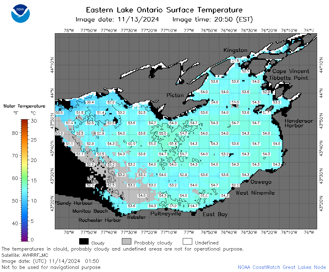
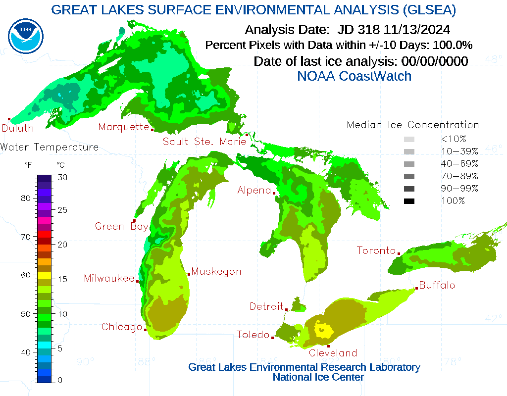
I mean… seriously. It is mid-November here. The lakes are mainly in the 50s with some high 40s over Lake Superior. This is near all time warmth for the lakes for this late in the year. This is shades of 2014. If the right cold air plunge comes down between now and the end of the year, especially over the next 1-4 weeks, we could be looking at feet upon feet upon feet of snow! Enough to cause a 2014 or 2001 or 1977 storm in Buffalo. The kind that rival history. I hope not. I am just saying that the fuel is there. If we get something to lite it up… BOOM!
Tomorrow I follow up with you all on the first revision to my winter weather outlook. If there was a time for this to come about, it would be now. Thank God! I was beginning to wonder if winter was ever going to come back! I will be seriously thinking about what if any changes to make to the outlook based on what I am looking at now.
Zack and Rich Lupia
Upstate Snow
November 14, 2024


