Hello everyone! I am so glad to see you again after nearly a week long break. So what happened? Well after I let the weekend spill off with not much rain or snow to deal with, I was about to write out my usual start to the snowmobile season report for the Adirondacks. That. Didn’t. Happen. I started getting sick during the day and by Monday Night, I was out for the count with 100+ fever. My fever peaked at over 102 during the week and I did practically nothing for a few days. The fever broke by Thursday morning and I returned somewhat to normal and handled things well. Today I feel 100% back to normal and and going to play it as such!
SNOWDEO IS TODAY THROUGH SUNDAY IN OLD FORGE! Thousands of people up there. Hundreds of sellers. Snowmobiles galore. Unfortunately it’s going to be unusually warm and what very little snow is left on the ground up there is likely to be gone shortly. After this unusually warm stretch of weather, starting Sunday night and going through the day on Monday, yes, we are going to have snow. We are going to have more than enough to need to clear it… and perhaps enough to engage our snow clearing armies too! Here is what I know as of right now: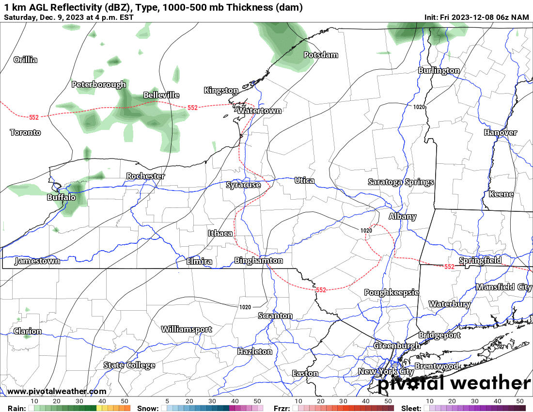
Through Sunday: It’s going to be warm. It’s going to be in the 40s and 50s. Deep southerly flow. Rain showers are light and scattered on Saturday. They become a little more widespread Saturday Night and especially during the daytime hours on Sunday.
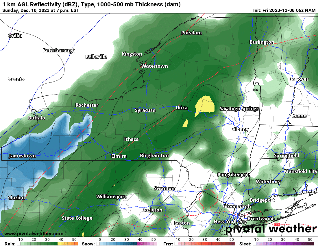
On Sunday, the rain becomes pretty much a consistent, all out washout across Upstate NY, particularly in the afternoon and evening. There is the chance even on Sunday afternoon and evening that THUNDER may be coming down along with the rain!
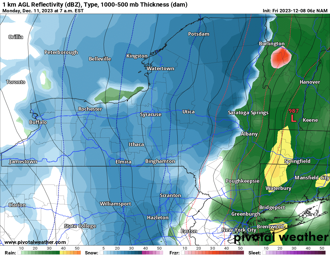
Sunday Evening is right now transition time from rain to snow. We start off in Western NY, to the Tug Hill, North Country and Adirondacks, then Central NY and the Southern Tier, then finally to the Catskills, eastern NY and the Capital Region by Monday morning.
What’s the biggest thing that’s going to drive accumulations out of this? What time it changes from rain to snow? How heavy the snow is after changeover? How long it stays like that before snow tapers off? All of these things are just getting into our short term models now. These models run every 6 hours between now and the storm. This means 10 more model runs. How much shall the models change between now and then? We have seen everything over the last 10+ years forecasting here at Upstate Snow from STELLA in 2017 to hardly and snow in late 2015 and also a good part of last winter, which worked great with my stroke recovery. Thankful for that.
After this storm moves out late Monday, the sun at least partially returns, the temperatures go back to near normal, and at least glimmers of sunshine enter the forecast. If not, actual partly sunny skies. That would actually be nice.
Heads up on tomorrow! That will be the FIRST FORECAST SNOWFALL ACCUMULATION MAP for Upstate NY for Sunday Night through Monday Night. Any revisions to that map will follow on Sunday Morning. So yep, expect a wild weekend ahead! But it’s December, snowmobile season has started in the Adirondacks and will start across the Tug Hill and North Country after this storm so definitely keep track of this one!
Rich


