
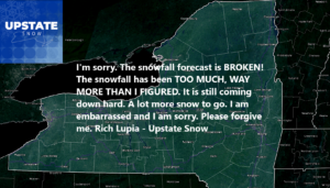
I AM SORRY. SO SORRY. THIS LAKE EFFECT, WIND, AND COLD EVENT HAS BEEN BEYOND WHAT I THOUGHT. THE SNOWFALL ACCUMULATIONS WERE WAY MORE THAN I THOUGHT. IT LOOKS LIKE THE SECOND “GENERATIONAL” TO “HISTORIC” LAKE EFFECT OFF OF LAKE ONTARIO. JUST THIS WINTER ALONE. I KNOW YOU ALL ARE BURIED SO BAD IT’S $&%#!!!
I have no idea where to start here other than to offer myself as a sacrifice. The City of Utica is pushing 2 1/2 feet of snow since Friday. Rome is pushing 4 feet. Again. Areas north of Syracuse, particularly from Camden to Central Square, Parish, Fulton, then along the south shore of Lake Ontario not just to Oswego and Fair Haven, but through Wayne County, to Monroe County and Rochester, even into Western NY.

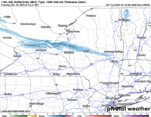
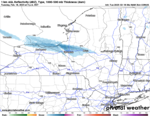
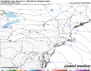
Oh my word. I have no idea what to do now. Except to say that the lake effect snow coming off of Lake Ontario will come off of Lake Ontario for about another 24 hours. Some of it will be very heavy. While yesterday the lake effect carried all the way to the Atlantic Ocean… AGAIN… today it should only carry to the mountains of Western New England. I don’t think the Connecticut Valley and points east will see the lake effect like they did yesterday. Here is my forecast map:
Hey! How do you like it? Isn’t this what you are supposed to have when the lake effect goes absolutely bonkers on you? I mean seriously, the amount of lake effect snow this year has been very impressive! We haven’t seen numbers like this for lake effect since the 1990’s, if not the 1970’s. Here are the weather maps for this afternoon and tonight.

Wednesday? You know what? THE SUN COMES OUT! IT’S TIME TO DIG OUT! Seriously. It is. That is GRRRRREAT news! GET OUT AND ENJOY IT! At least when you have to clear FEET of snow! And if you don’t live in the lake effect areas like where I am from and mostly covering, I AM SORRY.
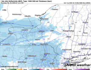
Now what about the big Nor’easter we were talking about several days ago that was going to hit on Thursday? We talked less about that a few days ago. Now… pretend it didn’t happen. Seriously. 5 to 6 days ago we were talking FEET of snow in the NYC and the Tri-State area. Then it was down to inches. Now it’s down to NOTHING today. If anything, some sun breaking through the clouds. Here in Upstate NY, snow showers. Perhaps a dusting to 2″. Seriously on that! After that…
BIG BREAK!
The big break we have been finally waiting for arrives. This is the longest and biggest break I think we have had since Christmas to New Year’s. Temperatures slowly come up to where by early next week, we actually start talking about maple syrup weather. Above freezing during the day. Below freezing at night. It is still looking cold and snowy again after next week but for several days, we get a reprieve. And with SEVERAL FEET of snow out there, a few days above freezing will not wipe out this snowpack. NOT EVEN CLOSE. Now in some areas of the state with a lot less snow like the Finger Lakes, Southern Tier and the Hudson Valley, I am sorry. This will probably shut you down next week. As for the rest of the state, especially north of the Thruway (between Syracuse and Albany), you are GOLDEN! For weeks!
Zack and Rich Lupia
Upstate Snow
February 18, 2025
Please thank our advertisers on Upstate Snow for 2024-25
Banner Sponsorship
Great Lakes Equipment
Enjem’s Flooring America
Ohio Ridge Riders
ilsnow.com
Southern Tug Hill Sno-Riders
Saratoga Snowmobile Association
Business Sponsorship
Wedge Life
Paton & Son Excavating and Landscaping
Personal Sponsorship
Jim and Colleen Andre


