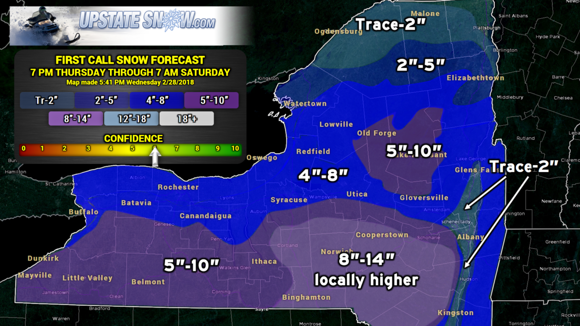
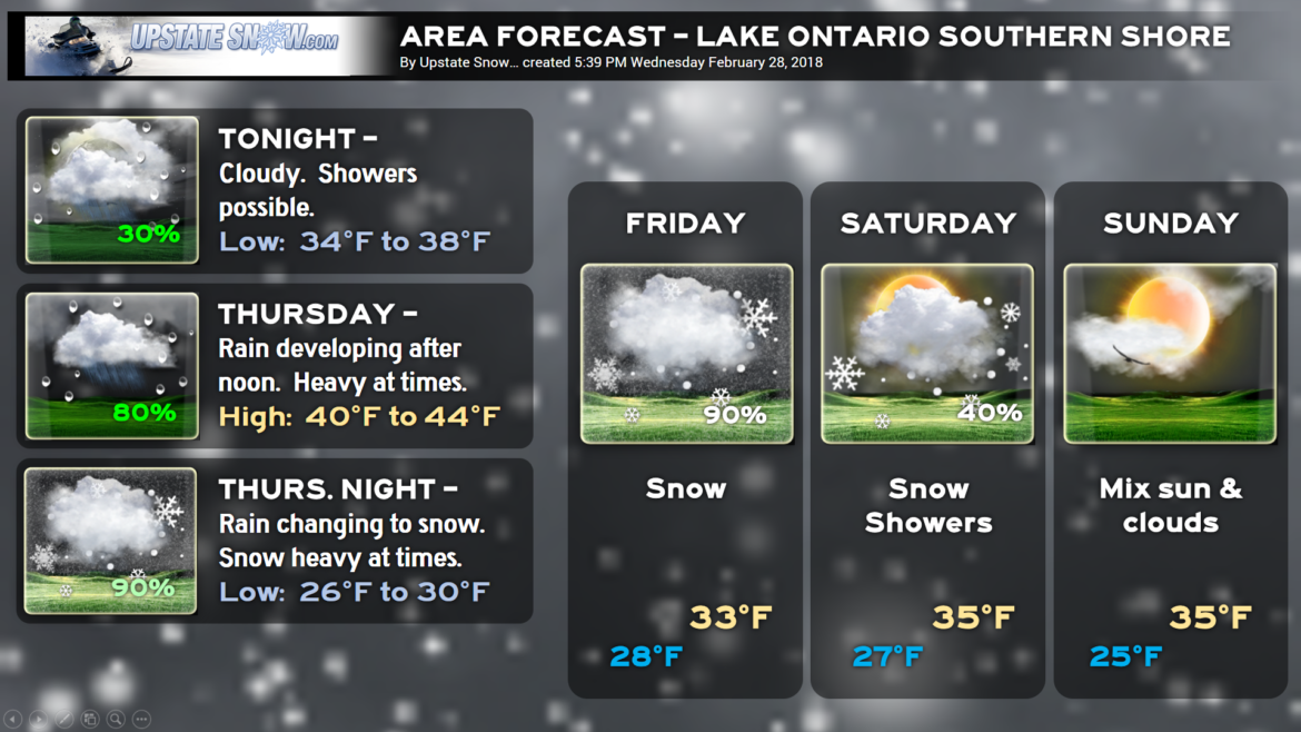
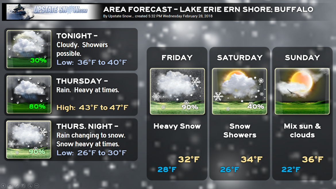
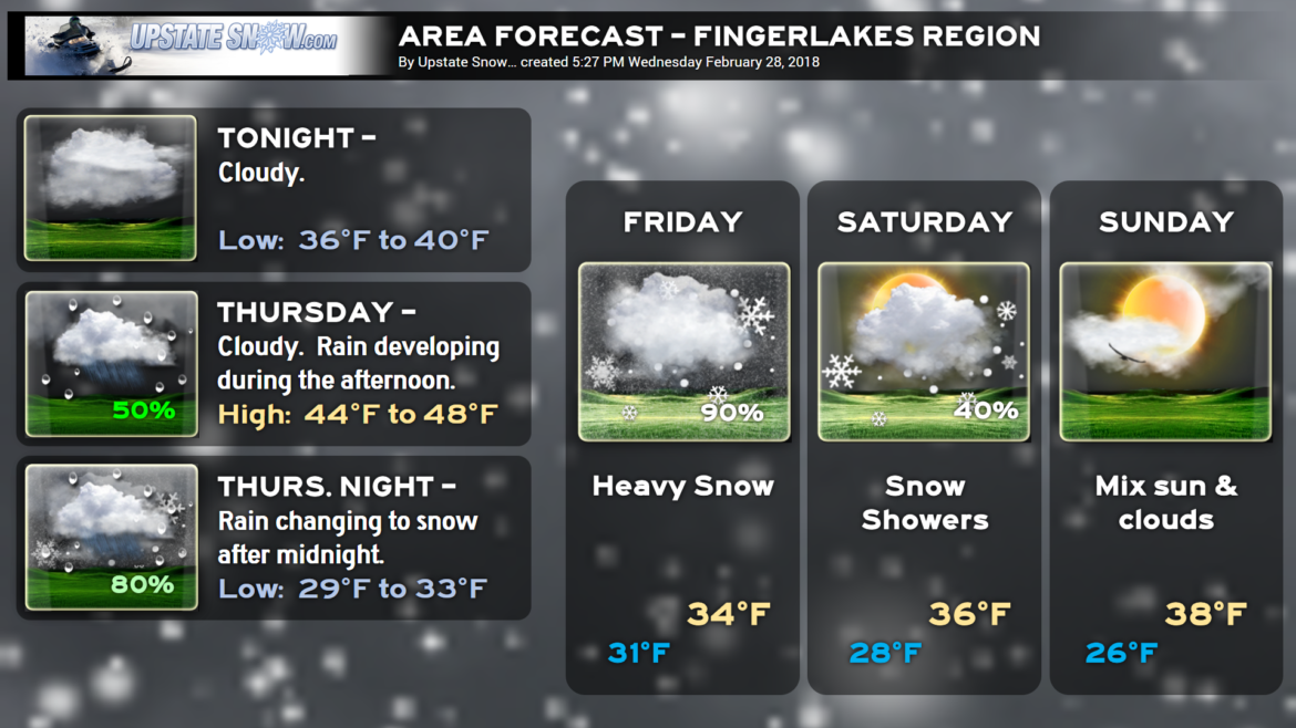
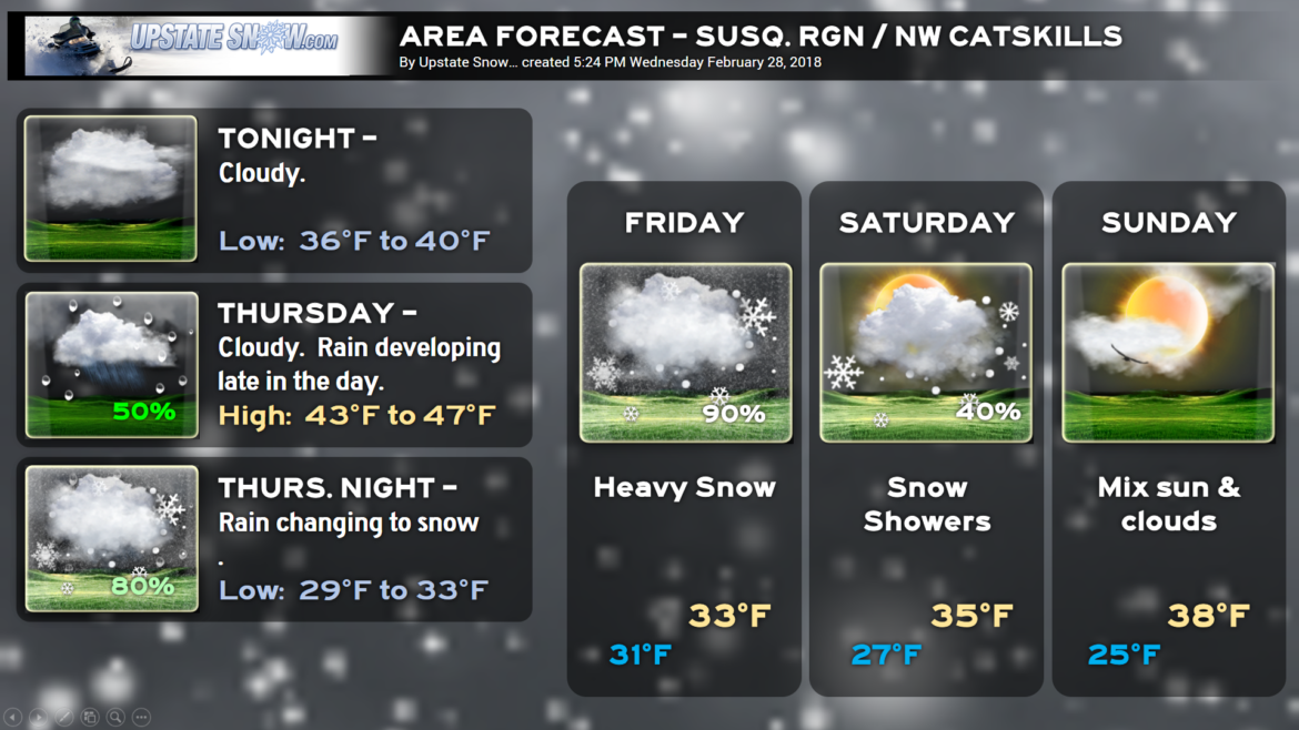
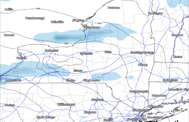
Good evening! Here we go, the map below is our “FIRST CALL” snow accumulation map for 7 PM Thursday through 7 AM Saturday. We are MODERATELY CONFIDENT with this forecast, and these numbers are probably on the conservative side.
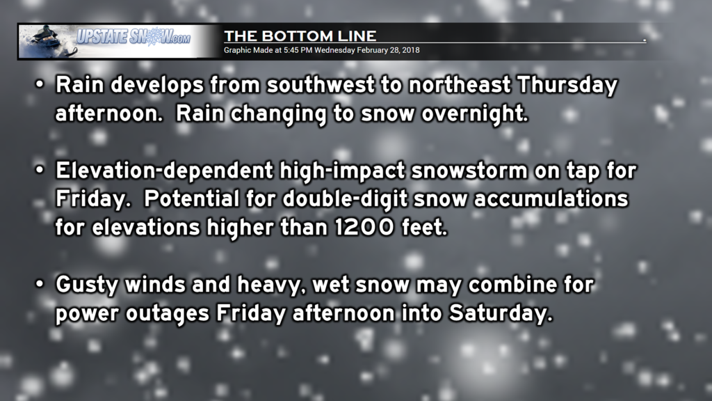
Why are we going with these numbers? Spring has sprung across most of the state and the ground is warm. The warm temperatures today certainly added to that. Secondly, we’re going to get a period of rain before cold air wraps into this system which will add to the soaked and warming ground. So once the transition begins, it will have to snow for a good while before any real accumulation starts.
This will be VERY ELEVATION-DEPENDENT, which is why we have some wide ranges here on our numbers. Folks over 1200 feet or so …. bazinga! Double-digit snows, particularly along and south of route-20, and ESPECIALLY as you get east of I-81 into the Susquehanna Region and Catskills. The upper level low is expected to move pretty much across central PA, which puts the Catskills and Susq. region right in the Goldilocks Zone for the heaviest totals.
It will also be windy, especially Friday as a very deep surface low blows up off the southern New England coast. This low is going to deepen quite remarkably and wobble back and forth for about 24 hours or so. This will keep gusty northwest / north winds and snow showers in the region through Saturday… some power outages can’t be ruled out given wet grounds, and the very heavy, wet consistency expected to the snow.
As a historical analog, this storm is remarkably similar to a storm that occured in late February 1998, which gave forecasters fits.

THERE IS A FAIRLY HIGH “BUST” POTENTIAL with these snow totals, hence the rather middle-of-the-road confidence.
Factors include
1) How quickly the low organizes off the coast…
2) WHERE the low develops off the coast…
3) How much cold air funnels in from the northwest…
4) WHEN the cold air starts funneling in from the northwest.
Also impacting snow accumulations will be temperatures… this is a situation where ONE OR TWO DEGREES can mean the difference between heavy snow and heavy rain. It could be, for instance, 31 degrees in Clark Mills, with heavy wet snow, but downtown Utica is 33 with a rain/snow mix. This is how it will be… there won’t be a sleet or freezing rain — it’s either going to be snow or rain or mixed snow/rain.
Strap in folks, as good ol JR from WWE fame would say: “Business is about to pick up.”

