The “Almost” Morning Blog 12.26.2020
Friday, 25 December 2020
by Upstate Weather
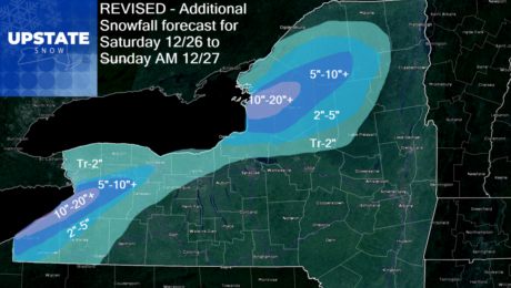
Heavy lake effect snow will continue off Lake Erie into Saturday, then the big show moves to areas off Lake Ontario, mainly the northern half of Tug Hill and snowbelt areas to the north. We made some tweaks to amounts and bands based off the 3km NAM projections. Still holding the big accums basically where
- Published in Weather
Special Christmas Blog *Major Weather Event and it’s not all snow*
Thursday, 24 December 2020
by Upstate Weather
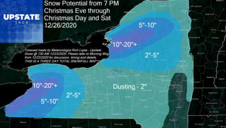
The snow map we issued for when precip does change to snow (it already has in WNY as of this 1030 PM Christmas Eve writing), through tomorrow and Saturday into Sunday AM… I’m going to run with it and repost it at the bottom of this blog, however, I have deep concerns about folks on
- Published in Weather
The Morning Blog 12.23.2020
Wednesday, 23 December 2020
by Upstate Weather
Before the snow gets here, heavy rains and warm temps will take a bite out of our snowpack Christmas Eve. The models are not in 100% agreement but closer than they were and I’m comfortable enough to take a shot at some details. Please note: This forecast is very much subject to change. Timing of
- Published in Weather
The Morning Blog 12.22.2020
Tuesday, 22 December 2020
by Upstate Weather
Certainty and uncertainty. That’s todays theme. The amount of uncertainty with the Christmas Eve warmth and rain is still high. How much? How long? When? Those are critical to determining how much snow pack survives. Models are still inconsistent on this. If you believe the Canadian RGEM, it’s a wipeout. If you believe the NAM
- Published in Weather
The Morning Blog 12.21.2020
Monday, 21 December 2020
by Upstate Weather
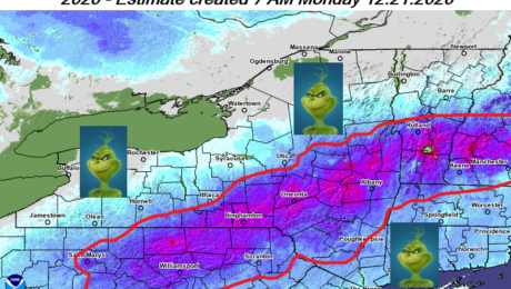
The Grinch that could steal your White Christmas is en route, ready to turn Christmas Eve into a freaking mess across Upstate NY. The map shows the 10″ snowpack line as of this morning. It’s areas that have LESS than 10″ of snow pack that are most likely to lose their snowpack Thursday. Based on
- Published in Weather

