What is happening now is Bing. Tomorrow is Bang. Saturday Night and Sunday Morning is BOOM!
Over the next 84-96 hours, the snowfall amounts for Upstate NY, in particular along and especially north of the Thruway will be significant. By early next week, we will continue to be below freezing with a whole lot more new snow. This is as good as 2018-19 or 2017-18. If anything, this could end up rivaling February 2015. Ten years ago. The most brutal month in our history. Not in terms of the bitter and brutal cold week after week but with the snows coming through every day or two with decent accumulations. It will pile on up and riding will just be automatic. Again, for the most part, I am talking about areas EAST of I-81, WEST of I-87, and NORTH of I-88, especially NORTH of I-90. For the rest of the state, much less snowfall is expected although you will not get shut out. Not in the least bit. Not now. We are within 4 days on these.
BING

By midday today the snows begin to focus to the east of I-81. Along and south of the Thruway is the best chance of seeing sleet and freezing rain. Or just plain rain as temperatures break freezing in the lower elevations. Due to the fact temperatures are low enough north of the Mohawk Valley and Capital Region, this is the area we expect mostly snow and as a result more of it to stick. It won’t be a whole lot. But it will be enough to slow you down today.

BANG

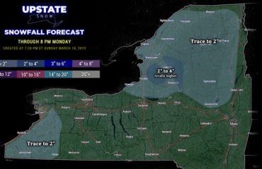
Heading into tomorrow we have a minor lake effect event developing downwind of Lake Ontario. Since the wind should be around 280 degrees, it favors Oswego, Northern Oneida, Northern Herkimer, Southern Lewis and into Fulton and Montgomery Counties. Not really a whole lot elsewhere. In the most localized bands, several inches of snow will accumulate. In some places 8″ or more. In other areas outside of the main squalls, not much will be expected on Friday.

BOOM

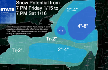
This much bigger storm rolls in fast on Saturday Night. This one has had my attention for a few days and we have confidence this one will be more significant. This one will hit the entire state with shovelable and plowable snow. Saturday Night the snow moves in quickly. The snow will be heavy at times, especially along and east of I-81. Lesser amounts to the west. Heavier amounts to the east. On Sunday Morning the snows taper off quickly from west to east. By midday on Sunday the snows are essentially done for Upstate NY. But with only a 12 to 15 hour storm, this one packs a punch. When it is overhead, 1″ of snows per hour will be common and widespread. So if you plan to be out on Saturday Night or heading to church on Sunday Morning, BEWARE! The snows will definitely slow you down!

And there are more snows to come! Believe it or not! At least one more storm middle of next week and potentially more storms Valentine’s Day and into President’s Day Weekend. No rest for the weary here! Just keep piling up the snows! We need to get more trails open! We need to get more people riding! We need to keep telling people daily that this is the best snowmobile season in several years, if not a decade! It has been a long time since we have been able to say that with full confidence. And now I have.
SO ENJOY YOUR SNOW! MAKE THE MOST OF IT! AND RIDE RIDE RIDE!
Zack and Rich Lupia
Upstate Snow
February 6, 2025
Please thank our advertisers on Upstate Snow for 2024-25
Banner Sponsorship
Great Lakes Equipment
Enjem’s Flooring America
Ohio Ridge Riders
ilsnow.com
Southern Tug Hill Sno-Riders
Saratoga Snowmobile Association
Business Sponsorship
Wedge Life
Paton & Son Excavating and Landscaping
Personal Sponsorship
Jim and Colleen Andre


