Good morning Upstate Snow Nation! Did you think I went away permanently? Well NO! Yes, Major Hurricanes tend to take most of my attention this time of year and I apologize for the delayed response on this. But now that Milton is out of the way, we have a lot of weather to talk about over the next week for Upstate NY. Particularly if you are in the higher elevations and/or downwind of Lake Erie or Lake Ontario, you will need to pay attention.
FROST ADVISORY TONIGHT: With high temperature today only hitting the upper 40’s to lower 50’s across Upstate NY this afternoon and with mostly clear skies ahead for tonight, that is TROUBLE. The average date of the first frost (32 F) temperature for Utica/Rome is October 7th. The average date for the first flakes there is October 21st. The average date for the first inch of snow is November 11th. Based on what I am seeing for tonight, I am seeing a majority of Upstate NY (over 50%) receive it’s first frost of the season. Whether it hits Utica/Rome or the bigger cities remains a question but for outlying areas by Friday morning, a good frost on the ground is likely and the growing season will be over for them.
Friday and Saturday will be warmer with temperatures reaching into the 60s. Nowhere near as cold Friday or Saturday Nights either. Now Sunday is where things turn and the second shot of cold air comes at us. This one is even bigger than the first one. Sunday will be mainly a rain day for Upstate NY with temperatures set to fall Sunday Night and into Columbus Day. Then it starts to get interesting…
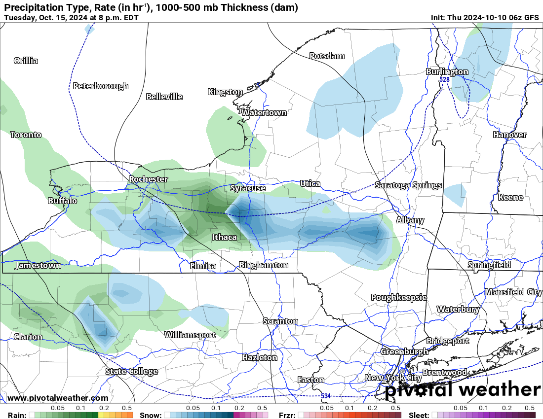
Here is the GFS:
This is more aggressive with snowfall, especially with a secondary front on Tuesday, spreading snowfall across most of Upstate NY on that date. Looking at a dusting to 1″ in the lower elevations with a few inches in the higher elevations, especially in the Adirondacks and Catskills.
Here is the Euro:
A 998 low, a much stronger low takes over Columbus Day morning. This helps to pull most of the moisture out of Upstate NY by Monday Night. It also helps to take the wrap around colder air with mix and snow and keep it farther north, generally along and north of I-90. Accumulations would be defined in these areas. Dusting in the lower elevations. Dusting to maybe an inch or two in the higher elevations.
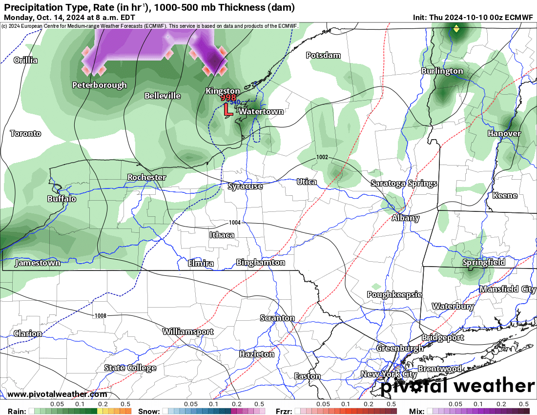
Both of these models are showing ACCUMULATING SNOW in the higher elevations and trace amounts at the lower elevations. With us being into Mid-October it is not unheard of for us to be talking about this. It’s only one week ahead of schedule based on our long term averages. But with the fact it has been so dang warm the last several years, just the fact we have something more “normal” for the 2024-25 season, at least to start the year, seems odd. Just because we haven’t seen it in several years doesn’t mean it’s weird or doesn’t happen anymore. It just means that we are that much closer to riding season.
With this being the case, and with the tropics finally getting quiet again, I will be on top of this day by day. It is the least you deserve.
Please do me a favor, if you haven’t already, please like, follow, and share my content online! That is the best thing that you can do to help me out with this. Appreciate your help!
Rich Lupia
October 10, 2024


