Another round of lake effect snow will hit downwind of Lake Erie and Lake Ontario, mainly through Wednesday evening. The weather should improve for the end of this week in terms of riding. Which just happens to be GREAT for us. More on that later in this post 🙂
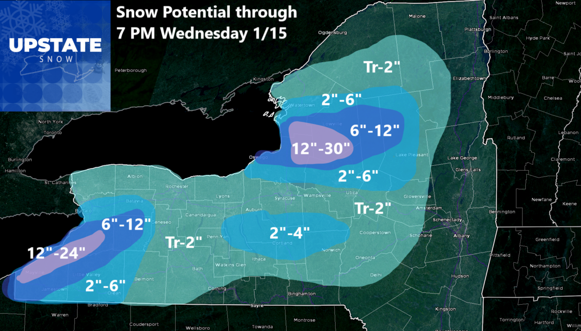
Good morning! We are having our first above freezing temperatures today across parts of Upstate NY with some locations in the lower elevations hitting the mid 30s briefly. Even though it won’t be that mild for that long, the melting and compacting of the snowpack will indeed change the way the snow looks around here. But a cold front is looming. And behind it will not only be another shot of cold but another shot of lake effect snow!
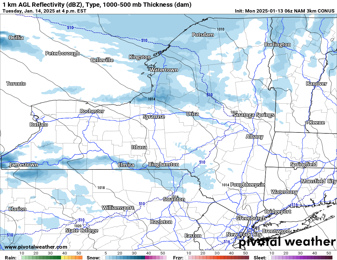
It starts to get going this evening as temperatures fall from the 30s to the teens. Then don’t rise up all that much tomorrow. Snow showers develop quickly as the colder air moves in. Air that is coming off of Lake Erie and Lake Ontario will have heavier snow showers and squalls with them. This starts tonight, is going all through the day Tuesday and into most of the day Wednesday before the winds slacken off and the temperatures are not as great for lake effect above us.
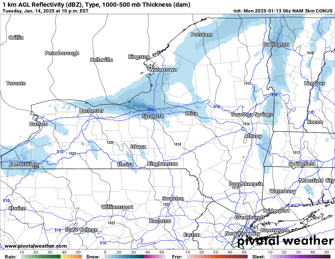
Some snow showers will still punch through Wednesday Night and into Thursday as temperatures start to rise. We should be near normal with temperatures in the 20s to around 30 on Thursday depending on your location. On Friday, temperatures in the lower elevations will reach freezing. Still staying in the 20s to near 30 especially up north.
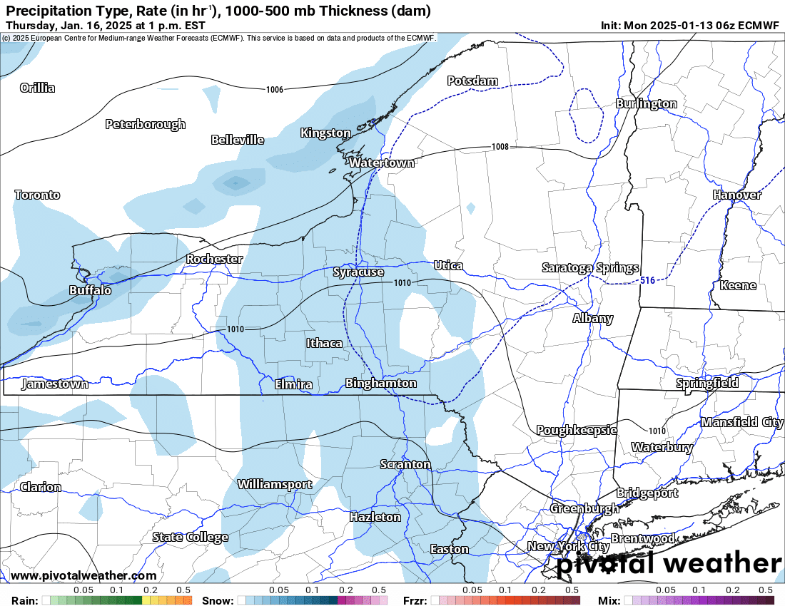
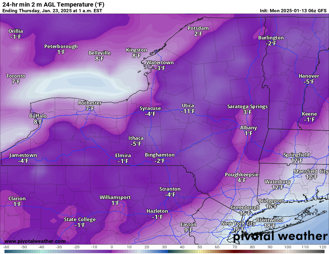
The next storm this weekend brings a mix with temperatures near to just above freezing. We will see on that. Then, it will definitely get super cold next week. It could be record cold if not approaching all time winter cold west of Upstate NY. While it will not be anywhere near as deathly cold as the Midwest, Mississippi, and Ohio Valleys, it will get BELOW ZERO for sure here in Upstate NY. We are looking at several days middle to end of next week and heading into the last days of January where lows will range from the single digits to some days -10s to potentially -20. We are way too far out to talk about lake effect snows, but it will be at least the coldest since 2018, 2016, 2014, 2011 and potentially 2004 and 1994.
TIK TOK ABOUT TO SHUT DOWN
We are less than a week from the TikTok ban. I have no idea if it will be saved in the 11th hour or not. I have a growing audience there that I am about to lose for good. Please help me by liking, sharing, and following me at any of the below:
facebook.com/meteorologistrichlupia
facebook.com/upstatesnow
youtube.com/meteorologistrichlupia
rumble.com/c/c-1034063
rumble.com/c/c-1034066
This reminder up above will be posted daily for the next week to 10 days. Follow us wherever you can!
Zack and Rich Lupia
Upstate Snow
January 13, 2025
Please thank our advertisers on Upstate Snow for 2024-25
Banner Sponsorship
Great Lakes Equipment
Enjem’s Flooring America
Ohio Ridge Riders
ilsnow.com
Southern Tug Hill Sno-Riders
Saratoga Snowmobile Association
Business Sponsorship
Wedge Life
Paton & Son Excavating and Landscaping
Personal Sponsorship
Jim and Colleen Andre


