The 10 day surge of cold and lake effect snow is now over. Coming up in the next three days: RAIN!
This cold surge has officially come to an end in Upstate Snow Country. On the evening of opening season in the North Country and in the Adirondacks and parts of the Tug Hill. The rain that is coming will come in two distinct waves: The first one being this evening through Monday afternoon. The second more intense wave will be from Tuesday afternoon through Wednesday evening, when it changes back to snow through Thursday before the atmosphere dries out and chills out.
OPENING DAY IS TODAY AT 5:30 PM!
If you are in the Adirondacks, North Country or parts of the Tug Hill, the snowmobile season starts this evening! For the next (about) 3-4 months, any snow that hits especially up there, we will cover. Remember even when the season opens up, trails may still be closed. Gates may still be locked. Please give clubs the opportunity to get things going right so your trails are not shut down.
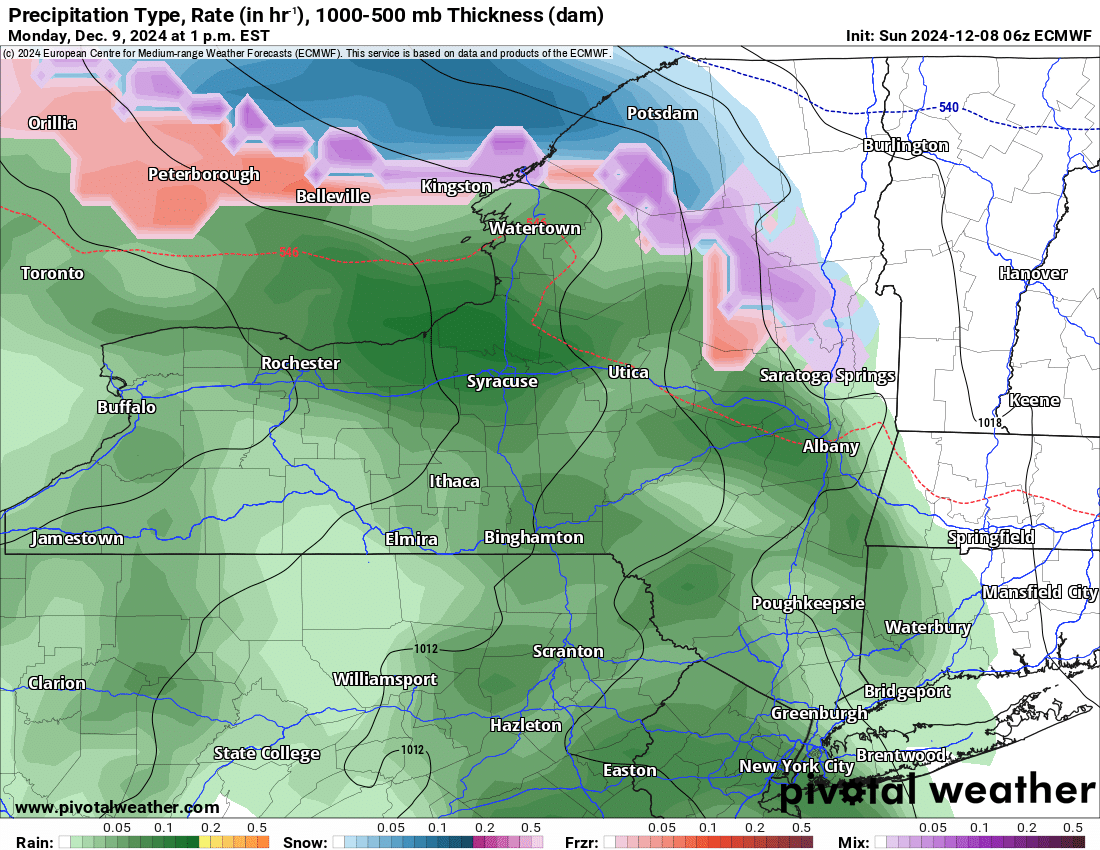
WARM UP PART 1
This moves in along with the opening of the season this evening and last through Monday afternoon and evening. It will be cold rain, and cold enough for sleet and freezing rain over parts of the North Country and Adirondacks. Nothing is on the watch/warning board yet, but something could pop up temporarily. This first batch of rain will be the colder rain and not as much rain
WARM UP PART 2
This is the part I don’t want to tell you about. From Tuesday afternoon through Wednesday afternoon, about 24 hours worth of time, it will be warm and it will be raining. The rain will be heavy at times. Temperatures will be in the 40s. The rainfall is likely to be measured in whole inches, like 1-2 inches with higher amounts. There will be significant melting, compacting, and opening up of waterways that are now at least partially frozen. This time period is not a good situation for us. Even in areas with feet of snow, this will significantly drop your snow cover.
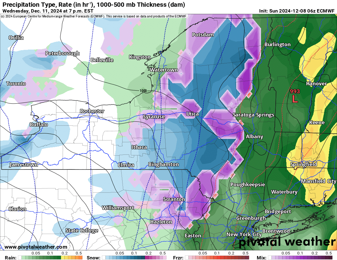
AFTER THE WARM STORM
The snow returns by Wednesday evening and continues into Thursday. It turns windy and much colder with temperatures falling through the 40s and into the 20s. If not lower. Will we see feet of snow? NO. Will we see inches of snow? PROBABLY. I am hoping we get enough on the back end of this storm. More often than not, it does not happen. Pray it does this time.
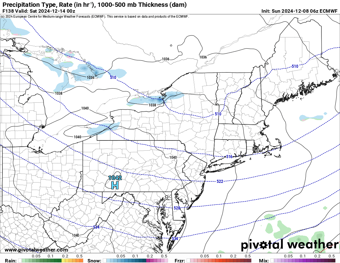
SNOWDEO
It will be a cold weekend for it. With whatever snow is left for it, it will be ridden hard and enjoyed by whomever decides to show up. This event usually brings thousands to Old Forge. We expect no less this next weekend, especially with the fact there is the treat of snow for the first time since 2018!
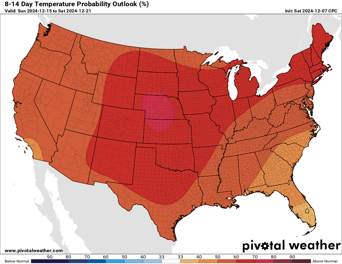
OH NO!
The 8-14 is not good. Definitely not good. It turns warmer than normal not just across NY but across the entire nation in the last full week before Christmas. This means more temperatures in the 40s and 50s than in the 20s and 30s. This means whatever snow is left on the ground after this week’s meltdown, will ultimately be GONE. I would expect at some point that no one will be able to ride at some point between now and Christmas. Just hold on and pray.
I am sorry to bring you this bad news on a Sunday. It is what it is. Just pray we can get out of this as best as we possibly can.
Zack and Rich Lupia
Upstate Snow
December 8, 2024
Please thank our advertisers on Upstate Snow for 2024-25
Banner Sponsorship
Enjem’s Flooring America
Ohio Ridge Riders
ilsnow.com
Southern Tug Hill Sno-Riders
Saratoga Snowmobile Association
Business Sponsorship
Paton & Son Excavating and Landscaping


