Welcome to Death Valley in Upstate NY. If you are downwind of the Great Lakes, you are about to be BURIED!
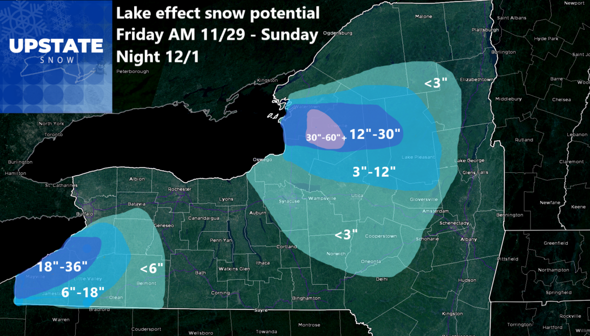
This is what I have waited for until now to show you. Why? Because it goes until Sunday Night. 84 hours. And even then it’s still going with mustard on it. And it starts in the next 12-18 hours so basically this will be at least a 72 hour event. Will it be a 10 day event like the all time record snowfalls for February 2007? I have no idea. I don’t think it will be that long. But I believe this will definitely be a good lake event. Anytime I can put 5 FEET in THREE DAYS ANYWHERE, EVEN ON THE TUG HILL, IT IS A DANG GOOD STORM!
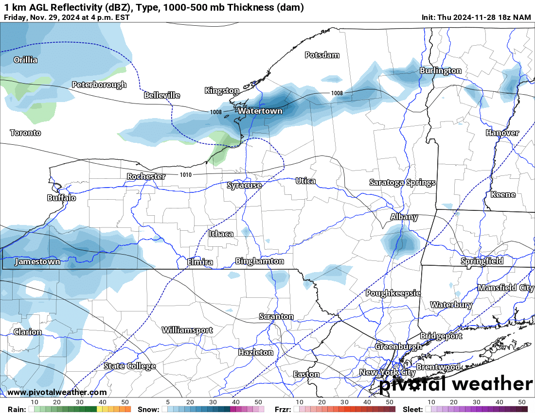
FRIDAY
The bands get going in the morning. Later in the afternoon and especially by Friday Night they are screaming hard where they are at. Where the bands set up, may be where it stays most of the time. Right now, based on the latest guidance, it looks like a 260 wind direction for it.
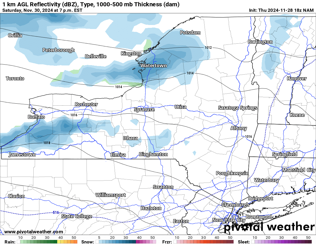
SATURDAY
Heavy snow continues across the northern half of the Tug Hill into parts of the Watertown area, then up into northern Herkimer (above Old Forge), southern St Lawrence, southern Franklin and northern Hamilton Counties. South of Buffalo, Chautauqua, Cattaraugus, and Allegheny Counties get the worst of it along with southern Erie, and southern Wyoming counties. Outside of these areas I would not expect to see all that much either tomorrow or Saturday. Or on…
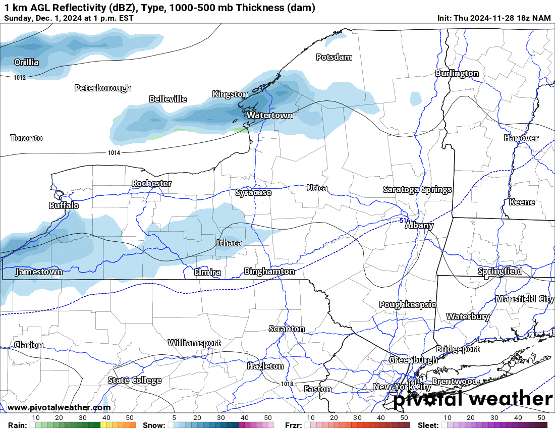
SUNDAY
The lake effect snow bands continue for a third day in a row. They become weaker as not as much wind comes pouring out of Canada like it does tomorrow or Saturday. Still though, just with the water temperature difference I would expect heavier lake effect snow bands that normal out of this scenario. Everyone is playing the same game. I am choosing to play this differently. To my merit or my peril.
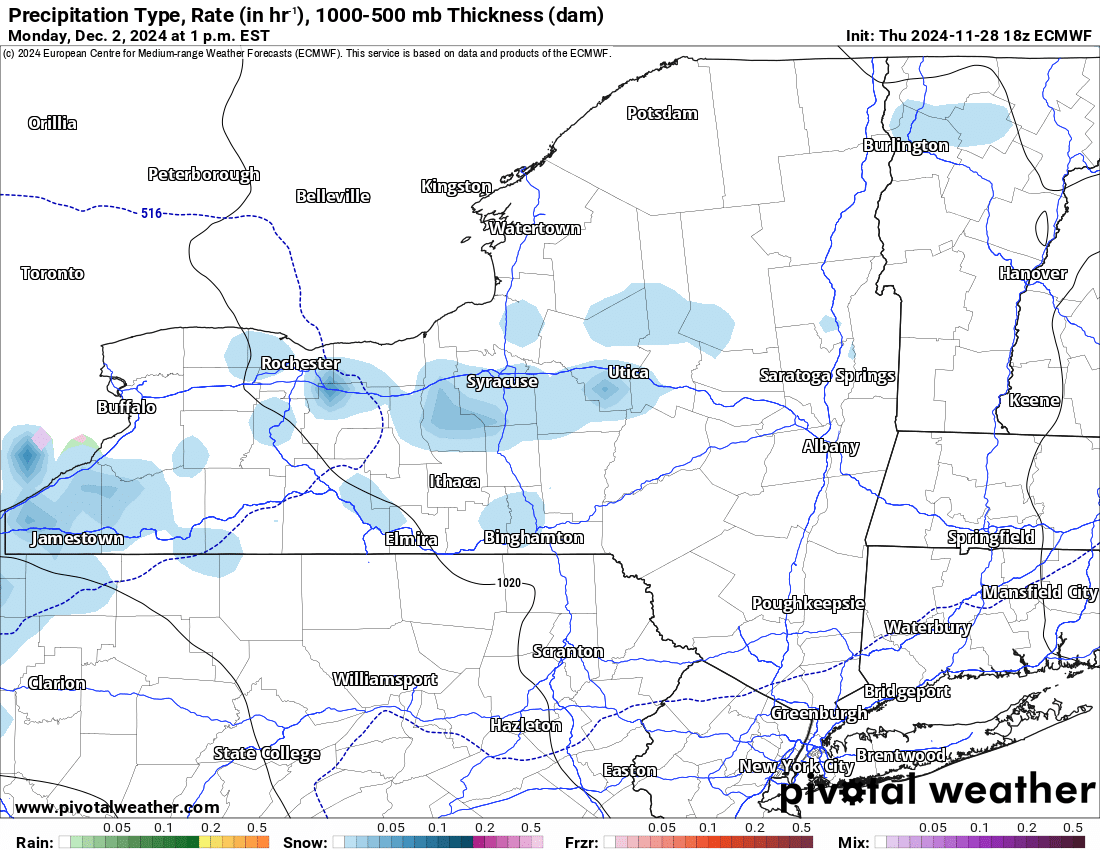
MONDAY AND BEYOND
With the main push coming towards the south into the Utica/Rome/Syracuse areas and points south, the amounts should come down here. At least somewhat. Still I would expect localized squalls with several inches of additional accumulation possible, mostly on Monday. Tuesday it does finally taper off and is gone by Wednesday. For now. We will continue to watch the models closely on this.
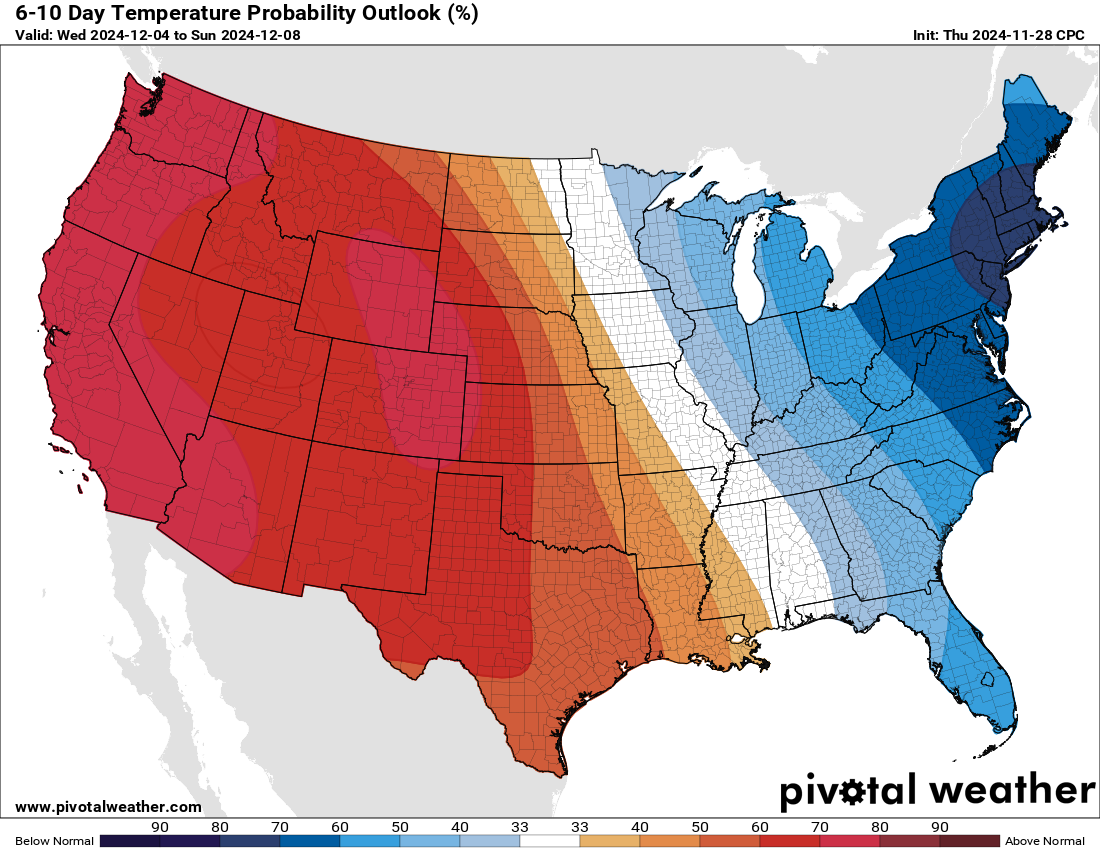
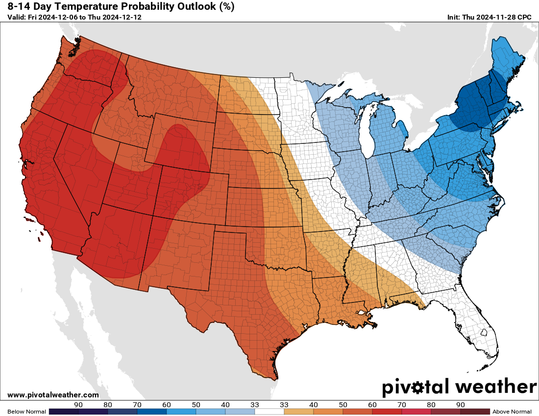
6-10 AND 8-14 DAY OUTLOOKS
It is continuing to look below normal, especially on the 6-10 day. However the 8-14 day is not looking AS BAD as it was a few days ago. This is giving me hope that some break in the pattern exists and we may get it by mid-December. Just don’t flip it all the way above normal, blow torch us, melt our snow and close everything down. Since 2017, that has happened every year. In late December to early January, all trails have closed at some point before better cold and snow arrived in later January and February to bring us back. Praying this winter is different.
I will be monitoring the heavy lake effect closely. Enjoy the rest of your Thanksgiving holiday!
Zack and Rich Lupia
Upstate Snow
November 28, 2024
Please thank our advertisers on Upstate Snow for 2024-25
Banner Sponsorship
Enjem’s Flooring America
Ohio Ridge Riders
ilsnow.com
Southern Tug Hill Sno-Riders
Saratoga Snowmobile Association
Business Sponsorship
Paton & Son Excavating and Landscaping


