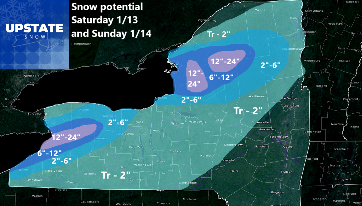
Good morning! If you are looking for change from my forecast graphics, you will not find it right now in the short term. After a look at the last few short term model runs, confidence is now high on this first Lake Effect event, which should last 36 hours. Perhaps a little more.
The forecast ranges for lake effect snow starting later today, once temps go below freezing for good (at least for the next week plus). The heaviest lake effect snows shall be between tonight and tomorrow night (Sunday Night) with 1-3 inches per hour in the strongest bands. While 1-2 feet is out for some areas… you know someone will probably top out in the 30s on this one in terms of snow so look out!
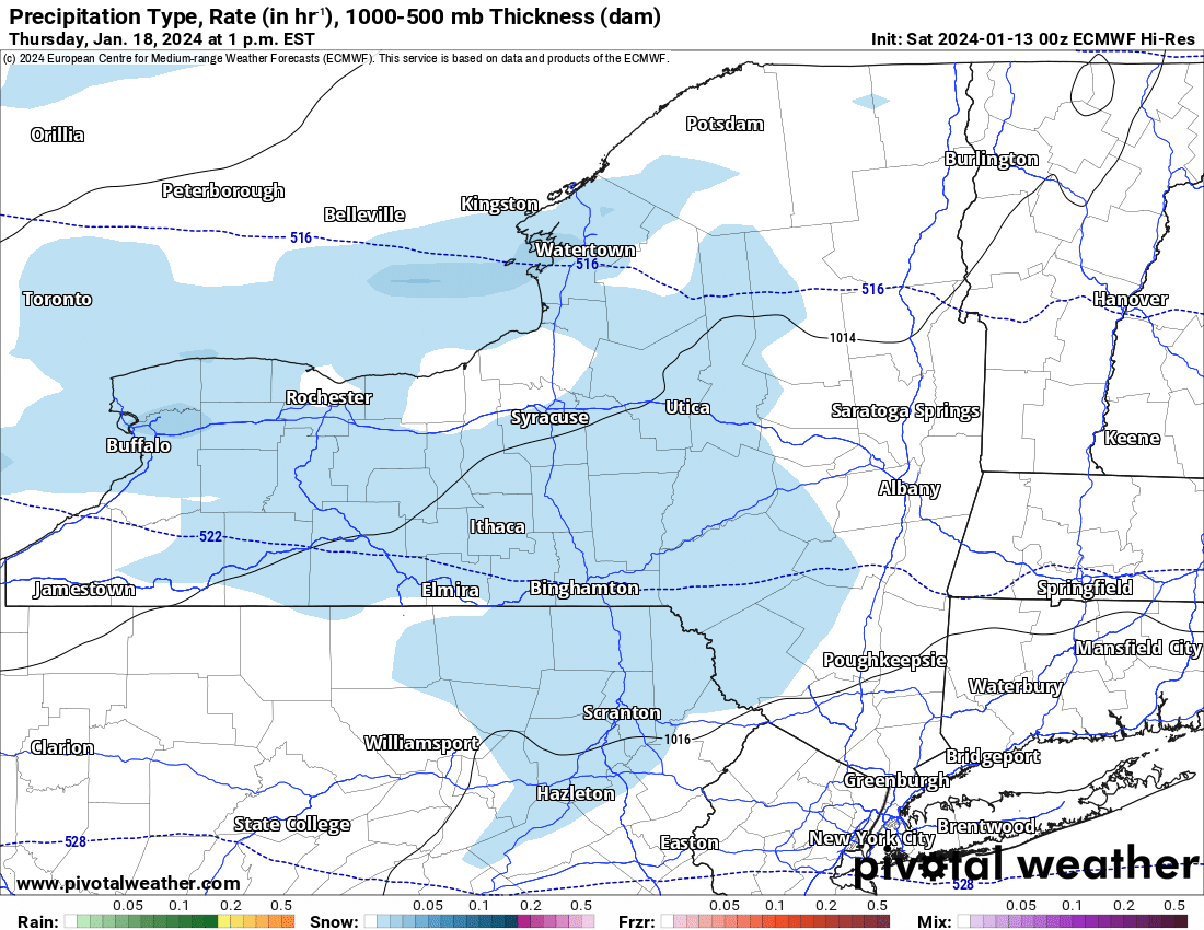
After that it turns into a much quieter but a much colder week, the coldest of the season by far. Temperatures in Upstate NY will not break freezing all week next week. Period. There are two periods we need to look out for precipitation outside of lake effect. Both periods will be light at best: Tuesday with light snow showers going by with a much bigger storm scooting on by to the south. The other time is on Thursday with general light snow showers. It’s 5 day out at this time but for me to say a few inches and not much else, for mid January, is just another day. Seriously it is. After very cold temperatures by next weekend, it does look like in the longer range we should get some relief and find temperatures at least back closer to normal. 20’s with some spots getting close to freezing? With average highs in the upper 20s, that is at to slightly above normal, which after 7-10 days below normal, will make the end of January feel not as bad.
That’s the way things are looking right now. Keep track of all the snows this weekend, especially downwind of the Great Lakes. And enjoy your weekend!
Rich Lupia
Upstate Snow


