Chance of riding through 1/8/24: Pretty much ZERO anywhere in Upstate NY until the Sunday 1/7/24 storm blows through.
Chance of riding 1/9/24 through 1/15/24: It’s looking a whole lot better than it was days ago. Now it’s looking much better than 50/50!
Good morning! We have nothing but junk right now. The good news is: It’s not going to stay like this forever. Now that we are in 2024, we have shifted into a pattern of every 3rd to 4th day we get hit with something. Over the next 16 days, I have counted 5 separate storms that could hit Upstate NY in some fashion. Some maybe just a little. Others will be much greater. And with each storm it depends on where you are in Upstate NY that determines what you see in terms of snow… or a mix… or rain. But most of this precipitation will be snow or a mix. That automatically makes this forecast the best we’ve had in over a month!
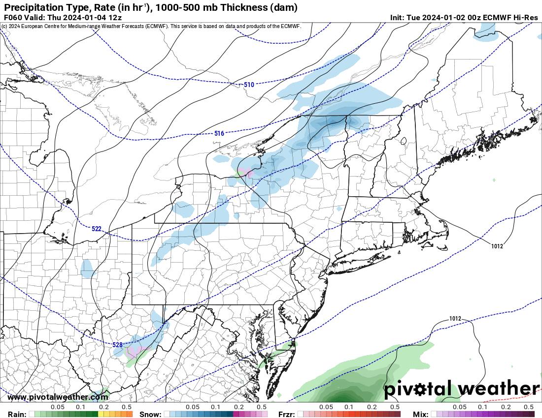
Storm #1 – 1/4/24
This one is a very weak disturbance with only scattered snow showers and some minor lake effect snow only in localized areas. I had thought about a map for it this morning but I still have tomorrow to put out one and have a better chance for accuracy. Most areas will only see a dusting to 2″ with very few areas seeing more than that.
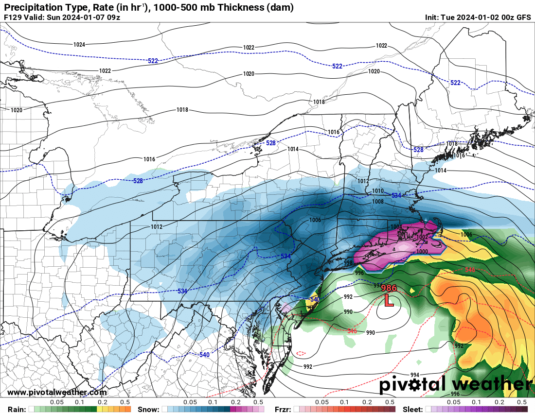 Storm #2 – 1/7/24
This is the first real storm we have seen in awhile. We have a high to our Northeast. Storm approaching from the Southwest. This is a typical Nor’easter pattern and this is what we shall see on Sunday. How much snow do we see? We are still 3 days away from seeing a snowfall map on this storm. Friday morning would be the time for that accumulation map. I would expect the heaviest accumulations to be in the Southern Tier, Binghamton Area, to the Capital Region and points south. Lighter snowfall amounts for Central NY, the Tug Hill and the Adirondacks with light to no snows in Northern NY and Western NY.
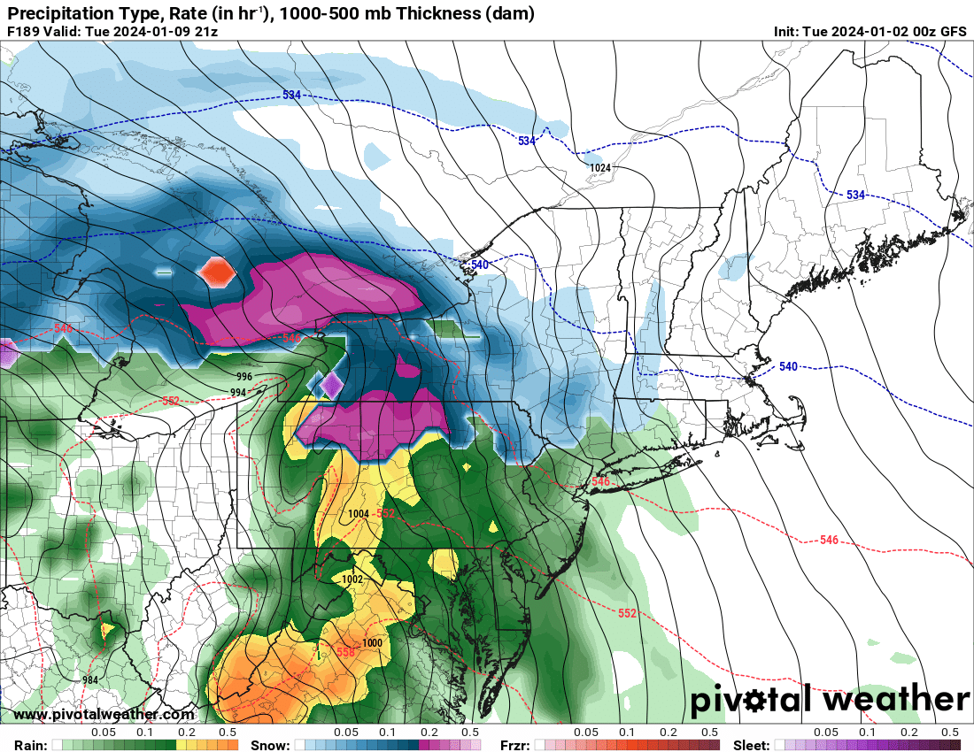 Storm #3 – 1/10/24
If storm #1 and storm #2 weren’t strong enough, storm #3 will get you! Next Tuesday afternoon into Tuesday Night and Wednesday the 10th we will get hit with wind: Potentially gale force winds! Snow, heavy at times, with accumulations particularly central and eastern NY, the Adirondacks and Catskills. It will change to rain for some hours on 1/10 before changing back to snow, turning windy as our big storm rolls out and lake effect snow gets going. Since this storm is at Day 7-8 right now: It is approaching maybe/maybe not territory. Leaning towards maybe already with the tight isobars and colder air coming in behind it.
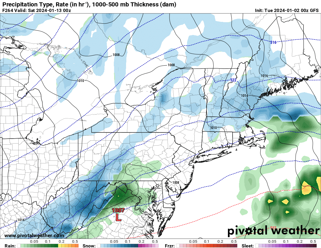 Storm #4 – 1/13/24
This storm has a burst of snow with lake effect afterwards. Because of how strong the last storm was, this storm is not forecasted to be anywhere near as strong. Which is good because this is a 3-day weekend.
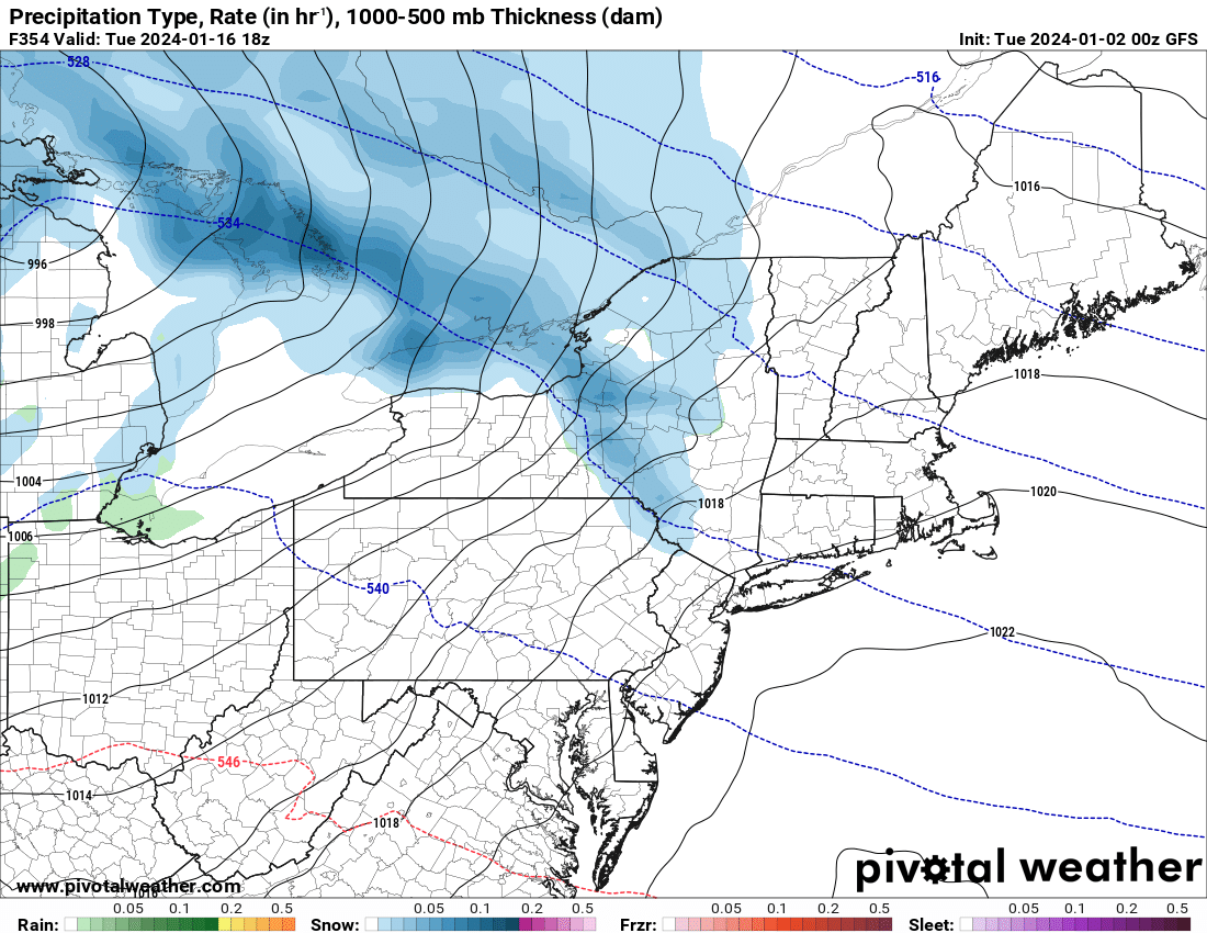 Storm #5 – 1/16/24
Yet another storm is expected to come rolling in. But since we are talking Day 14/15 here, I have about absolute authority to say that this storm, #5, IS CRAPOLA! This is by far the biggest figment of the imagination. But the models at 10 days out actually had an accurate forecast prediction of a lake effect snow event that dumped 1-3 feet across the Tug Hill, and 8-16 inches in the Adirondacks. So who knows what will happen there. But since I am a 27 year Meteorologist, I’d figured I would let you know.
This is what I know right now. Every morning here on Upstate Snow, I will update you on these storms and on the new storms to come that are not in view yet. It’s what I do. And I love to do it. Thank you for all your support and love!
Rich Lupia
Upstate Snow


