Good morning! Even though temperatures are above normal… as in way above normal… as in the 40s and 50s above normal… what goes up, must come back down! Sunday Night through Monday Night has been established as the window of opportunity, about 12-24 hours worth, with accumulating snows to come on down. Here are the details as per the 06Z NAM 3K:
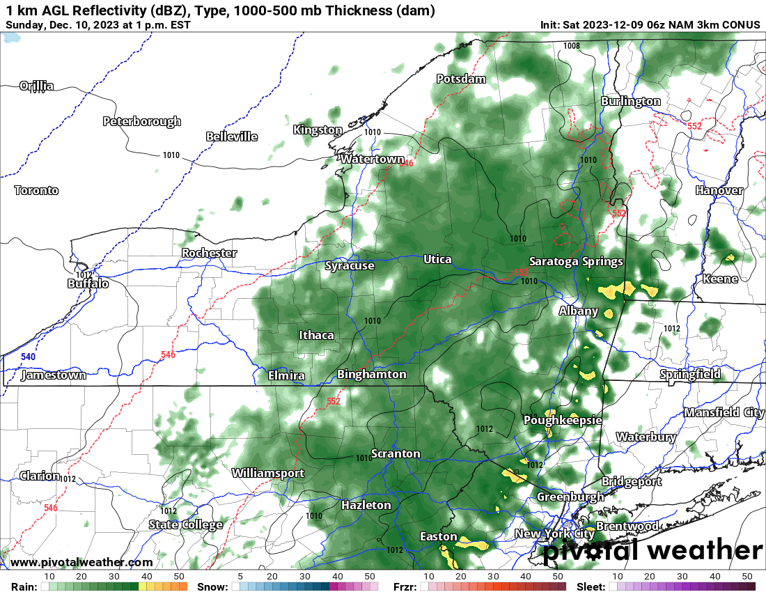
Sunday 1 PM – Rain throughout much of Upstate NY. Even a few rumbles of thunder detected in some parts of the state particularly to the south of the Thruway
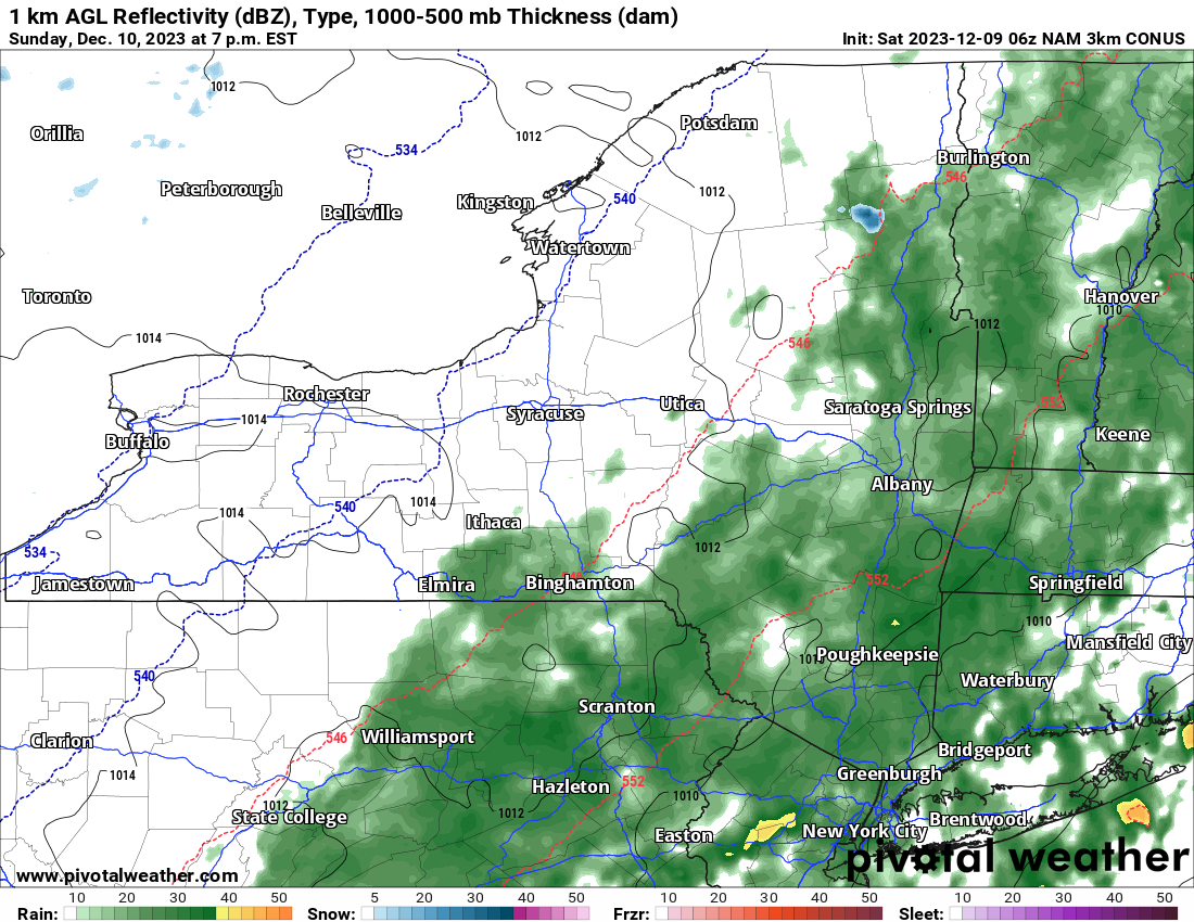
Sunday 7 PM – This is when changeover begins in some parts of the state, especially Western NY. Still staying rain eastbound of that line from Central NY eastbound.
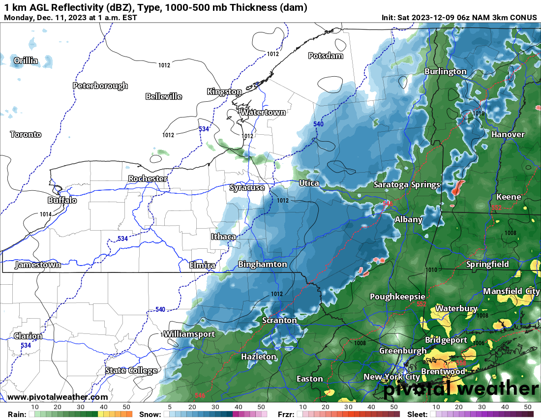
Monday 1 AM – Snow, heavy at times is taking over most of Upstate NY with the exception of the Hudson Valley and the Capital Region. Heaviest snows are in the hills south of the Mohawk Valley and to the north the Thruway. Travel becoming a problem quickly!
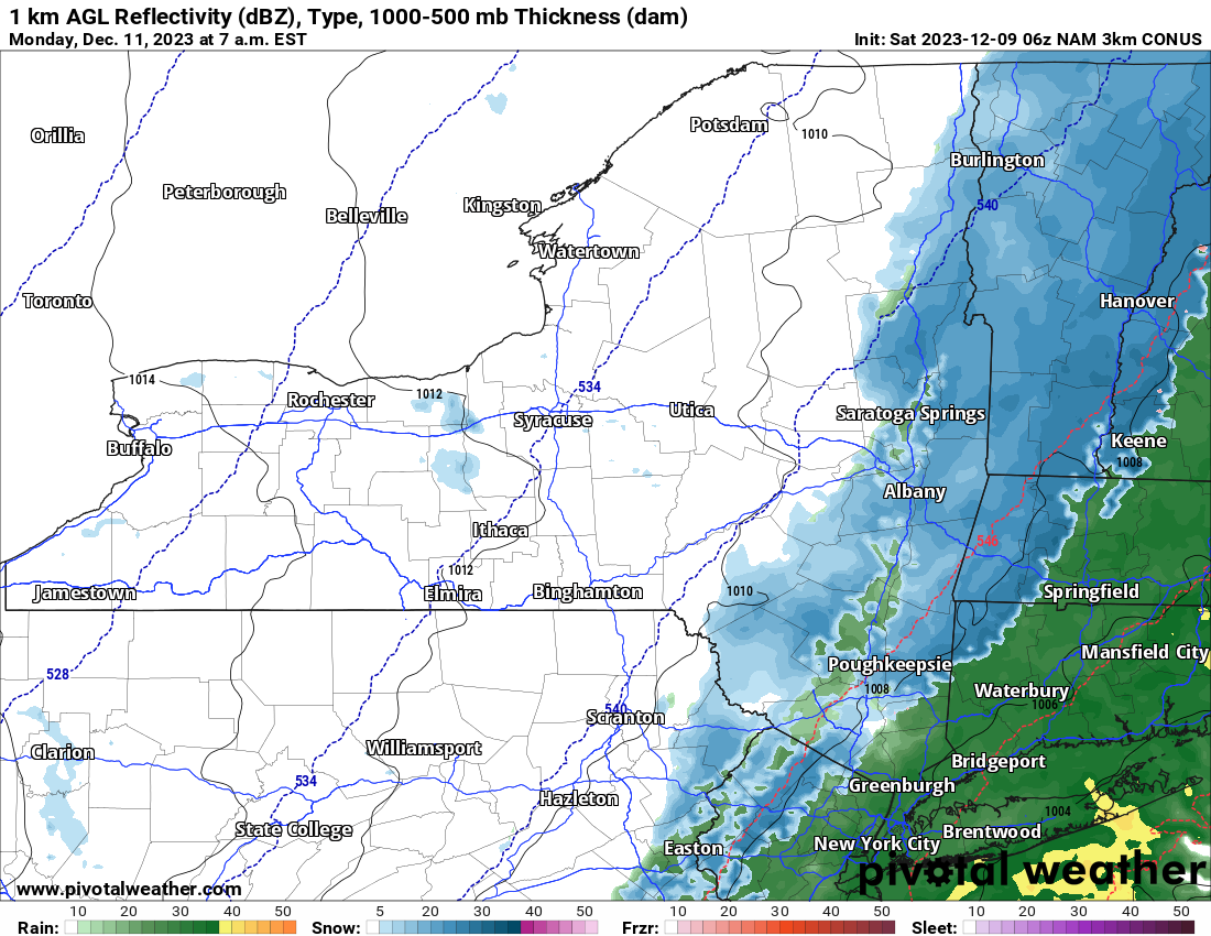
Monday 7 AM – Snow tapering off across Upstate NY with the exception of Eastern NY and Western New England. Still slick spots and delays to schools possible for many areas.
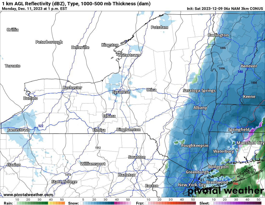
Monday 1 PM – Snow still hanging on well east of I-81 in Eastern NY and into Western New England.
It’s all over by Monday Night. Here is our snowfall accumulation map:
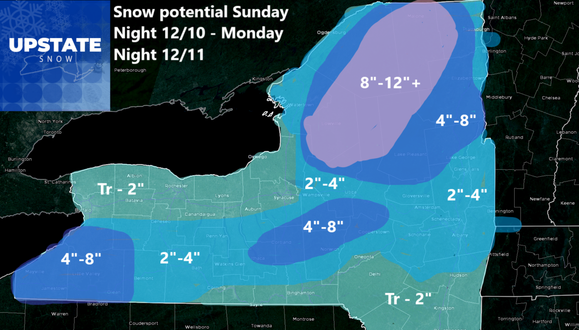
Temperatures will be critical for this to happen. If the temperatures end up 2-4 degrees above current projections, these numbers will end up being too high, straight up. Any colder than what we have, these numbers are a guarantee, if not low. That’s that problem with these early season, temperature dependent forecasts. It’s not mid January.
Also you will notice my ability, based on the maps to hang these accumulation amounts more to the west. Hoping that I don’t get ZONKED on that. Hoping…
Have a great weekend!
Rich


