Happy Thanksgiving!
Chance of snow through 11/29 – 100 percent
Chance of snow 11/30 through 12/6 – 100 percent
We haven’t had a Thanksgiving Day and a 7-14 outlook this promising since 2018! The last 4 La Nina years, particularly last year, were horrible for a variety of reasons. Today though, things are a lot different. There is not much snow in the forecast now. But. Starting in 84 hours and going through most of next week, honestly, looks like a winter week!
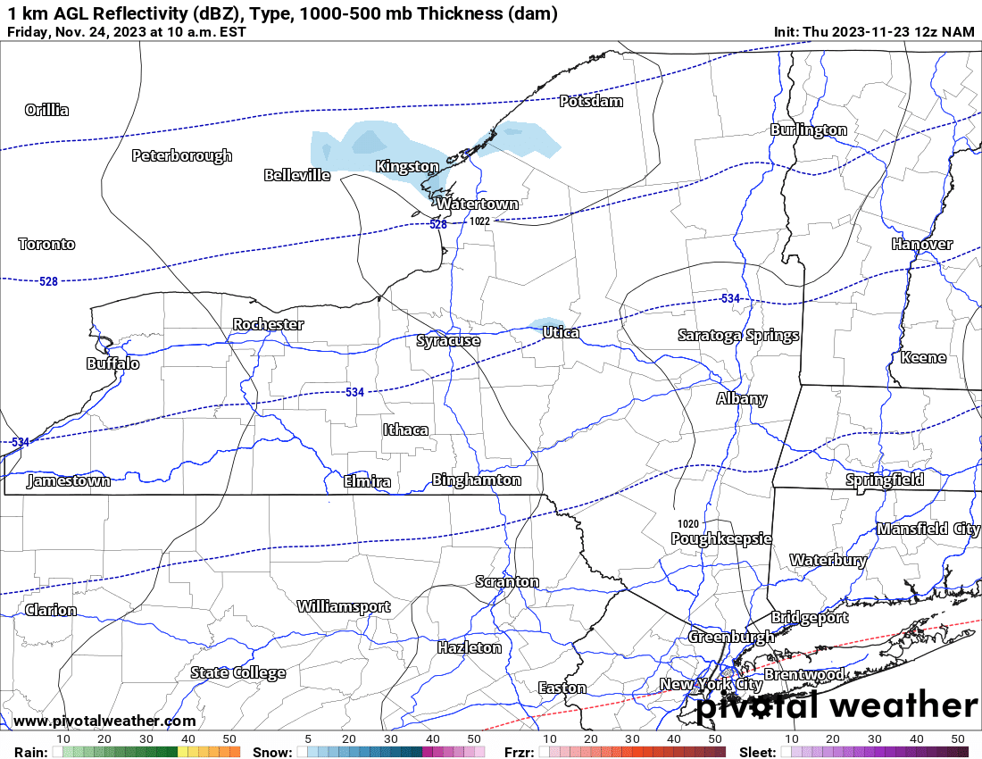
This is tomorrow morning. Black Friday will have mostly cloudy skies and cold conditions with a few snow showers. As you can tell from this map there is hardly anything to talk about. It’s a dusting at best. Clouds and snow showers may linger about through tomorrow night and then the weekend arrives along with the sunshine. It’s cold on Saturday. It’s a touch milder on Sunday but instead of above normal temperatures, near normal would be the consideration here. Increasing clouds on Sunday, especially west of Interstate 81 will be the rule as our next storm system approaches. If you live in Rochester, Buffalo, or anywhere in Western NY, get home as soon as you can on Sunday. Especially by dark. The next storm won’t wait for you.
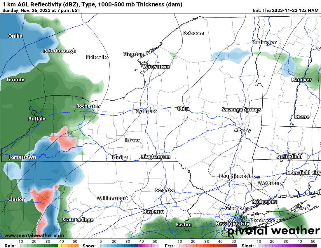
By 7 PM on Sunday, Eastern and Central NY are still dry. But not Western NY. From Rochester to Buffalo to Jamestown, all these areas will be getting hit with rain, snow, or a wintry mix. And as Sunday Night goes to Monday morning and colder air moves on in, gradually, this is going to go to all snow at all elevations. This activity will spread quickly across the state.
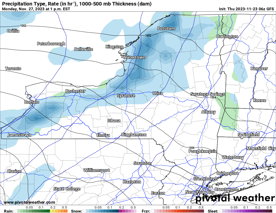
By Monday Afternoon the worst of the general snows will be over. As colder air becomes deeper across all of Upstate NY Monday Afternoon and into Monday Night, this is looking more and more likely for this to become the first significant Lake Effect Snow band of the season. Are you unsure about what I just said? OK, that’s fine. WATCH THIS…
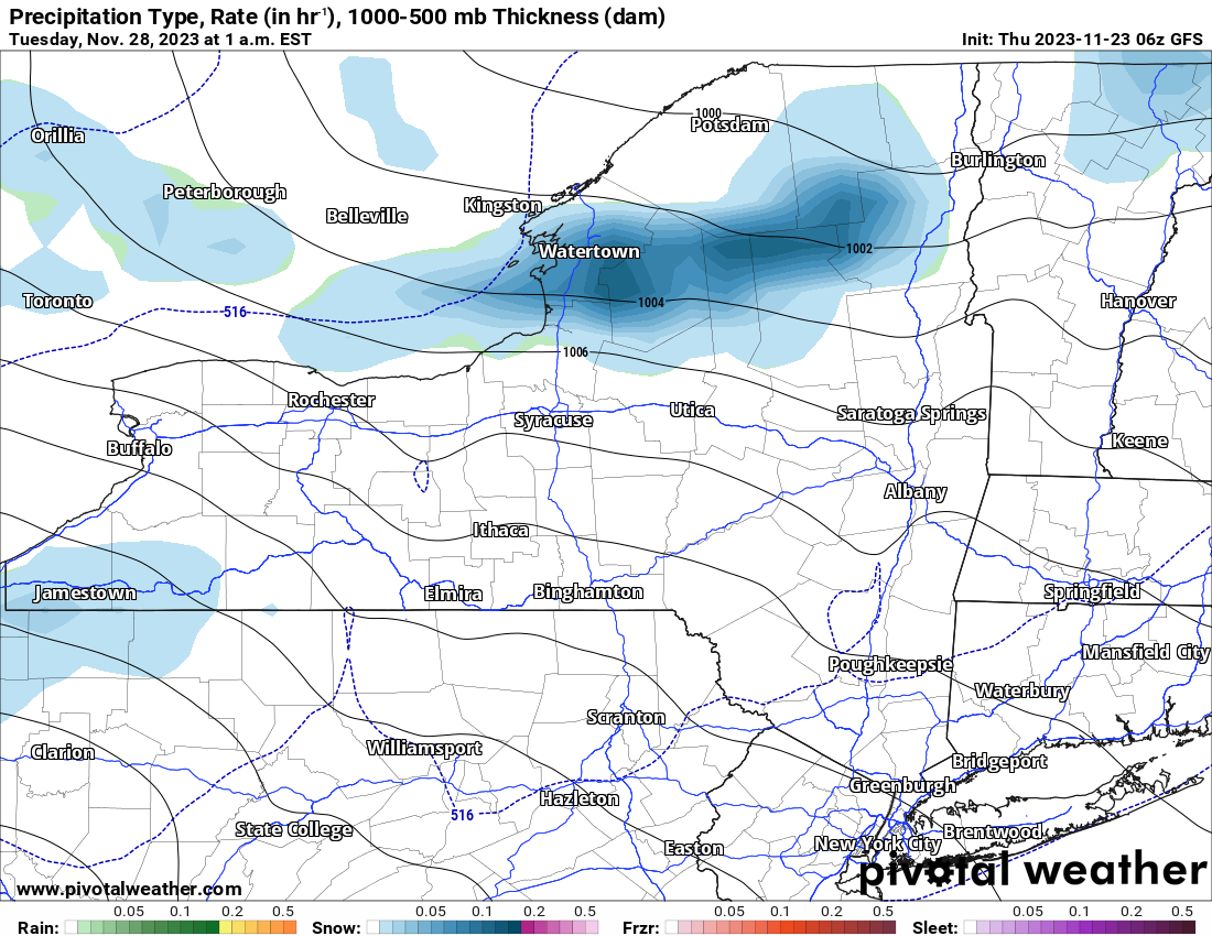
The bands off Lake Erie to the south of Buffalo look much weaker and lighter with only scattered activity. Not off Lake Ontario. Lake Effect Snows, with heavy snowfalls of several inches (because we are getting closer we can start to anticipate some possible accumulations), nailing Jefferson, Oswego, Lewis, N Herkimer, Hamilton, S St. Lawrence, S Franklin and W Essex Counties. Tuesday could be an eventful day, especially in the morning commute. Keep an eye on this time from Monday Night to Tuesday Morning in these areas…
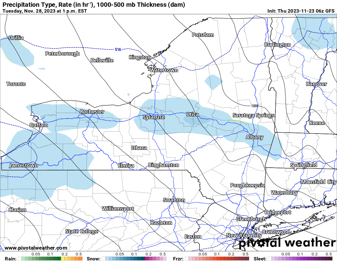
By Tuesday Afternoon, the Lake Effect Bands turn much lighter and sink southward towards Syracuse, Utica/Rome, the Mohawk Valley and towards the Albany area. Other Lake Effect will be happening south of Buffalo but shall again be much lighter here.
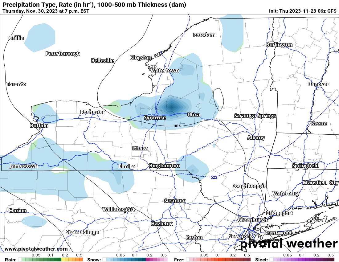
Wednesday should be a mostly quiet day with much lighter snows, if any. On Thursday though, our next system comes on in with snow showers for most of Upstate NY along with some more Lake Effect Snow possible. This edition of the Lake Effect for Thursday Night through Friday, at this time, looks way lighter than the Monday/Tuesday event. Also consider that’s Day 8-9. The one showing a lot more action is Day 4-5, which is a lot closer.
Looking ahead to Days 8-14 between November 30 and December 6, there are more systems, more cold and more snow than rain in the forecast. It doesn’t look to be super cold or near record. It definitely doesn’t look at or above normal either. For the next two weeks, if you place your bets on below normal temperatures, you will win most if not all days.
I will definitely keep a close eye on the storm system for Sunday Night into Monday Morning, and the potentially decent Lake Effect snows after that. Keep an eye out on Saturday for a potential map and forecast of the Lake Effect.
Rich


