Chance of snow through 11.27.23 – 90 Percent
Chance of snow 11.28.23 – 12.4..23 – 90 Percent
Good morning! It’s Thanksgiving week and many people are on the roads traveling. Perhaps you are among the millions of them today, tonight and/or tomorrow. If you are seeing this and can change/modify your plans for this afternoon and especially tonight, especially in the Tug Hill and in the Adirondacks, it would be a good idea.

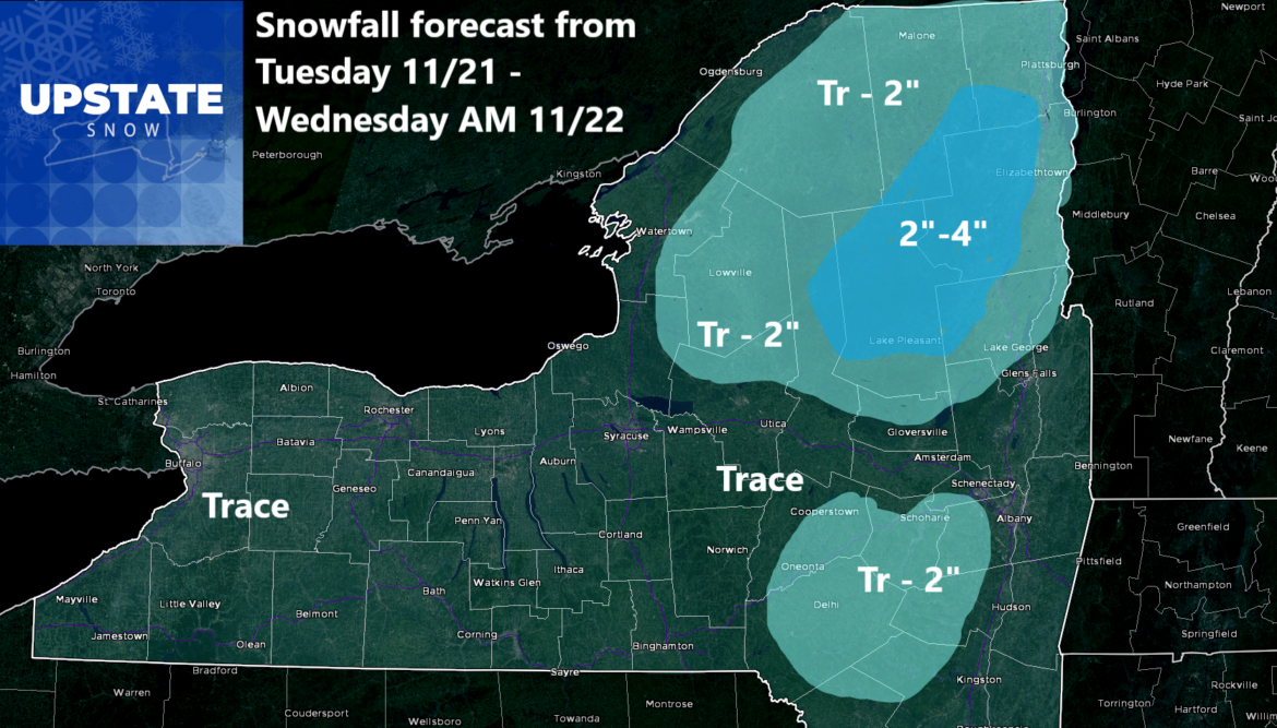
Our snowfall accumulations map that was posted yesterday is generally along with our going forecasts so without any major changes to this map, we are going to let it ride. Basically anyone who is north of the Thruway, especially in the higher elevations, will be white. This afternoon as the storm moves up, snow develops this afternoon and evening. This snow will be steady, and at times moderate. Given the amount of traffic on the roads, plan on extra time for sure. Later tonight and overnight, the mix of snow, sleet and freezing rain, changes to all rain except across the Adirondacks. It is here where snow will hang on the longest. By Wednesday Morning, it is rain everywhere, including in the Adirondacks. Rain tapers to scattered showers and temps shoot up into the 40s, melting most of the snow.
Heading into Thanksgiving and through much of the holiday weekend, we are looking at fair weather and cool conditions with highs in the 30s and 40s with lows below freezing. By Sunday Night and heading into Monday, our next storm system comes on through. With cold air filtering on in behind it, at this point, it looks like the potential for Lake Effect Snow is increasing.
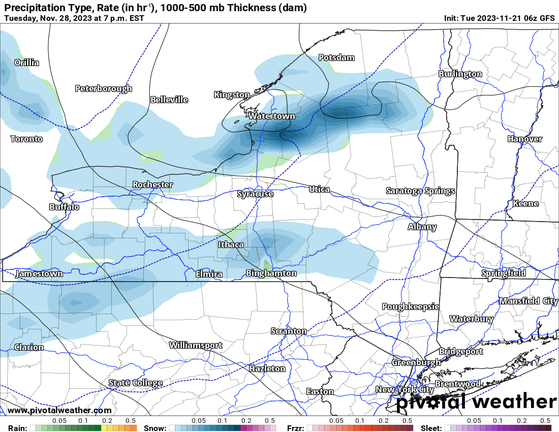
The Lake Effect Snows, at least based on this model run, could be the first decent dump of the season. And right on schedule. It shows Lake Effect starting Monday then getting heavier on Tuesday. Here is the Tuesday PM map showing lots of LE Snow blowing off both Lake Erie and Lake Ontario. These bands of snow diminish in time for Wednesday 11/29.
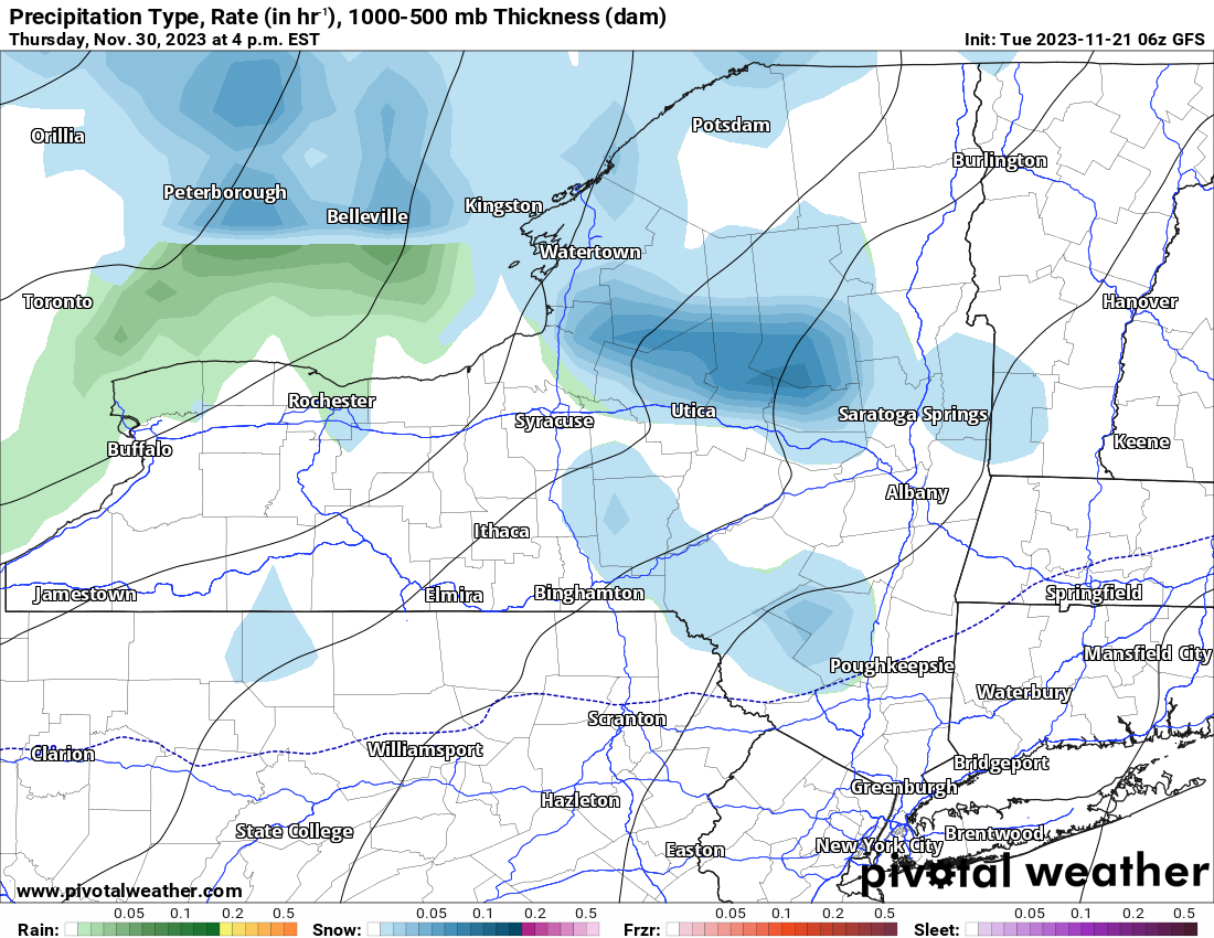
Then heading into Thursday 11/30, we get another cold front followed by more Lake Effect snow. Another band of Lake Effect, especially off Lake Ontario, comes roaring into areas along and especially north of the Mohawk Valley with locally another several inches possible. Now understand the difference between possible, likely and imminent. Possible means maybe or maybe not. Likely means more likely than possible but not imminent. Imminent means… well…
I’d love to say there is more stuff beyond December 1 but it looks like this pattern runs out of gas. At least temporarily. If anything, milder conditions are expected heading into the first week to two of December, which is not good, but it is what it is.
Are we going to ride Snowdeo weekend? Possibly for the first time since 2018. Will the season kickoff with enough snow to ride where we can? Possibly. We. Shall. See. It’s looking good based on what I am seeing at the moment that we at least have a shot at it.
Rich

