Good morning! Hope you enjoyed your scattered showers (for yet another) weekend. I know it stinks. One weekend in the future, we’ll go from Friday Night to Monday Morning precipitation free. How about that?!
In the meantime, we have two storms to get through between now and Thursday. Both of these have a shot to give us snow. One would be just enough to dust the ground briefly. The other may have a minor accumulation with it before it melts away on Thursday. Here are the details:
Storm 1 – This evening through Tuesday evening: Showers will develop this evening. Most of the showers shall be overnight and into Tuesday morning. During the day on Tuesday, a cold front will come through resulting in falling temperatures during the afternoon and especially Tuesday evening. It’s at this point, after dark on Tuesday evening that we may see snowflakes. But not much more that that. With limited moisture in back of the storm and just some snow showers leftover Tuesday night, a dusting for some areas, mainly higher elevations over 1000′ north of the Thruway, would be about all I could squeeze out of it.
Wednesday shall turn out to be a partly to mostly sunny day. But it will be chilly. Temperatures will have a hard time hitting 40 north of the Thruway and 40-45 is a good bet from the Thruway, southbound. As is the case at this time of year, systems have very little time between them. And this next one is indeed that. And this next one is more powerful than the last one.
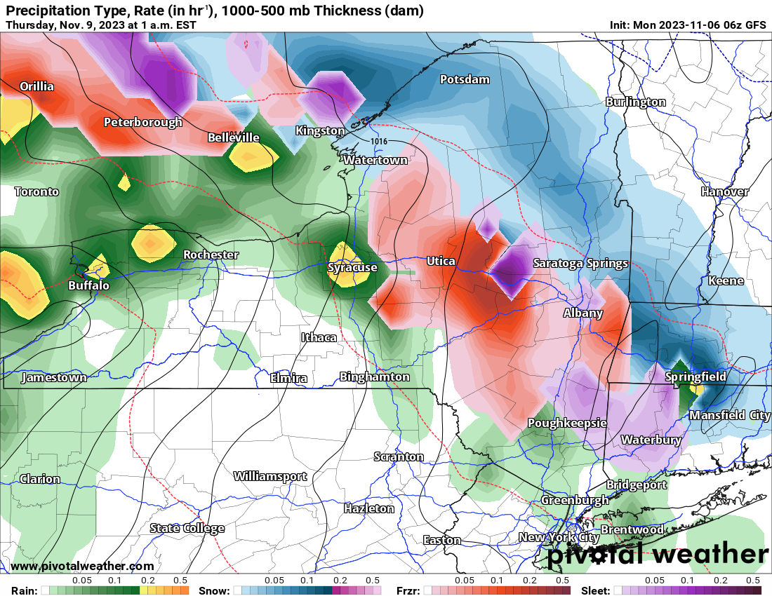
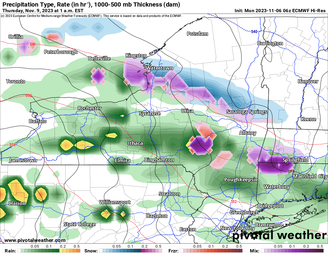
Storm #2: First off, this is not a Nor’easter. This is not a huge event. But this is enough, especially early in the year, to get your attention. Snow develops mainly across Central NY (east of 81) and Eastern NY, with mix to rain showers generally west of 81. This is how the maps shall look overnight. Notice the GFS is stronger with the precipitation than the Euro. But even the Euro has enough snow with it. How much snow are we talking? Most locations east of I-81, especially above the valley floors, should see anywhere from a dusting to 2″. Because warmer air is moving in and this is an early November storm we are getting onto the warm side off, I expect by Thursday morning by the time most are heading off to work or to school that snow has changed to rain… or will shortly. Rain shall be on tap as temps rise quickly to 50 or better later on Thursday, melting any snow and/or ice that may have fallen the night before.
So don’t blink. Any snow you see will be gone in a hurry. Then after that heading into Veteran’s Day Weekend and into next week, we shall continue with mostly at or below normal temperatures. There are more snow chances out there, although light, and not until at least a week from today, so we have plenty of time to watch that. In the meantime, enjoy your day! I will have my snowfall map for the Wednesday Night/Thursday Morning system, whatever that brings, tomorrow morning with my Trail Talk Tuesday!
Rich


