Good morning! I am expecting you are looking for another update on the big cooldown this weekend, rains Sunday and Monday, then the potential for a Nor’easter on Halloween into Wednesday. I have all of that coming up. What I don’t have are forecast numbers (we are still a few days too far out on that… I don’t put numbers on any storms until we are 60-84 hours out at max and the storms get into range of our higher resolution models. We are still looking at Sunday at the earliest but probably more like Monday morning at this time for that.
I’m just letting you know. I am a straight shooter here. You get what you get. Most of the time it’s good. Sometimes it’s not so good. We shall see. Anytime we deal with beginning of the season storms, it can be dicey. I’m just saying.
Yesterday I put up a version of the Euro that had not just snowfall, but an actual snowstorm across Central and Eastern NY with a low pressure in New Jersey heading NE on the morning of November 1st. I can tell you the runs that have come down since then have all shifted east a good distance and as a result are putting much less snowfall across Upstate NY. But again, I am too far ahead of myself.
We have record warmth with 70s today. 60s tomorrow morning before our front come through and temps tumble in the afternoon and evening. Sunday and Monday are rainy, cold days. We’ll spend those two days in the 40s. That’s the loser weather of all. Too warm for snow, too cold for thunderstorms.
Tuesday into Wednesday is when things get interesting. Snow showers develop on Tuesday, especially Tuesday evening. Having it snowing while kids are going “trick or treat” shall be very interesting and something that has happened only a few years in my lifetime. Last big one previous to that, we are at the 30th anniversary of. Welcome to Snowvember with a foot of snow on November 1st across a good portion of Upstate NY.
Looking at the last several runs, it looks as though the chances of this possibility, which was nowhere near 100% yesterday, is looking even thinner today. Instead of shovel and snowplow amounts of snow (a few in a lifetime this early in the year), it’s looking more like snow showers with minor accumulations (much more likely). Here is the Euro and the GFS on Wednesday 11/1:
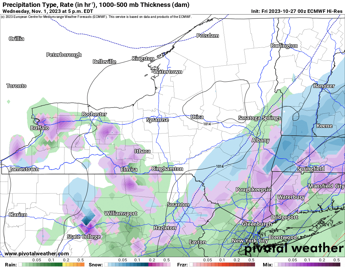
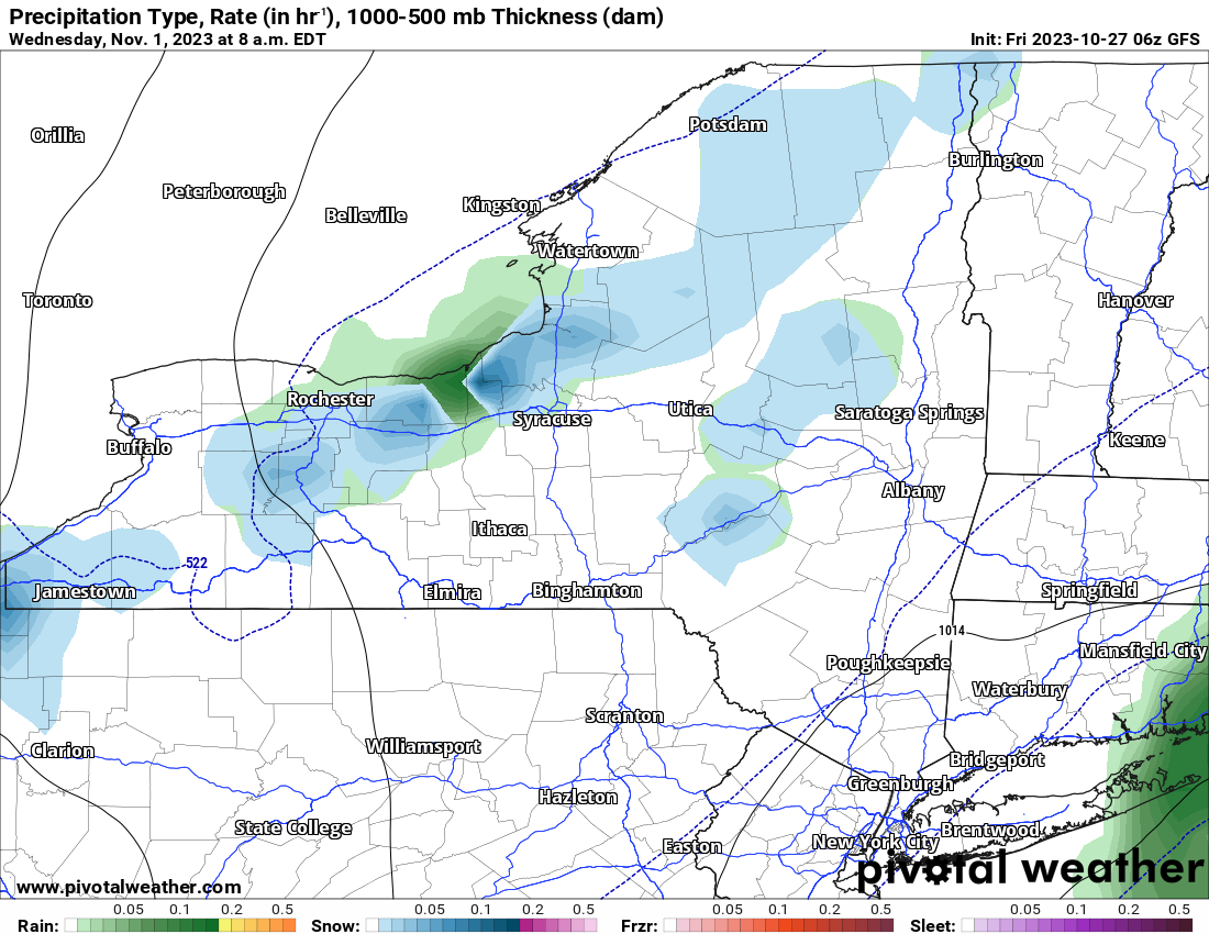
The Euro is still bolder than the GFS but both storms keep the bigger snows more for New England than Upstate NY at this time. Does it change? We have a few more days to look at the trends before we put numbers on this storm. But again not until Sunday at the earliest or definitively Monday.
After this it stays cold and some sun returns for the end of the week. But one thing the models are now starting to hint at are more systems and possible precipitation coming across the region next weekend. I don’t want to get into that yet, but, it is what it is. It’s 7-10 days away and as we all know beyond day 7, accuracy falls like a cannon into the abyss of “I don’t know”. So we won’t go into that right now and just monitor quietly here.
Enjoy your last near record to record high day today! Enjoy the temp plunge tomorrow then the miserable next several days afterwards. It is that time of year. Only question is: How much snow will different parts of Upstate NY get?


