Things just keep looking better and better when we look ahead to this week. At first, it was looking like potentially a wipeout. Three to Four days above freezing, strong south winds, temps in the 40s and 50s, especially in WNY, with heavy rain coming through then a dusting of snow to end the bleeding. It was looking really bad, considering the thin snow cover across Upstate NY, especially given it is the middle of winter. Then the big high to the north and west started showing up, and the cold air bleed from Ontario started showing up more in the models. Run after run this weekend, it kept looking better. Now we are 72-96 hours away, most of the range of that warmup is now entering the mesoscale models, and it’s just not there anymore. Not like it was.
It is not looking like a wipeout anymore. At least for most of Upstate NY. Along and especially north of the Thruway, and also for WNY, this is looking like potentially a GAIN of snow and base. Southern Tier, CNY south of Syracuse and Capital Region, well, not looking as good, but still close enough to where anything can happen. Lets detail this day by day.
MONDAY – Quiet day with sunshine and cold temperatures after a bitter cold start once again. If you can’t say much about the amount of snow on the ground, you can say a lot about the bitter cold freezing everything down. Thank God for that!
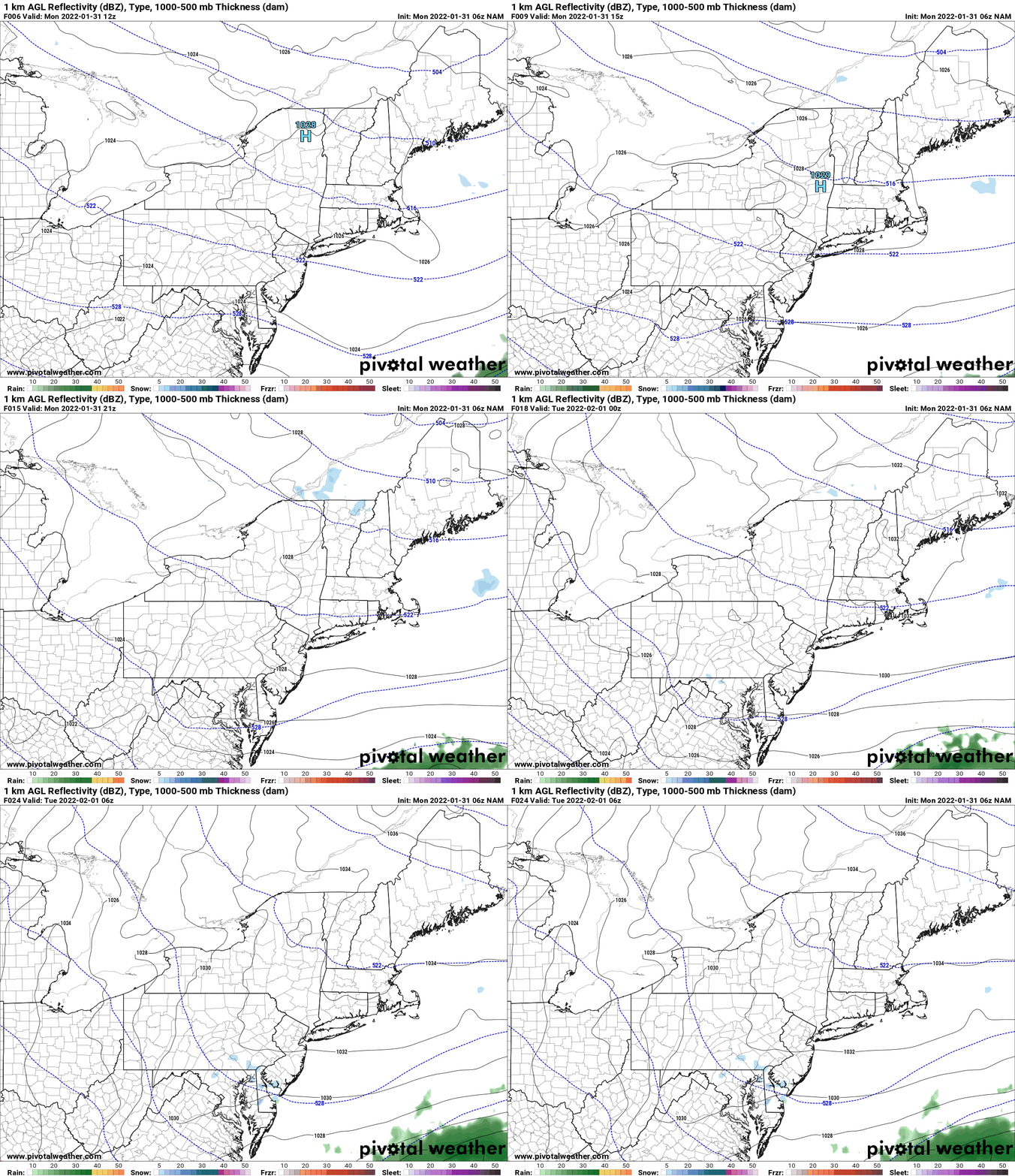
TUESDAY – Another quiet day, not as cold in the morning, with daytime temperatures approaching the freezing mark up north and well into the 30s along and south of the Thruway. WNY also well into the 30s to near 40 with increasing south winds.
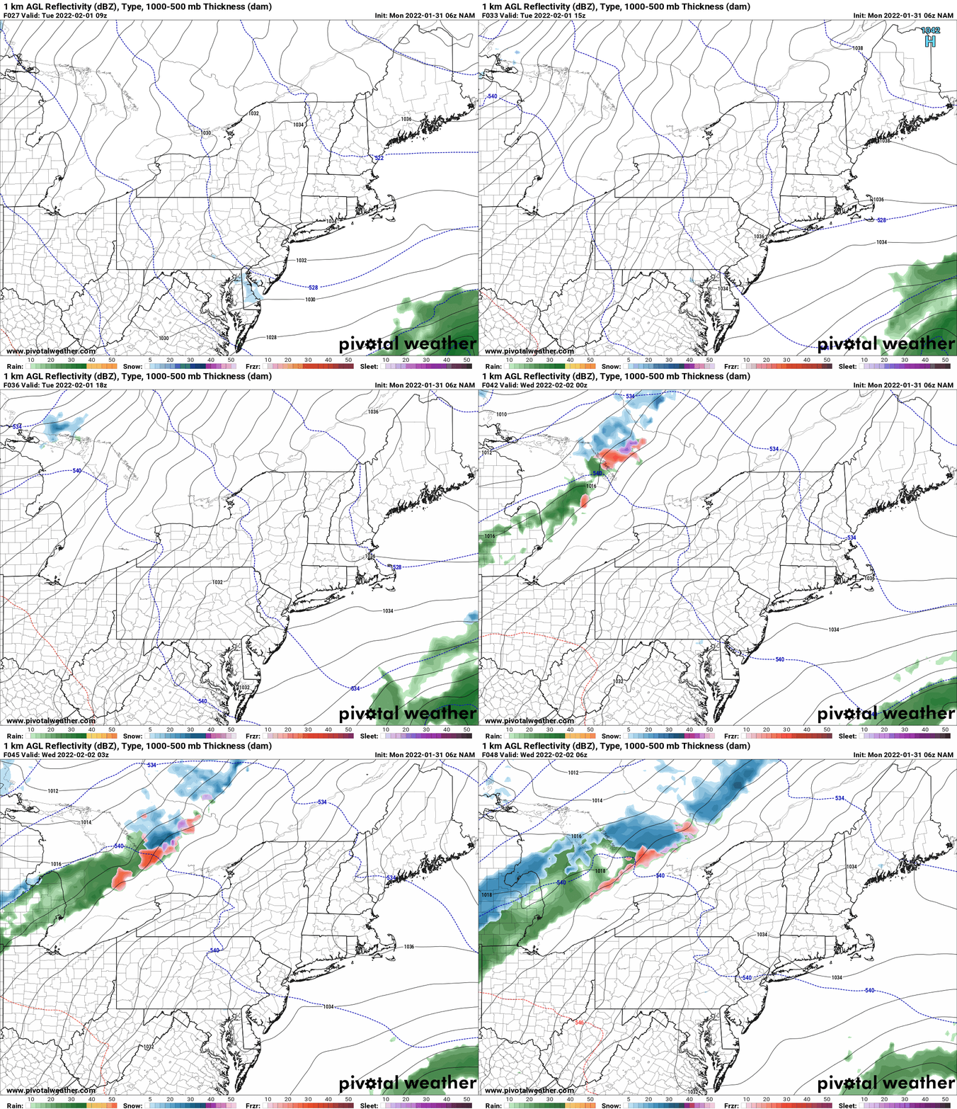
WEDNESDAY – Increasing clouds. Milder still. Everyone is above freezing, most locations at or above 40. based on how things are looking right now, this could be the day with the most thawing and most damage. This is a day where there will be melting and compaction. It will impact lower elevation trails and places that can’t afford to lose any snow, the most. Rain and precipitation as you notice begins to approach Upstate NY from the west, moving into WNY Wednesday afternoon and spreading into CNY and NNY by Wednesday Night. It should start out as rain during the day on Wednesday with mix mess beginning Wednesday Night.
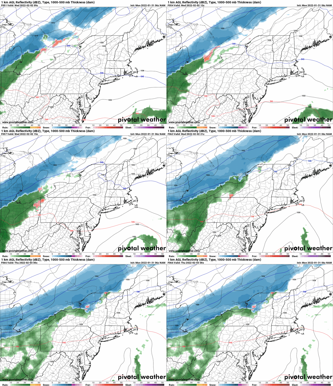
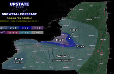
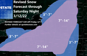
THURSDAY – GAME DAY. As the high builds in from the north and spring tries to surge forth from the south, the battle zone is Upstate NY. The storm track has shifted south the last few runs. GFS and Euro have flipped flopped with each other. Some key questions remain here: Where will there be sleet mixed in? Freezing rain? Just plain rain? We are hoping to answer those questions more specifically tomorrow when I put out my first call map for Thursday’s precipitation event. There is the potential for folks on the all snow side, WNY, Tug Hill, Adirondacks and North Country to get several inches of snow. Finger Lakes, CNY, Mohawk Valley and areas N of Albany look to be more mix/mess, but should still turn out OK. Southern Tier, Catskills, Hudson Valley, looking mix mess to rain. Still a lot of time and a lot of details to work out. For now, I will lean on a NAM/EURO mix for now, which shows cold and snow settling into all of WNY, into CNY and all of NNY first thing in the morning, with a warm surge sending mix mess in during the afternoon. That should turn back to snow Thursday night. This would leave most of the snow north of the Thruway for the Adirondacks and Tug Hill. Mix mess CNY, WNY, Mix mess to rain Capital Region and Southern Tier.
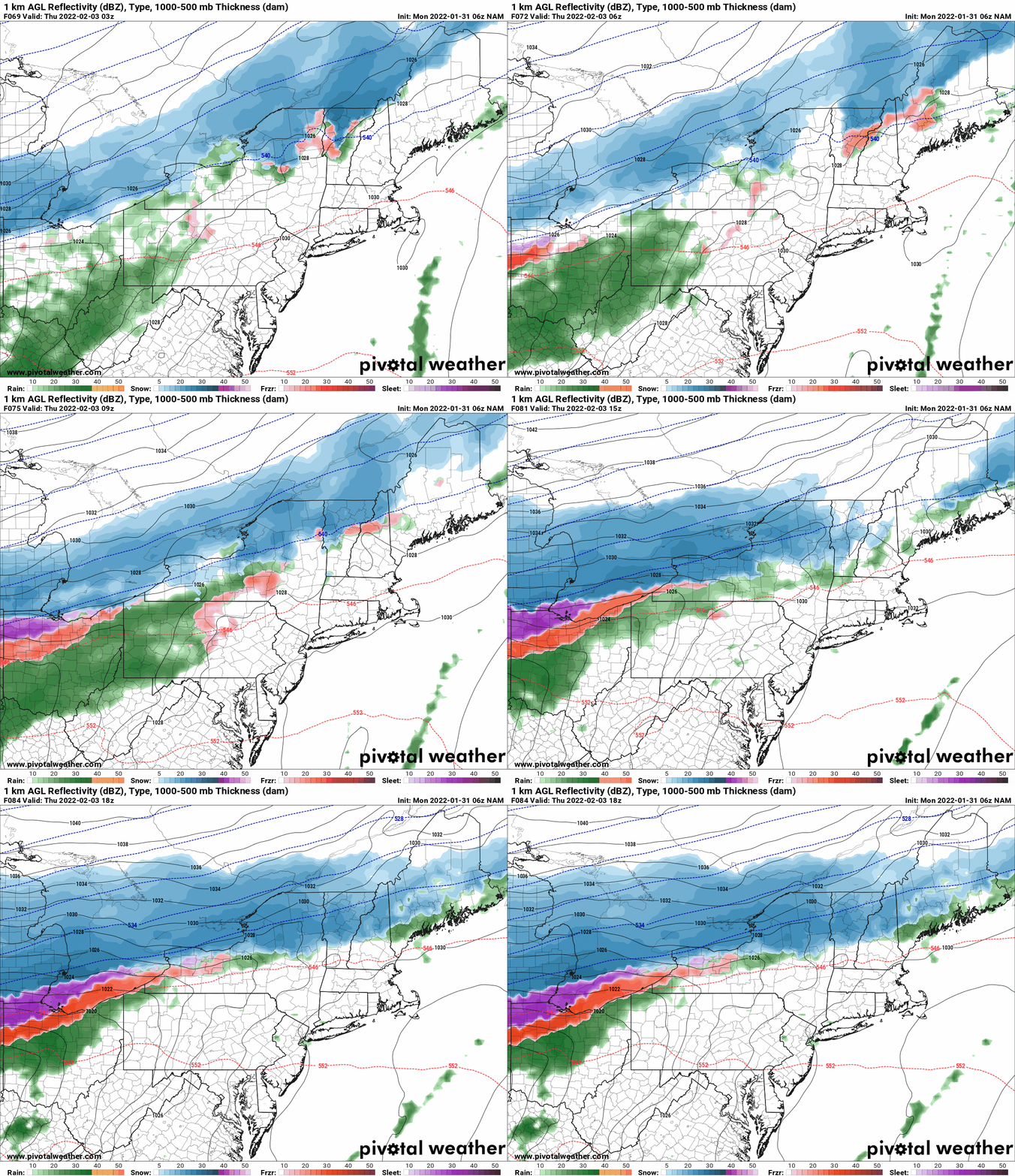
FRIDAY – GAME OVER. Any threat of warming and/or melting will end as the low pressure moving to the east will drive a northerly flow, colder temps, and a return to winter conditions across Upstate NY. There will not be much lake effect snow going on in back of the storm because the air will be dry, the flow will be too northerly (not as much fetch) and too much shear. 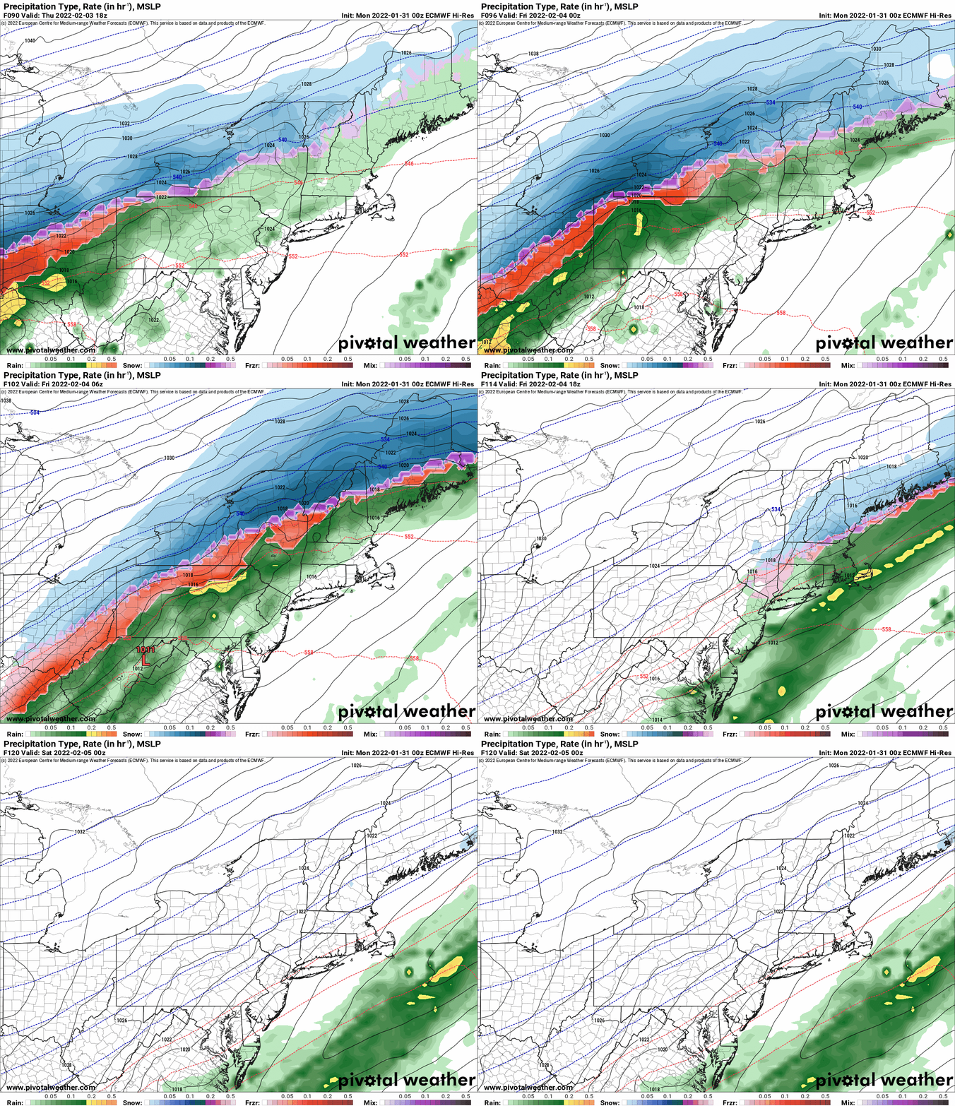
NEXT WEEKEND INTO NEXT WEEK – Staying cold. Chances for lake effect snow. It is looking likely there will be territory to ride, a possibility of improved conditions, especially north of the Thruway. There are, I think, some clubs that will be set back and may have to break for a bit, but with the cold pattern continuing, it will only take a clipper and some lake effect to get things back up and running.
WHAT CAN GO WRONG? Well the high pressure doesn’t build down from the north as much and more mix mess and rain makes it more into Upstate NY. It’s certainly still possible. Just as possible would be the high building down more, and the storm tracking farther south. That would limit the warmup further and guarantee more snow, less mix mess. We still have time. Pray the trend towards colder continues.
WHAT ABOUT US COMING UP? We had initially scheduled a window from February 6-12 to come up in that window of time. The alternate window is February 15-20. We want to come up and ride SO BAD. We are on hold and trying to decide what to do. This Thursday storm will be the deciding factor IF we come up sooner, rather than later, and WHERE we ride. The plan will come together quickly. Look for details soon. We will return and we will ride!
Thank you to all the faithful members and sponsors whom support Upstate Snow! You make the Morning Blog, Upstate Snow LIVE!, Trail Talk Podcast and Guide to Your Ride Podcasts and more possible. To become a MEMBER, drop me $10, and you’ll get name recognition, or if you wish not to use your name, recognition to your favorite snowmobile club or where you live. To become a SPONSOR, drop me $60 and I’ll put up a link to your business, Facebook page or snowmobile club!
Click below to get started
paypal.me/lupiallc
www.venmo.com/u/Richard-Lupia
THANK YOU to our faithful sponsors and members!
SPONSORS
Southern Tug Hill SnoRiders
Saratoga Snowmobile Association
Ohio Ridge Riders
ILSNOW.com
Enjem’s Flooring America
Water’s Edge Inn – Old Forge
Adirondacks Speculator Chamber of Commerce
White Lake Inn
Toads LLC Fisher and Snow Dog Plows, Cairo, NY
John Schoff Memorial Vintage Ride – January 15, 2022
Lincoln Mountain Gansevoort Snowmobile Club
ATV Tractor
Foley’s Lawn Care and Gardening
Better Homes and Gardens Pristine Real Estate – Cape Coral, FL
North Country Market – Thendara, NY
PR Plus Small Engine Repair – Sherrill, NY
EnergyMark LLC
Mountain Culinary Company – Mountain Top, PA
MEMBERS
Chris Rinck
Charles Klesse
Chaz Albertson
Dave Gleasman
John Bates
Darrin Harr
Mark Enjem
Matthew Pistner
Eric Vilovchik
Brian & Paula Bedell
Robert G. Gartley
Chris Higgins
Nathan DeMarco
Frank Presky
Chris Schoff
Richard Keller
Mark Spano
Paul Marconi
Michael Schrader
Chris Skipper
Frank Sansone
Mercy Board LLC
John Scalora
Tom & Alis Vincent
Angelina Gogola
Cricket Corelli
Russ Lamoy
Jeff Greene
Chaz Albertson Jr.
John Bossolt
John Foley
Andy Artessa
Jenny & Ron Tyre
Mark Finkbiner
Christopher Cawley
Darren Bryant
M&M, SnoCh!c and SnoL!fe
Doug Wasiura
Devon Senecal
Billy & Millie McLaughlin
Rachelle Gross
Marc Mellaly
DV
Vicki Muehleck
Gertude Corelli
Brian Shoemaker
Brian Salamone
Tom Sylvia
Tom Robinson
Eric Olofson
Gill Benedek
Jason Sosiewicz
Ron Linich
Debra Hubbard
Dennis Sullivan
JAYSOS!
JDR
Stephen Prinzi
Chautauqua Boat Works
Brian Bedell
Barbara and Joe Monahan
Des Ballard
Quade Kirk
Kyle Prill


