This is it. Don’t get scared now. We’re on the eve of the first significant lake effect snow event of the season. All of November and December with bupkis. Lakes still warm. Winter is finally showing up. It’s time to cash in.
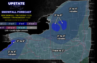
First of all, the snowfall map. Notice it is tighter with more detail. And instead of this being a 270-280 wind event, it’s looking more predominantly a 280-290 wind event. Meaning Oswego County, northern Oneida County, central Herkimer County, southern Hamilton County, Fulton County and northern Saratoga Counties are where the band will stay the most. Accumulations will drop off each county you go inland. There will be points it hits the Thruway, especially between Canastota and Little Falls. South of the Thruway will be less. South of Route 20 not all that much, and most of what you get will be in the final swing through Monday night with the arctic front.
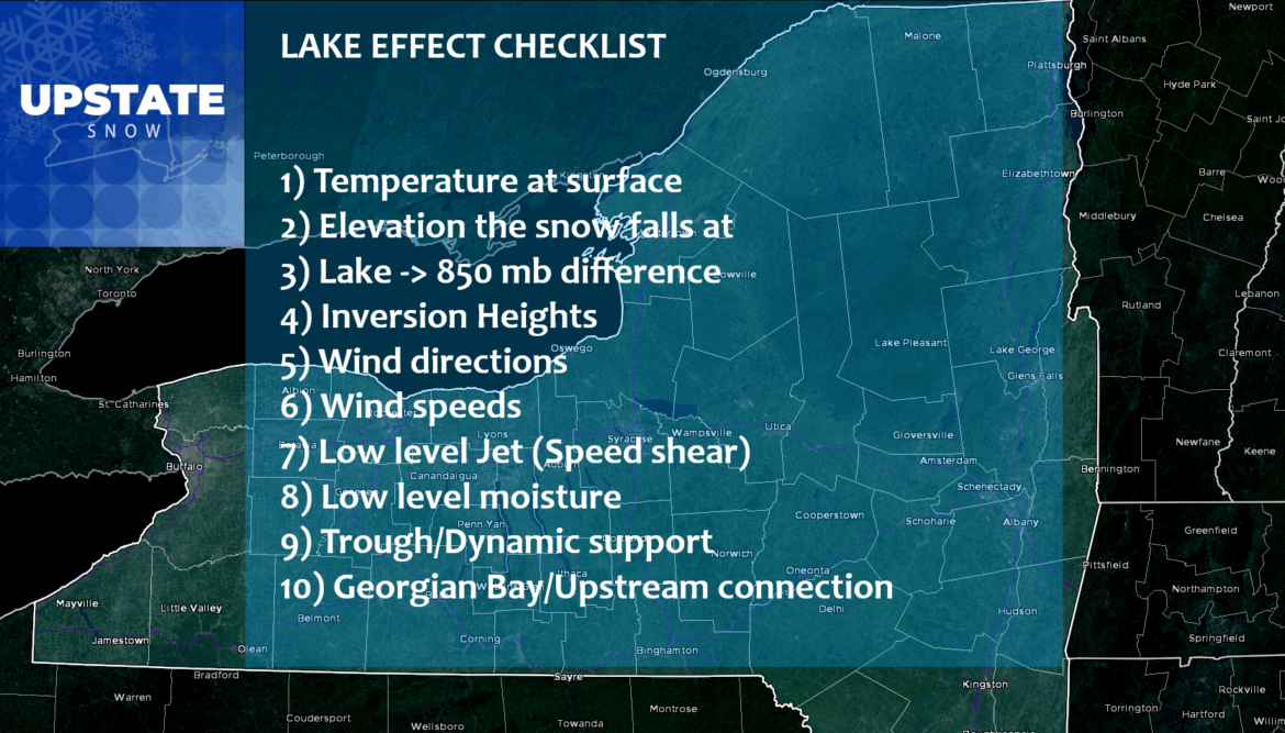
There is a checklist I look over with dealing with lake effect. This event checks every single box. It could be the biggest event of the year. It could be the first of many. We have no idea. Let’s just enjoy this for what it is: A big dump of snow to get the trails going. At least…
OK lets go chronologically here through this event. Follow along with the animating GIF I placed under here and slowed down for you. This runs from 3 PM Today, Sunday 1/9, to 7 AM Tuesday 1/11…
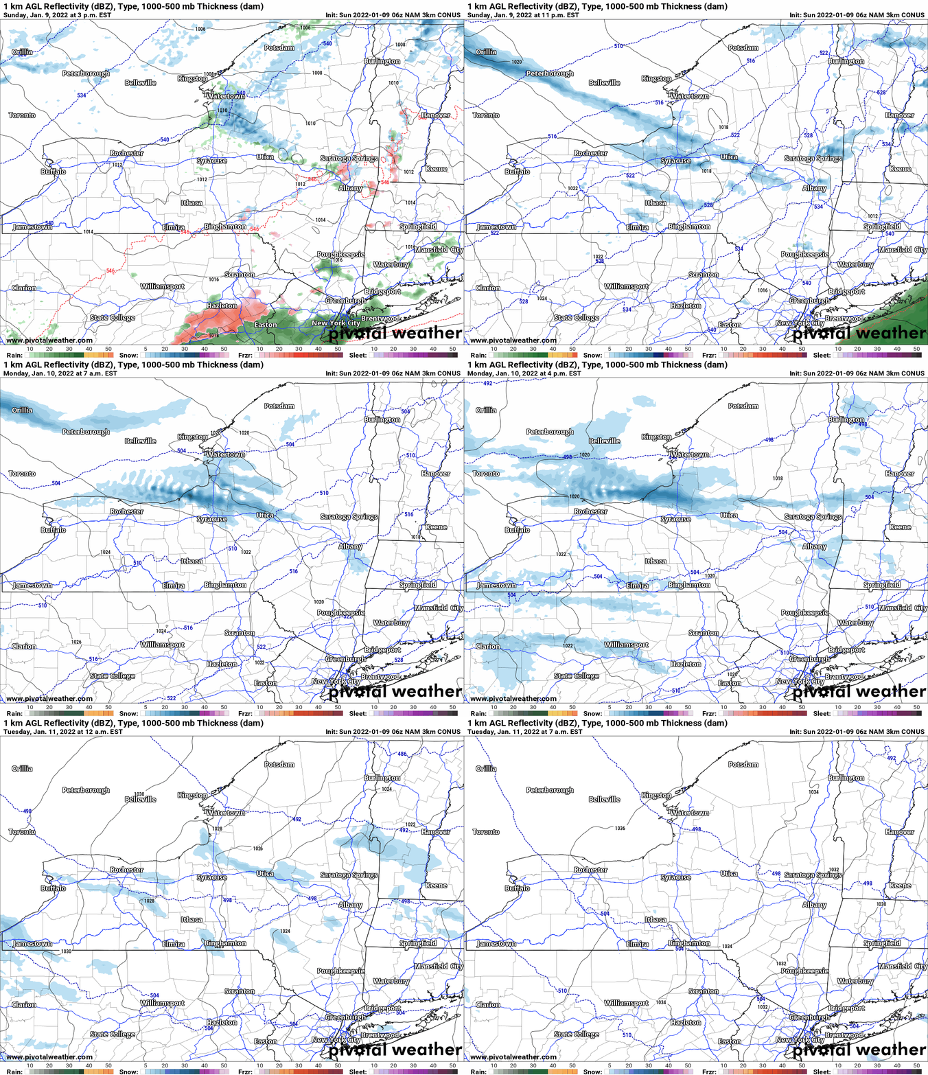
SUNDAY AFTERNOON
Snow develops as temperatures fall below freezing. Gets going north of the Thruway and Mohawk Valley.
SUNDAY NIGHT
Snow bands become stronger. There could be two bands developing, with two separate maximums of snow within them. Bands push along and south of the Thruway. This is the point the Syracuse and Utica areas will get a portion of their accumulations.
MONDAY MORNING
Snow bands lift to the north, mainly along and N of the Thruway now. Upstream connections complete, instability increases, wind shear settles in perfectly, band stretches way far inland. Band becomes intense. 1-3 inch per hour snows. Thundersnow possible.
MONDAY AFTERNOON
Intense snow band with 1-3″ per hour hitting Oswego, southern Lewis, northern Oneida and into central Herkimer County. This is the strongest/heaviest snow period. Thundersnow likely. Secondary band hitting western slopes of Tug Hill. Along and north of 177 is QUIET.
MONDAY NIGHT
Arctic cold front moves through. Heavy snow band pushes steadily south then settles into a 300-310 alignment, pushing into the Syracuse area and the hills along/south of Route 20 to the east. As upstream connection starts to get lost, temperatures plunge and we lose the best growth zone (-10 to -20 C), low level moisture weakens, and wind shear increases, the band will weaken.
TUESDAY MORNING. Multiband snows hitting areas mainly from Syracuse, south and west. Bands weaken in the morning to almost nothing by midday. Dry with sunshine in all other areas of the state. Below zero windchills. Actual air temps single digits to low teens. A brutal, old fashioned winter day.

Off Lake Erie the snows are a lot more muted because the inversion heights are lower, no upstream connection and wind shear profiles are not as favorable. Maybe 5/10 to 6/10. It’s 10/10 off Lake Ontario hence why the huge difference. Here’s my accumulation breakdowns:
Dusting to 3″ From Rochester westbound, south through Cortland County into Chenango, Otsego, Schoharie and Montgomery Counties. Most of this snow falls Monday evening/night. Fulton, Saratoga, Washington, Warren and Central Hamilton Counties (Indian Lake), This will be the excess blowoff from the main bands, most of this falls during the daylight hours on Monday.
3″-6″ – Eastern burbs of Ro cha cha from Irondequoit/Webster, to Macedon, Lyons, Auburn, Skaneateles, points north and east, into the hills of N Chenango County, you’ll get a little of this tonight, the rest of it Monday evening/night as the arctic front blasts the band through. This is inclusive of the City of Syracuse. Southern Oneida and southern Herkimer, N Otsego, W Montgomery and Fulton Counties, some of this is tonight, the rest when the front crashes through tomorrow evening/night. The 3-6 line should get as far as Saratoga Snowmobile Association and Lake Desolation. I can definitely see a 3″+ event at elevation there, less off the mountains. The 3-6 will stretch through Moose River Plains into the Old Forge Area (sorry Oh Foh… most of the white gold goes SOUTH of you), Big Moose, Big Moose to Brantingham to Lowville to along 177 through Barnes Corners to the lake. Just on the edge here.
6″-12″ – The secondary maximum in the hills of SE Onondaga, S Madison, extreme N Chenango, and S Oneida Counties is an orographically based maximum. I lived in this area for years and the lake effect will always maximize a few inches more than the lower elevations surrounding it. I think most in this area to the south probably more like 6-8 or 8-10. I don’t think too many S of the Thruway, if any, hit double digits, but I left it anyway. The 6-12 north of the Thruway goes from Fair Haven to the northern burbs of the Cuse. Anywhere from the Airport N into Clay, Cicero, the environs surrounding Oneida Lake, City of Rome, Deerfield Hill, Barneveld, Poland, Ohio, Salisbury to Powley Road, Caroga Lake, then back N and W to Piseco, Woodgate, Valley Snow Travelers, TRR then back to the lake.
12″-24″ – Most of Oswego County from Central Square to Pulaski, Fulton, Oswego, Mexico, Camden, Florence, Lee, Ava, Westernville, Remsen, Boonville, Fo-Po, Morehouse back around through Lost Trails to STH Land, TC Riders, Osceola, Redfield, and points west to the lake.
24″+ – Someone will win the jackpot. My best guess is somewhere between Tailwater Lodge and Swancott Mills, between Camden/Taberg and Osceola. Parish has a shot at the jackpot here too. We shall see.
The rest of the week, after the bitter blast Tuesday AM and Wednesday AM with below zero temps and windchills widespread, there will be a moderating trend towards the second half of the week. Moderating back to 20s to near freezing by day. Single digits and teens at night. In other words, for January, NORMAL.
More on this and things beyond in tomorrow’s morning blog. In the meantime THANK YOU to all those whom continue to give to Upstate Snow! I appreciate you all! Would you like to join in too? To become a MEMBER, drop me $10, and you’ll get name recognition, or if you wish not to use your name, recognition to your favorite snowmobile club or where you live. To become a SPONSOR, drop me $60 and I’ll put up a link to your business, Facebook page or snowmobile club!
Click below to get started
paypal.me/lupiallc
www.venmo.com/u/Richard-Lupia
THANK YOU to our faithful sponsors and members!
SPONSORS
Southern Tug Hill SnoRiders
Saratoga Snowmobile Association
Ohio Ridge Riders
ILSNOW.com
Enjem’s Flooring America
Water’s Edge Inn – Old Forge
Adirondacks Speculator Chamber of Commerce
White Lake Inn
Toads LLC Fisher and Snow Dog Plows, Cairo, NY
John Schoff Memorial Vintage Ride – January 15, 2022
Lincoln Mountain Gansevoort Snowmobile Club
ATV Tractor
Foley’s Lawn Care and Gardening
Better Homes and Gardens Pristine Real Estate – Cape Coral, FL
North Country Market – Thendara, NY
PR Plus Small Engine Repair – Sherrill, NY
MEMBERS
Chris Rinck
Charles Klesse
Chaz Albertson
Dave Gleasman
John Bates
Darrin Harr
Mark Enjem
Matthew Pistner
Eric Vilovchik
Brian & Paula Bedell
Robert G. Gartley
Chris Higgins
Nathan DeMarco
Frank Presky
Chris Schoff
Richard Keller
Mark Spano
Paul Marconi
Michael Schrader
Chris Skipper
Frank Sansone
Mercy Board LLC
John Scalora
Tom & Alis Vincent
Angelina Gogola
Cricket Corelli
Russ Lamoy
Jeff Greene
Chaz Albertson Jr.
John Bossolt
John Foley
Andy Artessa
Jenny & Ron Tyre
Mark Finkbiner
Christopher Cawley
Darren Bryant
M&M, SnoChic and SnoL!fe
Doug Wasiura
Devon Senecal
Billy & Millie McLaughlin
Rachelle Gross
Marc Mellaly
DV
Vicki Muehleck
Gertude Corelli
Brian Shoemaker
Brian Salamone


