Snow will overspread Upstate NY on Friday, lingering into Friday night and Saturday. Many areas that have only seen flakes, could get their first actual snowfall. Other areas that have only seen a trace to an inch… may get a little more than that. This is not major, but it is enough, especially with the big holiday weekend to give folks a HEADS UP as to what is going on around here. Before we do…

Tonight: Quiet.
Thanksgiving morning: Quiet. Clouds increase quickly.
Thanksgiving afternoon: Rain begins in WNY.
Thanksgiving night: Rain spreads across the whole state from west to east.
Friday morning: Rain changes to snow all across Upstate NY from west to east quickly during the morning.
Friday afternoon through Saturday afternoon: GAME ON. Heads up for snow and travel troubles. Not major, but enough.
Saturday Night: Snow tapers off.
Sunday: Good for travel across the state with fair weather, especially in the morning. Model differences as to when next system rolls in behind this thing so if you are traveling Sunday Night into Monday morning, heads up the next system may be in play with more rain/snow.
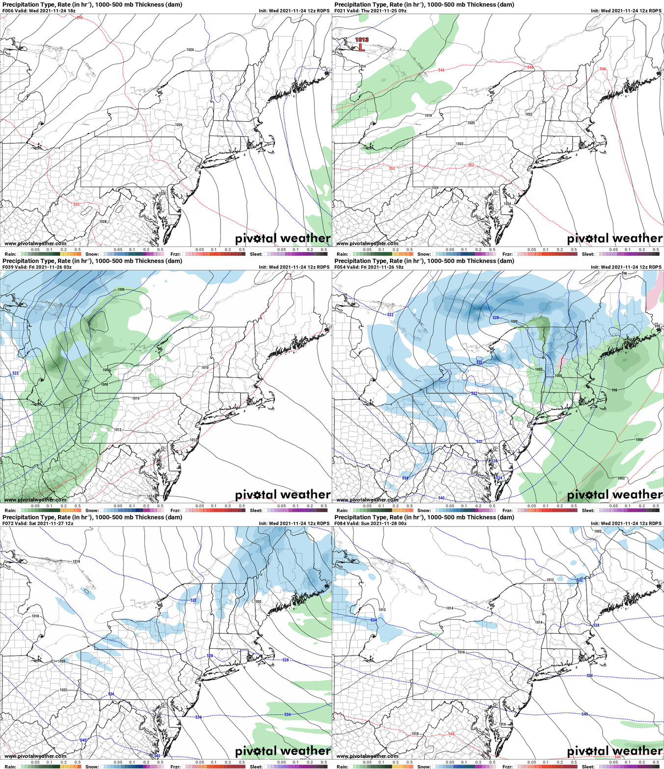
OK so to the details here, out of all the model depictions of this, and there are differences between the models, I like the Canadian RGEM the best out of all of them. The best period of snowfall starts Friday afternoon. Friday night is the best time for snow, with the reinforcing shot of cold air, copious low level moisture, and well developed lake effect bands pinwheeling from a 270-280 heading to a 300 to 310 heading. These bands Friday evening have the potential of putting out 1-2″ per hour at least. Saturday morning the bands settle on a 300-310 heading, hitting Rochester to Syracuse and the hills to the south. The bands should die out Saturday PM and be done with Saturday night, leaving Sunday good and quiet for traveling, especially in the morning. Sunday night into Monday you run into the next system approaching. If you are traveling about Friday afternoon/night, that is the time to be alert and on guard the most. More localized during the day on Saturday and decreasing in coverage.
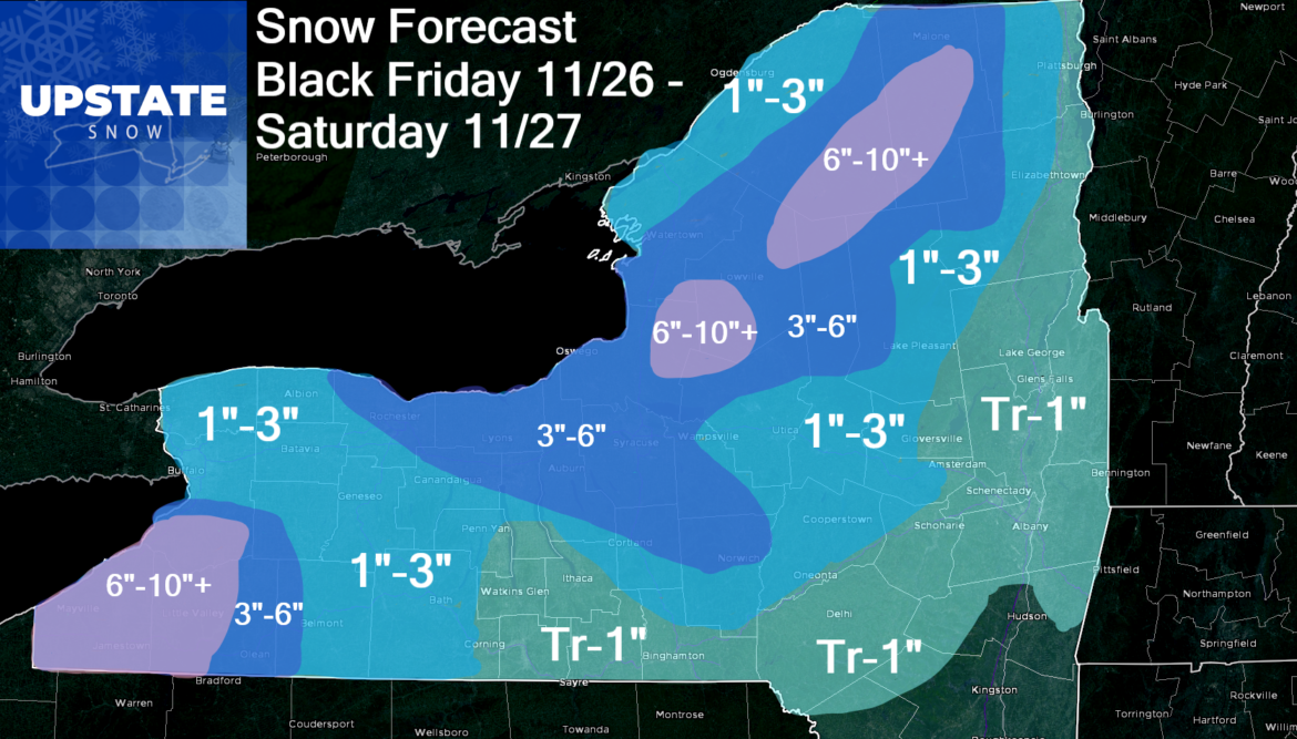
With a W to NW flow, low level moisture and reinforcing shot of colder air, upslope areas of the Adirondacks and Tug Hill will do the best on this one, as will from the Southtowns southbound into ski country in WNY. In these upslope areas, 6″ or more are likely with a few folks potentially threatening to hit the double digits. First time I have placed that on my snowfall map this year!
This map again is only a rough guestimate across the state… some areas may be higher or lower than indicated, but you get the idea.

Thanks for your understanding for the 3 PM post time… the whole Upstate NY family just arrived here in SC! Playing from behind today. Will monitor for any major changes Thanksgiving Day and may issue an update/revision Friday morning if necessary. Until then, blessed and safe travels for y’all and HAPPY THANKSGIVING!!!
If you enjoy our weather reports, podcasts, videos, and features, say thank you by becoming a SPONSOR or MEMBER of Upstate Snow! For just $60, sponsors receive a hyperlink to your business or social media page on every morning blog and podcast post on upstatesnow.com for the season (until 8/31/22). For just $10, members get name recognition, or if you wish not to use your name, recognition to your favorite snowmobile club or where you live.
Click below to get started
paypal.me/lupiallc
www.venmo.com/u/Richard-Lupia
THANK YOU to our faithful sponsors and members!
SPONSORS
Southern Tug Hill SnoRiders
Saratoga Snowmobile Association
Ohio Ridge Riders
ILSNOW.com
Enjem’s Flooring America
Water’s Edge Inn – Old Forge
Adirondacks Speculator Chamber of Commerce
White Lake Inn
Toads LLC Fisher and Snow Dog Plows, Cairo, NY
MEMBERS
Chris Rinck
Charles Kleese
Chaz Albertson
Dave Gleasman
John Bates
Darrin Harr
Mark Enjem
Matthew Pistner
Eric Vilovchik
Brian & Paula Bedell
Robert G. Gartley
Chris Higgins
Nathan DeMarco


