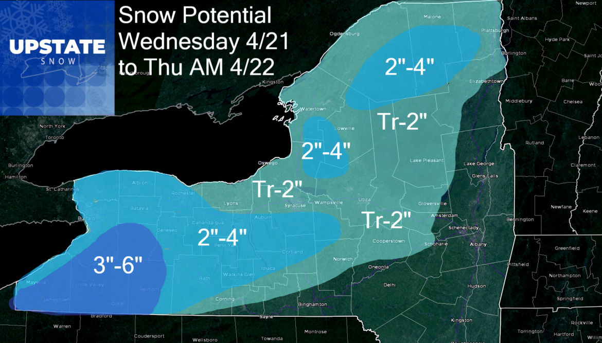
Here we snow again in late April. As with all early season and late season events, elevation will have a big impact on totals. There is finally some agreement on the low track across PA into the Capital Region of NY, then into Northern New England. This means areas south and east of the low get nothing. Near the low, only snow at the end after mainly rain, as will be the case for the Catskills, Hudson Valley, Capital Region and Champlain Valley. Central NY, Tug Hill and the Adirondacks will be elevation based, less down low, more up high. Finger Lakes and especially Western NY, and the hills south of Rochester and Buffalo, this will be accumulation, sticking to everything, and will impact road conditions. This is the area to watch.
TIMING: Tonight it comes down across WNY. Tapering off by morning. Not much happens until daybreak Wednesday morning east of 390. As cold air rushes in, expect rain to change to snow and stay snow despite the very high late April sun angle. It should taper off afternoon across the Finger Lakes and CNY. Expect lingering snow showers and lake effect (believe it or not) overnight Wednesday into Thursday morning across CNY, Tug Hill and the hills south of Syracuse along Route 20. Thursday is a chilly day and breezy. Improvement Friday and Saturday.

Once again another snow event outside of anything useful for snowmobiling and winter weather lovers. We are already over it and well into spring mode. Many have already mowed the lawns at least once! HOPING THIS IS IT. We need to save some for November, December and January. Agreed???
Don’t forget to like and follow richlupia.com for weather updates throughout the rest of the spring, summer and fall, through my new project WxLive at 645.
Thanks,
Rich


