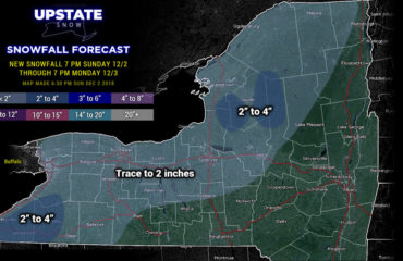
It’s not an April Fools Joke. The joke is on Upstate NY believing spring is here to stay. That doesn’t happen from March forward even in the warmest of years. And so here we are with an unseasonably cold airmass tangling with an unseasonably warm airmass… and the timing and placement of such clash favors Upstate NY getting bonus snowfall to add to season totals.
A refresher on early and late season snowstorms: These are elevation based storm systems. The higher elevations always win in October and Novembers as well as late March through early May in these scenarios. It is the combination of warmer ground and higher sun angles that make snow early and especially late season hard to call. Timing is everything. If all your potential snow hits during the daylight hours, you are fighting a sun angle that’s as high as Labor Day Weekend… when we can be in the 80s and 90s. On the flip side, track matters, and if your storm track and upper level energy matches up textbook, you can’t ignore the outlier that it could overperform. We saw this in late season storms at the end of last April in the Catskills and eastern NY. So the variability is much greater than usual, no matter the track or setup.
What’s going for a big snow across Upstate NY this time: The track is about dead perfect and all models at 48-72 hours are in surprisingly unison agreement. The surface low tracks between I-91 and I-95 in New England. For CNY and the Adirondacks, the CT Valley Track, I-91 to Worcester, MA is BULLSEYE. Closer to I-95 pulls snow away from areas west of I-81. So for this reason, I’m shaky on my confidence of snowfall amounts WEST of Rochester and I-390, leaning lower than some forecasts/models. In addition the dynamics are LEGIT. The 500mb trough is a big factor in coastal lows/storms. Until the 500mb trough passes EAST of you, you are subject to heavy snow, banding and a deformation zone. As you see below with the SFC tracks and 500mb low tracks, the heart of Upstate NY, especially CNY, Tug Hill and the Adirondacks (east of Route 30 and High Peaks) are sitting pretty for big snow potential. Even Thursday evening at 8 PM on the last map, the 500mb trough still hasn’t cleared the state with all kinds of dynamics over the state during the day. The dynamics, many times, can overcome borderline thermodynamics. Which we’ll get to in a moment below…
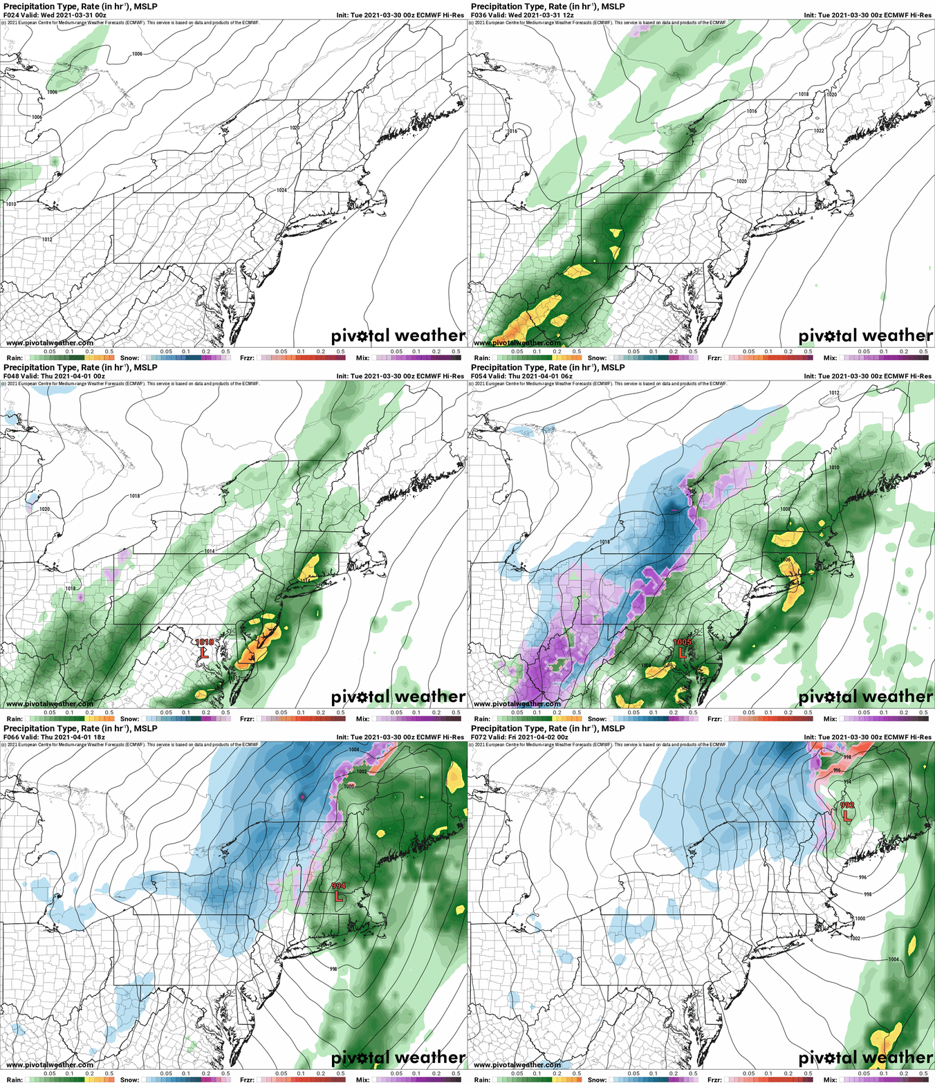

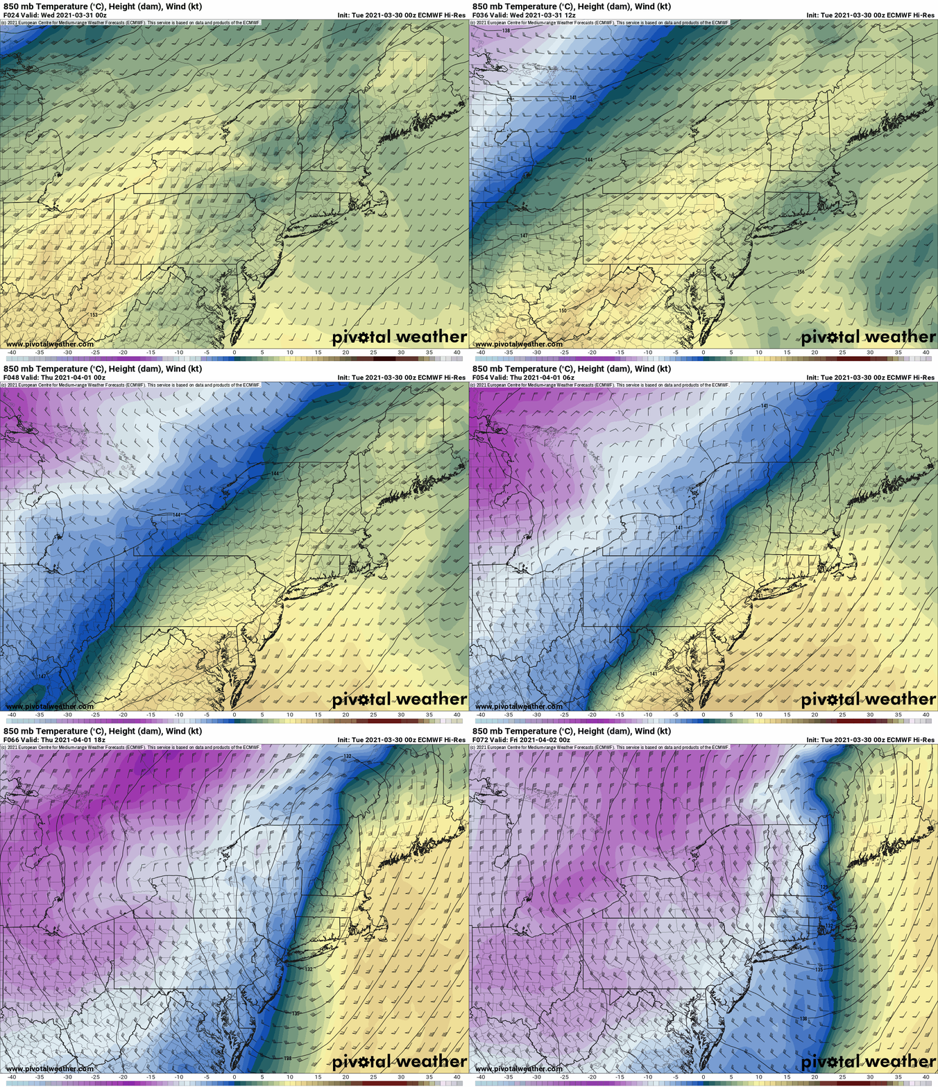
What’s going against a big snow across Upstate NY this time: Time of day, very warm ahead of the storm and warm ground melting initial snow. In the Southeast, storms tend to hit best with cold air already in place instead of the cold air racing to catch up to the storm. That’s what my time in the Carolina’s has taught me. There is no reason to think this same concept does not apply to Upstate NY where climatology on April 1 in places like Syracuse and Utica, is very similar to January 1 in places like Raleigh, Charlotte and Greenville. This is a BIG limiting factor. Add to this, the fact heaviest snow and biggest dynamics hit during the daylight hours, and you have complications. Check out the cold air at 850mb. We are WARM ahead of the storm with 60s (70s New England and the coastal cities), but the air in back is legit with 850s going middle minus teens, which means even if the air is fully mixed, you don’t get out of the 20s at the ground. How fast does the cold air get in? Does it slow down? Speed up? Any change of timing will shift storm totals dramatically. As it is I have the Capital Region getting skunked with CNY at bullseye, which means someone between Utica and Amsterdam I’m likely to miss too high or too low, but where???
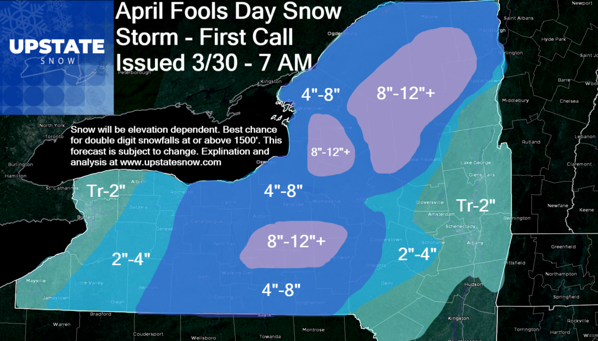
Timing of the snowfall: Areas west of 81, especially Rochester and Buffalo, and the Southtowns/Ski Country, most of your snow hits Wednesday night through Thursday morning. Between Rochester and Utica (Including Syracuse and CNY, Binghamton area, Tug Hill and most of the Adirondacks, snow starts overnight or as you wake up Thursday morning and lasts through the day. Tapers off going into Friday morning. Any snow the Catskills, Capital Region and eastern Adirondacks/Champlain Valley see should be Thursday PM through Thursday night with rain and warm air hanging on, limiting snow totals. The biggest bust/transition area from “where the snow go” to “holy cow” will be somewhere between NY Route 12 and the Northway/I-87.
First call: Subject to change. We will update the snow map if needed tomorrow 3/31 and might… just might… go live Thursday morning as the storm is materializing with some “nowcasting” to help guide you through your Thursday.
How does this compare historically, especially if it’s more than this map at my location? It’s not all time snowfall for this late in the year, but definitely in the category of “not every year” or “once in 5-10+ year event” for this late. In the lower elevations, based on Utica, NY, my hometown, only 7 storms in history dropped 6″ or more and only a dozen of the last 140 years have had total monthly snowfalls exceeding 6″. Again, lower elevation location at a point. But the point is, while not usual, not all time or unprecedented. In April 1979, two successive storms dumped 18″ on Utica. #1 month, #1 and #6 storm all time, back to back. And the #1 for Utica was almost a foot.
Interesting observation for severe weather junkies. That April 1979 time we were on the cold side of an extreme jet stream that nailed Wichita Falls, TX with the tornado outbreak of record 4/10/1979. In another record snowstorm and April snow year, 1974, just followed the “Superoutbreak” of April 3-4, 1974. 2000 was another year we got hit good. Many of the years in which April snows hit, seem to coincide with patterns that produce big tornadoes and severe weather outbreaks across the country. Just an anecdotal observation but as a weather geek in general, I’m just saying, it’s already been a BUSY start to severe weather season, and given the strong La Nina (present in 1974/1979/2000) I say it’s likely thunderstorms will be an issue nationwide and in the northeast and Upstate NY this year.
What about riding? Don’t even think about it. Mud gates up on all snowbowl trails and seasonal roads controlled by the NYS DEC. Old Forge is officially closed. Ground way too warm/thawed. If you have land and don’t mind, lawn jockey, like you would in November, but don’t trailer anywhere… Unless select clubs announce on their FB pages otherwise, don’t go.
After the storm: Bitter cold (but not unprecedented) by April standards. Friday Night/Saturday morning will start in the teens and single digits for many. Highs Saturday will jump into the 40s with sunshine so snow melt will commence quickly. Brief rain/snow showers Saturday Night then Easter Sunday should be Partly sunny with 50s returning and temps near normal for April sticking around… which means the snow… won’t be sticking around. Even in areas that get tons… it should melt within 3-7 days.
Thanks for checking in on us!
Rich Lupia
Meteorologist/Owner
Upstate Snow


