Cold enough for ya this morning??? This is the worst of the cold I think for this arctic outbreak and I’ll call it now: I think this is the coldest morning of the winter season. We’ll probably get close a few more times this month but when all is said and done, I think this will be the coldest morning of the 2020-21 winter for most.
If you want to hit the trails, be prepared as always, but this kind of cold with groomers working their magic all across the state, should make today particularly, and even tomorrow, two of the best days of riding in many years. Everyone has the cold and most trails are, what I like to call, “Flat and Fabulous!”
As I’ve mentioned in previous blogs and in yesterday’s Guide to Your Ride Podcast, the storm track, the jet stream is super fast and active. I was seeing signs it would shift more towards Upstate NY. This is indeed happening. The warmth in the Southeastern US is not going to be suppressed for long, and with the heart of the cold still tightly gripping the Ohio Valley, western Great Lakes and Upper Mississippi Valley, we have favorable conditions for a stormy President’s Day week ahead.
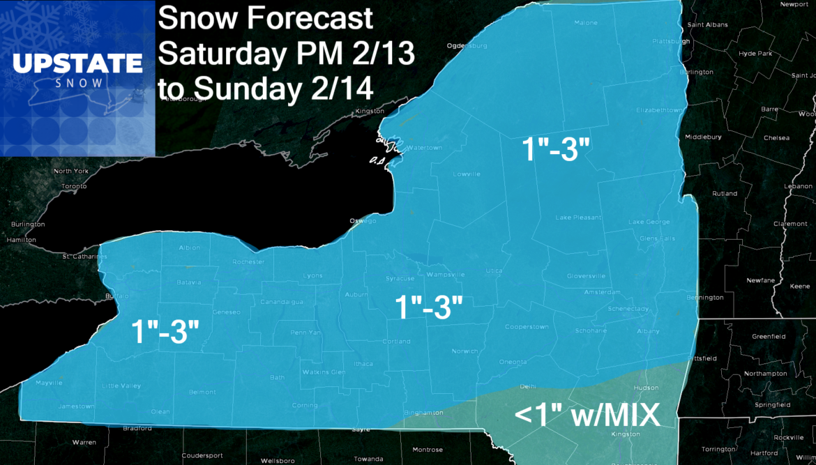
Storm #1 – Saturday PM to Sunday. Models still vary on the timing and phasing with the deeper moisture from down south. At this time, it looks like a light snow of 1″-3″ for most of Upstate NY. Are some 4″ amounts possible? Yes, but given models flip flopping in the fast jet stream, I’ll make adjustments tomorrow if necessary. This will freshen the snowpack. Areas south of I-88 and Albany County will be subject to sleet mix therefore lesser amounts.
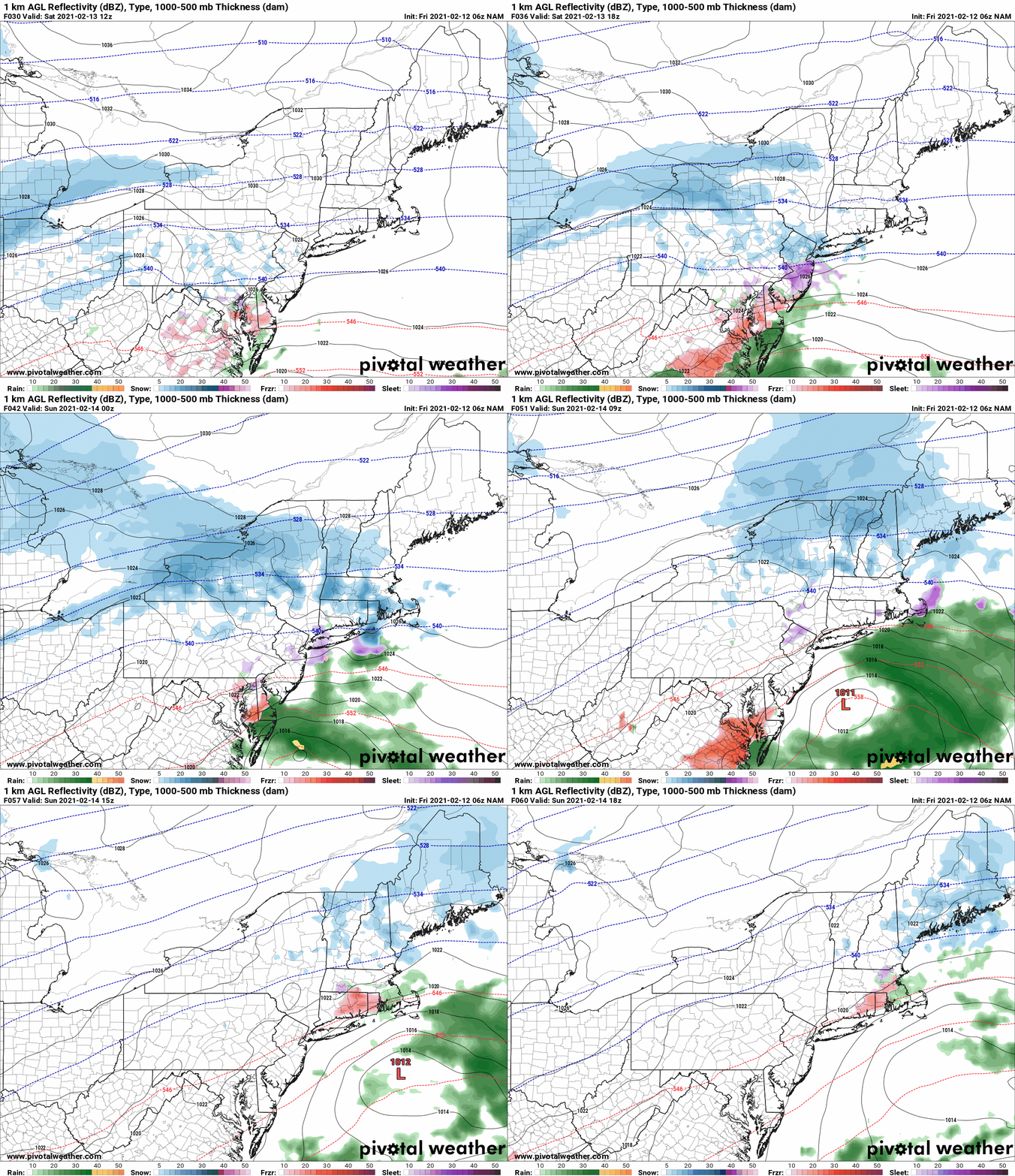
Storm #1 1/2 – Monday. Ok why am I calling it this? Some models keep this separate and ahead of Storm #2 (Tuesday-Wednesday). Other models phase it into the upcoming storm. So Monday is up in the air. At the moment I’ll play with the Euro’s separate system scenario, since storm evolution has been slower than predicted given recent trends. This means Monday we could have a separate 1-3 inch snow event with a few places more. Again unsure and will update when confidence is higher.
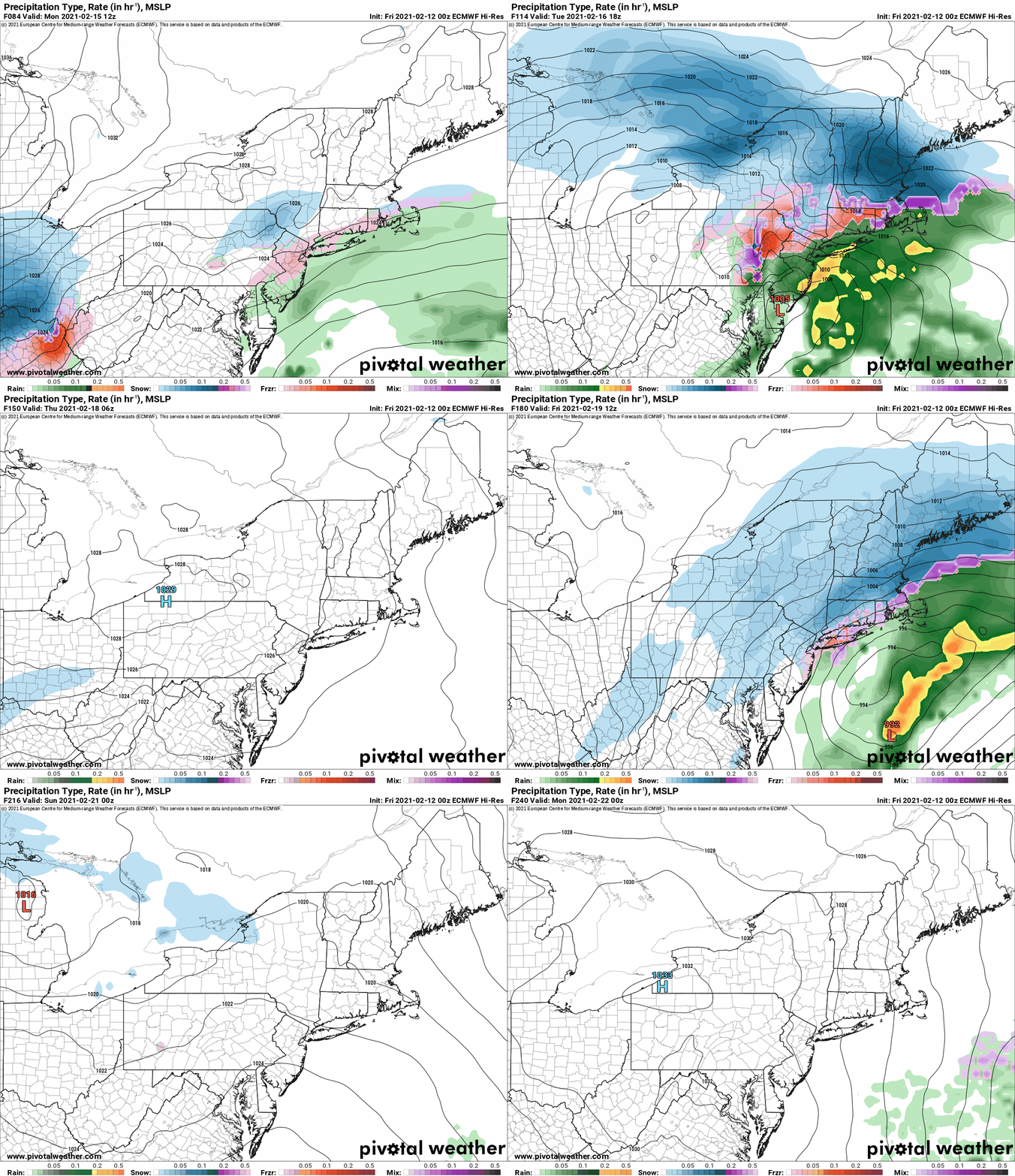
STORM #2 – TUESDAY – WEDNESDAY: Capitalization for emphasis. Question is no longer whether we get hit with something… but what we get hit with… it will be significant either way. Referring back to previous blogs, this pattern is a good ice storm pattern for a lot of the country including Upstate NY with arctic air widespread, big fast jet, and tons of warm moist air from the Gulf in play. At the moment, it starts on the western side of the Appalachians, and given recent Southeast US trends, I agree. But for Upstate NY, does it jump the Appalachians to the coast and redevelop off the mid Atlantic coast to ensure more snow than mix for Upstate NY? That’s the big question and concern for me. I can make a case either way. Given where the arctic air is well established and where the Polar Vortex and Greenland blocks should be set up, I’m favoring the jump to the coast scenario. For now. We are still 4-5 days out and as you’ve seen all winter, this is by no means a lock. Based on the above Euro scenario you see, we get several inches of snow to start, some areas especially S of the Thruway and Western NY, will get into a period of sleet mix. As it jumps to the coast we go back to snow. Should be a good hearty storm to add to trail bases. If it doesn’t jump to the coast, it’s a problem. This would mean extended period of mix and freezing rain, with S of the Thruway and WNY going to rain, then back to snow. If that happens, the playground for snowmobiling could shrink quickly to N of the Thruway. HOPING THIS DOES NOT HAPPEN. I’ll CALL THIS POSSIBLE, BUT NOT LIKELY AT THIS TIME. Still bears watching.
STORM #3 – This time next week. This could be a bonafide Nor’easter. Could. I think if #2 goes west and gives us #2, then #3 may not come out as well for us. If #2 behaves, #3 should come out better for snow lovers. And I’m just going to let that lie for now.
No matter how you slice it, temps should stay at or below normal the next week and a lot more storms will be coming through. Do the snow dance that winter stays large and in charge next week. Next week will determine if the snowmobile season starts to go downhill by the end of this month, or if we have a chance of hanging on into March.
Rich


