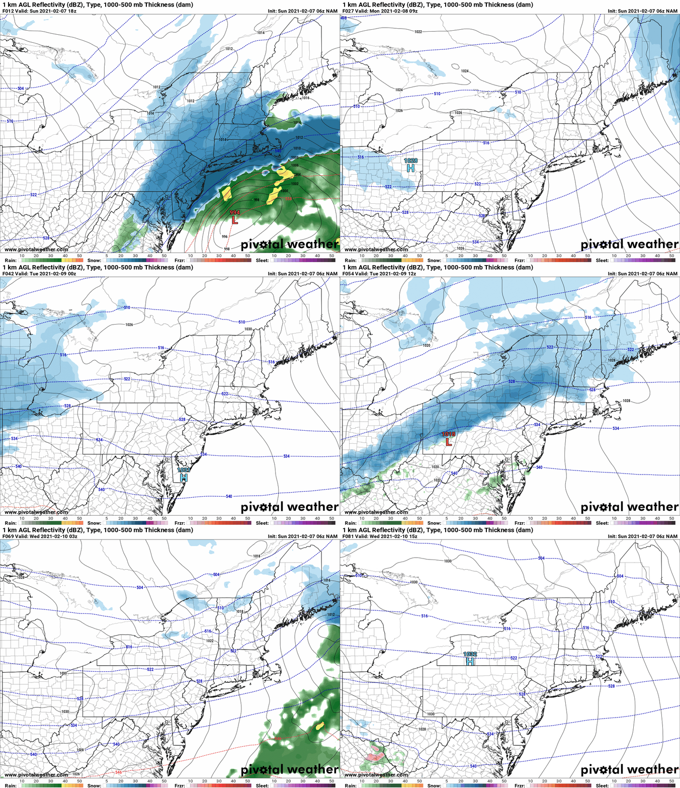
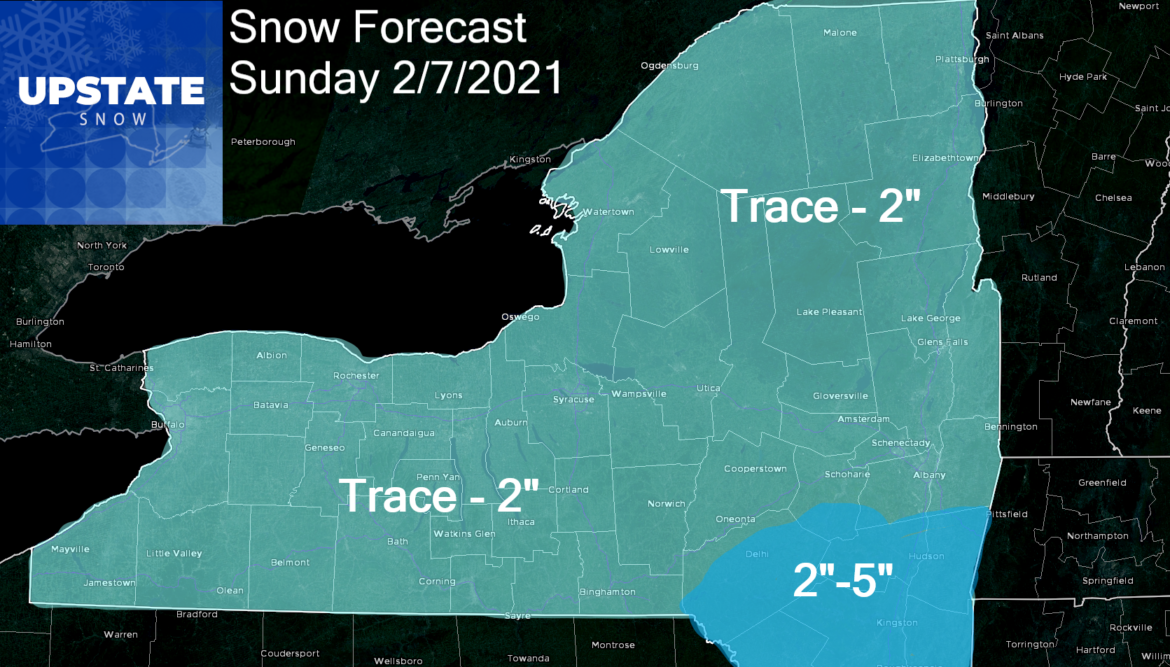
The next storm coming out of the Carolinas and the Virginias up the coast is moving too fast and doesn’t have the push to get up the coast and make the turn towards Upstate NY and New England. Most of the snow you’ll see today is from the edges of the storm and the upper low associated with the storm. For many today it will be a brush and lightly shovel snow, rather than a snow blower/plow snow. Unless you are in the Catskills or south of Albany, snow amounts should stay to a maximum of 2″ across Upstate NY. Downstate should be 2-5 with any 6″ amounts in NYC/Long Island and along the coast. Behind the storm tonight into Monday will be fair weather with cold temperatures. Next storm system moves in Monday Night and through the day Tuesday. This storm is one to watch. I’ll have a snow map on this one tomorrow. This clipper is looking like 2-4 for Upstate NY with localized areas of lake enhanced snow dropping 4-8 inches downwind of the lakes. More details tomorrow. Not a big storm by any means but a noteworthy one for sure that will keep road crews and plow drivers busy… and the groomers at snowmobile clubs across the state with plenty of white gold to mold and shape into the nice white ribbons we’ve been blessed to ride on in recent days.

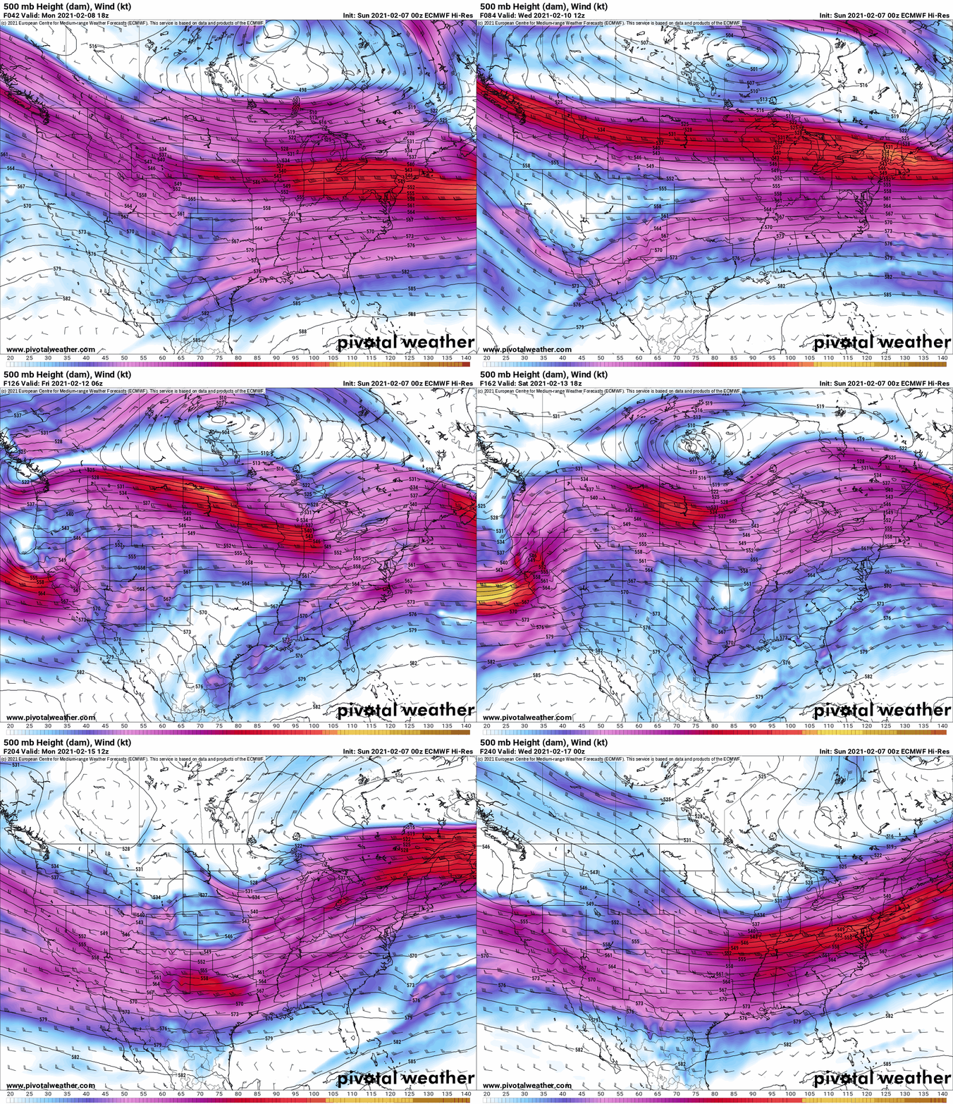
Storm timing beyond this, at the moment, looks to be Thursday PM into Friday and another one over President’s Day Weekend. Below I put the Jet Stream map. You’ll notice it’s not the gargantuan deep shot of super cold air all the way down into the Southeast. You’ll notice one big fat and fast jet across the country. The lack of ridge in the western US that was previously indicated concerns me. The Polar Vortex coming down into Central and Southern Canada assures me it will stay cold… SO LONG AS THE JET STREAM STAYS SOUTH OF UPSTATE NY.

Do I think the cold will hang on across Upstate NY and keep the great conditions for snow lovers and snowmobilers alike going strong into the Holiday weekend and beyond… YES. I’m just telling you right now it’s not as much of a slam dunk as it looked like several days ago. Yes I know NCEP has a very BLUE map (Below normal temps) over almost the entire country for the next 1-2 weeks. I’m not going against that. All I’m saying is the BUST POTENTIAL is MUCH HIGHER in a more zonal (west to east) flow. All the eggs are being put into the “Polar Vortex/Greenland Block” basket. If something unexpected happens in the next one to two weeks and these things weaken, then a storm blows up in the wrong part of the country… a blowtorch thaw/heavy rain event may pop up seemingly out of nowhere.
Folks I’ve been doing this since the 1990s… I’m good at long term pattern recognition. It wouldn’t take much for a sudden change.
I’m not going against the current forecasts and agree winter should be large and in charge through at least the middle of February… probably until the last week of the month. But I’m seeing things in this jet stream I don’t like… and it’s my job to shoot you straight and alert you getting through February without a thaw is not a guarantee. Remember when Atlanta was up on Brady 28-3 some years back on this Super Bowl Sunday??? It has been a strange winter. Don’t get comfortable. Take your rides NOW. Stay alert. Weather could change fast. I’ll stay on it as best as I can. And thank you for the well wishes. I’m feeling better.
Rich


