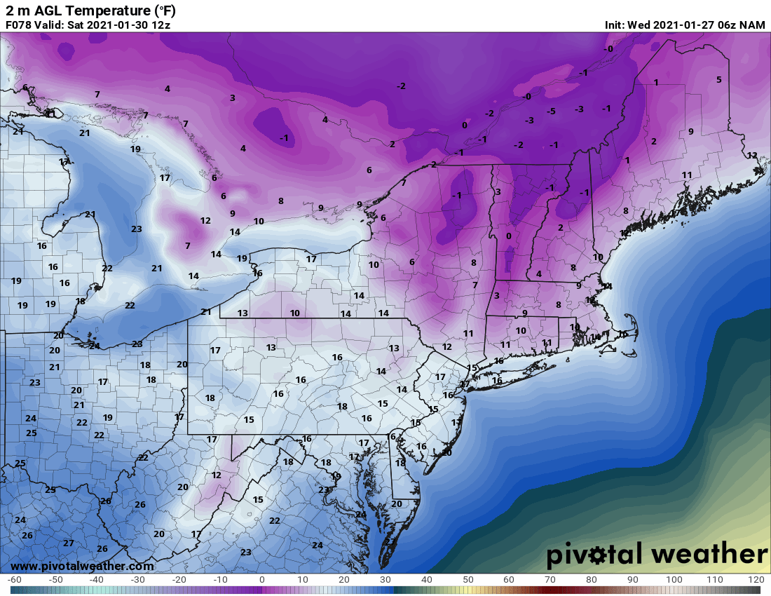
Now that snow has returned, what about the cold? It’s on the way again! With snow cover over much of Upstate NY now and more and more clubs opening up, it’s time to explore some areas that were previously closed off due to lack of snow. Don’t wait. THIS IS THE TIME! I’ll explain why in the blog as we look ahead. But first… THE COLD IS COMING BACK! Today will be the “warmest” day until well into next week. We are getting another shot of cold air from due north. This means lows will be back to near or below zero by the weekend (again), sunshine chances increasing for the weekend, and great conditions for ice making on the lakes and great conditions for groomers to work their magic on the trails. With the exception of a brief inch or two of snow Friday, expect fair weather for the next several days.

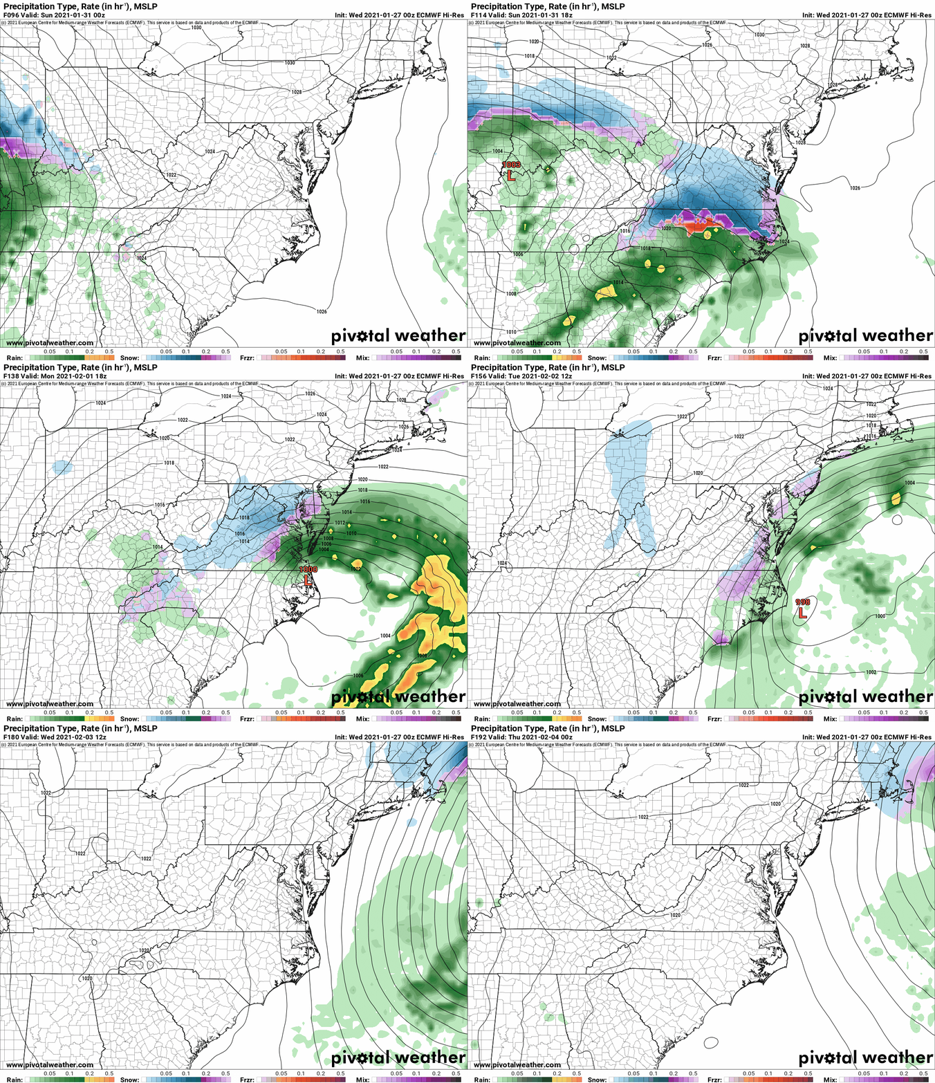
So with the cold in place it’s a good time to get hit with a big storm, right? Usually. But what about the Euro, wasn’t it flashing a potential storm for next week? Yes it was. And it still is. But as we are getting closer, I’m losing confidence we’ll see any impact from this storm in Upstate NY. The Virginias, Carolinas, Tennessee and Kentucky will have a much better shot. Why? While we have a good “Greenland Block” pattern, for now over Upstate NY, you need more than that to drive snowstorms into Upstate NY. A lot more. First the map of whom and where could get hit per the Euro’s latest run, to the south of Upstate NY…
Back to Meteorology 101 here. The best pattern for a snowstorm like a Nor’easter is for a trough at 500 mb to be placed just to our W over OHIO. Correspondingly you need a ridge out on the west coast, just inland near NEVADA. I call it the VEGAS RIDGE because that’s about where the highs at the SFC and 500 mb need to be. This creates the physics necessary to “dig” the trough from OHIO to the Atlantic coast, the send the low due north into New England. That’s how you get (usually) the one to three foot storms in Upstate NY. As you see below the 500 mb pattern IS NOT that. It’s almost the opposite. The trough from OHIO gets shoved straight east and can’t “dig” to force the low up the coast because THERE IS NO VEGAS RIDGE. If you’ve been watching the news lately you see Vegas JUST GOT SNOW for the first time in two years and California is getting annihilated with several feet of snow and hurricane force winds in the Sierra’s. As you see from the 500 mb map here, that’s what’s going to happen again early next week out there. No ridge to be found out west… because it gets killed, sent east into the Plains, which sends potential snowstorm out to sea.
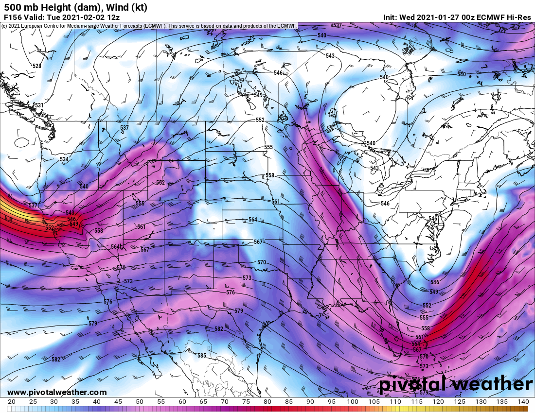
This is another reminder why you need to GO NOW. CARPE DIEM. Don’t make plans with your buds for late February or early March assuming things will be good until then. Yes it’s looking good now but with missing storms, and straight north winds only bringing us to just below zero instead of 20 to 30 below… I’m telling you I don’t see winter going into overtime this year. It’s not on the map and trends yet but the best of winter is right now, bar none.
Morning blog will take a few days hiatus. Guide to Your Ride podcast coming late tonight/early Thursday after we chat with Chris Rinck, I’ll drop a trail talk podcast on Friday, and next Morning Blog probably Saturday. That’s my goal right now. Be good. Stay safe and healthy! Rich

