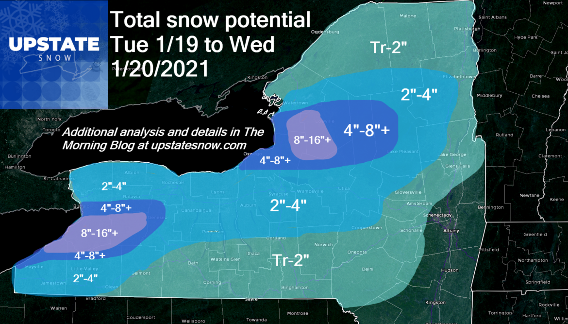
What we’ve been waiting for is here. Another lake effect event underway, already pounding Buffalo and the southtowns as of this writing, stretching even into the southern suburbs of the Rochester area. Soon to fire up over the Tug Hill and western Adirondacks again. A decent snow map for accums over the next 24-30 hours.
In WNY, Buffalo is in on it but southtowns, Genesee County, even into Livingston County will be the best bands of snow. Still good across Chautauqua and Cattaraugus, but mainly the northern parts of those counties. Rochester area will see accumulating snows with more to the east and southwest of greater Rochester.
CNY – I’ve got a general 2-4, thinking closer to 2″ in the lower elevations, closer to 4″ N of the Thruway and also in the hills S of the Thruway along Route 20.
Tug Hill – 8-16 with locally higher amounts on the hill proper (1500′-2000′), surrounding clubs and approaches to the hill 4-8 with the chance a localized double digits depending on band placement. Same for Black River Valley. Same also into the Old Forge area and traditional snow bowls of MRP, Morehouse and Perkins Clearing. Lesser amounts across the rest of the Adirondacks and hills N of the Thruway. Minimal snows in the Hudson Valley and Catskills. Most of the Capital Region and Hudson Valley get passed by.
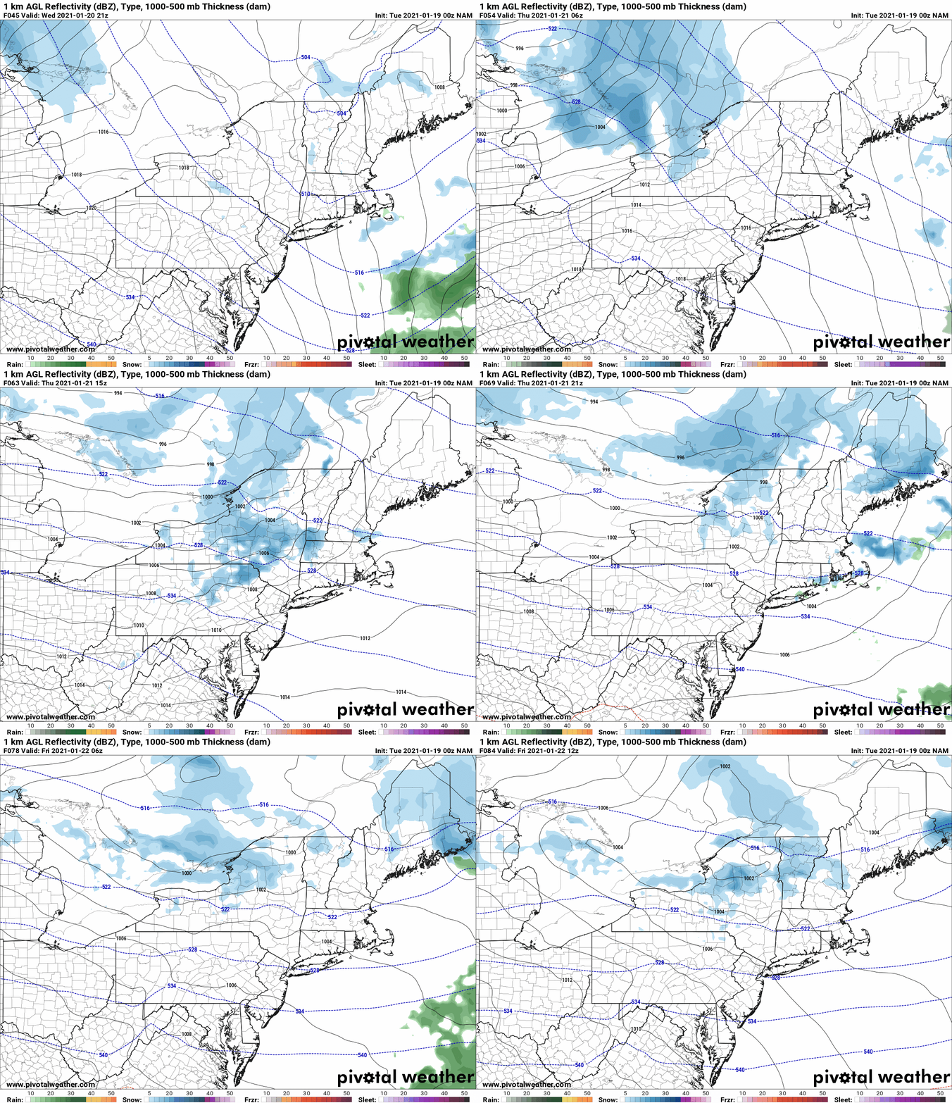
And after a brief break Wednesday PM, we are back at it with another clipper and another round of lake effect snow Thursday into Friday. Basically, the rest of the week is on and off snow, and a healthy dose of it for snowbelt areas. While temperatures will get a little colder, the real cold will hit this weekend after this system goes by…
This weekend will feature two things we have not seen a lot of this winter:
1) COLD TEMPS! Teens to low 20s for highs Saturday and Sunday. Overnight lows single digits for most with at or below zero in the Tug Hill and the Adirondacks! It’s a sad sign we are excited about such temperatures in mid to late January, the coldest two weeks of the year, and as such these above temps are truly ONLY about 5-10 degrees below normal. In this weather pattern we should be 10-20 degrees COLDER than this, but that’s the difference between quickly manufactured cold air in Canada, and true Arctic/Siberian air that has never made a run at us this so far this season.
2) SUNSHINE! We’ve seen hardly ANY in the last month. Even for the usually sunshine deprived Upstate NY during the winter (approximately 25% possible sunshine in November, slowly increasing through the 30% range during winter to closer to 40% in March), this has been among the more notable cloudy stretches we’ve seen. One of the great gems of Upstate NY is when the snow does come out across the frosted winter landscape with incredibly colorful sunsets, and mostly clear moonlit nights. This weekend will be that chance.
Check with clubs before you go, expect water hazards and limbs coming down with the gusty winds over the next few days… but Friday, and especially Saturday, Sunday and into Monday, expect increasingly fair weather with some breaks in the clouds to allow for Mr. Sunshine by day, and a first half to full moon bringing amazing views by night on the trails.
Rich


