Certainty and uncertainty. That’s todays theme.
The amount of uncertainty with the Christmas Eve warmth and rain is still high. How much? How long? When? Those are critical to determining how much snow pack survives. Models are still inconsistent on this. If you believe the Canadian RGEM, it’s a wipeout. If you believe the NAM you have hope it’s not as bad. GFS and Euro somewhere in the middle. Still uncertain how strong the wave of low pressure riding up the front is, and how much moisture gets thrown into the cold side for general snows at the end of this Christmas morning. If the low tracks towards CNY, big snows, especially for WNY on Christmas Day (more than just the well advertised lake effect), if it tracks W of Buffalo, it’s a lake effect only show, wipeout ahead of it across much of Upstate NY and delays the snow until daylight hours Christmas Day.
Take a look at 4 models, Euro, GFS, NAM and Canadian RGEM (or RDPS), each for 1 PM Christmas Day. Each paints a much different picture for Upstate NY.
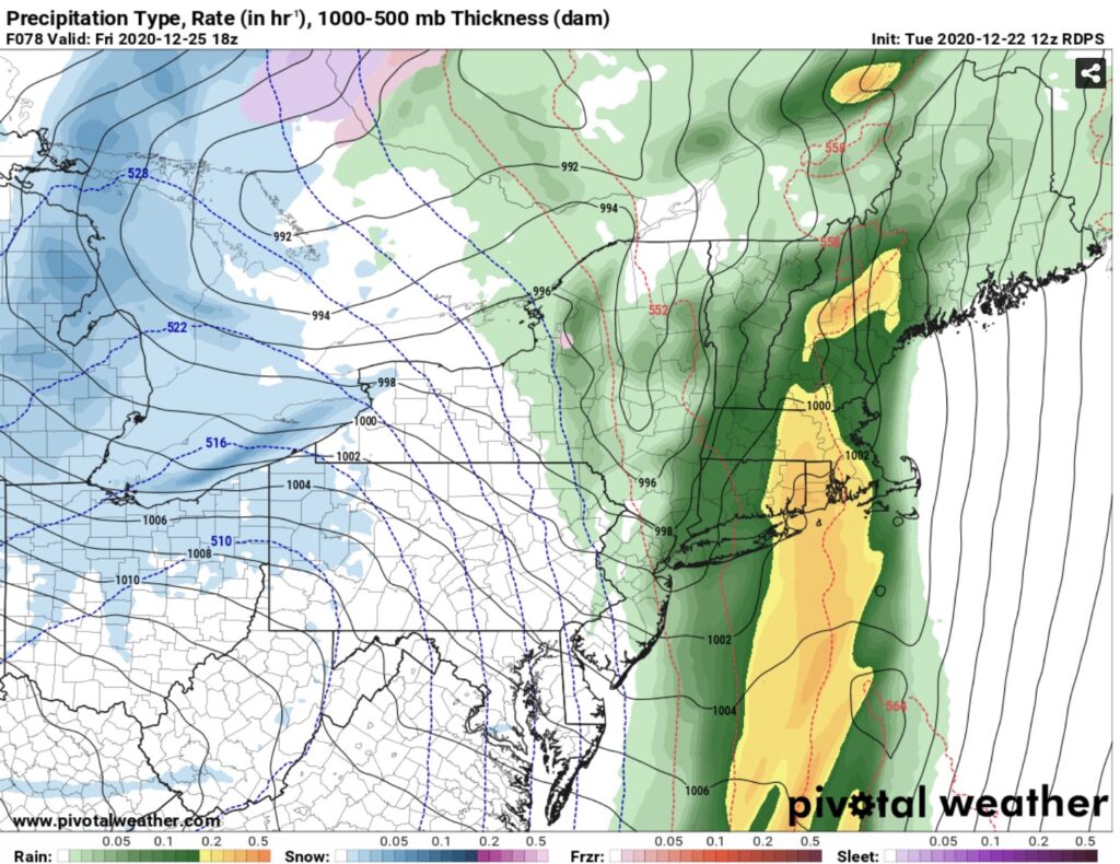
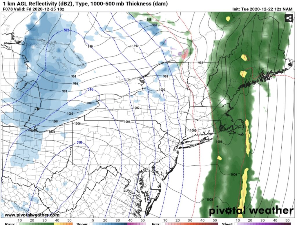
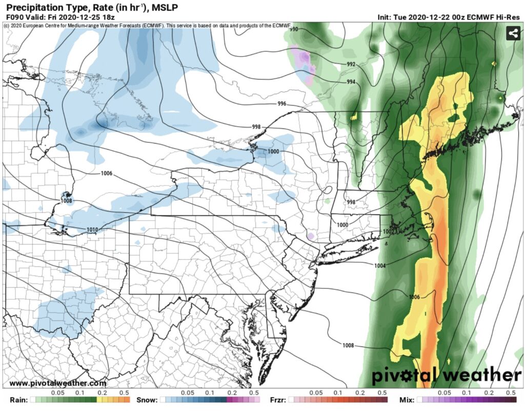
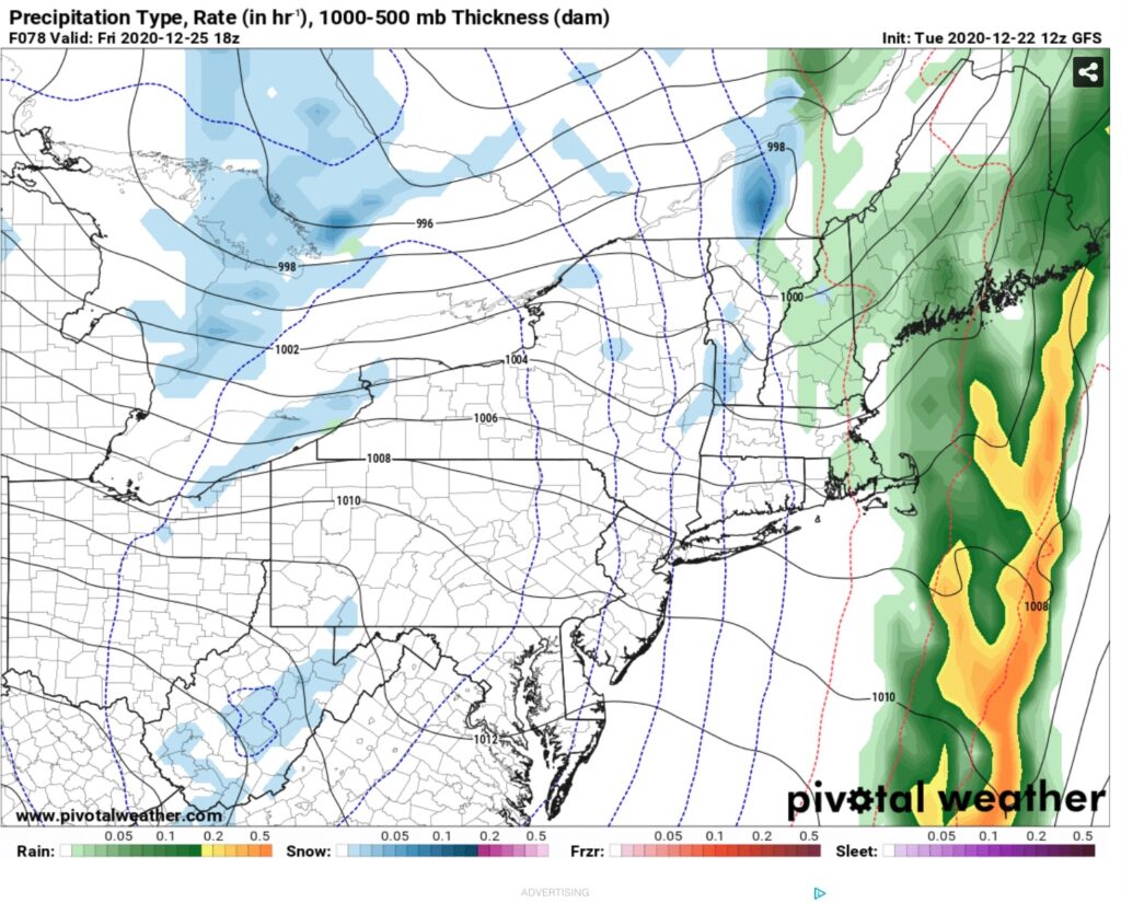
What is certain is as this strong cold front comes blowing through Christmas Day, whether before dawn or during the day, it goes from the 40s and 50s to the teens and 20s. This means lots of icy spots everywhere if traveling Christmas Day. Gusty winds over 30 MPH are a certainty. The potential for lake effect snows will be very high for the Buffalo/Rochester area and points south, also for the NORTHERN HALF of Tug Hill (North of a Redfield to Turin to Brantingham line), Watertown area, St Lawrence County and up into the Tri Lakes area.
What is still uncertain is the amounts involved between Christmas Day and Sunday. Could be in feet. Could be a few inches depending on location. Too early for specifics yet.
What is certain is the overall weather pattern going into next week looks REALLY GOOD. Best I’ve seen it so far this winter.
Keep your eyes open for two potential weather systems, each of which could bring general snows to Upstate NY, one between 12/28-29, the other New Years Eve to New Years Day. Uncertain of course this far out is the exact track and snow amounts… WAY TOO EARLY, but all I’m saying is that if you like snow and snowmobile riding, I’m liking more what I’m seeing each day.
Everything I’m seeing is giving me hope there will be riding after Christmas in some areas, and that the “playground” has a good chance of expanding across Upstate NY as we approach New Years Day and 2021.
I need a few more runs of the models before I take a shot at this. Snowmap for Christmas Day and beyond I’ll forecast and put up tomorrow in The Morning Blog. I also hope to have some more resolution to these uncertain questions.
Two last things: First is this: Snowmobile season is open statewide at sunset*
*(THIS DOES NOT MEAN TRAILS AUTOMATICALLY OPEN. YOU MUST CONFIRM, NOT JUST NOW BUT ALWAYS, WITH THE CLUBS WHERE YOU WANT TO RIDE WHETHER THEY ARE OPEN OR NOT). There has been way too much riding, trespassing, damage and disrespect to landowners and hunters. I know those people won’t read this or care but they are going to ruin the great trails we have if this doesn’t stop.
Second is this: It is #trailtalktuesday and our guest is Jim Rolf, Trail Coordinator for NYSSA. We had a great conversation. The podcast drops by 10 PM tonight after I get back from work and edit it.
Be good. God Bless. If we don’t meet up again beforehand, MERRY CHRISTMAS!
Rich

