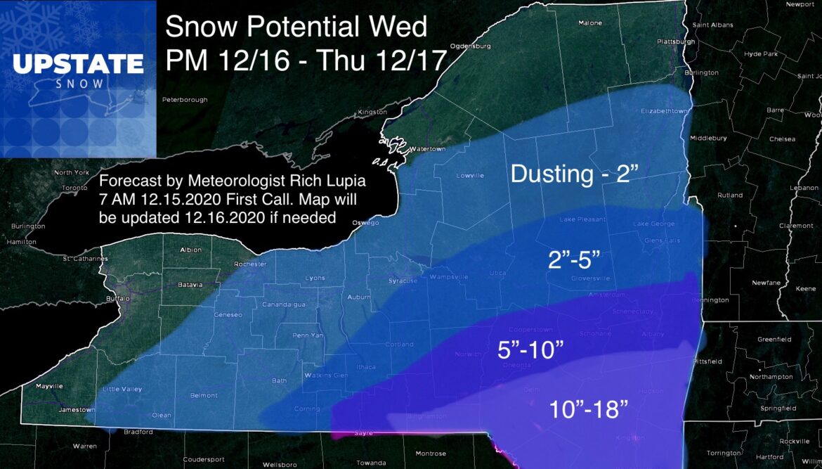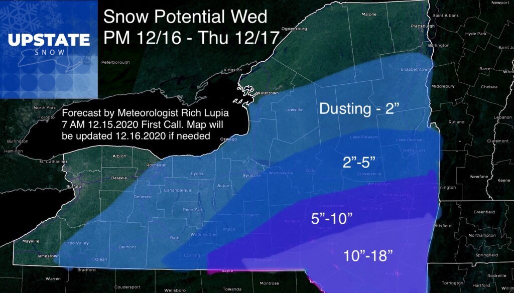
Our first snow map is out and is still subject to change tomorrow morning in the blog. We are now within 3 days and while comfortable enough to put our forecast out still have concern over the details and trends. I’m going to put the analysis for the snow map up front since I know these maps get shared a lot in storm situations and want to give those just looking for the bottom line, the bottom line. Then I’ll dive deeper like usual.
There will be a sharp gradient in amounts. Notice on the snow map the potential to see nearly a foot of snow or less than 2” of snow is separated by 50 miles or less. ANY SHIFTS WILL DRAMATICALLY CHANGE AMOUNTS AT A SPECIFIC POINT.
Snow develops Wednesday afternoon and evening, is heaviest during the overnight hours then tapers off Thursday morning. Morning drive Thursday will be the most difficult time for travel.
Unfortunately for the majority of Central NY, the southern Adirondacks and Tug Hill, even if snowfall amounts exceed my forecast, these areas are likely not to get the heaviest snows and likely not enough to ride on in areas where trails are open and people are looking to ride especially in areas from the Mohawk Valley northward.
IN DEPTH ANALYSIS AND WHY MY FORECAST IS WHAT IT IS
Storm track. Upper air features. Depth of cold dry air. Snow ratios. So much to consider. At the end of the day my trend towards being bullish yesterday morning has backed off some after 2 more model runs. There are some trends I see that not only lead to heavy snow not getting as far north but not as heavy on the north end.
The cold air is legit cold and dry. Temps tonight and tomorrow morning will be single digits to low teens. Adirondacks and Tug Hill may be below zero. That will help freeze the ground down prior to any snow and start to lock up lakes, which is great, but the depth of the cold and dry air may be too much for the storm to overcome. While the storm track on all the models below looks great, what do you notice if you read the previous blogs? The Low center while on a decent track is NOT as strong as previous runs, meaning overrunning precipitation instead of dynamic precipitation will be the bulk of the storm. When you have cold dry air to overcome on the north end of the storm you need overrunning and dynamics to overcome it. Overrunning along won’t do it, especially with the 6-12 hour window of heavy precipitation. I’ll cover the dynamics and the hope I could be low on the amounts in a minute. But with a weaker and faster moving low, it cuts down the chances for a big hit across the Thruway corridor and points north into snowmobile country.
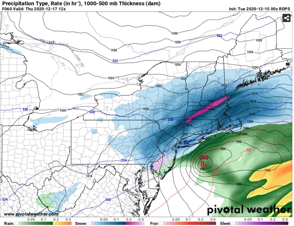
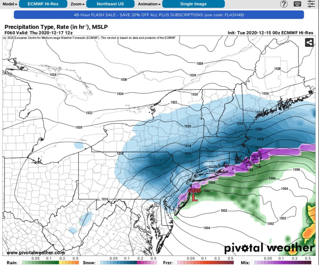
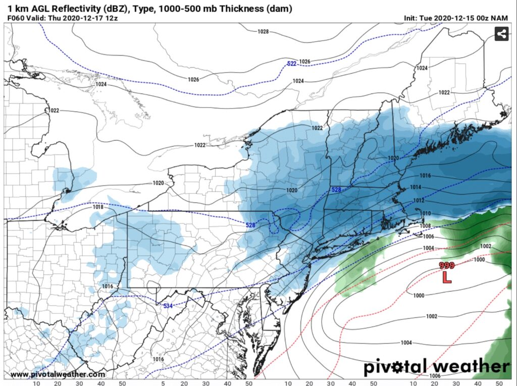
Another consideration cutting snow totals CNY, Adirondacks and Tug Hill is the storm track. It’s great up to Long Island but the biggest storms plow over Long Island, west of Boston and up the CT Valley into New Hampshire. This one makes a right turn to the 40/70 benchmark, opening up PA, Downstate NY, and Southern New England to the highest amounts. And I stand on that being the bullseye.
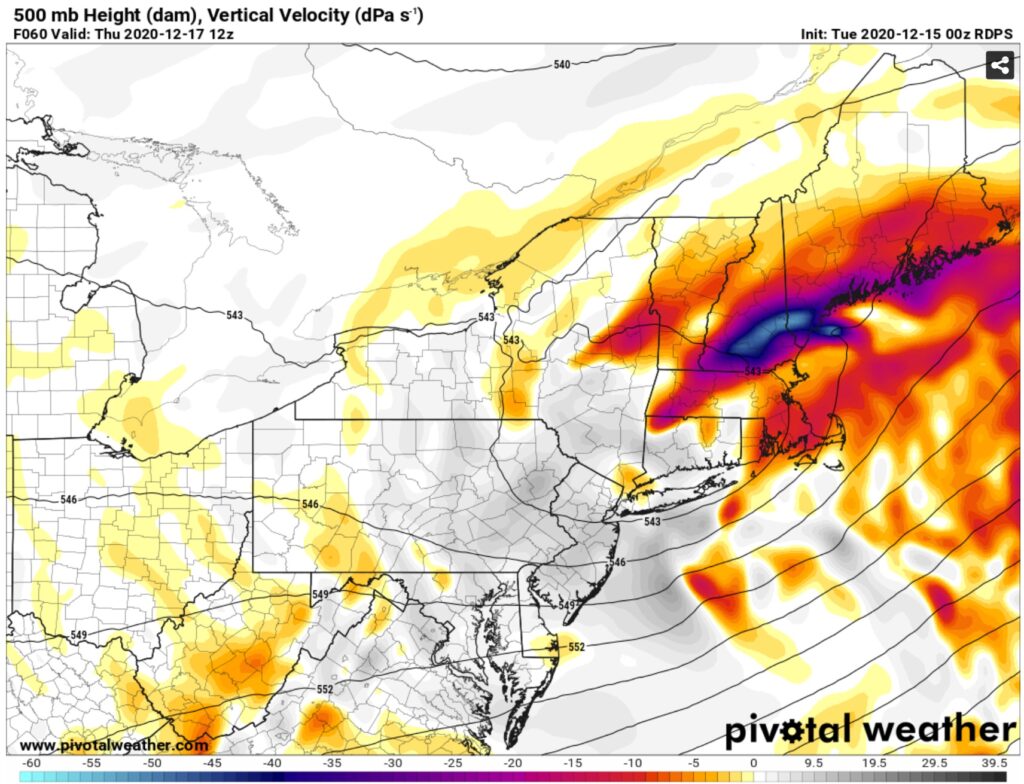
Out of all the models I like the Canadian the best. Here’s where there’s hope the storm could overperform my forecast in CNY, Tug Hill, Mohawk Valley and Southern Adirondacks. Not likely but still a possibility. The 500mb low. The deformation zone. This is where the dynamics for a period of time, 3-6 hours, could drop 1”+/hour snows that reach the ground in areas on the northern fringe. The 500mb trough axis is back in Syracuse and the actual low and zone if it sets up is over the I-88 corridor and either side of that as you see on the map above. I’m telling you right now it’s a stretch and I don’t think it will happen, otherwise my snow map would reflect this. But it’s indicated… I’ve seen it surprise before, and it’s something I’m watching. I’m not trying to give false hope to snow lovers… just trying to explain the “why” behind my forecast and things that could help or hurt it.
It will be cold and quiet for several days afterwards. It was looking very warm leading up to Christmas but now not so much. And there is hope for a more wintry pattern in the long range beyond Christmas. Snow lovers, don’t lose heart if you get less snow than you hope or want. If you get a bunch, enjoy it! If life has taught us anything, appreciate everything you’ve got. Rich

