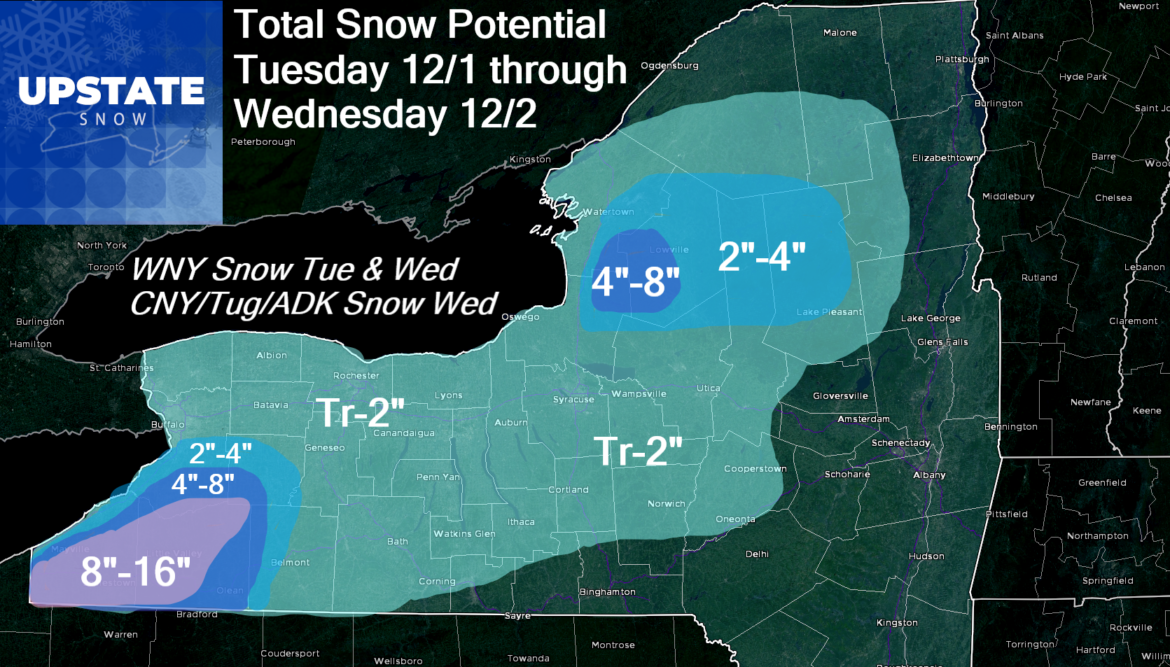
For snowbelt areas of WNY it’s GAME ON with Winter Storm Warnings up for southern Erie, Chautauqua and Cattaraugus. For the immediate Buffalo/Niagara and Rochester areas, there will be some snow around tomorrow and Wednesday but with marginal temps and a NW wind flow kicking in, it’s not the best direction for lake snows and enhancement. For all areas on the snow map basically east of I-390 and especially east of NY-14 (say a Sodus to Geneva to Watkins Glen line), all the snow that’s colored on the map IS NOT for tomorrow but for Wednesday. For snowbelt areas of the Tug Hill and western Adirondacks accumulations will mainly take place Wednesday and Wednesday night, same for the minor accumulations forecasted across CNY and the hills either side of the Thruway. Nothing unusual about this snowfall forecast for December 1-2.
Backing up a second, no change to today and tonight. Clouds increase, winds increase, rain increases south to north in the next several hours from this writing as expected. The storm center moves into Lake Ontario and into southern Ontario by tomorrow and that’s when the wrap around moisture plus lake effect plus upslope begins to drill areas south of Buffalo, and into NW PA and northern Ohio and father south into the Appalachians for that matter, well away from Upstate NY.
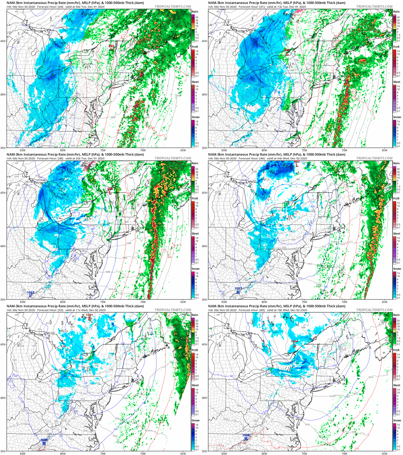
There will be a sharp gradient on accums south of Buffalo depending on elevation and wind directions. I’m thinking dusting to 2 for the city itself, West Seneca, Cheektowaga, Hamburg, especially by the lake. 2-4 as you get into the southtowns like Orchard Park and E Aurora. 4-8 once you get over 1000′ into the Boston Hills and approach Springville, and along the slopes of the Chautauqua Ridge facing Lake Erie. Basically on the ridge itself, east to Springville and into the Delevan area and points south, the rest of Chautauqua, Cattaraugus and southern Erie, this will be a legit snowstorm. This includes the Jamestown area and to around Salamanca.
East of Lake Ontario expect the snows to start to accumulate 24 hours later by the time you wake up Wednesday morning, and minor at that. Best chance for accums across CNY, Tug Hill and Adirondacks will be during the afternoon Wednesday into Wednesday evening. Wind flow in these areas being closer to the low should favor the Tug Hill proper, extreme N Oneida County, central and northern Herkimer and into the “snow bowls” of Hamilton County. Even here by early December standards, respectable, but not eye popping by any means.
Thursday through Saturday now looking quiet with temps in the 30s by day, teens and 20s by night. Not the kind of freeze the ground weather snowmobile clubs are looking for, but it’s the deck we are playing with at the moment and a major improvement over recent weather.
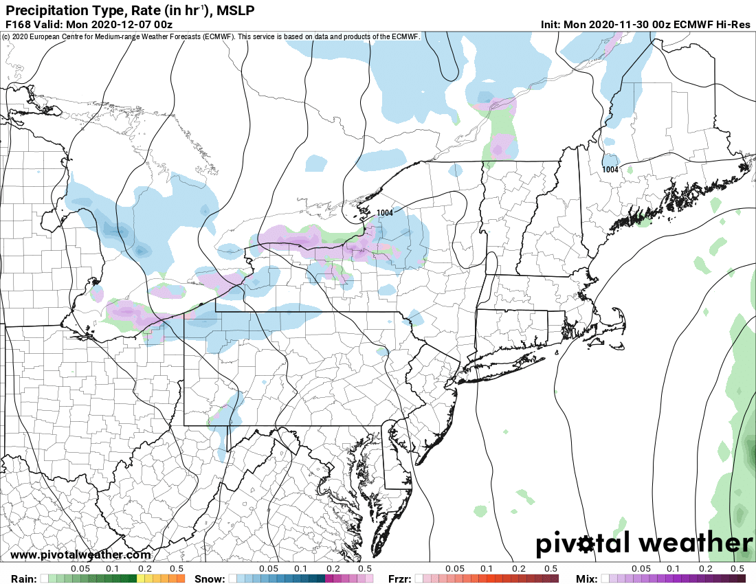
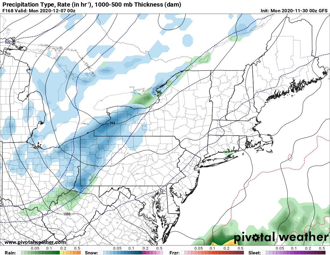
The Euro and GFS are now starting to agree that big Nor’easter later this week may not come up the coast after all, but still too early to rule out. What models are starting to agree on is for a reinforcing shot of cold air, clippers and lake effect becoming more likely starting Sunday 12/6 and beyond. How much colder, how much snow, and whether it will be enough for first trails to open later next week (in areas where hunting seasons end), still a huge question mark. Yes there is hope, but it’s not a huge hope based on my professional opinion. And then in the longer range, can we stay cold and hold on to what we got? Recent mid to late December history is not encouraging. Doesn’t mean it won’t happen, but I’m trying to keep your expectations realistic. If we get enough cold and snow to ride starting next week, in areas where clubs can open trails and hunting season is over, be an opportunist. If life has taught us anything this year it’s this: Don’t take anything for granted. Appreciate all you’ve got.
Have a great Monday! If snow map needs to be adjusted tomorrow morning, we will.
Rich

