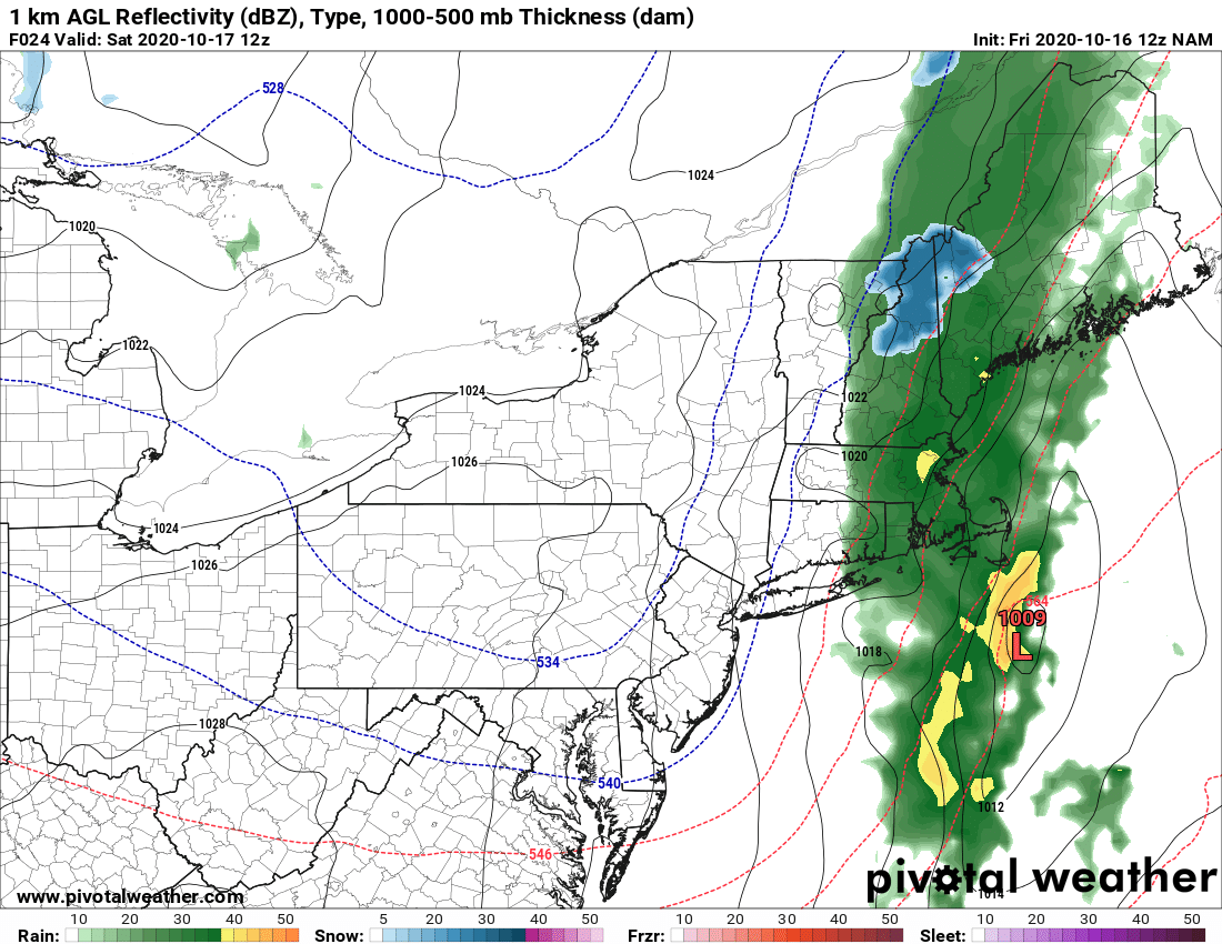
Welcome to October! Almost 80 yesterday… Chill today… For those looking for snowflakes and any quick accumulation over the Adirondacks later this afternoon/evening… it’s looking like the moisture will outrun the cold just enough.
Looking at the latest temps (as of 10 AM 10/16) and the radar trends, beneficial rains will continue but the cold won’t get deep enough for the changeover in most areas. Can’t rule out it ending as flakes or flurries N of the Thruway but you best chance would be inside the Adirondack Park and at elevation. Could be a quick dusting over 2500′ when you wake up at sunrise tomorrow in the Adirondacks but any accumulations at elevation will likely hit Northern New England Instead.
Good news if you are planning to hit up snowmobile club meetings and trail work this weekend. Dry, sun and cool! It looks like great fall weather for bridge projects and clearing up blowdown on the trails this weekend. Do watch out in the swampy areas after the rains from today…
Looking ahead the weekend chill down with frosty mornings and cool afternoons will give way to more almost Indian Summer-like weather next week (Remember the TRUE definition of Indian Summer is 3 days at or above 70 AFTER first snowflakes).
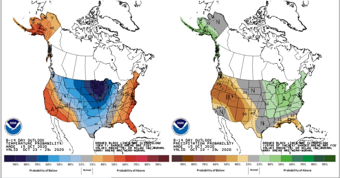
Looking ahead to the rest of October, the overall pattern will remain at or above normal with quick hitting weather systems and the chill hanging back over the northern Plains and western Great Lakes…
Much was made of the NOAA Winter weather outlook that indicated a mild winter for Upstate NY and much of the Northeast… Everyone wants the long range outlooks I know, and still people put way too much stock into them. That’s why over the years we’ve become a little more reserved. Especially when, for example, seasonal outlooks cannot call 68F and rain the second week of January, then below zero and excellent snow, ice and riding conditions in early February. It’s the short and medium range, not the long range that is the key for winter weather recreation, especially snowmobiling.
That being said, I’ll show you what the three month outlook is (Nov, Dec, Jan) from the NWS and it’s not too far off the official winter outlook.
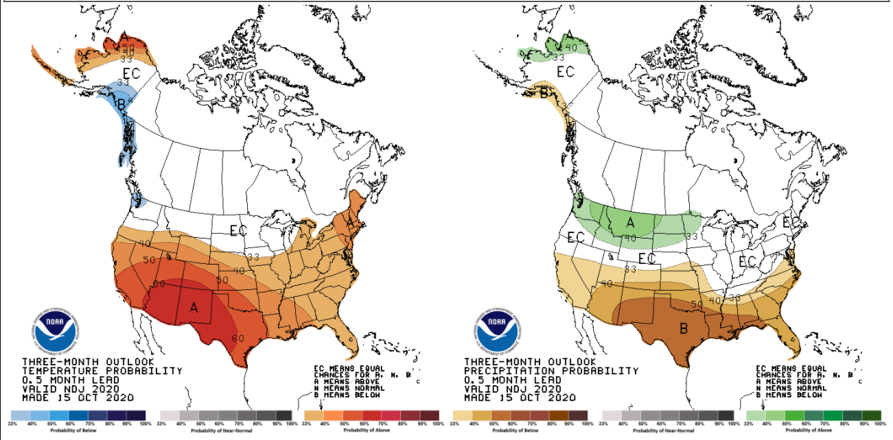
As a Meteorologist here’s what I take away from this forecast… the theory behind it.
They are anticipating an active Pacific jet steam, driven by a strengthening La Nina. This makes the southern US warm and dry, opposite of a strengthening El Nino (cooler and wet). This makes the northern branch of the jet more active. They are anticipating the polar vortex position more over western Canada than eastern Canada. If the polar vortex and the cold are too far west, we get more indirect shots of cold. Again this is not guaranteed, this is just their forecast theory. I put some markings on the map below to give you a better visual.
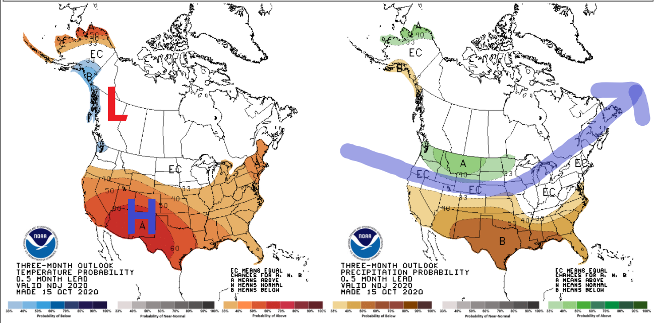
We’ll get more La Nina data next week and, of greater interest and impact to us, the Greenland block or NAO (North Atlantic Oscillation), we’ll take a little closer look at for trends in a future Morning Blog. Just giving you all little bits and pieces of what we are looking at early on in the game. We are still a solid two months out from riding and a lot can change quickly so don’t get too depressed or too excited about this in the meantime.
What I do want you to get excited about is the return of the TRAIL TALK PODCAST! As you know we launched Guide to Your Ride, which is a shorter, more event driven podcast of 10-20 minutes length with Chris Rinck, President of the Southern Tug Hill Sno-Riders. Trail Talk is a longer form podcast where we’ll talk to people involved deeply in snowmobiling and share interesting and informative stories about the people who make snowmobiling great in New York.
Don’t freak out, but #TrailTalkTuesday returns this upcoming Tuesday the 20th! 🙂
Have an awesome weekend! Join your local snowmobile clubs and give them a helping hand on the trails this weekend!
Best,
Rich

