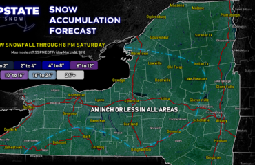
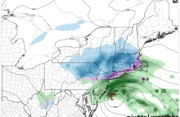
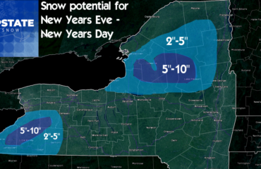
Yes, a May blog. Yes, I think all of Upstate sees at least flurries. Only the higher elevations mainly above 1000′ stand to see accumulations as of this point. We’ll continue to watch and refine as this approaches tomorrow.
Background on the history of May snow in Upstate NY: It’s not like it’s never snowed in May. 3 of the last 24 years we’ve had accumulating snows in some areas for Mother’s Day. In 2013 for Memorial Day Weekend, we had a near record cold shot of air that brought rain and upper 30’s to low 40’s to Upstate on 5/25/2013 which equaled heavy snows of 6-12+ inches over the high peaks of the Adirondacks. What is unusual is the widespread nature of this. Literally the whole of Upstate should see at least flakes in the air. If you are north of Interstate 84, count on at least seeing flakes in the air, even if it doesn’t accumulate or whiten the ground. Even in the lower elevations and the cities. For our downstate friends who check in, it would not shock me if at least flurries made in not just through Orange, Dutchess and Putnam Counties… Even Rockland County and the northern half of Westchester County could see flakes. Perhaps as far south as the Tappan Zee. It’s possible. We have the precip, storm and cold air to do it. I don’t think it will make NYC or Long Island… although it will be a CLOSE CALL. You’ll know if it did, because it will make national news if it makes it to Central Park. While not unheard of for most Upstate locations, even places like Albany and the upper Hudson Valley, you start talking downstate (which I consider south of I-84), flurries this late in the year is approaching once in a lifetime.
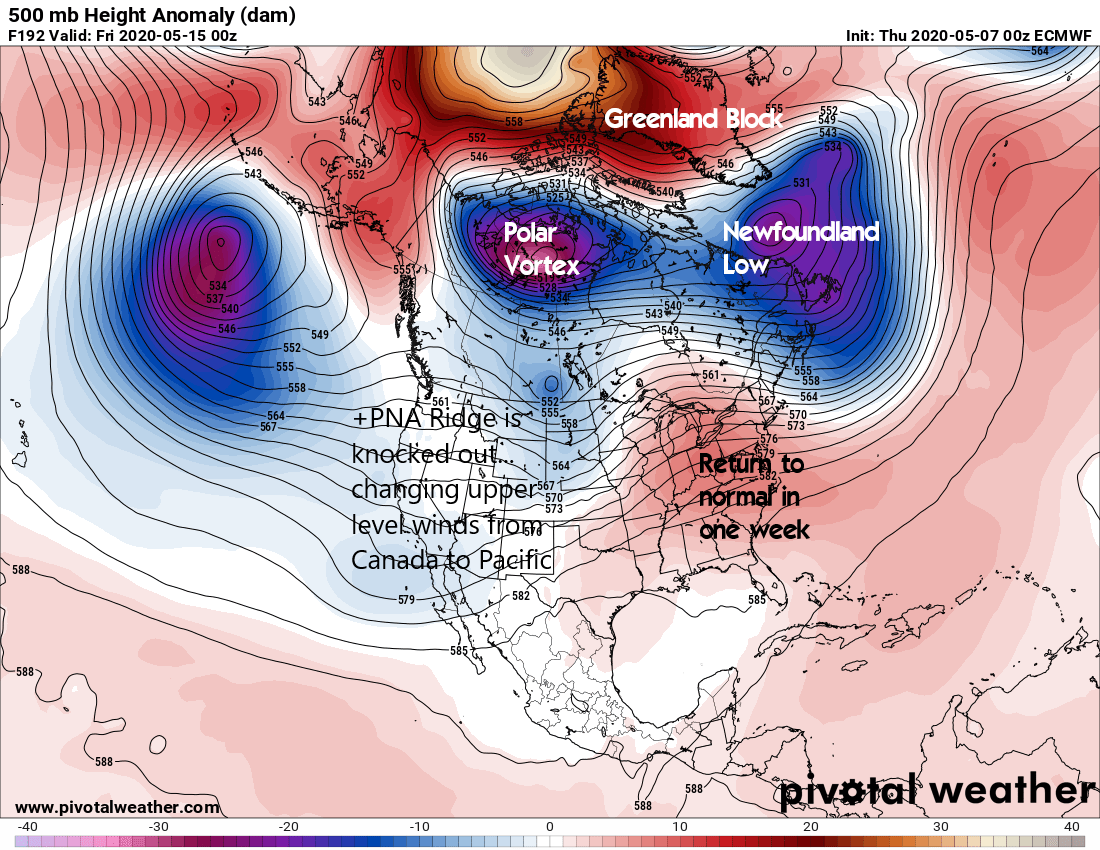
How did we get here? A strong storm system is taking a perfect track from the Ohio Valley, across the Appalachians, emerging near Philadelphia and shooting off the Jersey Shore, not far S of Long Island. If it were anytime between December and early March, this is nearly a guaranteed widespread snow event of several inches for Upstate. This late in the season, the cold air is usually not there. But not this year. Due to an intense ridge over the Western US and Canada, a strong Greenland block and Newfoundland low, you have the PERFECT scenario to dump whatever arctic air is left in Canada, near the Arctic Circle, and SIBERIA, straight into Upstate NY.
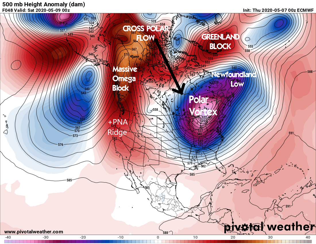
And it’s not just us… this storm will bring record late cold (frost/freeze) and late snows (accumulating and/or flurries) to places well south of NY State. Snowflakes could get into the mountains of West Virginia and Virginia, and near freezing temperatures into the Carolina’s… almost a month later than their usual last frost freeze. If there is ever a situation for you to hope or pray us Meteorologists are wrong, now is it. Because not just for some in Upstate NY, but especially farther S of New York, the potential implications for agriculture, orchards and vineyards is very serious.
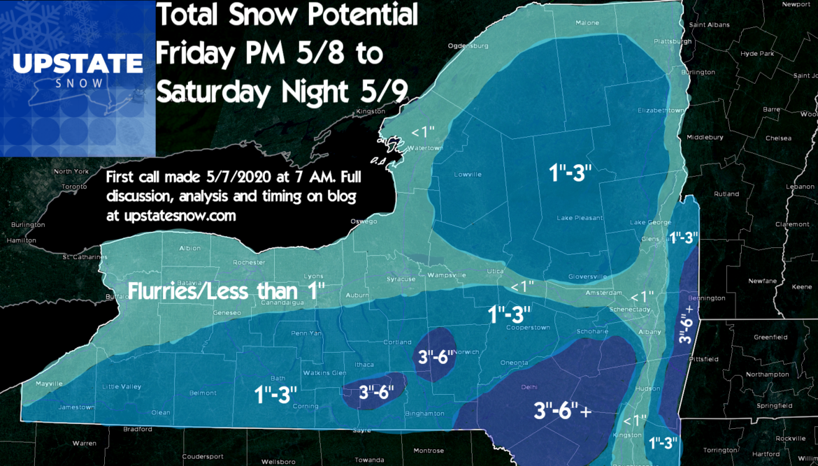
Details and timing of the snow: As low pressure jumps from the Ohio Valley to SE Pennsylvania Friday Afternoon/Evening, it begins to develop and moisture spreads over Upstate and most of the Northeast. With the bitter cold air rushing in behind the low, expect any rain showers to change to snow Friday evening, and especially after sunset Friday Night. Most of your snowfall accumulation from this storm will be from 6 PM Friday to 6 AM Saturday. It’s a fast mover and precip will be moderate to heavy at times, so if you have any travel plans in this window of time across Upstate, especially in the Southern Tier, Catskills, Mohawk Valley, Capital Region, and Hudson Valley, expect wintry conditions. In many areas it will fall fast enough to cover the roads, especially higher elevations. And yes, it’s possible in the higher elevations of the Catskills, Taconics, even the Helderburgs outside of Albany, 6″ may not be the max. Just like 10 days ago, when some of these same areas got 8-16″ of snow, there is a potential 6″ could be beaten in localized areas (higher elevations, NOT major population centers).
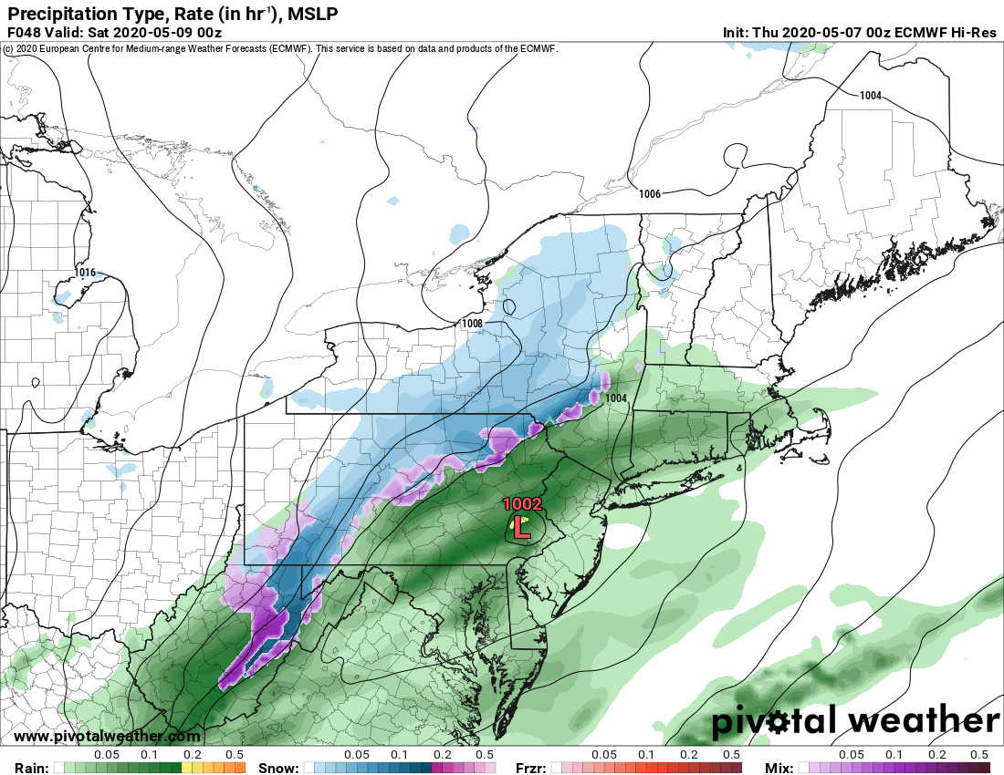

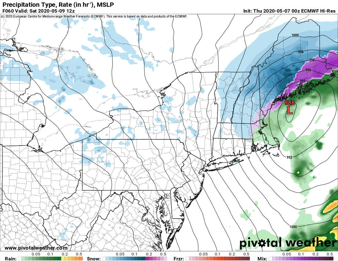
Waking up Saturday morning: Most if not all the snowfall for the Catskills, Hudson Valley, Capital Region, Taconics and areas near/east of I-87 should be OVER. For areas like the Adirondacks, Tug Hill, Western NY, and parts of Central NY, which will be on the edge of this storm, you will likely not wake up to much snow from the storm itself, if any snow. But this is where the storm, now a full fledged Nor’easter off the coast of Maine, sends the full shot of record cold air at 850 mb to set off RARE MAY LAKE EFFECT SNOW SHOWERS AND SQUALLS. Even during the daytime hours. In May.
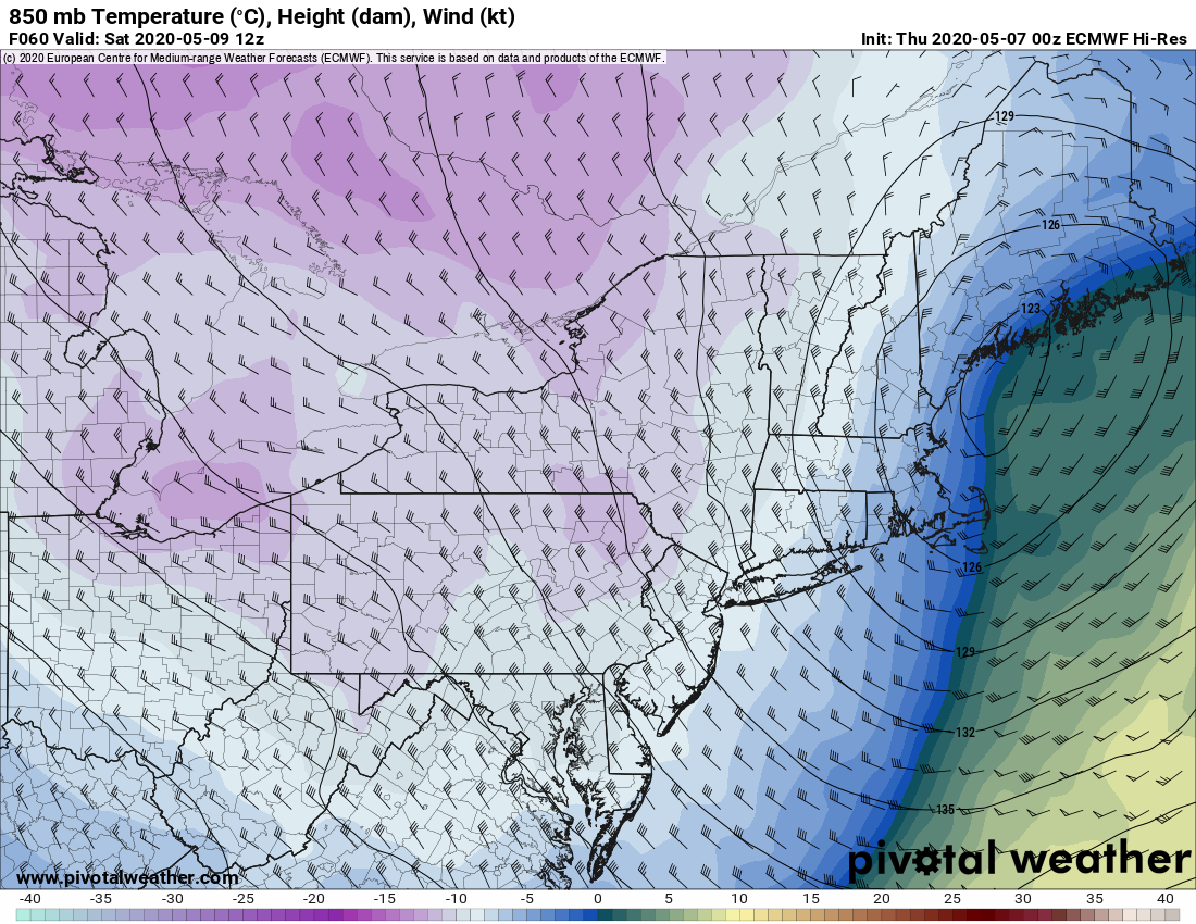
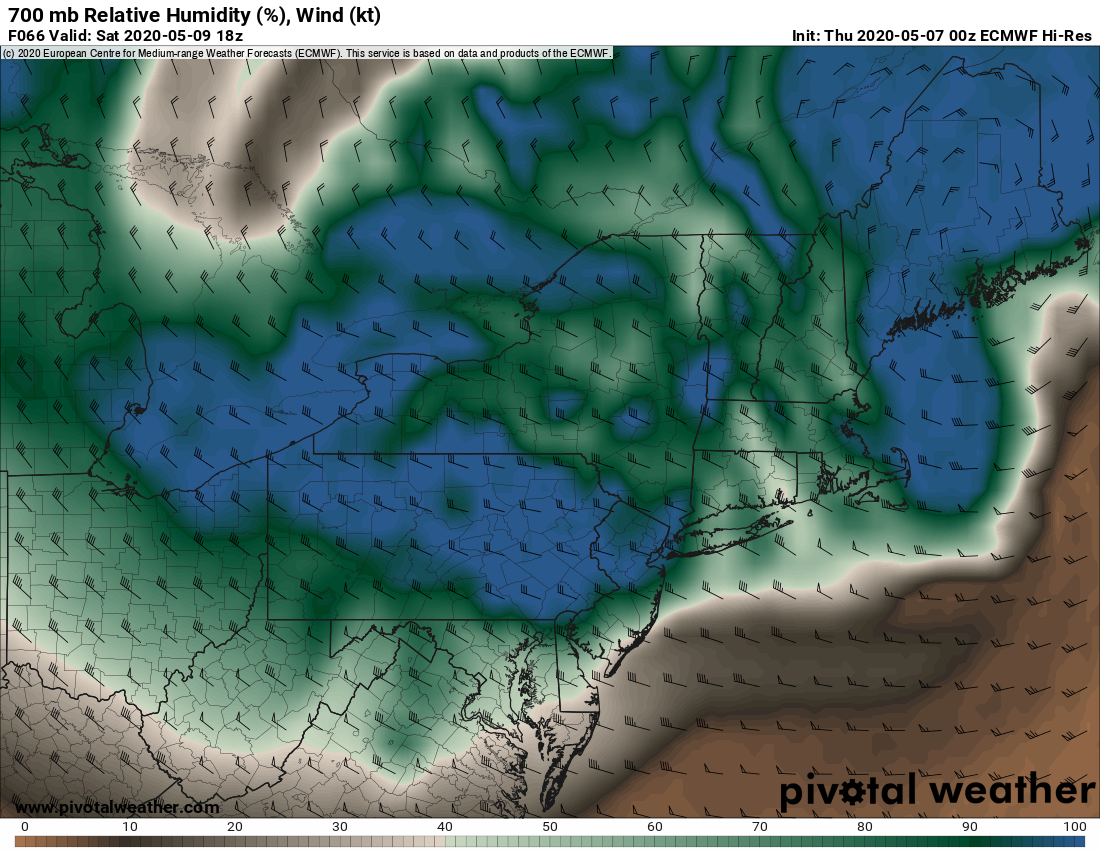
This is indeed a once in a lifetime event as the sun angle is the same May 9th as it is AT THE END OF JULY. Usually sun disrupts and warms the air enough, but all indications are with the polar vortex nearly on top of us, record cold temps of -10 to -12 at 850 mb, which means barely above freezing at ground level in the lower elevations at most. May snows usually are a nighttime event only. Not this time we think. In addition to this, sufficient wrap around moisture on Saturday coming back around the developing Nor’easter will crash into the Adirondacks, Tug Hill and Hills along Route 20, south of the Thruway on Saturday. This should be enough along with input from the lakes and instability to produce snow showers and squalls throughout the day on Saturday until it eases Saturday night with the storm pulling away.
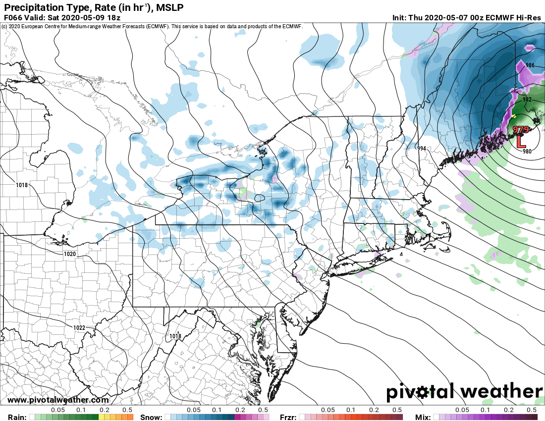
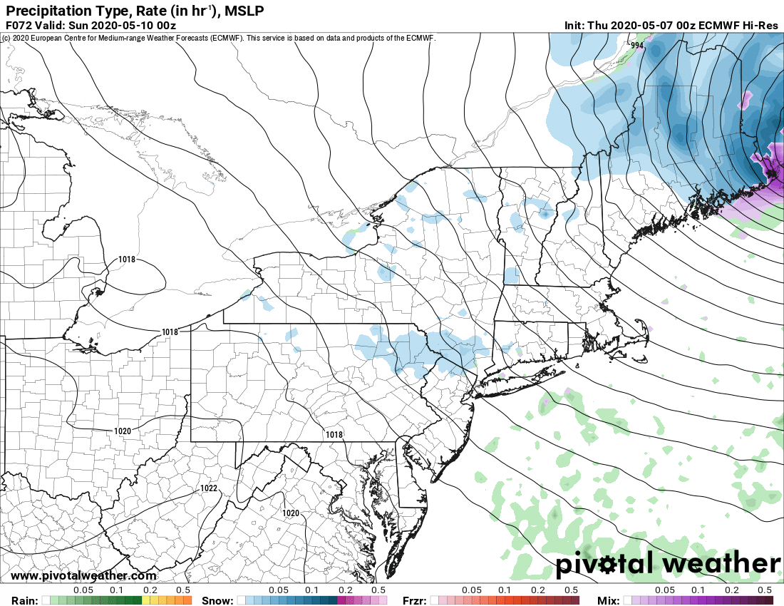
BOTTOM LINE: Accumulations are likely to be done by Saturday morning for the Catskills, Capital Region, Hudson Valley and eastern NY.
Most of the accumulations across Central/Western NY, Tug Hill and Adirondacks are likely to happen during the day Saturday into Saturday evening.
There are areas of the Southern tier (Otsego, Chenango, Cortland, S Madison, S Onondaga, S Oneida, S Cayuga and S Herkimer Counties) that may get snow not just from the Friday evening/night storm going off the coast but the lake effect/wrap around snows coming in behind the storm Saturday.
SO, TECHNICALLY, THERE SHOULD BE NO SNOW ON MOTHERS DAY. Sunday should be breezy, cold but not as cold as Saturday, with some sunshine returning.
What happens after this? Do we have any hope of spring coming back anytime soon? For the first time in nearly a week, there are FINALLY indications in the medium range (7-10 days) that this pattern of cold and winter like weather will FINALLY break. While the Polar Vortex will still be way far south for this time of year, it does retreat north. The Newfoundland Low and Greenland Block are still alive and well, which will keep any chance of full fledged sunshine and summer like warmth, 80s, which is not uncommon to have periods of 80s in May Upstate, down to near zero… BUT… The west coast ridge, the +PNA, that tele-connection that is sending us this late season snow, gets broken down by end of next week. This is major for us. It means eventually the air instead of coming from Canada, the Arctic and Siberia, will finally come from the Pacific. A more “zonal” flow. This means a return to normal, 60s and 70s for Upstate (and Downstate/NYC/LI too), is looking more likely by end of next week and into next weekend.
As we wrap up this long blog (which if you’ve read this far, THANK YOU), I want to thank you all for your support of Upstate Snow. We’ve all be through hell the last two months. I know people that have contracted the virus and a few that have passed. Many of you have too. Many of you fans are first responders and on the front lines of this. THANK YOU FOR YOUR SERVICE! None of us could have ever imagined losing tens of thousands of New Yorkers like this in such a short period of time and the economic/social impacts of all of this. We are all grieving over some impact of this. Please be loving and kind to one another. If there is anything we need right now, is kindness and understanding.
I have NO IDEA what impact this pandemic will have on the next winter season of 2020-21. No one knows. Hope and pray this pandemic goes away, especially from this state, for good and soon.
Respectfully,
Rich Lupia
Meteorologist/Owner
Upstate Snow
May 7, 2020


