Good morning. Get out and enjoy the great riding conditions today and tomorrow. Wherever trails are open, this is the peak of the season today and tomorrow in terms of best snow coverage, trail conditions and cold. The best riding is NOW. Heading into next week this mild winter will start to rear it’s ugly head. I don’t think it will be as bad as it could be, and many areas especially N of the Thruway have sufficient snowpack and frozen conditions to be able to withstand the inevitable at first… but just know after Saturday Night, things will start getting warmer, clubs with low snow will take the hurt first and be pushed out of the game later next week.
The big cold high pressure that brought the wet snow/mix earlier this week and the persistent lingering lake effect snow (a nice surprise) and the surprise snowstorm to parts of Virginia and the Carolina’s, is now dead overhead. Tons of sun the next few days. As the high sits overhead and the late February sun goes to work, the below zero conditions this morning will become a memory quickly. After another cold night tonight, Saturday will be sunny and a little milder.
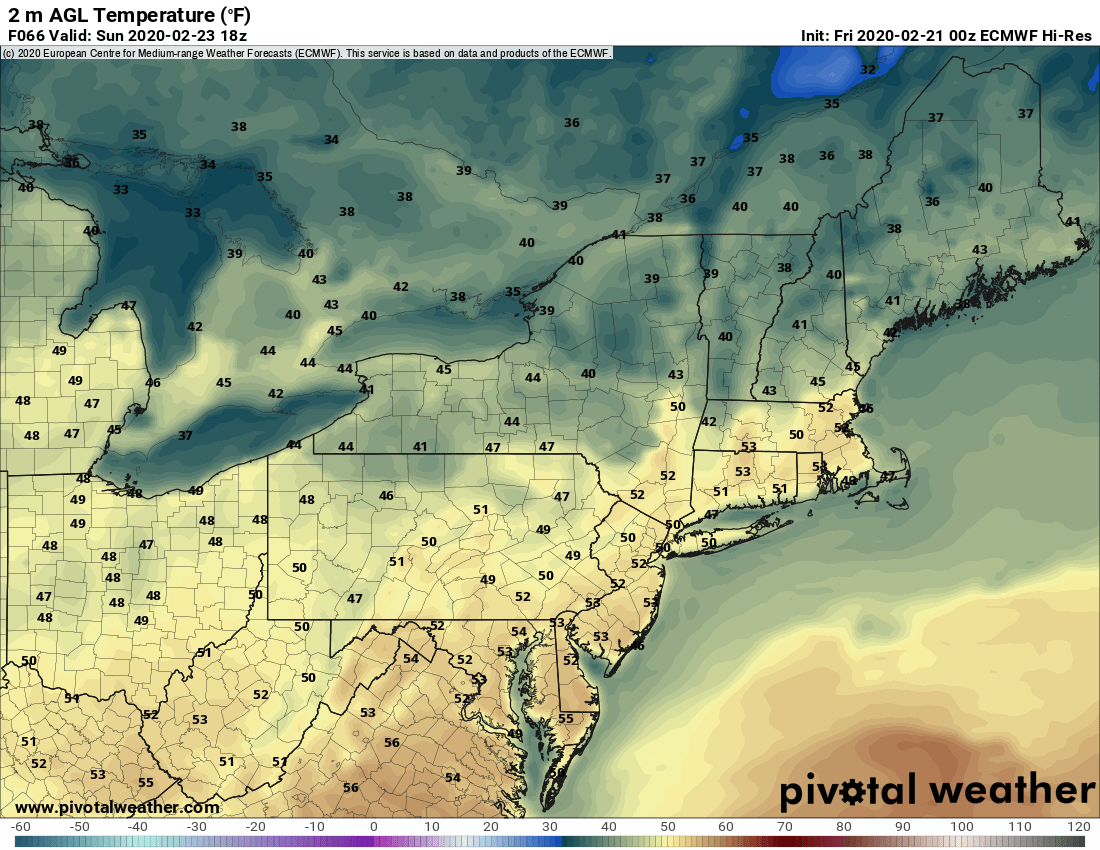
As the high moves off the coast Sunday and a southwest flow develops across Upstate, the warmer temps will come along with it. It’s very apparent Sunday afternoon and especially Monday afternoon:
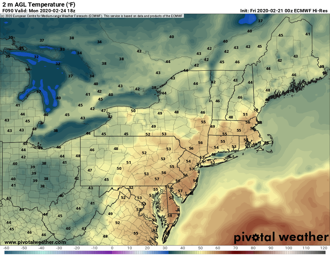
Heading into Tuesday, low pressure will approach from the SW to help spread more warm air and also some rain showers. A few days ago this looked to be more substantial but it doesn’t look as strong at this point. Still it will be above normal, more than mild enough for rain and southerly flow continuing.
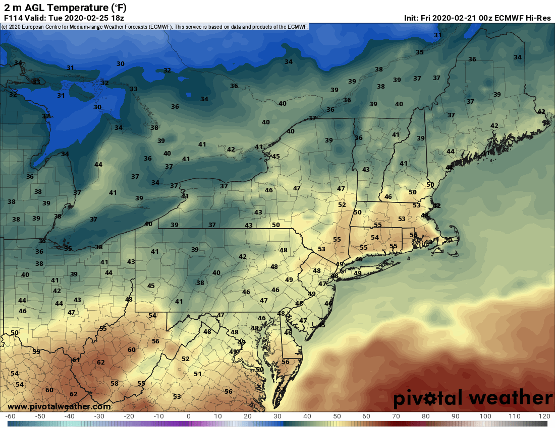
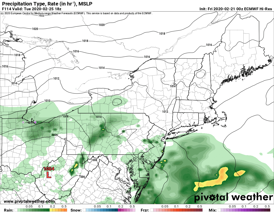
So middle of next week, late Wednesday into Thursday, a much stronger storm will follow, on a southerly flow and track to the west. Both the Euro and GFS are actually similar on this, which this winter, is odd. If this scenario plays out it’s mild again Wednesday with a potential for a bigger hurt of rain Wednesday Night into Thursday morning. The storm then lifts out and wraps cold air and lake effect snow in back of it late Thursday into next Friday.
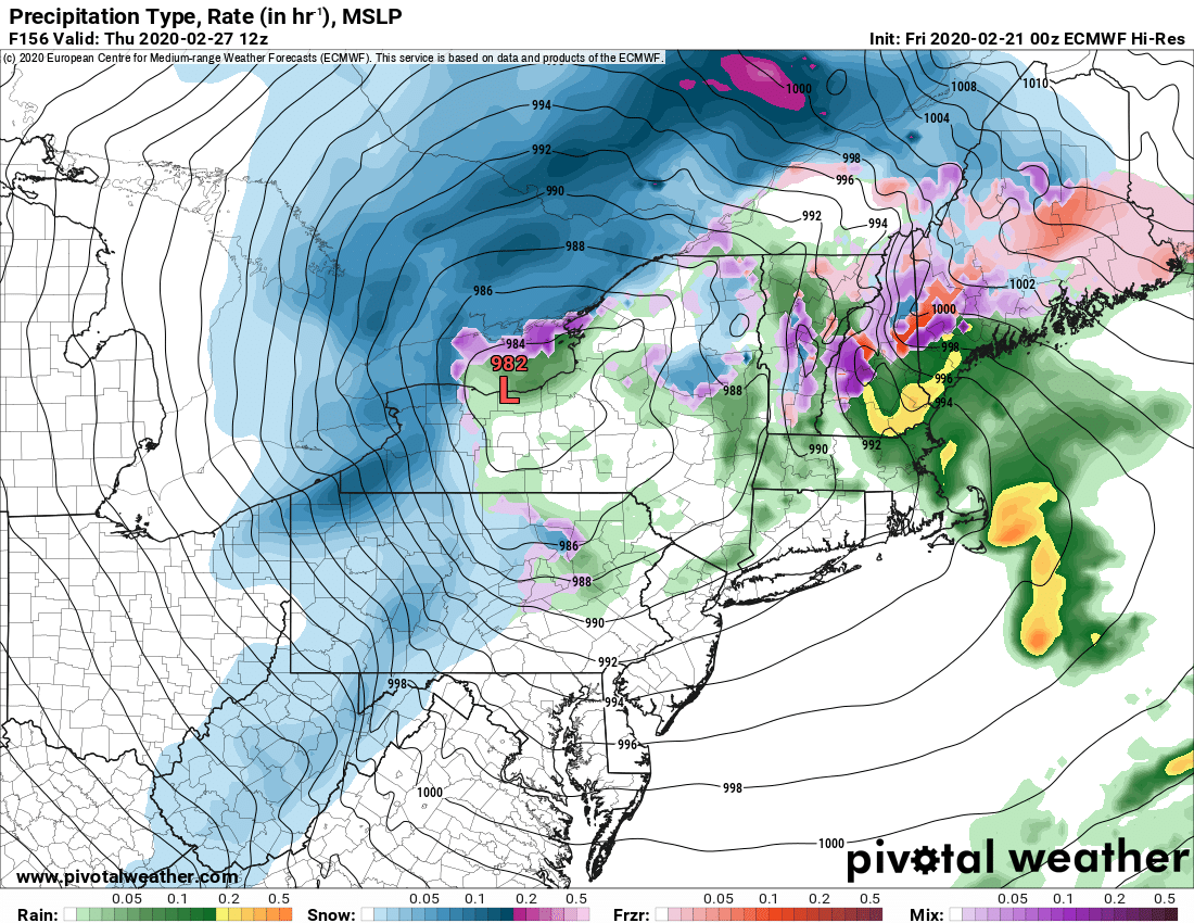
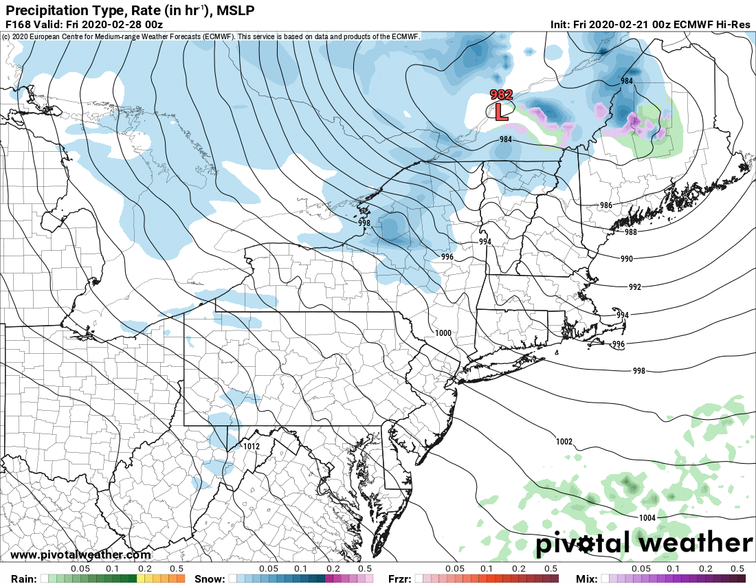
If this scenario happens it will definitely be a hurt to clubs in the lower elevations and S of the Thruway, but the Tug and Adirondacks should have enough snow in the bank to survive. The hope is that after this storm, cold and lake effect come back in to give clubs a chance N of the Thruway to set up for riding next weekend 2/28 to 3/1… But the playground will definitely be MUCH smaller should this all play out.
Got plenty of time to watch and we’ll update the details again in a few days. In the meantime, GET OUT AND ENJOY THE BEST OF OUR SEASON NOW!
These next two days are as good as it’s going to get this winter. You are on notice.
Rich

