Today will be quiet. Dusting to an inch or two of light snow Sunday. Getting active middle to end of next week, but the devil is always in the details…
Today: Mild temps so if you don’t get out to ride early… expect rougher conditions, even where there is snow to ride. We are going for a quick ride this morning just for that reason…
Sunday: Weak clipper drops a dusting to an inch or two of snow. Not enough cold air at this point for any lake effect behind it. For early February that should be a crime.
Monday and Tuesday: Quiet. Temps not warm (40s) but not cold (teens and single numbers) either.
Wednesday through next weekend: A brief pattern change that may help or hurt us. Jury is still out on this one.
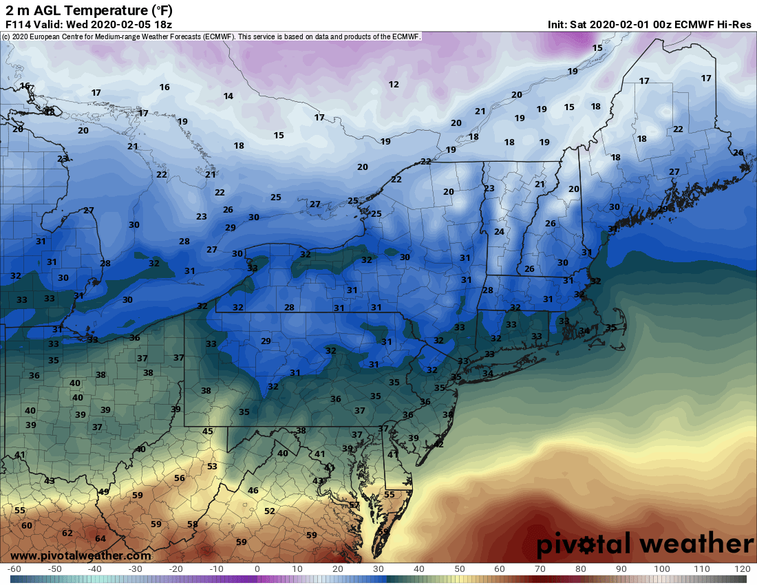
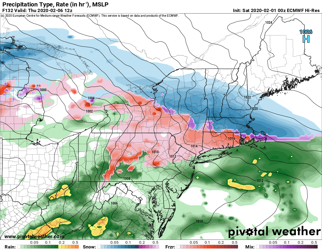
What’s happening? BATTLE ZONE. All models show a battle zone setting up with Upstate NY in the middle of it. Teens to the N in Canada. 60’s south of the Mason/Dixon line. Oh goody. Basically a stationary front gets established and that warm spring like air makes a run at Upstate late Wednesday into Thursday/Friday. Overrunning precip. There may be a few separate waves of this happening over the course of 3-4 days.
Euro says the warm air wins and rain changes to snow. GFS says cold air wins and mainly snow. Especially N of the Thruway. Canadian is a split decision. Too far out for the hi res mesoscale models to weigh in.
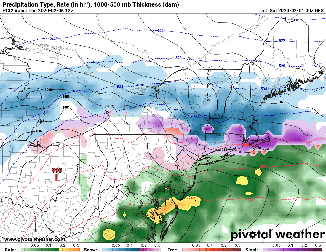
And we all know about the GFS cold bias and how wildly inaccurate it has been in the long range this winter. Remember, this is the same model that had a 954 mb, stronger than the blizzard of ’93 low off NY harbor with 2-4 feet of snow hitting us on a model run one week ago.
What do I think? Have no idea yet. Not the kind of winter i’d bet on snow, but the chance is there. All I can say is stay tuned. I’ll update the morning blog tomorrow only if it looks more than a dusting to 2″ or if the lakes do wake up. Otherwise I’ll catch you Monday morning on the blog… or this morning on the trails… if you can find us… and we’ll be out before lunch 🙂
Rich


