We have a much less than you were expecting snowfall forecast for this weekend, another ride report leading to the Guide to Your Ride Podcast.
This weekend’s Letdown
The well advertised and well hyped (by some no name free sites that pop up out of nowhere and give a ten day model total snow forecast, which actually included last weekend’s storm totals to make it look like we’ll need to dig tunnels from our homes to our car like Newfoundland ACTUALLY had to do recently)… well… as we said… we don’t like to speculate too far out.
YOU SEE HOW DIFFICULT THIS IS FOR A METEOROLOGIST WITH 20+ YEARS EXPERIENCE FROM 2 1/2 DAYS AWAY LIKE LAST STORM.
And we are not throwing deep balls to score or any best case scenarios here.
Basic Meteorology is now going totally against us. If the storm is just off the coast, most of Upstate is in the sweet spot. If it’s along I-95, Capital Region and Catskills gets screwed by a rain and snow mix. If the storm tracks inland farther, like between I-81 and I-87… Right over the mountains.. well you end up with THIS 🙁
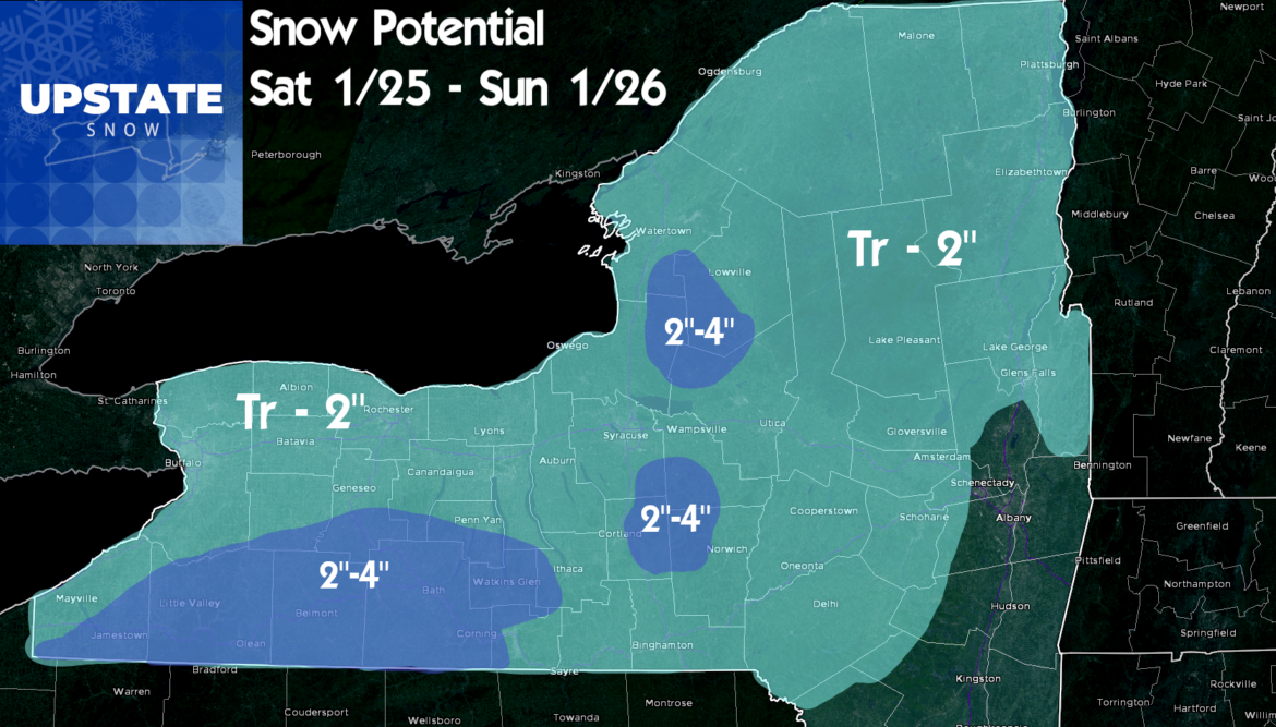
The models continue to pull the storm back to the west. This pulls the warmer air into Upstate, especially EAST of I-81. This puts heavier snows back WEST of I-81, and because of marginal cold air and a wet southern stream system, this will be a packy, high water content snow. And unlike most late January storms, this will tend to be more of an elevation event. And given the amounts on the board, I wouldn’t really call this a storm.
It’s something. It will help. Maybe. A little. It’s better than 65 and rain like two weekends ago. But it will not give clubs what they need to keep trails open or improve weather conditions. Is what it is. Hopefully this changes, goes farther east and we can revise amounts upward. But the trends like this will have to reverse.
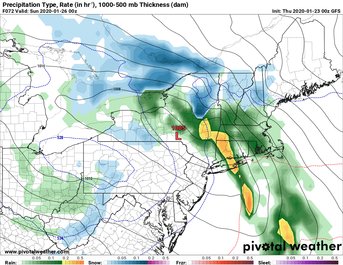
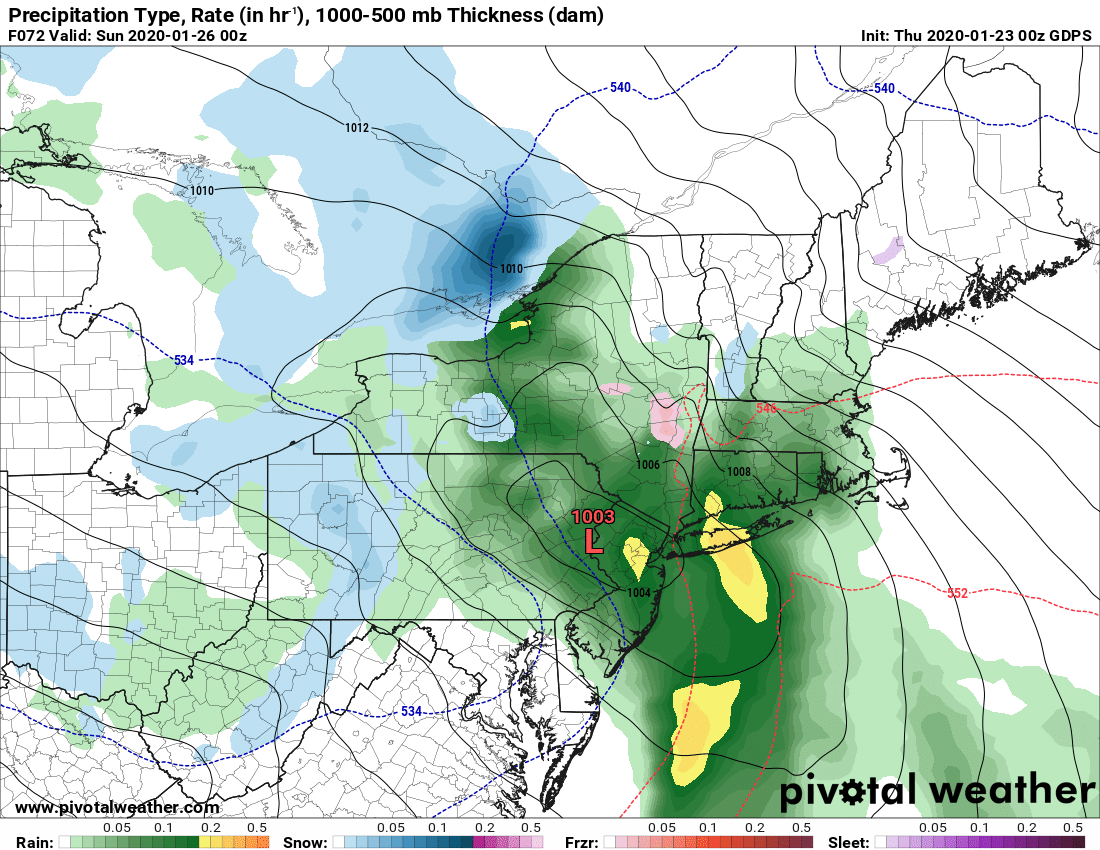
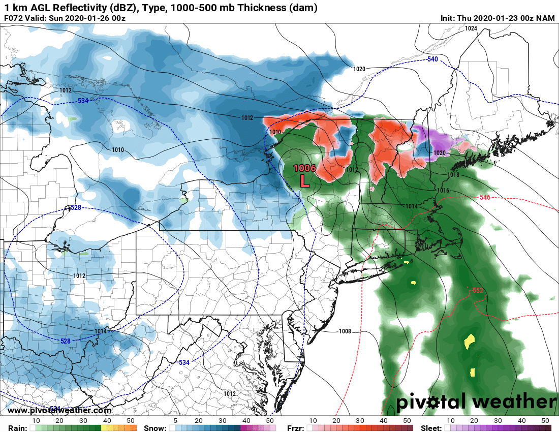
So in summary, it starts as snow Saturday AM, mixes with and changes (especially east of 81 and in the lower elevations) to rain Saturday PM and Evening. As the low moves to the N Sunday morning, colder air wraps around and a little snow may fall at the end Sunday AM.
The air coming in behind it is only seasonably cold. Trends are clear the cold we had at the beginning of this week WILL NOT BE BACK ANYTIME SOON. BELOW ZERO IS UNLIKELY ANYTIME IN THE FORESEEABLE FUTURE 🙁
Yes we may get some snow but next week, and especially going into the first week of February, it’s not looking good.
So what am I going to ride on? Where am I going to ride? This is why we have the Guide to Your Ride Podcast!
https://www.upstatesnow.com/podcast/guide-to-your-ride-podcast-6-01-23-2020/
If you have snow near you, ride it as much as you can. That’s what we’ve done 3 of the last 4 nights. And two of those came together last minute at the request of friends.
As we experienced Wednesday Night across Penn Mountain and especially the Ohio Ridge Riders system, snow cover is THIN. It is very thin to essentially “white paint” near Cold Brook and Poland where the trails into the lower elevations will age your sled quickly, though passable, as of this writing. Many areas will get knocked offline yet again heading into this weekend.
Wherever you ride expect heavier than normal traffic and less than the conditions you are accustomed to for late January in Upstate NY. Is it worth it to go where Chris recommends to ride? Absolutely! Go! Especially first thing in the mornings.
Lets hope this weekend brings more snow than rain, next week just a few degrees colder, and the next storms more snow than rain. That’s what we are reduced to in the winter of 2020. It’s not as bad as 2012 or 2016, but it ain’t much better. Just be thankful we have some riding and some businesses in the snow areas are getting business they need to survive.
Best,
Rich


