Snow returns today! NOT ALL IS LOST. THERE WILL BE RIDING OPPORTUNITIES NEXT WEEK! This pattern change we called for will hit starting today and means through Thursday, for the next 5 days at least, we will mainly be adding to the snow and bringing in the cold. We will be in rebuilding mode. Yeah the end of the week into the weekend we go back to the roller coaster and I’m not going to give you the stomach bug yet until I focus on THE GOOD NEWS.
Based on the weather scenarios I’m laying out here and have high confidence in happening through Thursday, we SHOULD see a gradual improvement in riding conditions across the Tug Hill and the Adirondacks. Is it possible riding could spread to the approaches to these areas or allow connections between the Tug and Adirondacks later this upcoming week, if only briefly? Yes, possible. If so, only for a few days. South of the Thruway and for most of WNY unfortunately I’m not very hopeful. Now to the details…
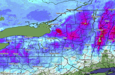
We are holding the forecast for snow. Based on the fact the Tug Hill and Adirondacks are about to go below freezing and there is a nice burst of precip on the radar over WNY as of blog time, I’ll let the 3-5 for these areas ride. I don’t see a scenario where anyone hits 6. If anything, 5 is a little aggressive as most should be 3-4 in that area. Just enough to re-whiten the ground WNY and Thruway/points north outside of the Tug and Adirondacks.
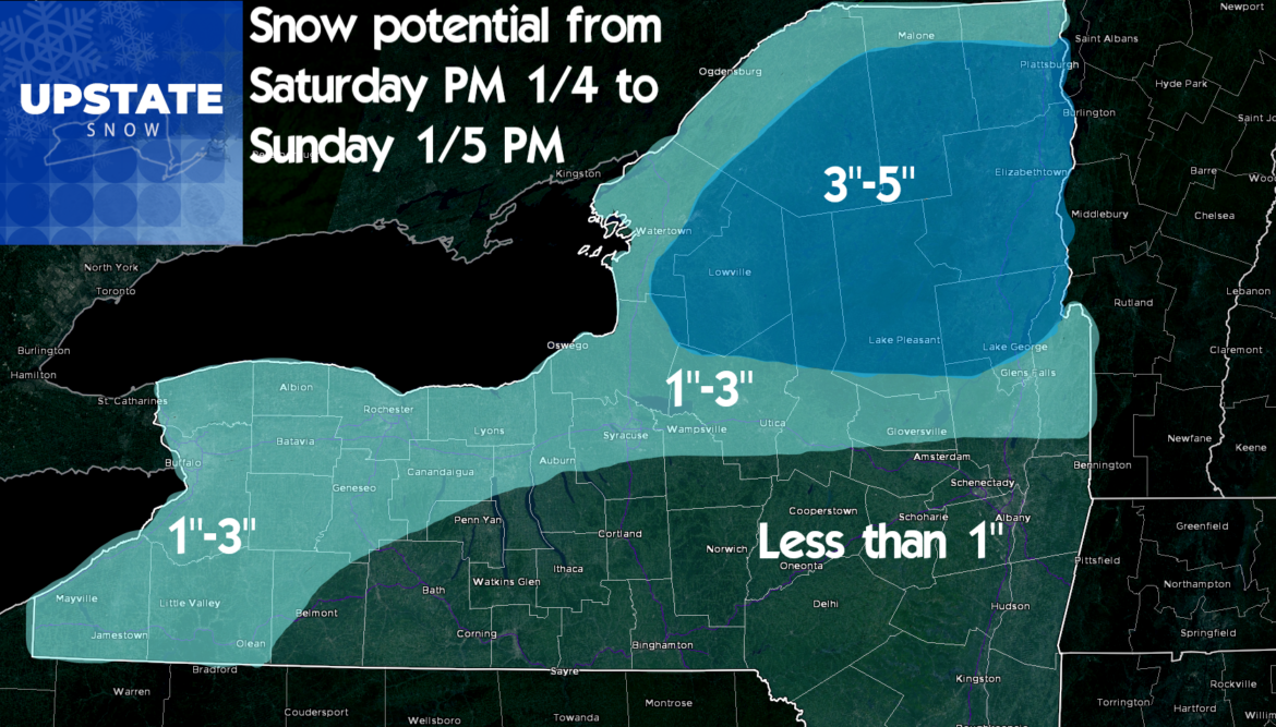
It’s below freezing most of the day Sunday. Sunday Night and into the day on Monday, our clipper system arrives and sets off light snow around most of Upstate. I’ll put out a snowfall map for this tomorrow but in general, Dusting to 2″ most of Upstate with 2″-4″ in the snowbelt areas of WNY and Tug Hill/Adirondacks. There is a chance the hill proper could get a little more than 4″ on Monday but if so, double digits are UNLIKELY.
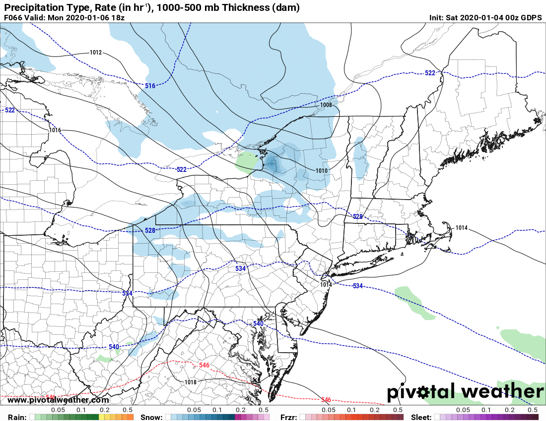
Tuesday is quiet most of the day until the next advertised storm rolls in after sunset Tuesday, overnight Tuesday into Wednesday morning. The track is favorable for a good snowfall across Upstate, but, the storm is moving fast. Our window for snowfall is basically 8-12 hours as this thing flies by on the unusually fast jet stream aloft straight off the coast. Not close enough or confident enough to give a firm call or snowfall map but I can say with some confidence a lot of Upstate will be shoveling/snow blowing Wednesday morning. So more than an inch or two is likely but I think too fast for it to get into double digits… even a half foot would be pushing it based on the speed of the storm. I’ll be more specific on this one with a snowmap by Monday morning.
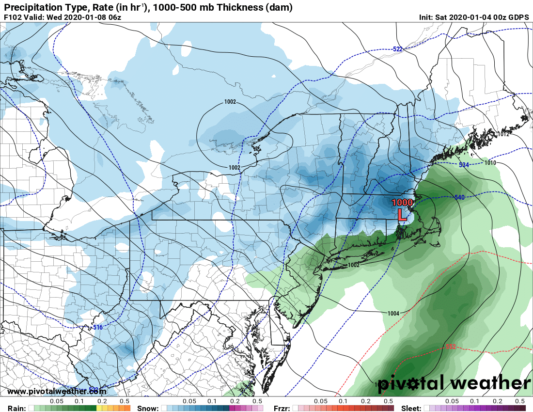
Behind the storm a brief shot of cold air and aligned flow will come off the lakes to reactivate this novel thing we sometimes have in Upstate New York called a LAKE EFFECT SNOW MACHINE. There is decent lake potential for a short window during the day Wednesday continuing into Wednesday night across mainly the Tug Hill and the Adirondacks. Notice by Thursday morning we have, if only for one early morning, respectable cold back in place.
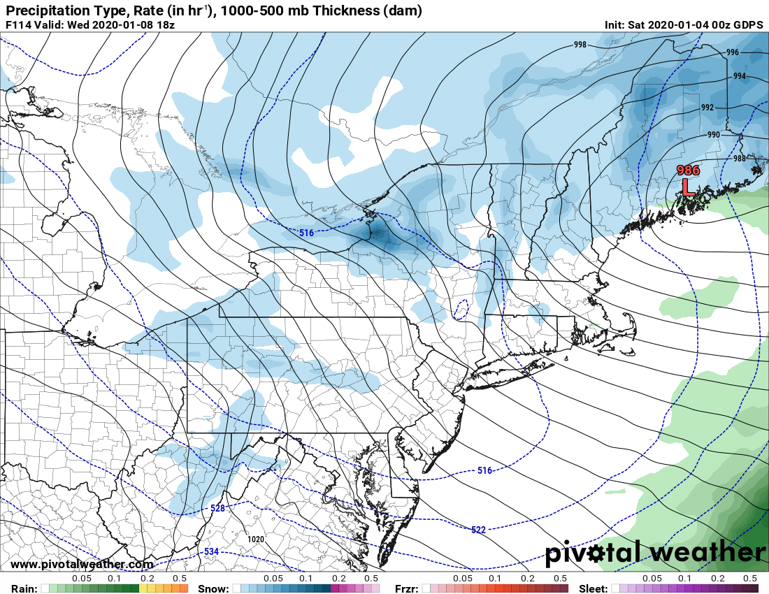
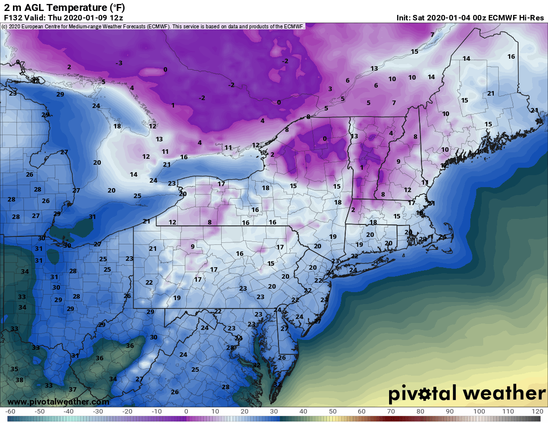
So if you have control of your schedule… I’m sounding the alarm RIGHT NOW… IF YOU HAVE ANY CHANCE TO GET THURSDAY OFF TO COME UP AND RIDE THE TUG HILL AND THE ADIRONDACKS, MAKE ARRANGEMENTS NOW. CONFIDENCE IS HIGH THAT THURSDAY 1/9 WILL BE YOUR BEST SHOT AT SOME DECENT SNOW AND RIDING PROSPECTS IN THESE AREAS. If we get lucky, the connections between the Tug Hill and Adirondacks if they get enough snow could have a shot at briefly opening. You heard it hear first. If there is one day to call in with the stomach bug, Thursday 1/9 is your day. Let’s put it this way, i’m trying to scramble to arrange my Monday 1/13 – Tuesday 1/14 trip with friends to this date given the conditions I’m seeing. And also given this…
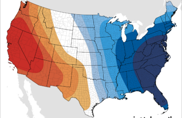
I’ve said the cold won’t hold because there is no blocking in place, a very fast jet stream in place, and the trough will be positioned well west of us. This means a SW flow aloft develops. This is how in 36 hours you go from standard winter cold to this by Friday afternoon…
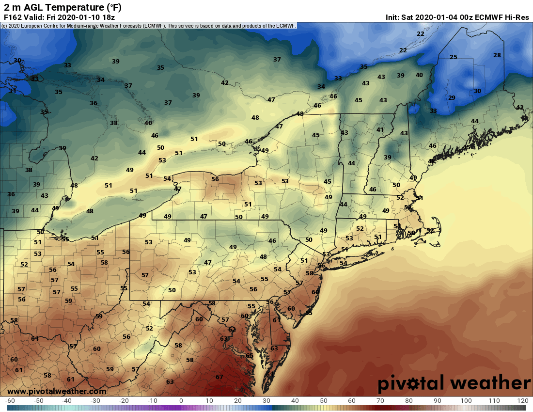
Not a misprint. If the Euro is correct next Friday turns into a repeat of what we’ve seen the last two days. That means potentially decent riding on Thursday 1/9 will gradually turn into mashed potatoes during the day on Friday 1/10 if this warmth verifies. Yes rain is indicated heading into Saturday 1/11 with this following it
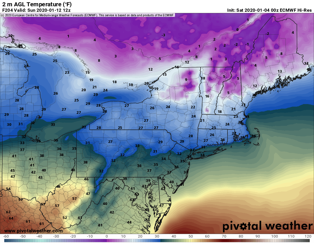
Did I mention after Thursday it would be a roller coaster pattern? Oh wait a minute… hold on…
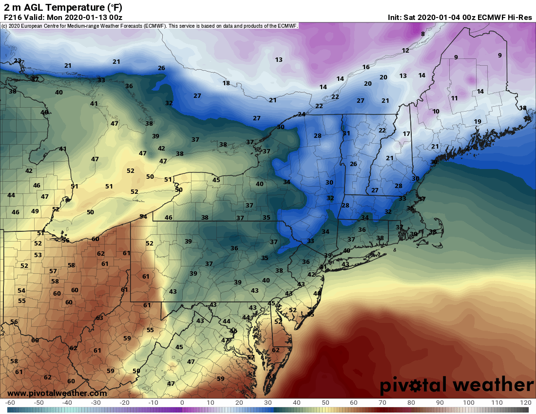
Yep. So there you go. Take what you can get and make the most of it while you can. Pay close attention to the weather updates going through next week, each day, pay close attention to the club reports and information each day, and abide by their call on the trails. If you get the go, don’t hesitate… GO. If they say NO, find where you can go. You will have places to go. Not a lot but better than nothing.
Thursday 1/9 – Best
Wednesday 1/8 and/or Friday 1/10 – Not as good but still OK
Monday 1/6 and/or Tuesday 1/7 – Doable but thinner snows in areas where you can ride.
Hope this helps. If you do go, be safe, ride right, AND SLOW DOWN! It will not be mid-season prime conditions. Just be thankful we can get out!
Best,
Rich and Zack
Schedule –
We will do another weather video by Monday. Morning blogs every day next week.


