The trend for our Tuesday snow event being colder and farther south continues. The good news is now that, outside of the Mid Hudson Valley, I expect this event to be all snow across most of Upstate as the trends go colder. The bad news is with the track being farther south and the initial surge of moisture already passing to our south, this will not be a significant event. Will it be a help, yes absolutely. Will it be the big dump and recovery from the previous two storm wipeouts? Not quite. At this point we’ll take anything we can get.
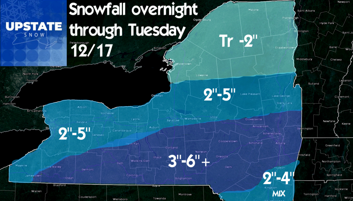
Snow starts overnight across Upstate. Expect snow covered and slick roads for morning commute on Tuesday, especially from Buffalo to Albany along the Thruway and points south. With the track shift, the heavier snows shift from along and north of the Thruway, to south of the Thruway. Southern Tier and Catskills along with the Capital Region get the most snows… still respectable amounts along the Thruway corridor and into the Tug Hill (especially the hill proper and southern approaches), and for the southern Adirondacks. There will be more in Morehouse and Piseco than Old Forge and Big Moose. Areas farther north into St Lawrence and Franklin counties won’t see much. Here is the revised map.
The next event follows closely and quickly on Wednesday. Low pressure/Clipper along with an arctic cold front and strong/gusty winds come in during the day on Wednesday. ALL OF UPSTATE will see at least a dusting to 2″ off the arctic front. It will fall quickly. Winds will cause blowing and drifting snow. Strictly from a travel perspective, Wednesday during the day to me is more of a travel concern than the steady light snows falling tomorrow during AM drive and PM drive. There will be some areas, especially downwind of Lake Erie and Lake Ontario that may squeeze out 3-5 inches with the front and with lake enhancement behind the front.
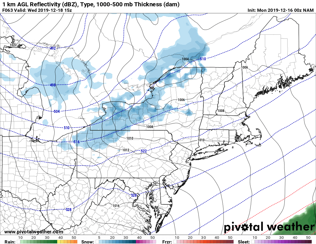
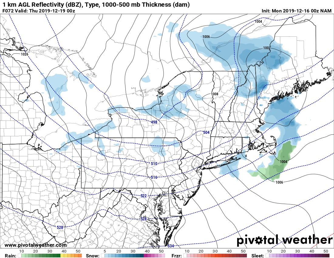
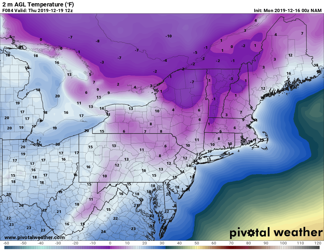
The lake effect will shut off quickly overnight Wednesday despite very cold temps. Dry air, wind shear then ultimately the winds tapering off by Thursday morning will keep the lake effect from being too strong. Again. Still looking at single digits for most of Upstate with at or below zero likely north of the Thruway.
Remember the season opens TOMORROW for the rest of Upstate, CONDITIONS PERMITTING AND ONLY IF LOCAL CLUBS GIVE THE GO AHEAD. Across most of the state, even in snowbelt areas, snow cover is not what it was and the recent warmth and rain have made it difficult to build any base (in areas currently with snow). BE PATIENT! We advise waiting until tomorrow’s snow, Wednesday’s snow and the quick blast of bitter cold run through Thursday. We need to get more snow, any snow, and the cold to slow the water down and freeze up water spots. With gusty winds areas of blowdown are possible. EARLY SEASON CONDITIONS IF YOU GO, IF CLUBS ARE OPEN. USE CAUTION, GO SLOW AND JUST BE THANKFUL TO BE OUT THERE! Our personal plan is to wait until Friday/Saturday. If you go before, please be careful and most of all RESPECTFUL to the conditions, clubs and landowners.
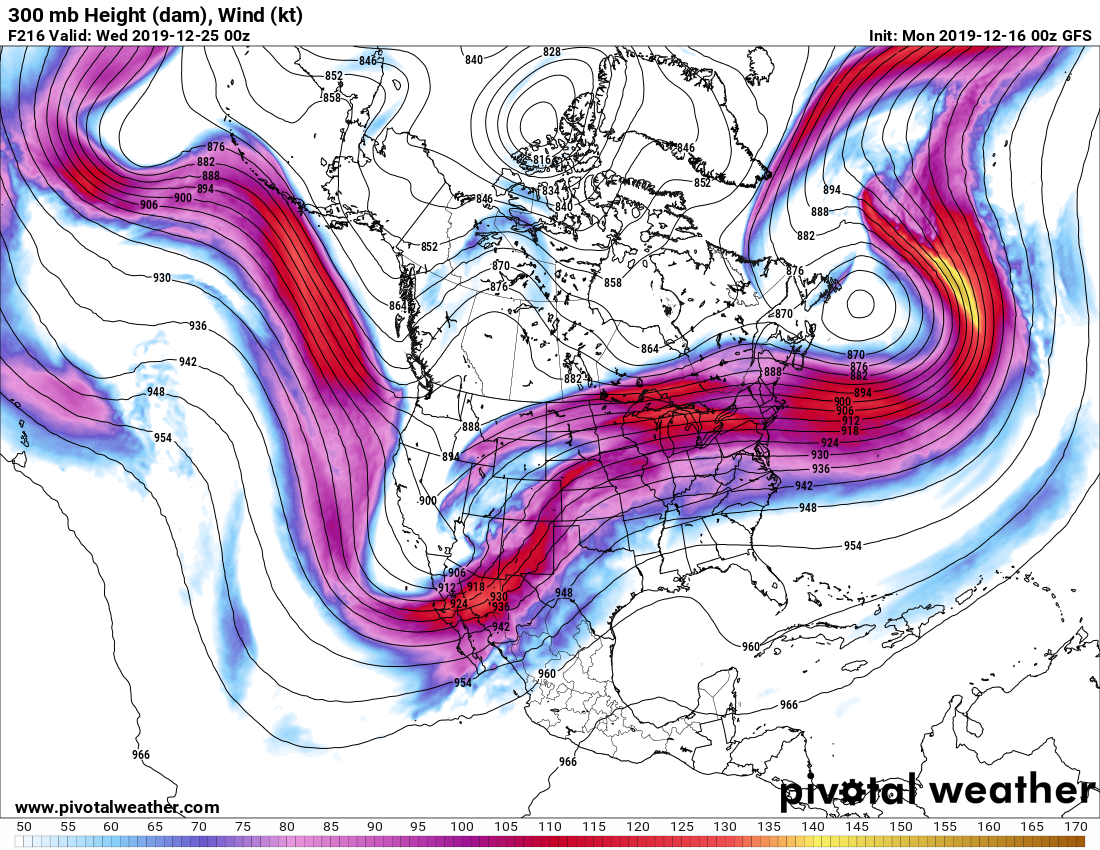
So what about Christmas week? The pattern in the Jet Stream is KILLING US on the west coast. The ONLY reason we got a little something in the last day, and why we have snow chances and cold this week are thanks to the Newfoundland Low and Greenland Block reappearing to our east. The lack of it last week KILLED US. The return of it IS WHAT IS SAVING ANY RIDING for us this week and next. Here you see the Jet Stream projection for 7 PM on Christmas Eve as Santa begins his journey across North America. Notice the Newfoundland Low and Greenland having just a little ridging/blocking. It will keep just enough NW flow over Upstate. But notice below that the milder air lurks closely by..
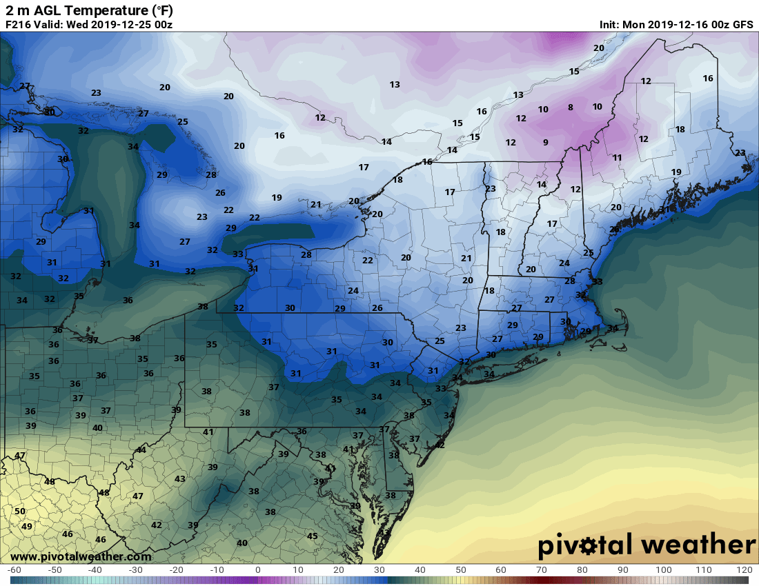
SO the bottom line is this: Be patient and wait for the snow and cold to return in earnest the next few days. Reach out to the clubs where you want to ride, let them give you recommendations. Some clubs may need a hand from anyone willing to help get last minute signs up and get gates/fences open. Ask. Wherever you can go and ride safely Friday and this weekend, take advantage. This up and down pattern, typical of most Decembers this past decade continues. It will likely be January, after the ball drops, that the ball will finally drop on these warm surges and threats to the snowpack and winter fully settles in across Upstate. Fingers Crossed!
Have a great day and God Bless…
Rich


