Written after 11 PM Sunday 12/1/19
We have gone over 8″ total snow in Deerfield at our location from 1145 this morning until 11 PM tonight. Some sleet mixed in here. A lot more fell to our south and west. Snow is really getting going in the Syracuse, Rochester, Finger Lakes, Elmira/Corning and Binghamton areas where a lot more sleet and freezing rain fell in the first part of the storm.
Wait a minute… a part one and a part two? Oh yeah, as I mentioned in last nights blog, scroll near the bottom, my reasoning for the previous forecast and why I went with what I did… it’s unsual for there not to be a break between the primary and secondary lows in this pattern… but it happened. And along the Thruway corridor (within 25 miles either side N or S) from Syracuse to Albany it was mostly snow with only a little sleet, pushing totals higher. Turns out some of my suspicions I had mused about last night came true. And the deformation zone setting up over this same area, a touch farther N than the I-88 corridor also moving the ranges and numbers. The link below will give more on those thoughts I said last night..
https://www.upstatesnow.com/12-01-19-forecast-discussion-on-winter-storm/
NOW, where do we go from here? Nowhere. This thing has formed and stalled. Snow will continue light to moderate (1/4″ to 1/2″ per hour) with occasional periods of heavier snow in the 1/2″ to 1″ per hour. It won’t be as hard as earlier Sunday, BUT, it’s steady and won’t taper off much until Monday evening. We start with the map valid 1 AM Monday 12/2

Next up is 7 AM Monday 12/2. Notice not much change

Then 1 PM Monday 12/2

Now 10 PM Monday 12/2. While Central NY finally catches a break, still holding on strong for Captial Region and Hudson Valley

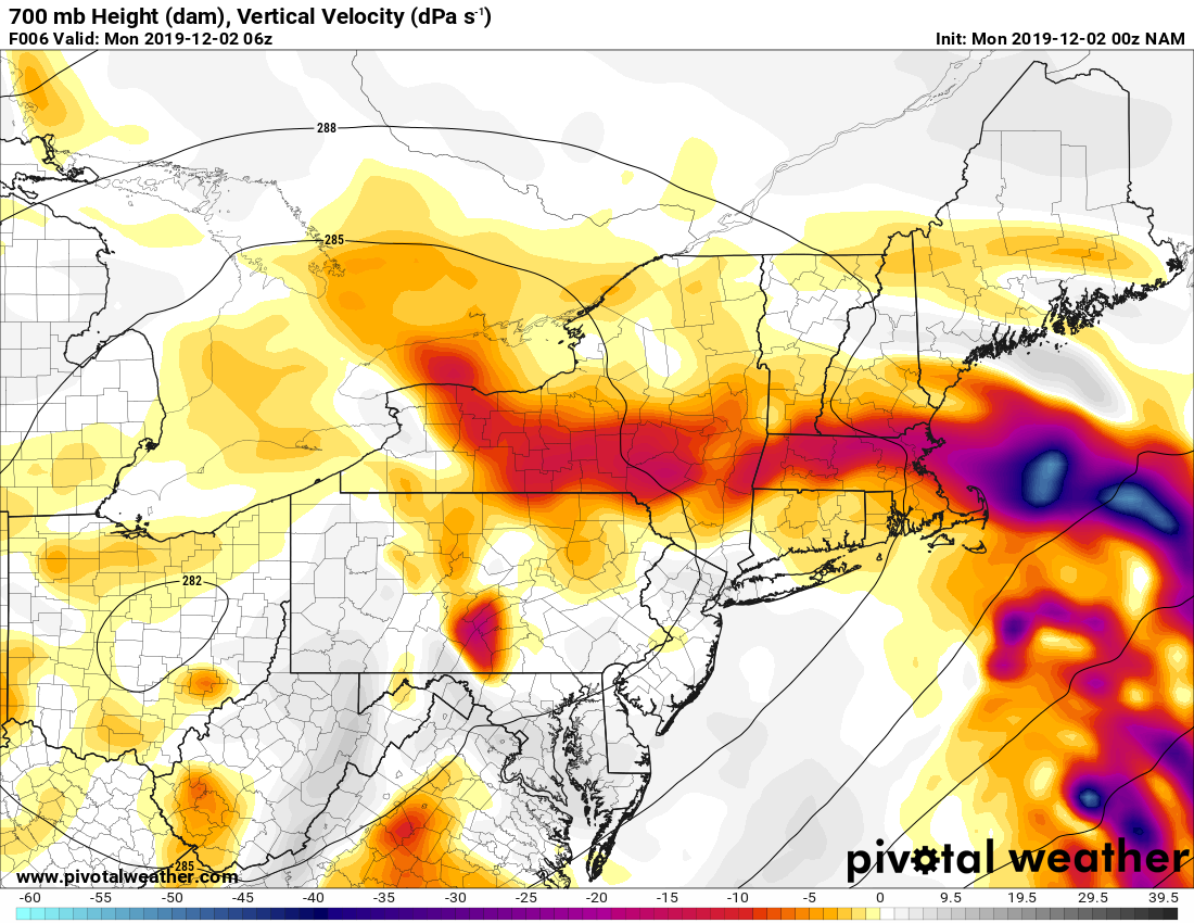
Now about the deformation zone. Lots of moisture, stalled upper air pattern and lots of lift at 700mb where it’s saturated, temps perfect for dendrite snow growth (larger crystals of snow) and the 500mb patter above that also stalled.
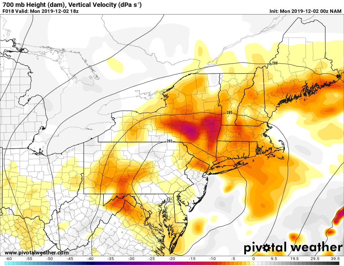
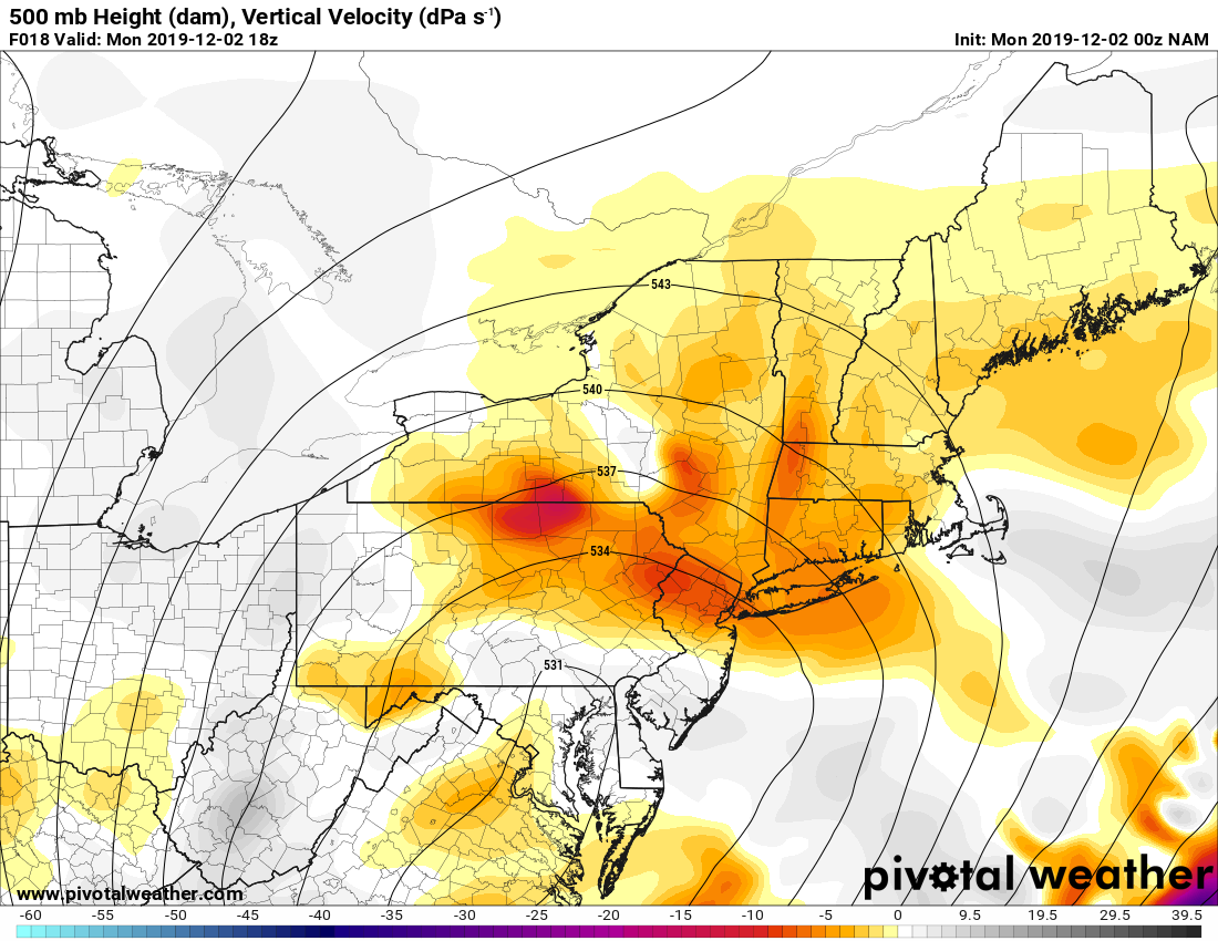
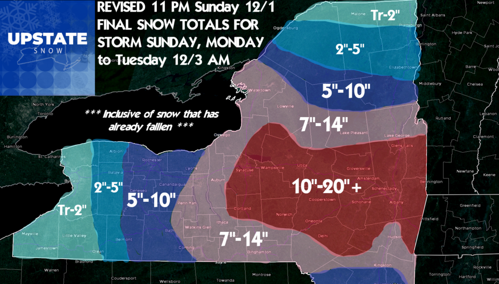
So this means yet one more revision on the snowfall map. I have to update this with the fact the Capital Region as of this writing is already closing in on a foot. Albany is already over 10″ and they started after us here in CNY! There WILL be 20″+ totals by events end, best chance in Capital Region, especially higher elevations surrounding…
Once again remember ALL SNOWMOBILE TRAILS ARE CLOSED! IT IS STILL HUNTING SEASON. TRAILS ARE NOT READY YET. MANY STILL DAMAGED FROM THE HALLOWEEN STORM. Nothing opens until Old Forge/Inlet and Hamilton County Monday 12/9 conditions permitting. We’ll update that as we get closer.
Look for snowfall updates and a possible live hit on the Facebook page during the day before 8 AM and/or after 4 PM
Special thanks to Jeremy Kappell out in Rochester, www.kappellweather.com, WxLive and Jeremy Kappell on Facebook for hosting us on Skype tonight on his WxLive program as we drove around New Hartford and Utica giving updates on the storm. Please like, follow and share his stuff. If you don’t know his story, you need to. Not just a great Meteorologist but and incredible man and family that’s been through a lot. Many thanks…
Rich


