There has been a lot of talk about this so here you go… at 2-3 days out i’m on the edge of being comfortable with putting out a snowmap… but given the holiday weekend travel and start of the new work week, I have enough confidence to put out a first call…
The setup is this… the BIG storm bringing heavy snow and blizzard conditions (this is what’s left of the “bomb cyclone that hit the W coast a few days ago), will nail the central US into the western Great Lakes Saturday before making it’s first push at Upstate on Sunday.
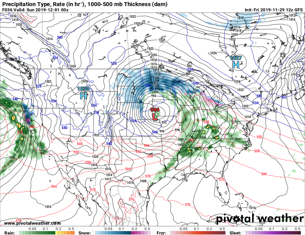
Because it will be coming in from the west, enough warm air will mix in to make a wintry mix or change to rain in WNY, while cold air holds tough over CNY and eastern NY to make a snow event during the day Sunday. Don’t be surprised to see several inches Sunday afternoon east of I-81, which will snarl heavy holiday traffic so alter plans if you don’t want the weather and/or traffic headaches.
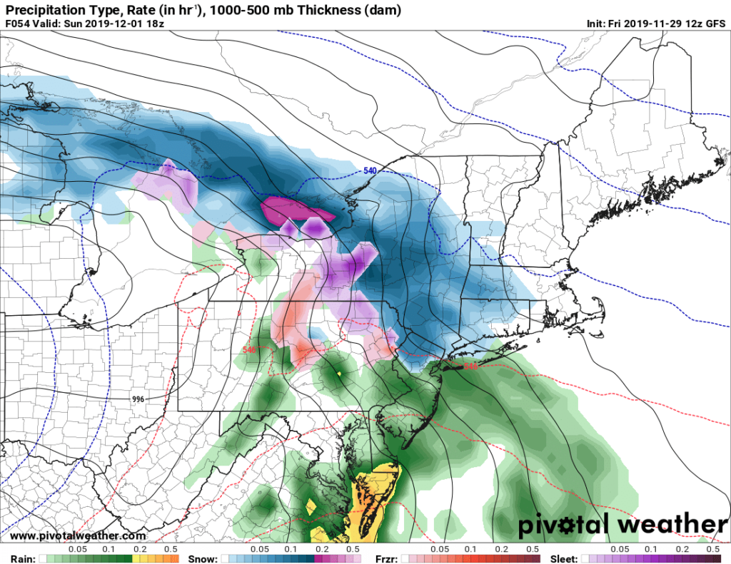
There may be a break Sunday night as the storm reorganizes by the Atlantic coast by NJ/LI/NYC and this is where the toughest part of the forecast happens. Where exactly does it jump to and how does it track? If it’s farther offshore, CNY and the Adirondacks end up with less, Capital Region and Hudson Valley get more. If it’s closer to the coast, CNY and the Adirondacks get more snow.
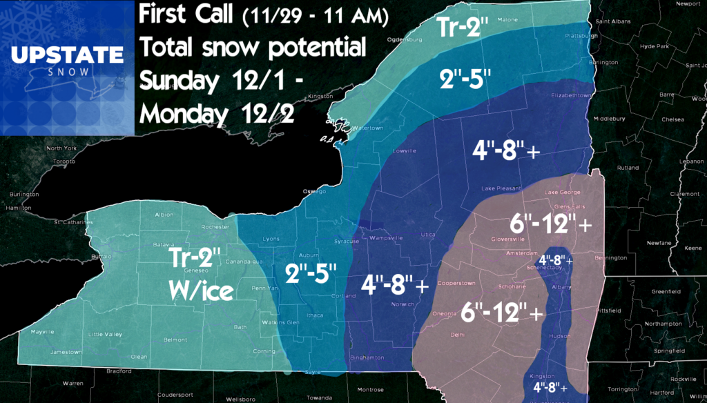
So here is our first call for the storm. Low to moderate confidence. Two day total snow. Subject to change! We will update tomorrow afternoon/evening with more, followed by a likely FB live on Sunday afternoon when it comes in… and we’ll test out some new things we’ve been cooking up in the background.
New episodes of the Trail Talk Podcast are now LIVE on the upstatesnow.com page
And if you need/want new curve skis for your sled… check out our special link with curve! If you buy through us you get two limited edition t-shirts from Upstate Snow + a $50 Stewart’s card on us! Link is here


