Good evening folks,
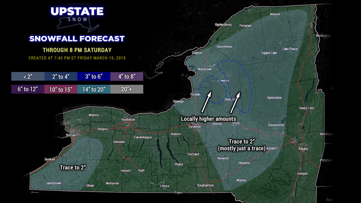
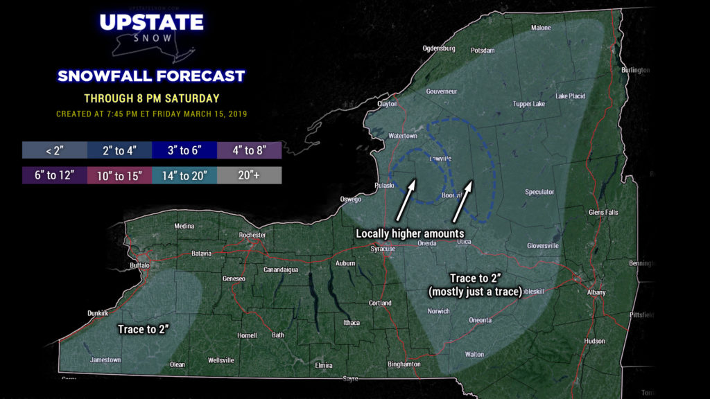
Tonight’s is a relatively quick hit because we’re running a bit behind. The first cold front has cleared the area; a second one will move through tonight and bring much colder air into the state, on a fairly stiff northwest flow. Scattered snow showers will break out across the state… and persist through the day on Saturday. On the whole this is not going to amount to much … trace to perhaps an inch in some areas, but some Lake Ontario effect (more upsloping / enhancement than true lake effect) on the Tug Hill as well as extreme western Adirondacks may squeeze out another inch or two of accumulation… nothing to get excited about.
Cold northwesterly flow continues into Sunday. Modeling shows a little disturbance zipping from the Ohio Valley to the coast Sunday into early Monday… this may bring a few more snow showers to the Southern Tier, but on the whole, the moisture is going to be lacking, and therefore don’t expect anything more than perhaps another “trace to an inch” type of scenario.
High pressure builds in by Tuesday afternoon. Our next system drops down across the state Wednesday into Thursday with rain and snow showers. This doesn’t look like it will be a significant system at all, but again, if you’re looking for super-late-season accumulating snow, well, the news isn’t good.
From there, taking a quick look at longer-term modeling through the end of the month….. well…. unless something radical happens, our season is essentially over.
That being said, we will keep up with our posts here for the next little bit. As always, we thank you for your support, for the interaction on the FB page, and supporting our sponsors. Without your participation, Upstate Snow doesn’t exist.
Have a good one, and we’ll see you tomorrow!

