Good evening….
A couple of “alerts” to talk about here — a WIND ADVISORY is up for Jefferson and Lewis counties until 6 AM Friday. A WIND ADVISORY is up for Chautauqua, Erie, Wyoming, Genesee, Monroe, Orleans, and Niagara counties from 6 AM to 8 PM Friday. A FLOOD WATCH is in effect from Friday morning through Saturday evening for St. Lawrence, Franklin, Clinton, and Essex counties.
A deep area of low pressure will move from the northern Lakes tonight far north into Quebec by Friday evening. Two cold fronts will cross the state… the first one will approach Buffalo in the predawn hours… advancing to a line from Malone to Elmira by around 8 AM… to a position from Whitehall through Albany and down the Hudson valley by lunchtime. A line of showers and possibly some thunder will accompany the frontal passage. At this point it does not appear that the warm air ahead of this will be as robust as earlier anticipated (more on why it didn’t get as warm as we thought it would in some areas today in a minute). Behind this front temperatures will fall, but not all that dramatically at first.
The business picks up when the second front approaches the state… Buffalo and the Lake Erie shoreline around midnight… Malone to Elmira around 3 AM, etc., etc. This second front will also have a bit more moisture to work with, so expect snow showers to break out from west to east behind the front. Winds become west-northwest, and, as temperatures fall at the 5,000 foot level, look for SOME lake enhancement, especially off of Lake Ontario… combined with upsloping along the Tug Hill. The wraparound moisture will continue into and through the day on Saturday… and a thin band of “true lake effect” may become established southeast of Lake Ontario as well… but the moisture, at this point, will be disappearing. Another little boundary drops through on Sunday which should result in some more snow showers.
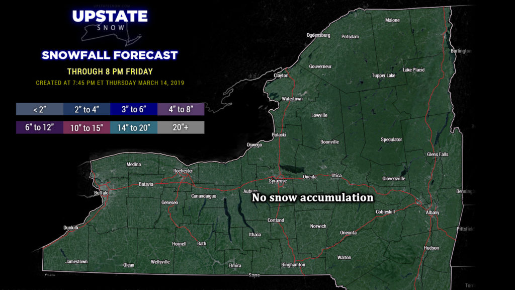
All-in-all, though, accumulations through the weekend will not amount to much… a trace to a couple of inches, and we think that’s being generous as well thanks to the late season, high sun angle, etc. Yes, cold air will return to the region, but that doesn’t mean we’re going to be looking at heavy LES accumulations or generalized snow accumulations worth anything at this point. No snow accumulation is expected through 8 PM tomorrow, as reflected on our snow map.
Temperatures: Briefly… no… several areas did not see great warmth today. Yeah, it was mild, but not what we originally thought. This is blamed on something called a “low-level inversion.” Cold air gets trapped at the surface… but just off the deck, temperatures were indeed quite warm. The colder surface air never really got scoured out in some areas — here is an HRRR model sounding I grabbed earlier this afternoon:
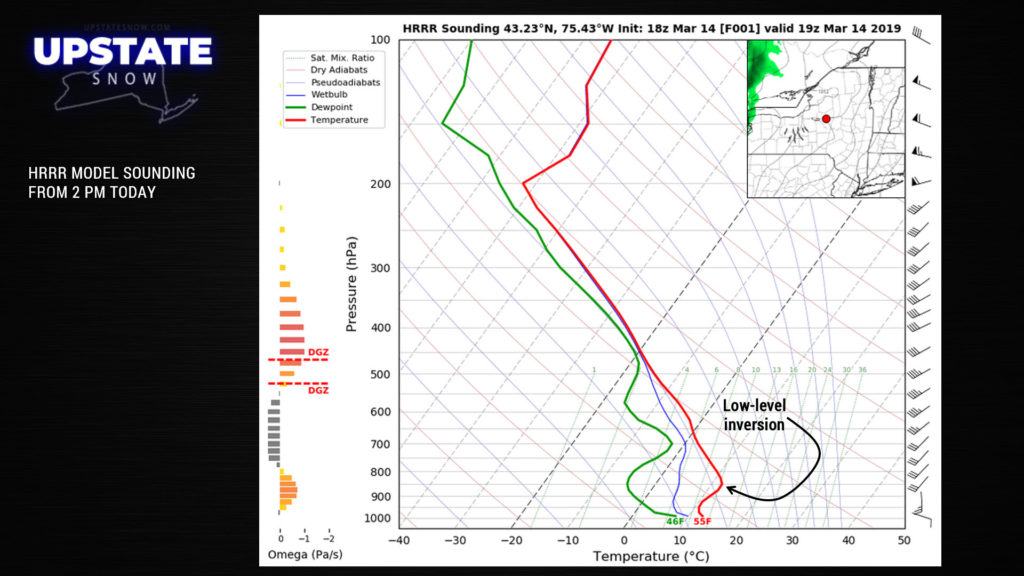
You see the temperature line (the red line), as it goes upward from the bottom curves left at first, and then hard right — that is a warming of the temperature with height, also called an inversion. Typically you have temperatures that get colder with height. Sometimes the modeling does not grasp these inversions very well…. another case of, “it is what it is.” Temps ahead of the front tomorrow across eastern NY will likely jump into the 50s and 60s.
Winds: As mentioned, wind advisories are up for the lake counties, and also as noted, the time frames are different. The first wind action will come tonight. A low-level jet is expected to move across the western part of the state tonight. At the 5,000-10,000 foot level, these winds will be 65 mph or higher. That’s not going to be the case on terra firma because the ingredients for our stew just aren’t lined up right. However, winds of 25-45 mph are possible.
The second “round” of winds will come on the heels of the cold front. As the colder air pushes in from the west/northwest, it will do so from the “top-down,” meaning that temperatures will tend to drop pretty quickly as you go from the ground-up. (Remember the sounding image — imagine your temperature line following the hour-hand on a clock, and it’s 10 o’clock). That will induce winds again 25-45 mph along the Lake Erie shoreline, northward to the Niagara Frontier east toward Rochester. Similar to the last couple of events.
Next Week: Cold weather continues Monday into Tuesday next week with a chance for more snow showers, especially east of Lake Ontario, but again, that’s all it’s really going to be — snow showers. A big surface high pressure will then dominate Tuesday PM through Wednesday. Modeling gets a little wonky from there… the only agreement is that our next general weather system makes a run in our direction later Wednesday. Some folks are jumping on the “potential coastal storm” bandwagon, but we’re not at this time… it’s simply too early to make any kind of call, and what one model says today is likely going to flip-flop by tomorrow. Either way, we don’t foresee any further “significant” accumulating snows at this point.


