Good evening!
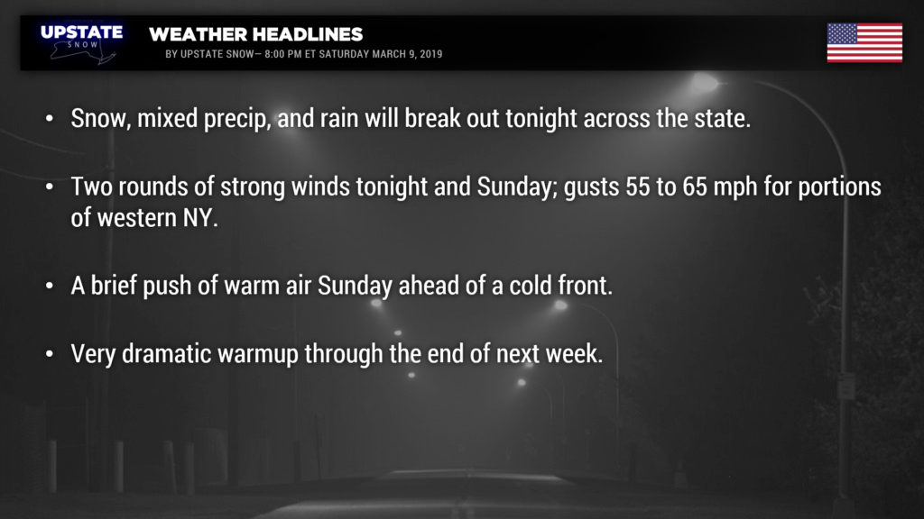
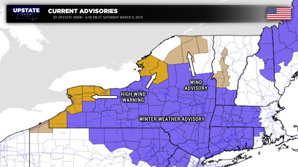
Messy and windy weather headed our way as low pressure tracks west and north of the area. Winter Weather Advisory, Wind Advisory, and High Wind Warning flags are flying across the state as this blog is being typed.
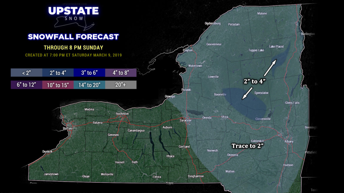
Conditions will deteriorate later tonight from southwest to northeast. An abundance of overrunning moisture will stream northeastward tonight… well ahead of a warm front (which by midnight will extend from central Ohio southeastward into North Carolina). Precipitation will break out around or shortly after midnight for the southwestern portions of the state, quickly pushing northeastward overnight. Rain will fall for most of western NY… but as this moisture pushes into colder air hanging tough, look for mixed precip and snow to break out along and east of I-81 during the overnight. As we time-travel during the night, the cold air will continue to stay locked in place, especially over the Adirondacks and the Catskills. We’re looking at snow totals of a trace to 2 inches for most of the area, but the hills just north of the Valley and higher elevations of the ADKs will probably see some 3- to 4-inch amounts of wet snow into Sunday morning. Warmer air will continue to “fill in” the layers of the atmosphere, bringing mixed precipitation/freezing rain, with everything eventually transitioning to rain showers before ending.

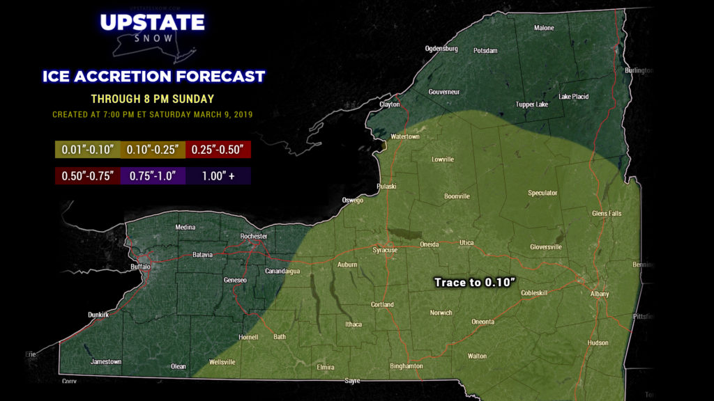
We are looking at SOME ice accretion during the overnight. This is a tough call, and you will need to take our ice map with a grain of salt. On the whole, ice accumulations should be light, but travel early tomorrow morning might be kind of dicey. That’s why the Winter Weather Advisory flags are up.
For western NY, the bigger story with this system will be wind. It looks like two wind “events” will occur as this deep, strong low pressure center moves north and then east. The first one will during the late evening and early overnight, as a low-level jet (much stronger winds in the lower levels of the atmosphere) become established. Downsloping winds on the Chautauqua Ridge and along Lake Erie could cause winds to gust 55 to 65 mph at times during the overnight, and a High Wind Warning is up for that.
This low-level jet reaches the areas east of Lake Ontario during the overnight/early Sunday morning. Downsloping winds off the Tug could also gust 55 to 65 mph at times early Sunday morning, and a High Wind Warning has been posted.
Round 2 of the wind event occurs after a cold front crosses the state Sunday. Fortunately the surface low will be in a process of weakening, so we’re not looking at another round of hurricane-force winds or anything ridiculous like that. Models do show, however, that winds at 2,000 to 5,000 feet will still be hauling right along, and as cold air moves into the state behind the front, some of these higher winds could pushed down to terra firma… winds gusting 50-60 mph from the Niagara Frontier to Rochester are looking pretty likely, and High Wind Warnings are up for that as well.
While these winds aren’t going to be anything like we had last time, these winds can blow down trees and power lines, and cause some structural damage.
A northwesterly flow of cold air will continue to move into the state Sunday evening and overnight. Any leftover rain showers will change to snow showers from west to east Sunday afternoon. Snow showers should continue into Monday, especially over the Tug Hill and the western Adirondacks, but honestly this isn’t going to amount to much. Winds will also slowly die down through the day on Monday.
Surface high pressure begins to press into the area Monday night and whatever lake effect snow showers will come to an end. Tuesday and Wednesday look dry with temperatures by day generally in the 30s to lower 40s, with lows in the 20s Tuesday night.
And that ends the good news of tonight’s blog.
As we go to the second half of next week, temperatures rise and rise. Modeling indicates highs could jump into the 50s and 60s for much of the southern tier by the end of next week. While our temperatures jump, another frontal system will bring rain showers to much of the state Thursday into Friday. Modeling shows a pretty good cold front coming through later Friday with colder air returning NEXT weekend… but by then it’s not likely there will be much, if any, snowpack remaining outside of the Adirondacks. 🙁

