
Good evening!
Well, who’s up for a good old fashioned Nor’easter? Hold that thought.
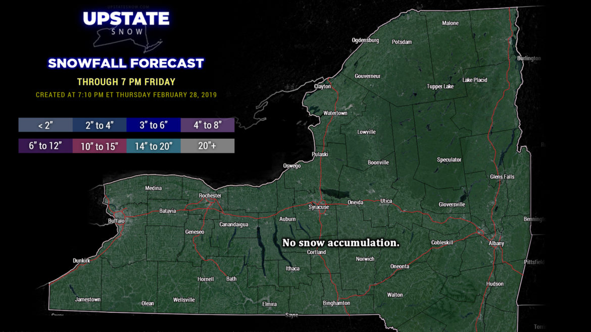
March will arrive like a lamb across the upstate. We can expect quiet and calm weather across the state on Friday, with highs ranging from around 30 in the North Country to the mid and upper 30s for the lake plains, as well as the lower Hudson valley.
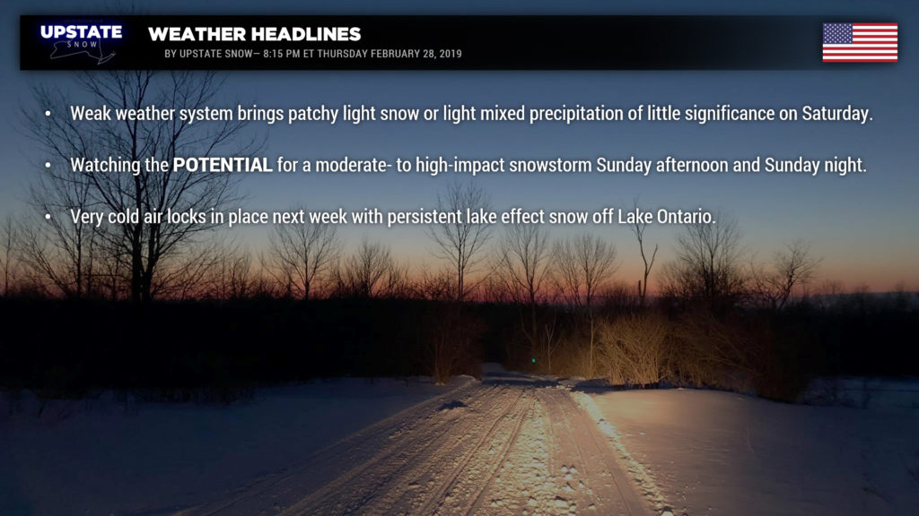
Our next weather system arrives on Saturday. A weak wave of low pressure lifts from the Great Lakes due north into Canada, while a secondary low forms off the coast. There is some disagreement in the modeling on just where this storm forms, but all in all we are looking at areas of light snow or perhaps light mixed precipitation for Saturday afternoon, transitioning to snow showers Saturday night. This is a minor system which should be of little overall significance.
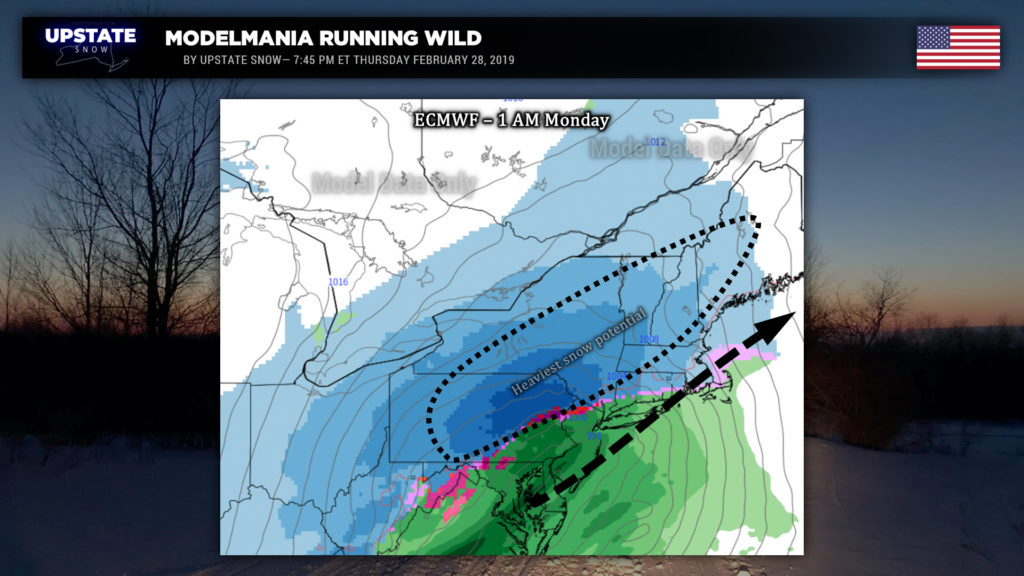
Now… the main event that all eyes are focused on… the potential Nor’easter for Sunday and Sunday night. Models are really starting to hone in on this… the European, GFS, FV3-GFS, and Canadian all taking a low from the southern jet riding northeast off the coast. There are still some question-marks here, and we’re still kind of pumping the brakes on this … it is only Thursday, so we don’t want to get TOO excited yet. It’s way too soon to get into numbers, but if the European verifies, we’re looking at a high-impact snowstorm Sunday afternoon through Sunday night… as it has the low running a bit closer to the coast, kind of in what we could call a “Goldilocks zone,” the best-case scenario for a snowstorm across the Upstate. There is a close line, though, because if the low as illustrated by the Euro comes too close, we could be looking at mix/rain south and east of I-88. The model does not show that at this time.
The GFS runs a little bit farther south and east, with cold high pressure well off to our west/northwest working to push things just a tad. So if the GFS verifies, we’d still be looking at the potential for decent snows across south/central NY, with lesser impacts farther north and west. FV3 version of the GFS also wants to go a little farther south and east.
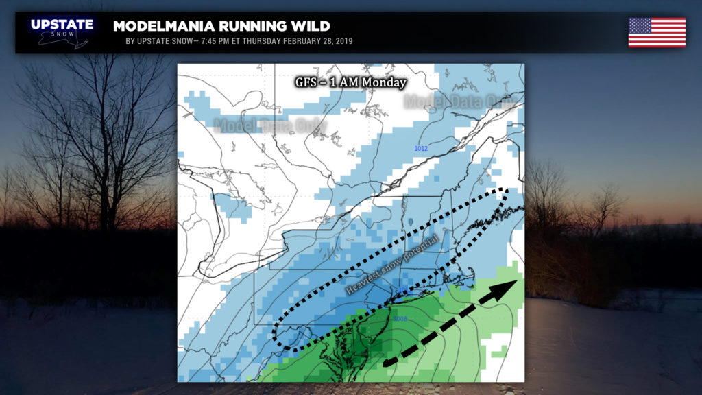
Pumping the brakes: Remember, as we said above, it’s only Thursday. As we said last night, it’s easy to “wish-cast” ourselves into big disappointment, and the way this season has been makes it even more easy. Models will shift and jog back and forth over the next few days. So clinging to one model solution over another this far out… just won’t end well and will drive you nuts.
The take-home message: There is the POTENTIAL… for a moderate- to high-impact snowstorm across the state Sunday afternoon into Sunday night. There are no guarantees in weather… there’s no such thing as 0% or 100%.
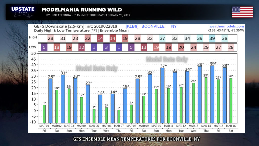
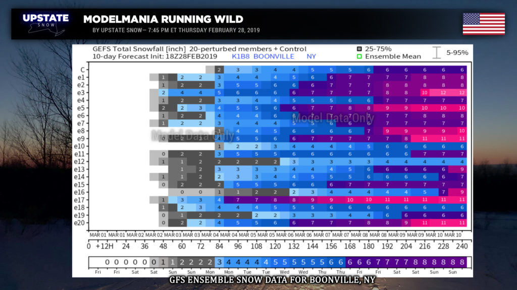
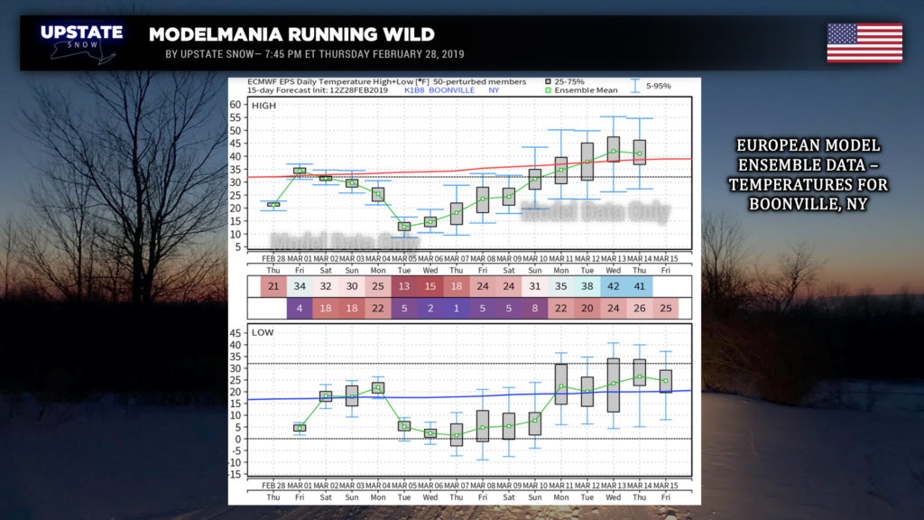
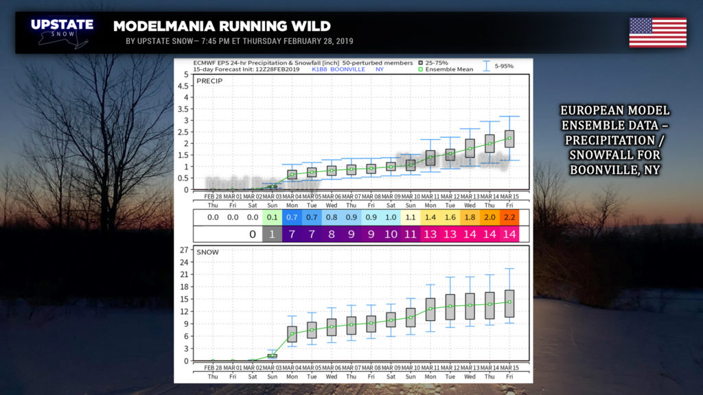
Whatever happens on the coast Sunday night moves away for your Monday. The first week in March looks unseasonably cold. In fact, modeling keeps the majority of the state below freezing through at least March 9. We pulled some model data for Boonville, picking that as a nice central location. The 9km European keeps highs in the teens Tuesday-Thursday next week, with lows dipping below zero. The GFS ensembles also point to highs in the teens Tuesday through Thursday next week but a rapid warmup as we go toward March 10 and beyond. The GFS ensembles also give us some more snow chances (at Boonville anyway) as we move through next week.
Which makes sense because with this deep, Arctic air mass and a persistent WNW flow comes late-season lake effect. FV3 seems to indicate a steady plume of LES lasting much of next week (with a minor “general” snow system thrown in for good measure). The GFS operational also shows some LES off of Lake Ontario for a good portion of next week.
Here are some of the model numbers that I referenced earlier….
All eyes focus on this weekend, and we’ll go from there. Have a good one!

