Good evening…
First up, a Wind Chill Advisory is posted for portions of the Adirondacks tonight, with wind chills down to 30 below zero expected.
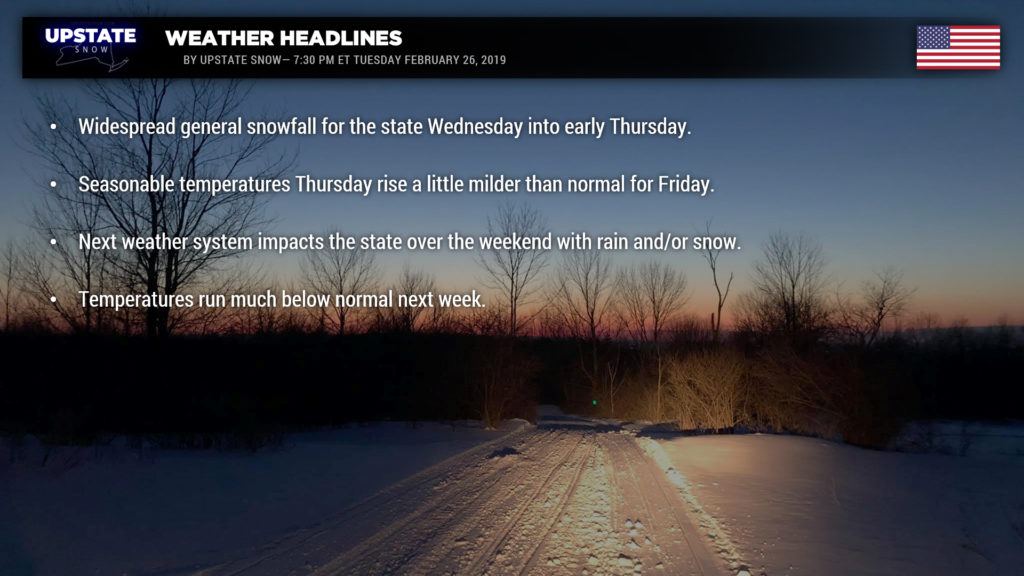
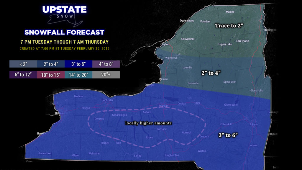
An all-snow event headed our way for a change. Winter Weather Advisories are up for Wednesday into early Thursday for all of New York with the exception of the Canadian border counties. A widespread 4-6 inches of snow is expected across the state. Our map extends through 7 AM Thursday, the entirety of this event. There may be some isolated higher snow totals, especially over the Fingerlakes and central southern tier, but on the whole, 4-6 looks like a pretty good firm call… this is consistent with all of the modeling. Look for snow to develop around breakfast-time for southwestern NY, and overspread the remainder of the state through about noontime. Snows are expected to continue, with varying intensity, until tapering off after midnight from west to east. A nice little snowfall to wrap up the month of February.
High pressure settles in Thursday through Friday before the next system heads our way. A perfect illustration of our winter, the next system isn’t going to be so straightforward. Low pressure will organize over the Mississippi Valley and move northeastward through West Virginia into southern Pennsylvania, and then northward into New England. A very strong, big blue cold high pressure ridge will extend influence from wester and central Canada southeastward into the northern United States. The strength of this high will also work to “shove” the low center a little farther east, but there is still some model disagreement on the track of this low. The European is far south and east, to a point where it has very little “direct” influence on the upstate (other than a wave bringing snows to western and northern NY Saturday night into Sunday). The GFS tracks the low from southeast PA into New England, with rain possible Saturday afternoon/evening for central and eastern NY, transitioning to snow on Sunday before ending Sunday afternoon. The Canadian aligns better with the European, tracking the low well offshore but bringing some accumulating snows along and south of I-88 Sunday into early Monday. On the extreme other end of the spectrum, the Icon (a rendition of the Euro) takes the primary low well north and west of the state, pumping in milder air and bringing a widespread rain event Saturday afternoon and Saturday night, transitioning to some snow on the back side of the system.
We think, at this point, “splitting the difference” is the way to go. We’ll go for a forecast of “rain or snow” Saturday afternoon into Saturday night, transitioning over to snow as we get into Sunday. The storm system does not appear that it will be very strong, either way, so impacts should be fairly mild. (As of now anyway.)
As we go into next week, much below normal temperatures will greet the area. A deep upper level trough will become established, and we’ll be seeing highs more appropriate for early January than early March. With this deep cold air mass will come a northwesterly to westerly wind flow in place… and this could lead to some very late season lake effect snows east of Lake Ontario next week.
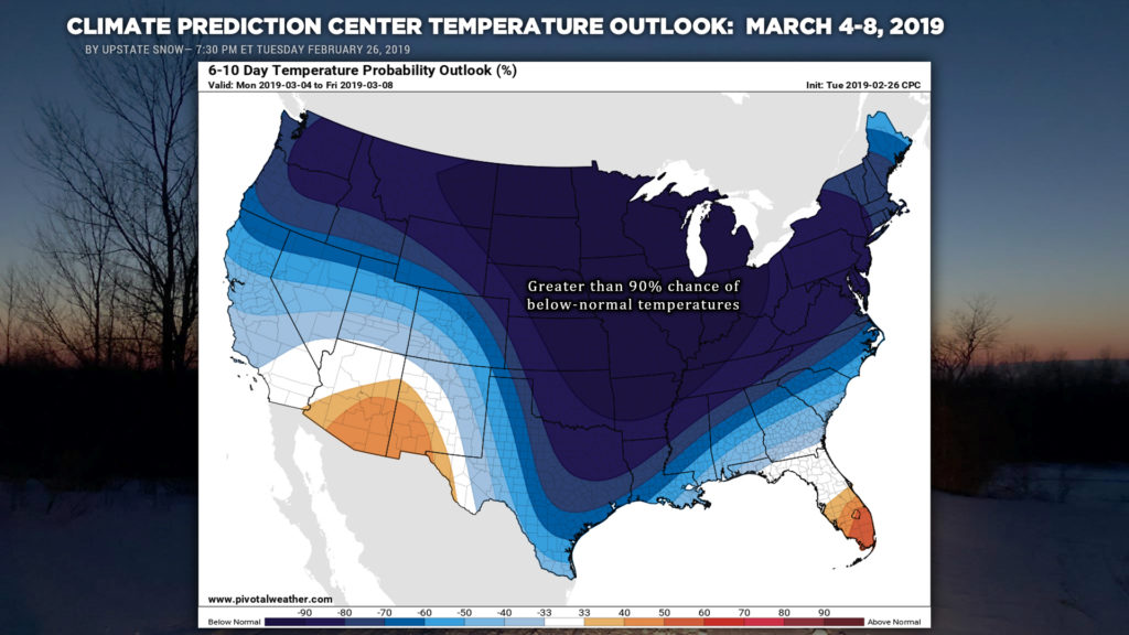
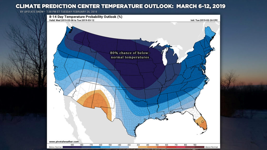
Here are the latest temperature outlooks for the Climate Prediction Center… indicating below-normal temperatures lasting into the middle of March. This does not show how much below normal — just the percent chance of below normal temps.
Have a good evening, and thanks for your support!


