Good evening everyone…
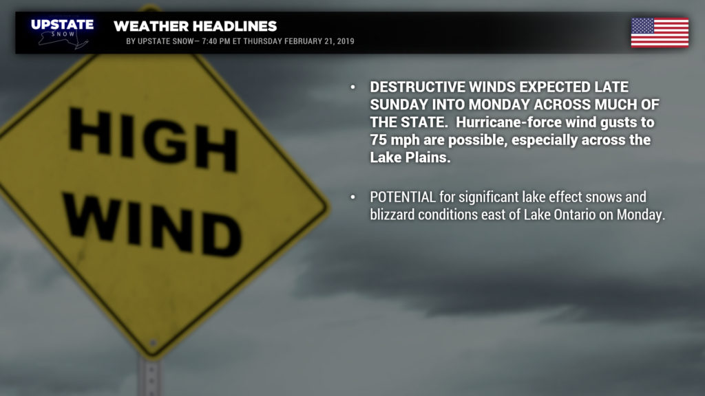
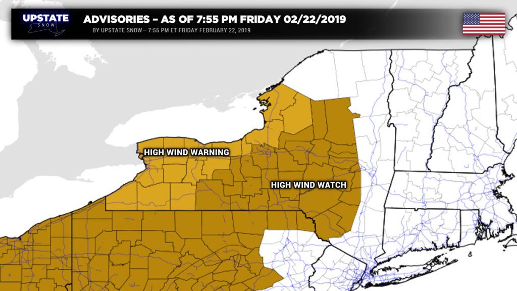
A potentially devastating wind storm is on tap for Sunday afternoon into Monday. High wind warnings have been posted for numerous counties of western NY — winds could gust to 75 mph (that’s hurricane force). A high wind watch has been posted for a large portion of central NY including the Mohawk Valley, Susquehanna region, Central Southern Tier / Fingerlakes for Sunday into Monday; wind speeds in this area may reach up to 60 mph at times.
There really isn’t much change in the weather setup from last night’s post. Low pressure will lift northward from central Kansas through northern Michigan between early Saturday morning and early Sunday morning, and then into Ontario and Quebec through Sunday evening. The low will explosively strengthen as it lifts northeastward.
Rain or mixed precipitation is expected to break out late Saturday afternoon (more likely early in the evening) from south to north across the state . Temperatures over the Catskills and portions of the Adirondacks will hover around the freezing mark for quite a while Saturday night, so areas of freezing rain are becoming likely. Warm air will win the battle, saturating the column and changing everything to rain after midnight Saturday night / early Sunday. The rain could be locally heavy, at least if you believe the high-res modeling, especially as a cold front starts to cross the state Sunday morning.
This cold front… will be one of the strongest fronts to cross the state in quite some time. Rain, and a chance for thunderstorms, will accompany the frontal passage from west to east. Temperatures will rise into the 40s and 50s on Sunday despite this front; colder air will tend to “lag” behind. Rainfall amounts statewide should be less than an inch for this event, although some isolated higher amounts are possible. Colder air begins to push in as a second boundary pushes across the state. Here is where business really starts to pick up.
We’ll see windy conditions with the passage of the initial cold front. Ahead of the front, southwest winds between 15 and 30 mph with gusts to 40 mph are possible. These winds become virtually due-west… and the likelihood is increasing for a devastating wind storm.
Soggy ground conditions combined with this prolonged wind event means that wind gusts (remember… up to 75 mph across the lake plains) can easily “bring down numerous trees and power lines and result in widespread power outages. Power may be out for several days in some areas. Shallow rooted pines will be particularly vulnerable. Property damage is also possible, especially to roofs and siding. Buildings under construction and old deteriorating buildings may be damaged significantly. Travel in high profile vehicles will be very difficult at times, and empty tractor trailers may be in danger of being blown off the road” (NWS Buffalo). Wind speeds should be slightly less across the rest of CNY, “only” up to 60 mph (which is enough to also make driving difficult and could result in power outages and property damage). The strongest of the winds should be from late Sunday afternoon through the pre-dawn hours on Monday… lasting as long as 12 hours (!!)… as the storm center continues to lift north/east.
This wind event will be comparable to events from February 10, 2001; February 1, 2002; and January 9, 2008. According to NWS Buffalo, the event from January 9, 2008, is most similar in terms of surface weather features; however, this current event will have a strong area of high pressure moving across the plains, which creates a tighter “pressure gradient,” further increasing the potential for wind gusts of 65-75 mph.
The powerful winds will also create some water rises on the eastern edges of Lakes Erie and Ontario. Per NWS Buffalo, regarding Lake Erie, “significant water rises are expected along shoreline areas with the expected seiche. Ice in place at the eastern end of the lake will get pushed onto shoreline areas likely causing damage, including the Buffalo Harbor and Buffalo waterfront. Ice will also get pushed across the Niagara River Ice Boom into the Upper Niagara River likely causing damage along shoreline areas of the Upper Niagara River.” With regards to Lake Ontario, “significant water rises and high waves are expected to impact shoreline areas from Oswego county to the Saint Lawrence River. Ice in place, especially at the northeast end extending to the Saint Lawrence River will get pushed onto shoreline areas likely causing damaging. Areas which may be particularly vulnerable to flooding and ice damage are Sandy Pond, Black River Bay, Chaumont Bay, and the Thousand Islands Region of the Saint Lawrence River.”
Aaah, but we’re not done. Temperatures are going to continue to tumble Sunday night into Monday. Winds will eventually become oriented from the WNW (think of the little hand at the 9:30 o’clock position on a clock face). The stage is being set for a heavy lake effect snow event… and possibly blizzard conditions… off of Lake Ontario. Lake Erie will also get in on some of the action, but the limited open water will likely limit snow accumulations. It’s seriously way too early to even begin to make a guesstimate on amounts… but diffuse bands of lake effect snow, along with winds still gusting in the 30-45 mph range on Monday, will create whiteout conditions during the day. Snows should come to an end on Monday night. Going back to Lake Ontario, the wind direction is modeled to be aligned absolutely perfectly with the open waters. Again, it’s too early to begin to discuss snowfall amounts, but significant snow accumulations are possible. The bigger picture will be the blizzard conditions expected over Oswego county and the southern Tug. Again, the snows should taper off Monday evening / Monday night as surface high pressure takes control.
Models are completely out to lunch on what may or may not happen as we go into the middle of NEXT week. The GFS and Canadian models show a weak system diving southeast across the area bringing widespread light snows, but the European laughs and scoffs at that assumption. It appears we will close out the month of February with generally seasonable temperatures.
Ok that’s it for tonight, take care!


