Good evening…
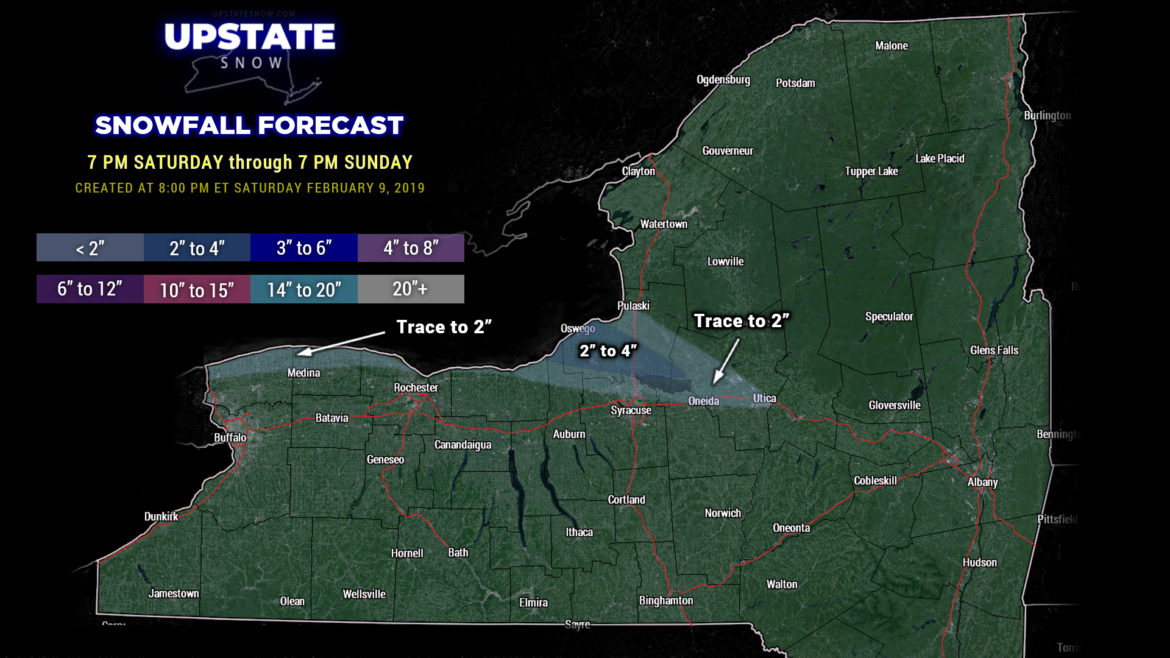
A band of lake effect snow just doesn’t want to die over Oswego county… this will probably continue through Sunday morning and drop another several inches of snow over and just south of the city of Oswego. Lighter snows may extend along the Thruway toward Utica tonight.
An area of high pressure to our north brings a dry and cold Sunday. By Sunday night, areas of low pressure will extend from Colorado and Wyoming… through northern Arkansas… to just off the Carolina coast. Light snow / snow showers will fall over the region… but it’s not going to amount to much of anything given a lot of dry air over the area.
That goes away for your Monday, leaving us with dry conditions once again with variably cloudy skies. Temps will range from around 30 / lower 30s for the southern Tier, upper 20s for the Mohawk Valley, to the upper teens over the far north.
Now we get to the weather focus for the coming week. On Monday night, a complex storm system will organize over Illinois and Indiana… with a warm front extending east through Virginia to the coast. As we move through time… the original low will lift northward into southern Michigan, while a secondary low forms somewhere along the coast. The models have been going back and forth several times, and today is once again no exception.
“Devil is in the details” and temperatures will ride a swing set. As it stands… right now… precipitation will overrun a warm front Monday night… we’ll start out initially as some moderate wet snow Monday night into early Tuesday… and there could be a decent accumulation. As the warm front pushes to our north, warmer air aloft starts to build in… and precipitation will transition to sleet and freezing rain Tuesday afternoon and eventually rain by Tuesday evening as warm air wins the battle.
Rain is expected Tuesday night as the original low pressure lifts slowly ENE through northern NY by early Wednesday. As the coastal storm shoots off to the Gulf of Maine by Wednesday morning, colder air will wrap back in and change our precip back to snow. However, the strengthening coastal low, by this point, will be too far east/northeast to really bring much impact here. Meanwhile, light snows/snow showers will persist and gradually diminish through the day Wednesday. A lake response develops Wednesday night into Thursday.
By next weekend another potentially significant system takes aim on the northeast … and this far out in time we’re not even going to make an assessment (modeling shows this to be a heavy rainmaker).


